Browse Items (304 total)
- Tags: Cook’s tour
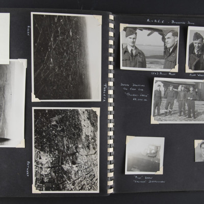
Targets and A&AEE Boscombe Down
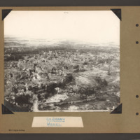
Top left - a note 'got to here'. Top right - an aerial oblique view of a city-scape with some large buildings and some damage visible. Captioned 'Essen' on the reverse 'Essen'.
Middle - an aerial oblique view of a…
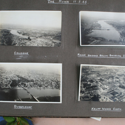
The Ruhr
Top right - view from air down wide river with damaged bridge in foreground and town on right bank. Captioned 'Rhine Bridge below Duisburg (Top Right)'.
Bottom…
Tags: aerial photograph; bombing; Cook’s tour
Thomas Payne's Royal Canadian Air Force Pilot’s Flying Log Book
Tags: 15 Squadron; 1653 HCU; 26 OTU; 90 Squadron; Advanced Flying Unit; aircrew; Cook’s tour; Flying Training School; Heavy Conversion Unit; Lancaster; Lancaster Finishing School; Lincoln; Operational Training Unit; Oxford; pilot; RAF Brough; RAF Feltwell; RAF Lichfield; RAF Little Horwood; RAF Mildenhall; RAF North Luffenham; RAF Tuddenham; RAF Waddington; RAF Wing; Tiger Moth; training; Wellington
Time out for war
Tags: 1 Group; 12 Squadron; 1653 HCU; 1656 HCU; 3 Group; 50 Squadron; 576 Squadron; 84 OTU; Advanced Flying Unit; aircrew; Anson; bombing of the Boulogne E-boats (15/16 June 1944); bombing of the Le Havre E-boat pens (14/15 June 1944); Bombing of Trossy St Maximin (3 August 1944); Cook’s tour; coping mechanism; crewing up; Distinguished Flying Cross; faith; Gee; H2S; Halifax; Halifax Mk 2; Heavy Conversion Unit; Initial Training Wing; Lancaster; Lancaster Finishing School; Master Bomber; military living conditions; military service conditions; mine laying; navigator; Nissen hut; Normandy campaign (6 June – 21 August 1944); Operation Dodge (1945); Operational Training Unit; Pathfinders; RAF Chedburgh; RAF Desborough; RAF Fiskerton; RAF Halfpenny Green; RAF Hemswell; RAF Lindholme; RAF Methwold; RAF Sturgate; RAF Torquay; RAF Waddington; RAF Wickenby; Stirling; tactical support for Normandy troops; target indicator; training; V-1; V-2; V-weapon; Wellington
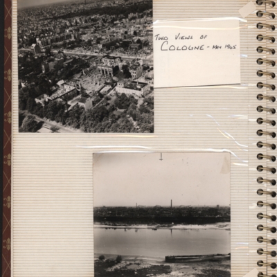
Two views of Cologne - May 1945
Bottom - oblique aerial photograph with the river Rhine running left to right and buildings including chimneys…
Tags: aerial photograph; bombing; Cook’s tour
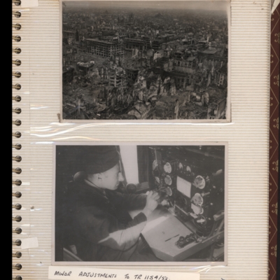
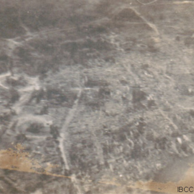
Unknown damaged town
Bottom - a man sitting in front of a wireless…
Tags: aerial photograph; bombing; Cook’s tour
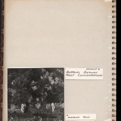
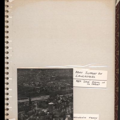
Unknown town
Tags: aerial photograph; bombing; Cook’s tour
W C Jones’ navigator’s, air gunner’s and air bomber’s flying log book
Tags: 11 OTU; 1669 HCU; 218 Squadron; Advanced Flying Unit; aircrew; bombing; Cook’s tour; Dominie; Heavy Conversion Unit; Lancaster; Operation Exodus (1945); Operation Manna (29 Apr – 8 May 1945); Operational Training Unit; Proctor; RAF Chedburgh; RAF Langar; RAF Llandwrog; RAF Madley; RAF Westcott; training; Wellington; wireless operator
W E Lucas’ pilots flying log book
Tags: 139 Squadron; 15 Squadron; 162 Squadron; 19 OTU; 20 OTU; 9 Squadron; aircrew; Anson; bombing; bombing of Cologne (30/31 May 1942); Cook’s tour; Flying Training School; H2S; Halifax; Lancaster; Magister; mine laying; Mosquito; Operational Training Unit; Oxford; pilot; RAF Alconbury; RAF Bourn; RAF Hartford Bridge; RAF Honington; RAF Hullavington; RAF Kinloss; RAF Lossiemouth; RAF Upwood; RAF Warboys; RAF Waterbeach; RAF Wyton; Stirling; training; Wellington; Whitley
W J Martin's flying log book
Tags: 1651 HCU; 1660 HCU; 1668 HCU; 5 Group; 57 Squadron; aircrew; Cook’s tour; Distinguished Flying Cross; flight engineer; Fw 190; Gibson, Guy Penrose (1918-1944); Heavy Conversion Unit; Lancaster; Lancaster Finishing School; mine laying; Normandy campaign (6 June – 21 August 1944); RAF Cottesmore; RAF East Kirkby; RAF St Athan; RAF Swinderby; RAF Syerston; RAF Woolfox Lodge; Stirling; tactical support for Normandy troops; Tiger force; training; V-1; V-2; V-weapon
W R P Perry pilot's flying log book. Three
Tags: 106 Squadron; 1654 HCU; 227 Squadron; 242 Squadron; 29 OTU; Advanced Flying Unit; aircrew; Anson; bombing; bombing of Kassel (22/23 October 1943); C-47; Cook’s tour; Flying Training School; Heavy Conversion Unit; Initial Training Wing; Ju 88; Lancaster; Lancaster Finishing School; Lancaster Mk 1; Lancaster Mk 3; Operation Dodge (1945); Operational Training Unit; Oxford; pilot; RAF Balderton; RAF Metheringham; RAF North Luffenham; RAF Oakington; RAF Ossington; RAF Syerston; RAF Wigsley; Stirling; training; York
W R P Perry pilot's flying log book. Two
Tags: 106 Squadron; 1654 HCU; 227 Squadron; 242 Squadron; 29 OTU; Advanced Flying Unit; aircrew; Anson; bombing; bombing of Kassel (22/23 October 1943); C-47; Cook’s tour; Flying Training School; Heavy Conversion Unit; Initial Training Wing; Lancaster; Lancaster Finishing School; Lancaster Mk 1; Lancaster Mk 3; Manchester; Operation Dodge (1945); Operational Training Unit; Oxford; pilot; RAF Balderton; RAF Full Sutton; RAF Metheringham; RAF North Luffenham; RAF Oakington; RAF Ossington; RAF Scampton; RAF Snaith; RAF Stoney Cross; RAF Syerston; RAF Wigsley; RAF Woolfox Lodge; Stirling; training; Wellington; York
Walter Braithwaite’s Observer’s and Air Gunner’s flying log book
Tags: 10 OTU; 1652 HCU; 171 Squadron; 21 OTU; 24 OTU; 77 Squadron; aircrew; Anson; bale out; Battle; Bolingbroke; bomb aimer; bombing; Bombing and Gunnery School; bombing of the Normandy coastal batteries (5/6 June 1944); Cook’s tour; Halifax; Halifax Mk 2; Halifax Mk 3; Halifax Mk 5; Heavy Conversion Unit; mine laying; navigator; Normandy campaign (6 June – 21 August 1944); Operational Training Unit; Oxford; RAF Elvington; RAF Full Sutton; RAF Honeybourne; RAF Marston Moor; RAF Moreton in the Marsh; RAF North Creake; RAF St Eval; tactical support for Normandy troops; training; Whitley
Walter Goodwin’s pilots flying log book
Tags: 1661 HCU; 21 OTU; 463 Squadron; Advanced Flying Unit; aircrew; Anson; Cook’s tour; Flying Training School; Heavy Conversion Unit; Lancaster; Operational Training Unit; Oxford; pilot; RAF Clyffe Pypard; RAF Moreton in the Marsh; RAF Shawbury; RAF Skellingthorpe; RAF Winthorpe; Tiger Moth; training; Wellington
War Memoir - George Bilton
Tags: 427 Squadron; 428 Squadron; 434 Squadron; 6 Group; aerial photograph; Air Raid Precautions; aircrew; anti-aircraft fire; bomb aimer; bombing; C-47; civil defence; Cook’s tour; crewing up; flight engineer; Halifax; Heavy Conversion Unit; lack of moral fibre; Lancaster; military discipline; military ethos; military living conditions; military service conditions; mine laying; Normandy campaign (6 June – 21 August 1944); Pathfinders; RAF Bruntingthorpe; RAF Croft; RAF Harwell; RAF Middleton St George; RAF St Athan; RAF Thorney Island; RAF Topcliffe; RAF Warboys; RAF Woodbridge; target indicator; target photograph; training; V-2; V-weapon; Wellington; Window; wireless operator / air gunner
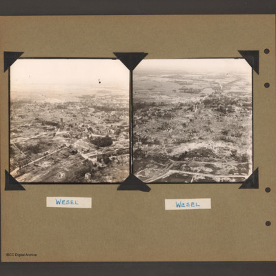
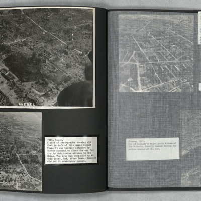
Wesel
Tags: aerial photograph; bombing; Cook’s tour
Wesel
Tags: aerial photograph; bombing; Cook’s tour
Wesel
Tags: aerial photograph; bombing; Cook’s tour
Wesel
Tags: aerial photograph; bombing; Cook’s tour
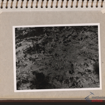
Wesel Bomb damage
Tags: aerial photograph; bombing; Cook’s tour
Wesel Cooks tour
Tags: aerial photograph; bombing; Cook’s tour
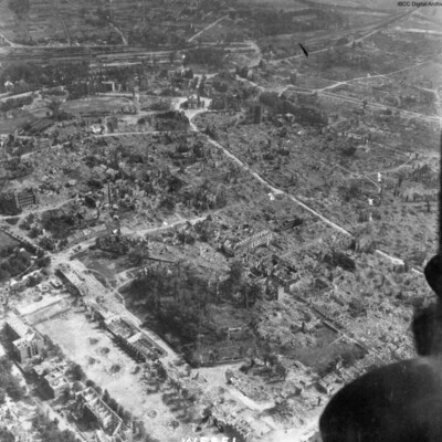
West Essen
This is West Essen, the photo is taken…
Tags: aerial photograph; bombing; Cook’s tour
William James Herbert’s flying log book for navigator’s, air bomber’s and air gunner’s
Tags: 1654 HCU; 50 Squadron; aircrew; bombing; bombing of the Creil/St Leu d’Esserent V-1 storage areas (4/5 July 1944); bombing of the Pas de Calais V-1 sites (24/25 June 1944); Bombing of Trossy St Maximin (3 August 1944); Cook’s tour; flight engineer; Heavy Conversion Unit; Lancaster; Lancaster Finishing School; Normandy campaign (6 June – 21 August 1944); RAF Skellingthorpe; RAF Swinderby; RAF Syerston; RAF Wigsley; Stirling; tactical support for Normandy troops; training
William Jones Service and Release Book
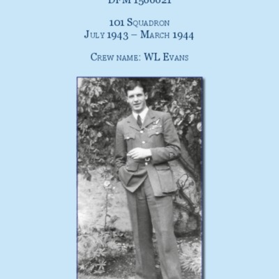
WO Donald Keith Fraser
Tags: 1 Group; 101 Squadron; 1667 HCU; 1668 HCU; aircrew; bomb trolley; bombing; bombing up; briefing; Churchill, Winston (1874-1965); Cook’s tour; dispersal; Distinguished Flying Medal; fear; FIDO; fitter engine; flight engineer; flight mechanic; fuelling; Gee; George VI, King of Great Britain (1895-1952); ground crew; ground personnel; Halifax; Harris, Arthur Travers (1892-1984); Heavy Conversion Unit; intelligence officer; Lancaster; memorial; military ethos; military living conditions; military service conditions; navigator; Nissen hut; Operational Training Unit; perception of bombing war; perimeter track; petrol bowser; radar; RAF Bottesford; RAF Catfoss; RAF Coningsby; RAF Cottesmore; RAF East Kirkby; RAF Lindholme; RAF Ludford Magna; RAF North Luffenham; RAF Sandtoft; RAF St Athan; RAF Waddington; RAF Wickenby; runway; searchlight; service vehicle; Tiger force; Tirpitz; tractor; training; Window; wireless operator

