Browse Items (42 total)
- Spatial Coverage is exactly "France--Watten"
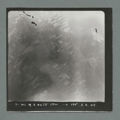
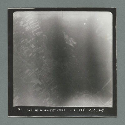
Lancaster JB139 Dark Victor
This item was sent to…
Tags: 617 Squadron; 619 Squadron; air gunner; aircrew; anti-aircraft fire; bale out; bomb aimer; bombing of the Boulogne E-boats (15/16 June 1944); bombing of the Le Havre E-boat pens (14/15 June 1944); C-47; flight engineer; Lancaster; mess; Mosquito; navigator; Normandy campaign (6 June – 21 August 1944); pilot; prisoner of war; RAF Coningsby; RAF Woodhall Spa; Resistance; Spitfire; Tallboy; target indicator; target photograph; V-1; wireless operator
Len Curtis' Flying Log Book
Served at RAF Dumfries, RAF…
Tags: 106 Squadron; 1660 HCU; 29 OTU; 617 Squadron; 630 Squadron; Advanced Flying Unit; aircrew; Anson; bomb aimer; bombing of Kassel (22/23 October 1943); bombing of the Boulogne E-boats (15/16 June 1944); bombing of the Le Havre E-boat pens (14/15 June 1944); Bombing of the Saumur tunnel (8/9 June 1944); bombing of the Watten V-2 site (19 June 1944); bombing of the Wizernes V-2 site (20, 22, 24 June 1944); bombing of Toulouse (5/6 April 1944); Botha; Heavy Conversion Unit; Lancaster; Manchester; missing in action; Normandy campaign (6 June – 21 August 1944); Normandy deception operations (5/6 June 1944); Operational Training Unit; RAF Dumfries; RAF East Kirkby; RAF North Luffenham; RAF Swinderby; RAF Syerston; RAF Woodhall Spa; Tallboy; Tiger Moth; training; Wellington
Alfred Sweeney’s RAF Pilot’s Flying Log Book
He was stationed at RAF…
Tags: 115 Squadron; 1651 HCU; 1653 HCU; 1669 HCU; 216 Squadron; 51 Squadron; 514 Squadron; 84 OTU; Advanced Flying Unit; aircrew; Anson; B-29; bombing; bombing of the Le Havre E-boat pens (14/15 June 1944); bombing of the Normandy coastal batteries (5/6 June 1944); C-47; Cook’s tour; Flying Training School; Halifax; Halifax Mk 7; Harvard; Heavy Conversion Unit; Horsa; Lancaster; Lancaster Finishing School; Lancaster Mk 1; Lancaster Mk 2; Lancaster Mk 3; Lancastrian; Lincoln; Meteor; Normandy campaign (6 June – 21 August 1944); Operation Dodge (1945); Operational Training Unit; Oxford; pilot; RAF Aqir; RAF Bassingbourn; RAF Boscombe Down; RAF Carlisle; RAF Church Lawford; RAF Desborough; RAF Feltwell; RAF Langar; RAF Lyneham; RAF Marham; RAF North Luffenham; RAF Syerston; RAF Waterbeach; RAF Watton; RAF Witchford; RAF Wratting Common; Shackleton; Stirling; tactical support for Normandy troops; Tiger Moth; training; Wellington; York
J.C. Cockram’s RCAF Observer’s and Air Gunner’s flying log book
Tags: 1652 HCU; 27 OTU; 462 Squadron; 466 Squadron; Advanced Flying Unit; Air Observers School; aircrew; Anson; bombing; C-47; Flying Training School; Halifax; Halifax Mk 2; Halifax Mk 3; Halifax Mk 5; Heavy Conversion Unit; navigator; Normandy campaign (6 June – 21 August 1944); Operational Training Unit; RAF Church Broughton; RAF Driffield; RAF Leconfield; RAF Marston Moor; RAF West Freugh; tactical support for Normandy troops; Tiger Moth; training; Wellington
Navigation log and plotting map for operation to Watten
Tags: 462 Squadron; aircrew; bombing; Halifax; Halifax Mk 3; navigator; RAF Driffield
Navigation logs and a plotting map for an operation to Watten
Tags: 462 Squadron; aircrew; bombing; Halifax; Halifax Mk 3; navigator; RAF Driffield
Robert Palmer's pilot's flying log book. Two
Tags: 109 Squadron; 15 OTU; 20 OTU; aircrew; Anson; bombing; bombing of the Normandy coastal batteries (5/6 June 1944); Lancaster; Lysander; Magister; Martinet; Mosquito; Normandy campaign (6 June – 21 August 1944); Operational Training Unit; Oxford; Pathfinders; pilot; RAF Abingdon; RAF Hullavington; RAF Lossiemouth; RAF Marham; tactical support for Normandy troops; Tiger Moth; training; V-1; V-2; V-weapon; Wellington
W G Didcote’s South African Air Force observer’s or air gunner’s log book
Tags: 115 Squadron; 1651 HCU; 1653 HCU; 1678 HCU; 17 OTU; 186 Squadron; 218 Squadron; 83 Squadron; 90 Squadron; Advanced Flying Unit; aircrew; Anson; bombing; bombing of Nuremberg (30 / 31 March 1944); bombing of the Le Havre E-boat pens (14/15 June 1944); bombing of the Normandy coastal batteries (5/6 June 1944); Botha; Heavy Conversion Unit; Lancaster; Lancaster Mk 1; Lancaster Mk 2; Lancaster Mk 3; Me 110; navigator; Normandy campaign (6 June – 21 August 1944); Operation Dodge (1945); Operation Exodus (1945); Operational Training Unit; Oxford; RAF Chedburgh; RAF Coningsby; RAF Manby; RAF Millom; RAF Silverstone; RAF Stradishall; RAF Tuddenham; RAF Waterbeach; RAF Witchford; RAF Wratting Common; Stirling; Tiger Moth; training; Wellington
Bomb Aimer's Notes
Ronald Hickey - Royal Australian Air Force flying log book. One
Tags: 1652 HCU; 27 OTU; 462 Squadron; 466 Squadron; Advanced Flying Unit; aircrew; Anson; bombing of Luftwaffe night-fighter airfields (15 August 1944); C-47; Flying Training School; Halifax; Halifax Mk 3; Heavy Conversion Unit; Normandy campaign (6 June – 21 August 1944); Operational Training Unit; Oxford; pilot; RAF Church Broughton; RAF Driffield; RAF Hullavington; RAF Leconfield; RAF Marston Moor; RAF South Cerney; tactical support for Normandy troops; Tiger Moth; training; Wellington
John Thorp's list of operations
Charles Bertram Sandland’s Royal Canadian Air Force pilot’s flying log book
Based at: Marshall’s Flying…
Tags: 1678 HCU; 26 OTU; 514 Squadron; 6 BFTS; Advanced Flying Unit; aircrew; bombing; bombing of the Le Havre E-boat pens (14/15 June 1944); bombing of the Normandy coastal batteries (5/6 June 1944); bombing of the Pas de Calais V-1 sites (24/25 June 1944); British Flying Training School Program; Flying Training School; Harvard; Heavy Conversion Unit; Initial Training Wing; Lancaster; Lancaster Finishing School; Lancaster Mk 1; Lancaster Mk 2; Lancaster Mk 3; Lancastrian; Normandy campaign (6 June – 21 August 1944); Operational Training Unit; Oxford; pilot; RAF Feltwell; RAF Lyneham; RAF Waterbeach; Stearman; tactical support for Normandy troops; Tiger Moth; training; Wellington; York
Don Cameron’s Royal Canadian Air Force pilots flying log book. Two
Tags: 115 Squadron; 1651 HCU; 1656 HCU; 1678 HCU; 17 OTU; 242 Squadron; 26 OTU; aircrew; bombing; bombing of the Le Havre E-boat pens (14/15 June 1944); bombing of the Normandy coastal batteries (5/6 June 1944); Cook’s tour; Flying Training School; Harvard; Heavy Conversion Unit; Lancaster; Lancaster Finishing School; Lancaster Mk 1; Lancaster Mk 2; Lancaster Mk 3; Normandy campaign (6 June – 21 August 1944); Operational Training Unit; Oxford; pilot; RAF Dishforth; RAF Feltwell; RAF Finningley; RAF Full Sutton; RAF Lindholme; RAF Little Horwood; RAF Little Rissington; RAF Oakington; RAF Silverstone; RAF Snaith; RAF Waterbeach; RAF Windrush; RAF Wing; RAF Witchford; RAF Wratting Common; Stirling; tactical support for Normandy troops; training; Wellington; York
J Millar’s navigator’s, air bomber’s and air gunner’s flying log book
Tags: 1657 HCU; 61 Squadron; 620 Squadron; air gunner; Air Gunnery School; aircrew; Blenheim; bombing; Bombing of Mailly-le-Camp (3/4 May 1944); bombing of Nuremberg (30 / 31 March 1944); bombing of the Juvisy, Noisy-le-Sec and Le Bourget railways (18/19 April 1944); bombing of the Normandy coastal batteries (5/6 June 1944); bombing of the Pas de Calais V-1 sites (24/25 June 1944); bombing of the Watten V-2 site (19 June 1944); Heavy Conversion Unit; Lancaster; Me 109; Normandy campaign (6 June – 21 August 1944); RAF Coningsby; RAF Leicester East; RAF Newmarket; RAF Pembrey; RAF Skellingthorpe; RAF Stradishall; Stirling; tactical support for Normandy troops; training; Wellington
Donald Chinery’s flying log book for observers and air gunners
Tags: 16 OTU; 1651 HCU; 17 OTU; 196 Squadron; 61 Squadron; Advanced Flying Unit; air gunner; Air Gunnery School; aircrew; bombing; Bombing of Mailly-le-Camp (3/4 May 1944); bombing of Nuremberg (30 / 31 March 1944); bombing of the Juvisy, Noisy-le-Sec and Le Bourget railways (18/19 April 1944); bombing of the Normandy coastal batteries (5/6 June 1944); bombing of the Pas de Calais V-1 sites (24/25 June 1944); bombing of the Watten V-2 site (19 June 1944); Cook’s tour; Heavy Conversion Unit; Me 109; mid-air collision; Normandy campaign (6 June – 21 August 1944); Operational Training Unit; RAF Barford St John; RAF Barrow in Furness; RAF Coningsby; RAF Finningley; RAF Llandwrog; RAF Newmarket; RAF Silverstone; RAF Skellingthorpe; RAF Turweston; RAF Waterbeach; RAF Witchford; tactical support for Normandy troops; training
Henry Pollock’s navigator’s, air bombers and air gunner’s flying log book
Tags: 10 OTU; 1663 HCU; 78 Squadron; air gunner; Air Gunnery School; aircrew; Anson; B-24; bombing; bombing of Luftwaffe night-fighter airfields (15 August 1944); C-47; Flying Training School; Halifax; Harvard; Heavy Conversion Unit; Martinet; Meteor; mine laying; Normandy campaign (6 June – 21 August 1944); Operational Training Unit; RAF Abingdon; RAF Andreas; RAF Breighton; RAF Feltwell; RAF Rufforth; RAF Stanton Harcourt; tactical support for Normandy troops; training; V-1; V-weapon; Whitley
Dennis Denton's log book
Tags: 13 OTU; 139 Squadron; 17 OTU; 2 Group; 21 Squadron; 226 Squadron; air gunner; Air Gunnery School; aircrew; Anson; anti-aircraft fire; B-25; Blenheim; Botha; C-47; Defiant; Dominie; Operational Training Unit; Proctor; RAF Bicester; RAF Evanton; RAF Hartford Bridge; RAF Methwold; RAF Oulton; RAF Swanton Morley; RAF Upwood; RAF Watton; RAF West Raynham; RAF Yatesbury; training; Ventura; Whitley; wireless operator / air gunner
A bomber pilot’s journey through WWII
Tags: 11 OTU; 1660 HCU; 1668 HCU; 196 Squadron; 214 Squadron; 5 Group; 617 Squadron; 8 Group; aircrew; Bennett, Donald Clifford Tyndall (1910-1986); bombing; bombing of the Boulogne E-boats (15/16 June 1944); bombing of the Creil/St Leu d’Esserent V-1 storage areas (4/5 July 1944); bombing of the Juvisy, Noisy-le-Sec and Le Bourget railways (18/19 April 1944); bombing of the Le Havre E-boat pens (14/15 June 1944); bombing of the Mimoyecques V-3 site (6 July 1944); Bombing of the Saumur tunnel (8/9 June 1944); bombing of the Siracourt V-weapon site (25 June 1944); bombing of the Watten V-2 site (19 June 1944); bombing of the Wizernes V-2 site (20, 22, 24 June 1944); bombing of Toulouse (5/6 April 1944); Boston; C-47; Chadwick, Roy (1893-1947); Cheshire, Geoffrey Leonard (1917-1992); crash; Distinguished Flying Cross; Distinguished Service Order; final resting place; Flying Training School; Gibson, Guy Penrose (1918-1944); Grand Slam; grief; H2S; Halifax; Halifax Mk 3; Harvard; Heavy Conversion Unit; incendiary device; Lancaster; Lancaster Finishing School; Lincoln; Meteor; Mosquito; Normandy campaign (6 June – 21 August 1944); Normandy deception operations (5/6 June 1944); Oboe; Operational Training Unit; Oxford; P-51; Pathfinders; pilot; promotion; RAF Bassingbourn; RAF Boscombe Down; RAF Church Lawford; RAF Coningsby; RAF Cranage; RAF Cranwell; RAF Driffield; RAF Leconfield; RAF Stradishall; RAF Swinderby; RAF Syerston; RAF Upavon; RAF Wainfleet; RAF Woodhall Spa; Spitfire; Stirling; Tallboy; Tiger Moth; training; V-1; V-2; V-3; V-weapon; Wallis, Barnes Neville (1887-1979); Wellington
V Group News, November 1944
Tags: 5 Group; 617 Squadron; 9 Squadron; air gunner; aircrew; bomb aimer; bombing; bombing of the Boulogne E-boats (15/16 June 1944); bombing of the Creil/St Leu d’Esserent V-1 storage areas (4/5 July 1944); bombing of the Mimoyecques V-3 site (6 July 1944); bombing of the Watten V-2 site (19 June 1944); bombing of the Wizernes V-2 site (20, 22, 24 June 1944); Distinguished Flying Cross; Distinguished Flying Medal; flight engineer; Gee; gremlin; H2S; Lancaster; Lancaster Finishing School; mine laying; navigator; Normandy campaign (6 June – 21 August 1944); Oboe; Operation Catechism (12 November 1944); pilot; radar; rivalry; Tallboy; Tirpitz; training; wireless operator
V Group News, July 1944
Tags: 5 Group; air gunner; air sea rescue; aircrew; bomb aimer; bombing; bombing of the Creil/St Leu d’Esserent V-1 storage areas (4/5 July 1944); bombing of the Mimoyecques V-3 site (6 July 1944); Cheshire, Geoffrey Leonard (1917-1992); Distinguished Flying Cross; Distinguished Flying Medal; Distinguished Service Order; ditching; flight engineer; Gee; H2S; Lancaster; mine laying; navigator; Normandy campaign (6 June – 21 August 1944); Oboe; pilot; radar; rivalry; searchlight; sport; tactical support for Normandy troops; training; V-2; V-3; V-weapon; wireless operator


![MRobertsEJH[See#-DoB]-170712-030011.jpg MRobertsEJH[See#-DoB]-170712-030011.jpg](https://ibccdigitalarchive.lincoln.ac.uk/omeka/files/square_thumbnails/1901/35286/MRobertsEJH[See -DoB]-170712-030011.jpg)
