Browse Items (102 total)

  • Contributor is exactly "Andy Fitter"

PBirdJH18010038.jpg
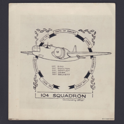
Sergeant Bird's crew award for the best photographs for August 1944. The artwork comprises a drawing of a Wellington with Bird and his crew, Boulton, Bentley, Dean and Beckett named below, set against a circular ribbon with the words: 'THE BEST…

PTrappSV1602.jpg
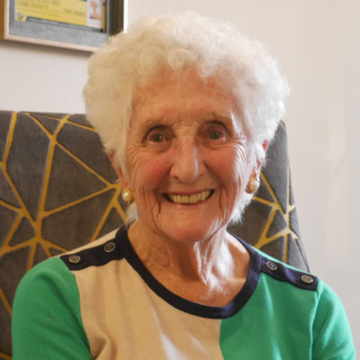
Sylvia was born in Mansfield where her father was a miner and her mother had worked at Lawns Mills. She had two brothers and a sister. Sylvia was 15 when she left school to work at the hosiery mills and recalls the German manager being deported. She…

PTeasdaleA22020005.jpg
Audrey left school at 14 and began work as a clerical assistant for a tailoring firm in Leeds, then moving into furniture sales.
Audrey was 23 when the war started and was conscripted on 15 December 1942 electing to join the Women's Auxiliary Air…

PRoyallG1501.jpg
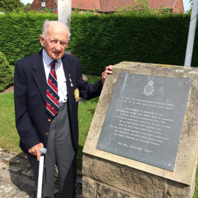
George volunteered to be a pilot but settled for Air Observer. He talks about his selection and training in London and then in Stratford-upon-Avon, where enjoyed the theatre and how, at Brighton, illness separated him from the rest of the course. So,…

SRAFIngham19410620v070001-Audio.mp3
Mieczyslaw Maryszczak was born in Bokyivka, Ukraine and served in the Polish Army and then the Polish Air Force. An early memory of the war is throwing bread to starving Russian prisoners being marched from Lviv to Podlesice. At seventeen he was in…

PWhitworthJ1515.jpg
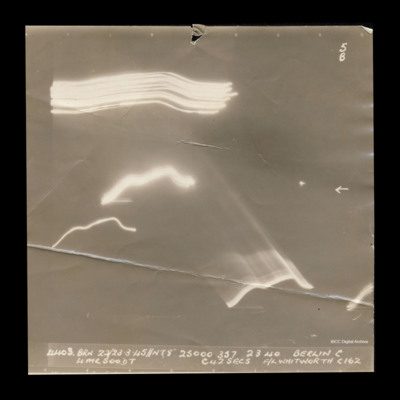
Target photograph taken on an operation to Berlin. Several streaks of light are clustered toward the top left of the photograph and others are across the centre and lower half. No ground features are visible. One small flare is visible to the right…

PWhittakerH1713.jpg
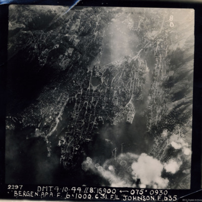
A near vertical aerial photograph of Bergen Harbour, showing its entire layout, with the town in the centre. In the town the seven-sided lake, Lille Lungegardsvannet, next to the Festplassen can be identified. Above this is the large body of water…

PDarbyCAH18010001.jpg
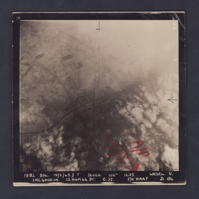
A vertical aerial photograph of Wesel, orientated with south to the top. Wesel is not covered by the photograph but lies below the bottom edge. However, the Wesel-Datteln Kanal is clearly visible, cutting across the middle of the frame, as are the…

PDarbyCAH18010003.jpg
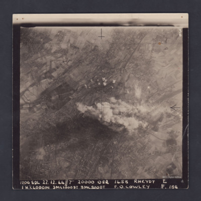
A clear, vertical, aerial photograph taken during a bombing operation at Rheydt, a borough of Mönchengladbach, orientated with south-east at the top edge. There are open fields visible in the upper left, upper right and the lower right corners of…

PDarbyCAH18010007.jpg
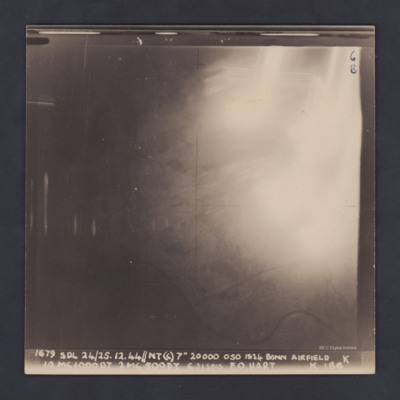
A vertical aerial photograph of Hangelar (Bonn) airfield taken during a bombing operation. The image is orientated with south-east at the top edge. A large, bright glare obscures most of the ground detail but the River Seig is visible, meandering…

PDarbyCAH18010009.jpg
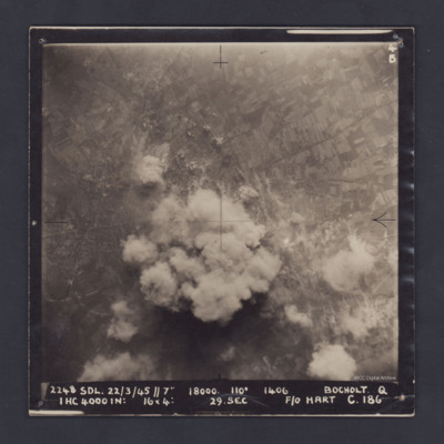
A vertical aerial photograph of Bocholt. On the left side is the distinctive diamond shape of Friedhof Bocholt cemetery and on the middle left edge is the artificial lake, the Bocholter Aasee. The upper left quarter of the image shows open…

PDarbyCAH18010011.jpg
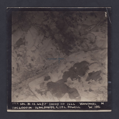
A vertical aerial photograph of Vohwinkel, near Wuppertal, orientated so that the top edge is roughly south. The multi-track railway is obvious and runs from the lower left corner to a large marshalling yard at the mid-right edge. A branch line joins…

PDarbyCAH18010015.jpg
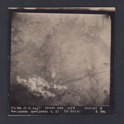
A vertical aerial photograph of Rheydt, near Mönchengladbach. The railways clearly stand out, one entering the image at lower right, branching out into a marshalling yard and another sweeping in from the upper right corner of the image. The centre…

PDarbyCAH18010017.jpg
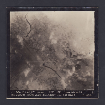
A vertical aerial photograph of the centre of Saarbrücken, orientated with south-east at the top and clearly showing the River Saar. Cloud and/or smoke covers parts of the town but residential areas, the railway and other details can still be seen.…

PDarbyCAH18010019.jpg
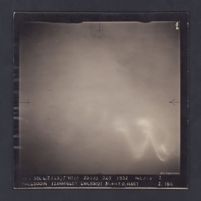
An aerial photograph of cloud-covered Neuss, near Düsseldorf. The cloud obscures all detail and all that can be seen through the cloud is a large glow, probably from the ground, and the wavy trace of a flare.

The photograph is captioned:
'1814…

PDarbyCAH18010021.jpg
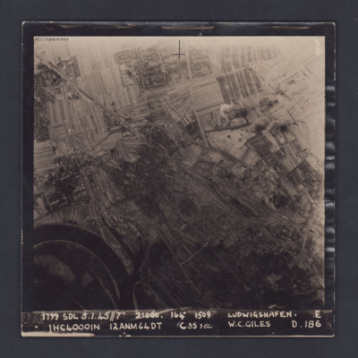
A vertical target photograph of Ludwigshafen, orientated with the south west at the top. In the lower left corner is a bend in the River Rhine and the entrance to Kaiserworthhafen docks. Just visible at the bottom edge is the end of Luitpoldhafen…

CRoyallGL-220420-01.jpg
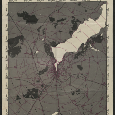
A radar (H2S) prediction map of Flensburg. Bodies of water are shown in white, lines of communication and built up areas are shown in purple and wooded areas and rail lines are shown in black. The map is also marked with concentric rings, centred on…

Tags: ;

SCockramJC419379v10032.pdf
Operation 33. Three Navigation log sheets recording the routes and observations. A plotting map showing the routes out to Dusseldorf and back.
A target photograph in which everything is obscured, mainly by illuminated smoke or cloud. Caption for…

SCockramJC419379v10030.pdf
Operation 31 for the crew. Three sheets of a Navigation Log showing the route to be taken to and from the target and the Observations made along the way. Part of a Plotting Map showing the route to and from Domburg on Walcheren Island. On the reverse…

SCockramJC419379v10027.pdf
Operation 28 for the crew. Two navigation sheets with only the Observations on route recorded. Part of a plotting map showing the route to and from Bochum.
A target photograph in which the ground is almost completely obscured by smoke or cloud. It…

SCockramJC419379v10025.pdf
Operation 26 for the crew. Three navigation log sheets showing the route to be taken and the observations made throughout the operation. The plotting map shows the coasts of England and Holland and the route to Sterkrade.
The target photograph…

SCockramJC419379v10023.pdf
Operation 24 for the crew. Three navigation log sheets showing the route to be flown and the observations taken. A plotting map showing the route to the target. A target photograph in which a large area of bright light obscures everything on the…

SCockramJC419379v10022.pdf
The three navigation sheets give details of the planned routes out and back as well as observations and events during the operation. The map plots the routes to be flown.
Note from the Navigation Officer 'Satisfactory. Why not use 40[degree] method…
Output Formats

atom, dc-rdf, dcmes-xml, json, omeka-xml, rss2