Rheydt
Title
Rheydt
Description
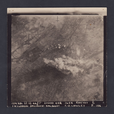
A clear, vertical, aerial photograph taken during a bombing operation at Rheydt, a borough of Mönchengladbach, orientated with south-east at the top edge. There are open fields visible in the upper left, upper right and the lower right corners of the image and at the left hand side, Bresges Park shows up as a dark area. A railway track enters the image at upper right and runs down to the bottom edge. Another railway track enters at a third of the way down the right side and also runs to the bottom edge. The streets and houses of Rheydt can be clearly seen as can the oval of the Evangelist Friedhof Rheydt cemetery in the lower left corner. To the left of this is a small industrial area. The central part of Rheydt and some of the rail track is obscured by smoke from explosions and some other explosions can be seen just above this.
The photograph is captioned:
'1706 SDL 27.12.44 // 7" 20000 052 1458 Rheydt E
1HC4000IN 3MC1000DT 8 MC 500 DT F.O. COWLEY F.186'.
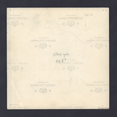
On the reverse is handwritten '1500yds 065°
The photograph is captioned:
'1706 SDL 27.12.44 // 7" 20000 052 1458 Rheydt E
1HC4000IN 3MC1000DT 8 MC 500 DT F.O. COWLEY F.186'.
On the reverse is handwritten '1500yds 065°
Creator
Date
1944-12-27
Temporal Coverage
Language
Type
Format
One b/w photograph
Conforms To
Publisher
Rights
This content is available under a CC BY-NC 4.0 International license (Creative Commons Attribution-NonCommercial 4.0). It has been published ‘as is’ and may contain inaccuracies or culturally inappropriate references that do not necessarily reflect the official policy or position of the University of Lincoln or the International Bomber Command Centre. For more information, visit https://creativecommons.org/licenses/by-nc/4.0/ and https://ibccdigitalarchive.lincoln.ac.uk/omeka/legal.
Contributor
Identifier
PDarbyCAH18010003, PDarbyCAH18010004
Collection
Citation
Great Britain. Royal Air Force, “Rheydt,” IBCC Digital Archive, accessed October 29, 2024, https://ibccdigitalarchive.lincoln.ac.uk/omeka/collections/document/39723.
Item Relations
This item has no relations.


