Sterkade
Title
Sterkade
Description
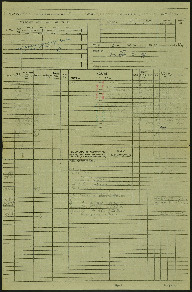
Operation 26 for the crew. Three navigation log sheets showing the route to be taken and the observations made throughout the operation. The plotting map shows the coasts of England and Holland and the route to Sterkrade.
The target photograph shows an area just to the west of Sterkrade and is orientated with north at the upper edge. The image shows roads, buildings, rail and rivers. From the lower right corner the east - west route of the Kleine Emscher river and a railway run side by side until the railway turns to the south. Across the upper right corner is the larger Emscher river. The upper left corner is obscured by smoke from explosions. The photograph is captioned: 2643. DRF. 6-10-44 // 7" 17300 →090.1717. Sterkrade. P. 16 X 500. C. 34secs. F/O Hickey. P. 462.
The target photograph shows an area just to the west of Sterkrade and is orientated with north at the upper edge. The image shows roads, buildings, rail and rivers. From the lower right corner the east - west route of the Kleine Emscher river and a railway run side by side until the railway turns to the south. Across the upper right corner is the larger Emscher river. The upper left corner is obscured by smoke from explosions. The photograph is captioned: 2643. DRF. 6-10-44 // 7" 17300 →090.1717. Sterkrade. P. 16 X 500. C. 34secs. F/O Hickey. P. 462.
Creator
Temporal Coverage
Language
Format
Two navigation log sheets, part of a plotting map and a target photograph
Conforms To
Publisher
Rights
This content is available under a CC BY-NC 4.0 International license (Creative Commons Attribution-NonCommercial 4.0). It has been published ‘as is’ and may contain inaccuracies or culturally inappropriate references that do not necessarily reflect the official policy or position of the University of Lincoln or the International Bomber Command Centre. For more information, visit https://creativecommons.org/licenses/by-nc/4.0/ and https://ibccdigitalarchive.lincoln.ac.uk/omeka/legal.
Contributor
Identifier
SCockramJC419379v10025
Collection
Citation
JC Cockram, “Sterkade,” IBCC Digital Archive, accessed October 22, 2024, https://ibccdigitalarchive.lincoln.ac.uk/omeka/collections/document/39229.
Item Relations
This item has no relations.

