Browse Items (283 total)
- Spatial Coverage is exactly "Atlantic Ocean--English Channel"
Copy of Peter Potter's flying log book
Tags: 30 OTU; 626 Squadron; air gunner; Air Gunnery School; aircrew; anti-aircraft fire; bombing; bombing of Luftwaffe night-fighter airfields (15 August 1944); bombing of the Normandy coastal batteries (5/6 June 1944); Chadwick, Roy (1893-1947); fear; Ju 88; Lancaster; Me 109; Me 262; military ethos; mine laying; Normandy campaign (6 June – 21 August 1944); nose art; Operational Training Unit; RAF Hixon; RAF Pembrey; RAF Wickenby; tactical support for Normandy troops; target indicator; training; V-1; V-weapon; Wellington
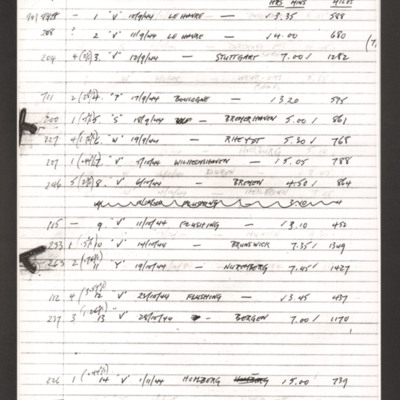
D A MacArthur's log book extracts
Tags: 166 Squadron; aircrew; Bombing of Mailly-le-Camp (3/4 May 1944); bombing of the Le Havre E-boat pens (14/15 June 1944); bombing of the Normandy coastal batteries (5/6 June 1944); Lancaster; Lancaster Finishing School; mine laying; navigator; Normandy campaign (6 June – 21 August 1944); RAF Hemswell; RAF Kirmington; tactical support for Normandy troops; training; V-1; V-3; V-weapon
D Hinshelwood’s Royal Air Force Navigator’s, Air Bomber’s and Air Gunner’s Flying Log Book
Tags: 10 OTU; 1658 HCU; 78 Squadron; air gunner; Air Gunnery School; aircrew; Anson; bombing; bombing of the Normandy coastal batteries (5/6 June 1944); Halifax; Halifax Mk 3; Heavy Conversion Unit; Ju 88; mine laying; Normandy campaign (6 June – 21 August 1944); Operational Training Unit; RAF Abingdon; RAF Breighton; RAF Dalcross; RAF Riccall; RAF Stanton Harcourt; tactical support for Normandy troops; training; Whitley
David Donaldson's pilot's flying log book. One
Tags: 100 Group; 149 Squadron; 15 OTU; 156 Squadron; 1667 HCU; 192 Squadron; 57 Squadron; Air Observers School; aircrew; Anson; bombing; Bombing and Gunnery School; Cook’s tour; Distinguished Flying Cross; Distinguished Service Order; Flying Training School; Gee; Halifax; Heavy Conversion Unit; Hudson; Lancaster; Magister; Operational Training Unit; Oxford; Pathfinders; pilot; Proctor; RAF Brize Norton; RAF Evanton; RAF Feltwell; RAF Foulsham; RAF Hampstead Norris; RAF Harwell; RAF Lindholme; RAF Mildenhall; RAF Warboys; RAF West Raynham; RAF Wyton; Tiger Moth; training; Wellington
Dennis Moore's flying log book. One
Tags: 12 OTU; 15 Squadron; 1653 HCU; 218 Squadron; 52 Squadron; Advanced Flying Unit; aircrew; Anson; bombing; C-47; Heavy Conversion Unit; Lancaster; Lancaster Finishing School; Lancastrian; navigator; Operational Training Unit; RAF Chedburgh; RAF Chipping Warden; RAF Feltwell; RAF Methwold; RAF Mildenhall; RAF Shenington; RAF Wigtown; RCAF Rivers; Stirling; Sunderland; training; Wellington; York
Details from log book of Henry Townsley DFM
Tags: 15 Squadron; 166 Squadron; 8 Group; 9 Squadron; 97 Squadron; aircrew; bombing; bombing of Hamburg (24-31 July 1943); bombing of the Normandy coastal batteries (5/6 June 1944); bombing of the Pas de Calais V-1 sites (24/25 June 1944); Bombing of Trossy St Maximin (3 August 1944); Distinguished Flying Medal; flight engineer; Ju 88; mine laying; Normandy campaign (6 June – 21 August 1944); Pathfinders; RAF Bourn; RAF Coningsby; RAF Woodhall Spa
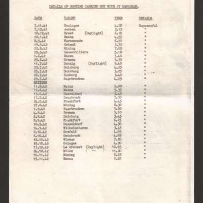
Details of sorties carried out with 97 Squadron
Tags: 97 Squadron; bombing
Details of tour
Dieppe
Don Cameron’s Royal Canadian Air Force pilots flying log book. Two
Tags: 115 Squadron; 1651 HCU; 1656 HCU; 1678 HCU; 17 OTU; 242 Squadron; 26 OTU; aircrew; bombing; bombing of the Le Havre E-boat pens (14/15 June 1944); bombing of the Normandy coastal batteries (5/6 June 1944); Cook’s tour; Flying Training School; Harvard; Heavy Conversion Unit; Lancaster; Lancaster Finishing School; Lancaster Mk 1; Lancaster Mk 2; Lancaster Mk 3; Normandy campaign (6 June – 21 August 1944); Operational Training Unit; Oxford; pilot; RAF Dishforth; RAF Feltwell; RAF Finningley; RAF Full Sutton; RAF Lindholme; RAF Little Horwood; RAF Little Rissington; RAF Oakington; RAF Silverstone; RAF Snaith; RAF Waterbeach; RAF Windrush; RAF Wing; RAF Witchford; RAF Wratting Common; Stirling; tactical support for Normandy troops; training; Wellington; York
Donald Briggs' log book
Tags: 156 Squadron; 8 Group; aircrew; bombing; bombing of Dresden (13 - 15 February 1945); bombing of Luftwaffe night-fighter airfields (15 August 1944); flight engineer; Lancaster; Lancaster Mk 3; Normandy campaign (6 June – 21 August 1944); Pathfinders; RAF Upwood; tactical support for Normandy troops; V-1; V-weapon
Donald Cochrane's operations
Tags: anti-aircraft fire; bombing; Bombing of Mailly-le-Camp (3/4 May 1944); bombing of Nuremberg (30 / 31 March 1944); bombing of the Boulogne E-boats (15/16 June 1944); bombing of the Le Havre E-boat pens (14/15 June 1944); bombing of the Normandy coastal batteries (5/6 June 1944); Halifax; Ju 88; Lancaster; mine laying; Normandy campaign (6 June – 21 August 1944); Pathfinders; searchlight; target indicator
Donald Cochrane’s observer's and air gunner's flying log book
Tags: 1657 HCU; 30 OTU; 460 Squadron; aircrew; Anson; bombing; Bombing of Mailly-le-Camp (3/4 May 1944); bombing of Nuremberg (30 / 31 March 1944); bombing of the Boulogne E-boats (15/16 June 1944); bombing of the Le Havre E-boat pens (14/15 June 1944); bombing of the Normandy coastal batteries (5/6 June 1944); Dominie; Heavy Conversion Unit; Lancaster; Lancaster Finishing School; mine laying; Normandy campaign (6 June – 21 August 1944); Operational Training Unit; Proctor; RAF Binbrook; RAF Feltwell; RAF Seighford; RAF Stradishall; Stirling; training; Wellington; wireless operator
Douglas Hudson's observer’s and air gunner’s flying log book
Tags: 100 Squadron; 1656 HCU; 1662 HCU; 1667 HCU; 28 OTU; Advanced Flying Unit; Air Observers School; aircrew; Anson; bombing; bombing of Nuremberg (30 / 31 March 1944); bombing of the Normandy coastal batteries (5/6 June 1944); Cook’s tour; Halifax; Heavy Conversion Unit; Lancaster; mine laying; navigator; Normandy campaign (6 June – 21 August 1944); Operational Training Unit; Pathfinders; RAF Blyton; RAF Grimsby; RAF Lindholme; RAF Sandtoft; RAF Staverton; RAF Wymeswold; training; Wellington
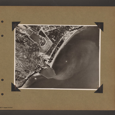
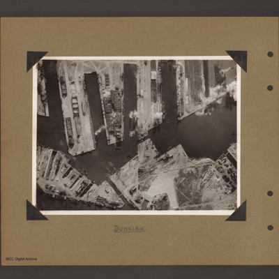
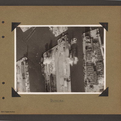
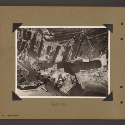
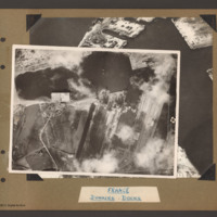
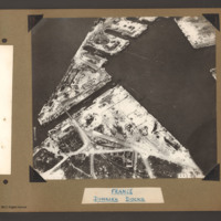
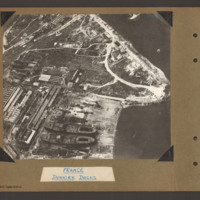
Dunkirk docks
Dunkirk docks
Dunkirk docks
Dunkirk Docks
Dunkirk Docks
Dunkirk Docks
Dunkirk Docks
Tags: aerial photograph
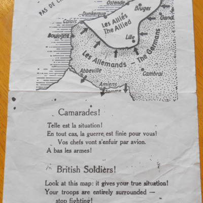
Dunkirk leaflet
This item was sent to the IBCC Digital Archive already in digital form. No…
Tags: propaganda
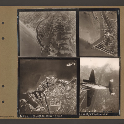
Dunkirk, Den Helder, Vlissingen and Ventura over Ijmuiden
Top right an aerial vertical…
E J Haddow’s navigator’s air bomber’s and air gunner’s flying log book
Tags: 115 Squadron; 1651 HCU; 1678 HCU; 17 OTU; aircrew; bombing; bombing of Nuremberg (30 / 31 March 1944); bombing of the Le Havre E-boat pens (14/15 June 1944); flight engineer; Heavy Conversion Unit; Lancaster; Normandy campaign (6 June – 21 August 1944); Operational Training Unit; RAF Dunkeswell; RAF Silverstone; RAF Talbenny; RAF Waterbeach; RAF Witchford; RAF Wratting Common; Stirling; training; Wellington

![LMacArthurDA[Ser%20-DoB]v1.pdf LMacArthurDA[Ser%20-DoB]v1.pdf](https://ibccdigitalarchive.lincoln.ac.uk/omeka/files/square_thumbnails/1020/11364/LMacArthurDA[Ser 20-DoB]v1.jpg)
