Dunkirk Docks
Title
Dunkirk Docks
France Dunkirk Docks
Description
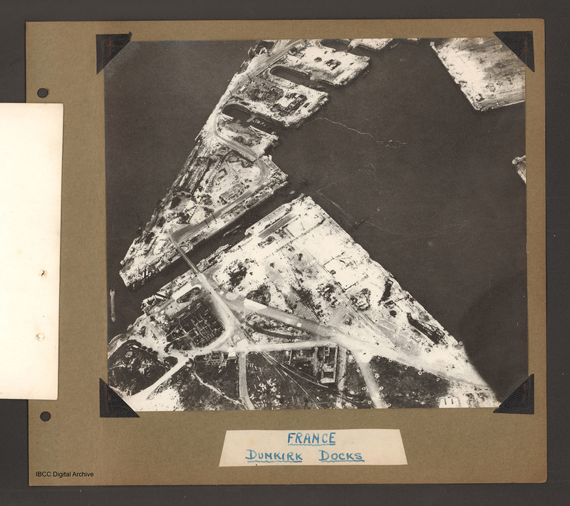
Oblique aerial photograph of Dunkirk docks. The entire area has been extensively bomb damaged. In the bottom half, a triangular shaped area of dockland with roads and railway lines. There are several damaged buildings without roofs and destroyed dockside cranes . A bridge crosses a narrow waterway which runs from lower left towards the centre where it enters a large trapezoid shaped water basin. The bridge connects to a spur of land runs from the centre left to the top centre. The spur has three small indented docks on the lower side. There are some further damaged buildings scattered over this area. Several capsized or partially sunk watercraft can be seen throughout including one across the entrance to the narrow waterway and another within this canal. Captioned 'France Dunkirk Docks'.
Coverage
Language
Type
Format
On b/w photograph mounted on an album page
Conforms To
Publisher
Rights
This content is available under a CC BY-NC 4.0 International license (Creative Commons Attribution-NonCommercial 4.0). It has been published ‘as is’ and may contain inaccuracies or culturally inappropriate references that do not necessarily reflect the official policy or position of the University of Lincoln or the International Bomber Command Centre. For more information, visit https://creativecommons.org/licenses/by-nc/4.0/ and https://ibccdigitalarchive.lincoln.ac.uk/omeka/legal.
Contributor
Identifier
PBanksP15010008
Collection
Citation
“Dunkirk Docks,” IBCC Digital Archive, accessed July 27, 2024, https://ibccdigitalarchive.lincoln.ac.uk/omeka/collections/document/1414.
Item Relations
This item has no relations.

