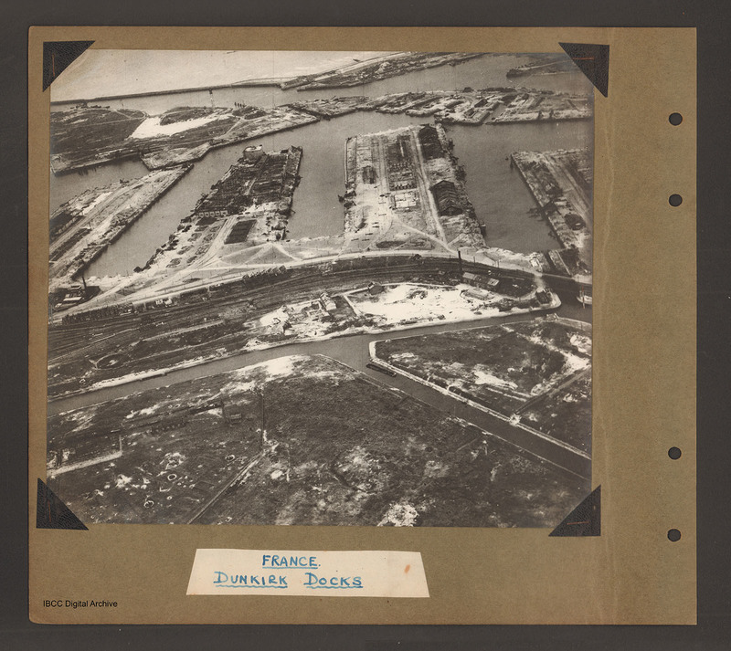
Dunkirk Docks
Title
Dunkirk Docks
Description
Oblique aerial photograph at low level showing docks, waterways, buildings and other port facilities. No vessels are visible. Across the centre four wide moles numbered 1 to 4 from right to left. The area has been heavily damaged with bomb craters, roofless buildings and collapsed quayside cranes. Mole 1 is only partly visible. Mole two has two large buildings on the right side and damaged buildings in the centre. Mole 3 has damage buildings and a large square structure at the far end. Mole 4 has building with roofs damaged on left side. Above the moles more land with dock facilities with a chimney at the left end aligned with mole 4, and beyond a further waterway and a sea wall with open sea on the far side at the top. Running along the bottom of the moles is land with railway tracks. At the bottom of mole 1 is a building alongside the tracks with a chimney. Underneath the railways is another waterway running left to right with a spur running of from a junction just underneath the left side of mole 2. Captioned 'France Dunkirk Docks'
Coverage
Language
Type
Format
One b/w photograph mounted on an album page.
Conforms To
Publisher
Rights
This content is available under a CC BY-NC 4.0 International license (Creative Commons Attribution-NonCommercial 4.0). It has been published ‘as is’ and may contain inaccuracies or culturally inappropriate references that do not necessarily reflect the official policy or position of the University of Lincoln or the International Bomber Command Centre. For more information, visit https://creativecommons.org/licenses/by-nc/4.0/ and https://ibccdigitalarchive.lincoln.ac.uk/omeka/legal.
Contributor
Identifier
PBanksP15010006
Collection
Citation
“Dunkirk Docks,” IBCC Digital Archive, accessed November 2, 2024, https://ibccdigitalarchive.lincoln.ac.uk/omeka/collections/document/1356.
Item Relations
This item has no relations.

