Browse Items (97 total)
- Spatial Coverage is exactly "France--Creil"
St Leu D'Esserent
St Leu D'Esserent
Subsequent fate of Lancasters
Tags: crash; ditching; Lancaster; missing in action; RAF Lakenheath; shot down
V Group News, July 1944
Tags: 5 Group; air gunner; air sea rescue; aircrew; bomb aimer; bombing; bombing of the Creil/St Leu d’Esserent V-1 storage areas (4/5 July 1944); bombing of the Mimoyecques V-3 site (6 July 1944); Cheshire, Geoffrey Leonard (1917-1992); Distinguished Flying Cross; Distinguished Flying Medal; Distinguished Service Order; ditching; flight engineer; Gee; H2S; Lancaster; mine laying; navigator; Normandy campaign (6 June – 21 August 1944); Oboe; pilot; radar; rivalry; searchlight; sport; tactical support for Normandy troops; training; V-2; V-3; V-weapon; wireless operator
V Group News, August 1944
Tags: 5 Group; air gunner; air sea rescue; aircrew; bomb aimer; bombing; bombing of Luftwaffe night-fighter airfields (15 August 1944); Bombing of Trossy St Maximin (3 August 1944); Distinguished Flying Cross; Distinguished Flying Medal; Distinguished Service Order; ditching; flight engineer; Gee; H2S; Heavy Conversion Unit; Lancaster; mine laying; navigator; Normandy campaign (6 June – 21 August 1944); Oboe; pilot; radar; rivalry; sport; Stirling; tactical support for Normandy troops; training; wireless operator
V Group News, November 1944
Tags: 5 Group; 617 Squadron; 9 Squadron; air gunner; aircrew; bomb aimer; bombing; bombing of the Boulogne E-boats (15/16 June 1944); bombing of the Creil/St Leu d’Esserent V-1 storage areas (4/5 July 1944); bombing of the Mimoyecques V-3 site (6 July 1944); bombing of the Watten V-2 site (19 June 1944); bombing of the Wizernes V-2 site (20, 22, 24 June 1944); Distinguished Flying Cross; Distinguished Flying Medal; flight engineer; Gee; gremlin; H2S; Lancaster; Lancaster Finishing School; mine laying; navigator; Normandy campaign (6 June – 21 August 1944); Oboe; Operation Catechism (12 November 1944); pilot; radar; rivalry; Tallboy; Tirpitz; training; wireless operator
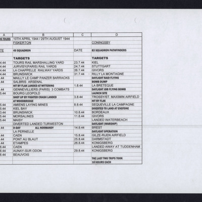
Alan Edgar's Operations
Tags: 49 Squadron; 83 Squadron; bombing of Luftwaffe night-fighter airfields (15 August 1944); Bombing of Mailly-le-Camp (3/4 May 1944); bombing of the Juvisy, Noisy-le-Sec and Le Bourget railways (18/19 April 1944); bombing of the Normandy coastal batteries (5/6 June 1944); Bombing of Trossy St Maximin (3 August 1944); mine laying; Normandy campaign (6 June – 21 August 1944); Pathfinders; RAF Coningsby; RAF Fiskerton; RAF Tuddenham; RAF Waterbeach; RAF Woodbridge; V-1; V-weapon
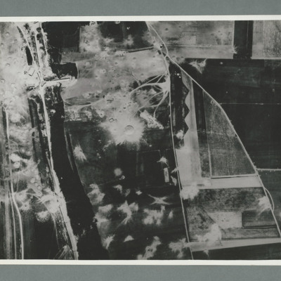
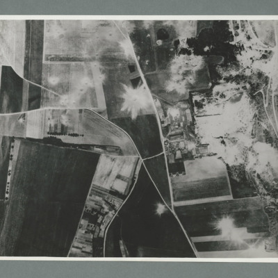
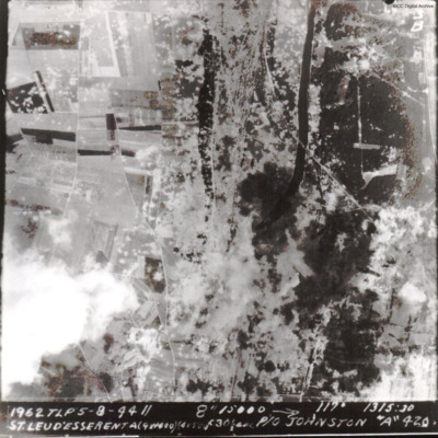
St Leu d'Esserent
The caption reads '1962 TLP 5-8-44 // 8" 15000 --> 117° 1315:30 St Leu d'Esserent A(9x1000)(4x500)f30sec P/O Johnston "A" 420'
The second image is identical.
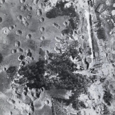
St Leu d'Esserent
Photo 1 is a vertical image showing bomb craters. It is annotated with 'C' and 'D's.
Photo 2 shows an entrance to an underground store.
Photo 3 show an entrance to an underground store. It…
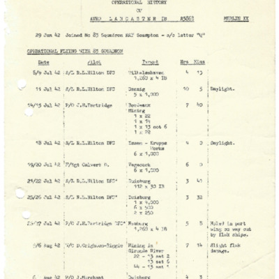
Operational history of Lancaster 1B R5868
Tags: 467 Squadron; 83 Squadron; bombing of Hamburg (24-31 July 1943); Bombing of Mailly-le-Camp (3/4 May 1944); bombing of the Creil/St Leu d’Esserent V-1 storage areas (4/5 July 1944); bombing of the Juvisy, Noisy-le-Sec and Le Bourget railways (18/19 April 1944); bombing of the Normandy coastal batteries (5/6 June 1944); bombing of the Pas de Calais V-1 sites (24/25 June 1944); Lancaster; mine laying; Normandy campaign (6 June – 21 August 1944); Pathfinders; RAF Bottesford; RAF Scampton; RAF Waddington; RAF Wyton; tactical support for Normandy troops; target indicator; V-1; V-weapon
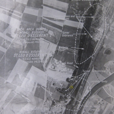
St Leu d'Esserent
Photo 1 is a vertical target photograph with tunnels, railway and landing quay marked.
Photo 2 is a vertical aerial photograph taken during the operation. It is captioned '1962 TLP 5-8-44//8" 15000…
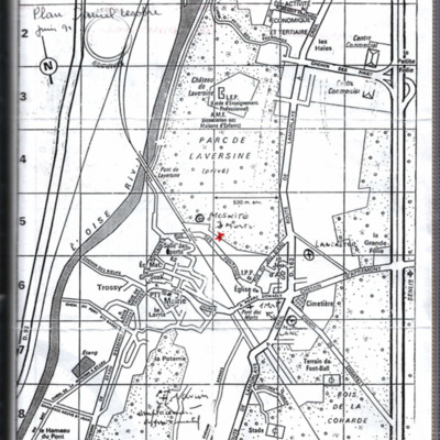
Map of Saint Maximin
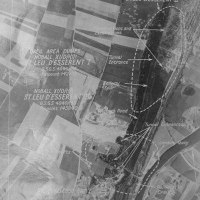
St Leu d'Esserent
Photo 1 is a target aerial photograph with areas to be bombed. Tunnel entrances, constructions, excavations, railway and a landing quay are marked.
Photo 2 is a vertical aerial photograph taken during the…
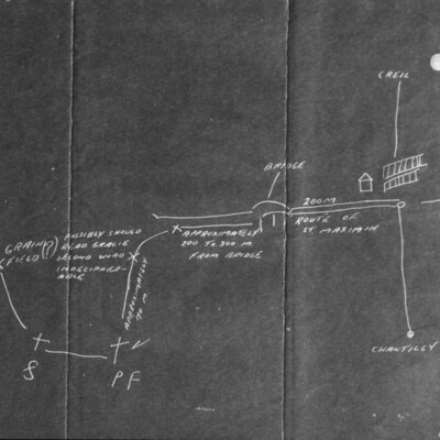
Sketch Map of St Maximin
Information supplied with the collection describes it as 'ANACR map original'. [French Resistance] and as a map drawn by…
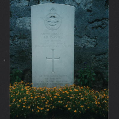
John "Jack" Richard Davies
Tags: 166 Squadron; air gunner; aircrew; anti-aircraft fire; bale out; bomb aimer; bomb struck; Bombing of Trossy St Maximin (3 August 1944); evading; final resting place; killed in action; Lancaster; Lancaster Mk 1; Mosquito; Normandy campaign (6 June – 21 August 1944); RAF Kirmington; Resistance; V-1; V-weapon; Window
Headstone
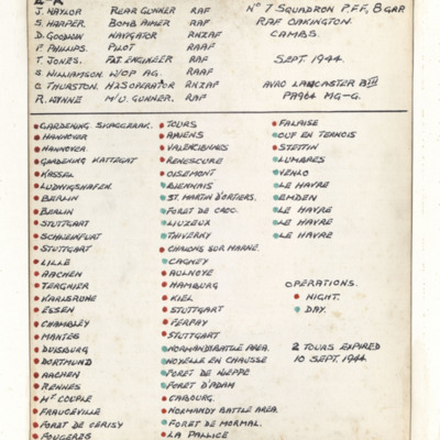
List of operations
Main Ops - with crew only
Tags: 12 Squadron; 626 Squadron; anti-aircraft fire; bombing; Bombing of Trossy St Maximin (3 August 1944); ground crew; Ju 88; Lancaster; Master Bomber; Me 109; Mosquito; Normandy campaign (6 June – 21 August 1944); nose art; P-51; Pathfinders; searchlight; Spitfire; superstition; target indicator; V-1; V-weapon; Wellington
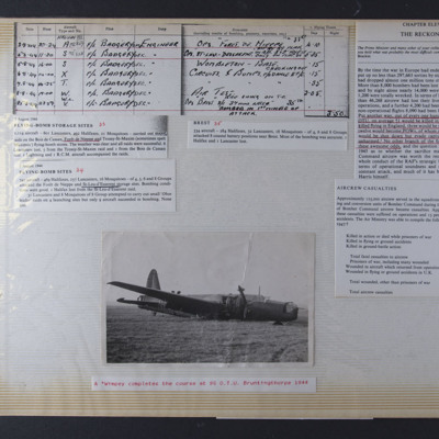
Operations
Right - document titled "The Reckoning". Giving details of bomber commands sorties, aircraft and…
Tags: 4 Group; 6 Group; 8 Group; 85 OTU; aircrew; bombing; Bombing of Trossy St Maximin (3 August 1944); crash; flight engineer; Halifax; Halifax Mk 3; killed in action; Lancaster; Mosquito; Normandy campaign (6 June – 21 August 1944); Oboe; Operational Training Unit; P-38; prisoner of war; RAF Bruntingthorpe; training; V-1; V-weapon; Wellington
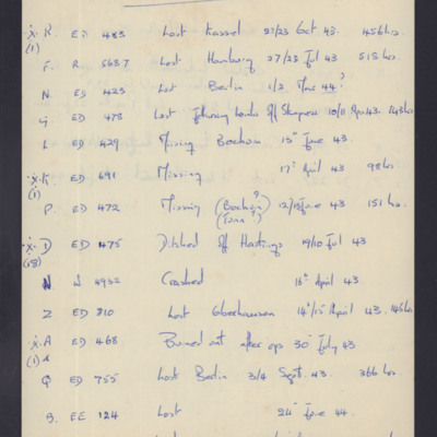
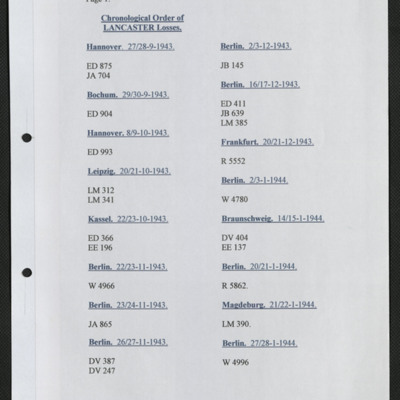
List of Lancaster losses
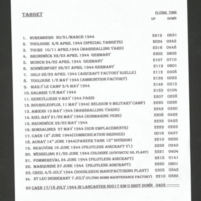
Ron Carter's List of Operations
Tags: 44 Squadron; Bombing of Mailly-le-Camp (3/4 May 1944); bombing of Nuremberg (30 / 31 March 1944); bombing of the Creil/St Leu d’Esserent V-1 storage areas (4/5 July 1944); bombing of Toulouse (5/6 April 1944); Lancaster; Normandy campaign (6 June – 21 August 1944); shot down; tactical support for Normandy troops; V-1; V-weapon

