Browse Items (1414 total)
- Tags: aerial photograph
Sort by:
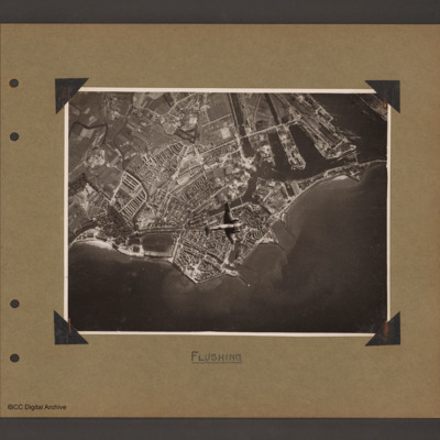
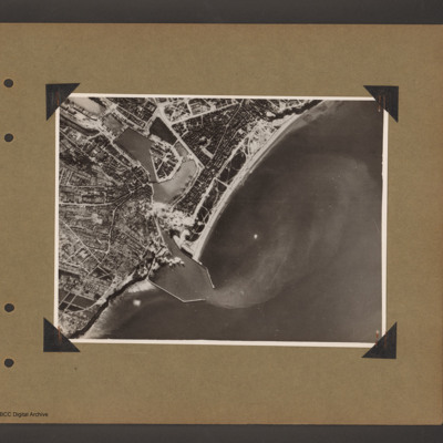
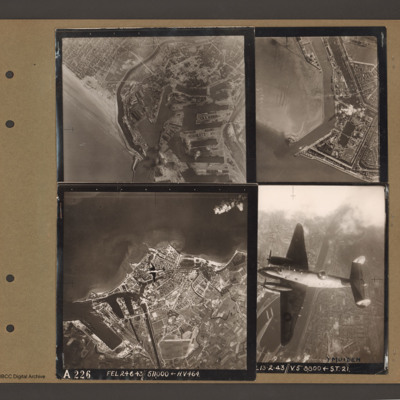
Ventura over Flushing
Aerial vertical photograph of coastline with town and docks. Coastline runs from mid left to right with a broad peninsular in the centre on which is a large town with docks. There are five jetties/piers running out into the sea. There is a Ventura…
Tags: aerial photograph; bombing; Ventura
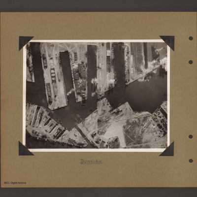
Dunkirk docks
Aerial vertical photograph of docks. Along the top four moles below which an interconnected water way. Below is land with a narrow water passage slanting down towards the centre bottom. The moles and land have various scattered dockyard…
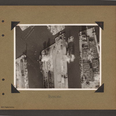
Dunkirk docks
Aerial vertical photograph of docks. Three moles extend from the bottom to just over half way up. The right hand mole is covered with dockyard installations, the other two are mostly bare. Bomb impacts are visible in the water between the right hand…
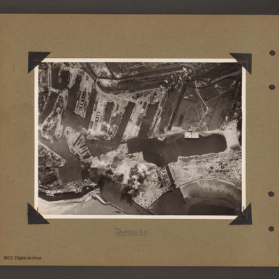
Dunkirk docks
Aerial vertical photograph of interconnected dock basins. At the bottom centre an inlet slanting left. To its left a canal. To its right a spit of land with a narrow waterway leading to a large basin. To the right of the waterway a beach with…
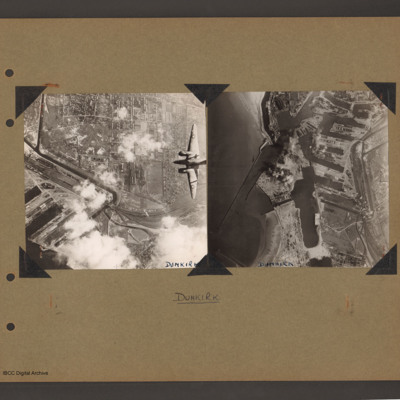
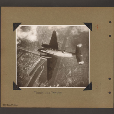
Ventura over Dunkirk and Dunkirk docks
On the left an aerial vertical photograph of town, canal and docks. A canal zigzags from top left down, right and the left back towards dockyard in the bottom left. A town with dwellings and industrial areas lies mostly to the right of canal. The…
Tags: aerial photograph; bombing; target photograph; Ventura
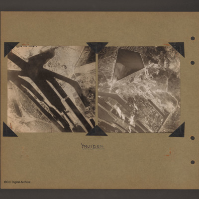
Ijmuiden Holland
On the left an aerial vertical photograph of canals and locks. Multiple canal channels go from top left to bottom centre which are at the North Sea end of the Noordzeekanaal at Ijmuiden. There are various lock gates on each canal. There is a possible…
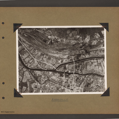
Abbeville
Aerial vertical photograph of town with canals and marshalling yard. A river/canal runs from mid left slanting down initially and then right across to the right hand side. In the middle another canal splits off upwards then goes right to middle right…
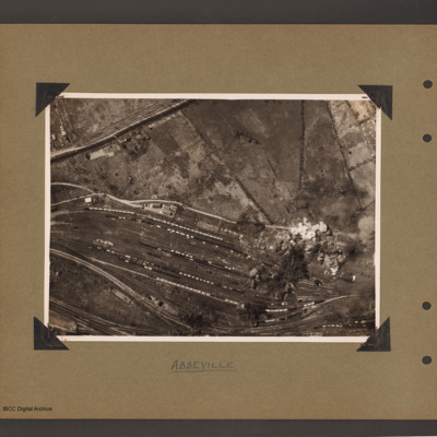
Abbeville marshalling yard
Aerial vertical photograph of a marshalling yard running from left slanting down to the right. The yard has a large number of goods wagons and locomotives spread throughout. To the top right is open countryside. There are bomb explosions at the…
Dieppe
Aerial vertical photograph of a coastal port. Coastline runs from top right to bottom left with open sea to the right. One quarter way up from left there is an inlet with breakwaters which leads into inland dock basins surrounded by a town. There are…
Ventura over Ijmuiden
Aerial vertical photograph of Ventura flying over canals and town. A Ventura coded YH of 21 squadron flies from right to left. Below is a canal which splits into a number of channels and a branch goes up into the town on the left side. Town buildings…
Tags: 21 Squadron; aerial photograph; Ventura
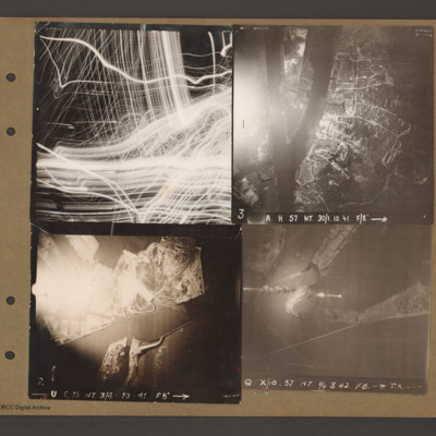
Le Havre and target photographs
Top left aerial vertical photograph completely filled with anti-aircraft tracer trails.
Top right an aerial vertical photograph of a canal junction. A canal runs from bottom left to a junction and then up to the top. At the junction a branch…
Top right an aerial vertical photograph of a canal junction. A canal runs from bottom left to a junction and then up to the top. At the junction a branch…
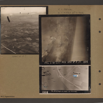
Air to ground photographs
Top left an aerial inclined photograph of open countryside. A road runs up the left hand side and below to the right are fields. There are many unidentified small black objects over the whole area. Caption 'What is it'.
Top right caption 'V =…
Top right caption 'V =…
Dunkirk, Den Helder, Vlissingen and Ventura over Ijmuiden
Top left an aerial vertical photograph of Dunkirk docks. A river runs from the sea bottom centre in a curve to top centre. Docks with moles and basins are to the right and the town is to the left of the river.
Top right an aerial vertical…
Top right an aerial vertical…
Caen-Carpiquet, Den Helder, Morlaix and unidentified canal
Top left an aerial vertical photograph of part of Caen-Carpiquet airfield. The runway runs from mid left to top right. The airfield is surrounded by a perimeter track and there is a square built up area at the bottom of the airfield.
Top right an…
Top right an…
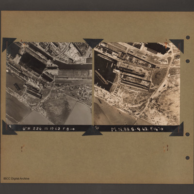
Le Havre docks
On the left an aerial vertical photograph of docks. A waterway runs from top left downward before turning horizontal across to the right. At the bend there is a narrow channel leading to a basin to the left. Below this is a further basin with a barge…
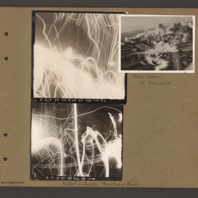
Images of night anti-aircraft tracer and a day attack on Philips radio and valve works in Eindhoven
On the left two aerial vertical photographs showing night anti-aircraft tracer tracks. Top photograph caption 'P Z/7 75 8/9-3-42 NT f/8 TX'. Bottom photograph caption ' A F 75 NT 30/1.10.41 F/8' Page caption 'Night x Flash 70xM candle power'.
To…
To…
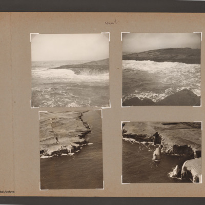
Coastline near Wick
Top left view of waves breaking on rocky shore.
Top right coastal view of waves breaking against shore at the top. Near shore at the bottom.
Bottom left aerial inclined photograph of shore line with cliffs. Open sea to right and below. Road…
Top right coastal view of waves breaking against shore at the top. Near shore at the bottom.
Bottom left aerial inclined photograph of shore line with cliffs. Open sea to right and below. Road…
Tags: aerial photograph
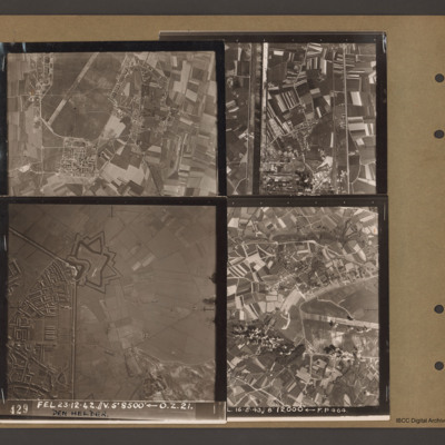
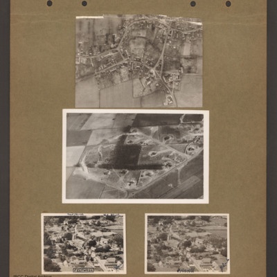
Feltwell village
Top an aerial vertical photograph of a village. Two roads lead in from the left joining a circular road running round the village. Roads lead off top and bottom right.
Middle an aerial inclined photograph of a diamond shaped aircraft dispersal…
Middle an aerial inclined photograph of a diamond shaped aircraft dispersal…
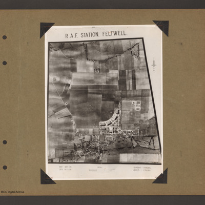
RAF Station Feltwell
An aerial vertical photograph of a grass airfield. Airfield is in the centre. A curved line of four hangars are at the bottom of the grass on the right. There is another hangar underneath the left hand of the line and station building are in the…
Tags: aerial photograph; bomb dump; hangar; RAF Feltwell
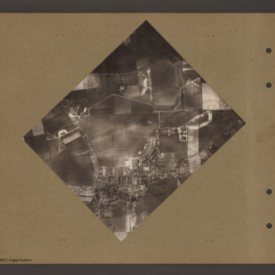
RAF Feltwell
Aerial vertical photograph of a grass airfield. Pentagonal shaped grass airfield in the centre. Hangars and station buildings in the bottom right corner of airfield. Dispersal at top left and track to off airfield bomb dump on the right of airfield.…
Tags: aerial photograph; bomb dump; dispersal; hangar; RAF Feltwell
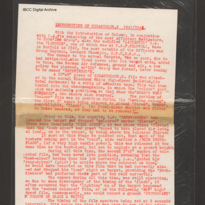
Introduction of Kodakcolor X 1941/1942
Account of problems of accurate bombing, introduction of pathfinders and use of marker flares. Relates use of cameras and photo-flash to obtain aiming point pictures. Goes on to talk on the introduction of colour film by attaching pieces colour film…
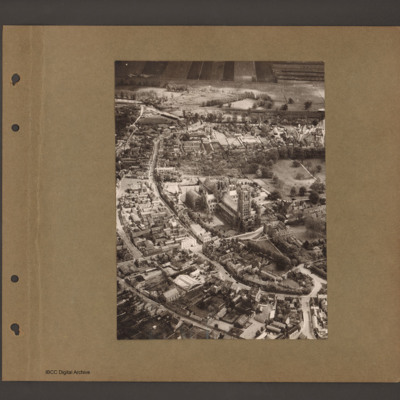
Ely
Aerial inclined photograph of a Ely with cathedral in the centre. Two parallel roads curve from bottom right round the church to top left. Buildings lie between the roads and above the church. At the top open countryside.
Tags: aerial photograph
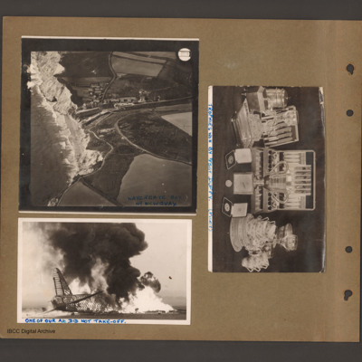
Watergate Bay, burning Wellington and trophies
Top left an aerial incline photograph of cliffs and beach. On the left side cliffs and beach border the sea. In the centre a small village in a valley leading down to the beach. To the right open farmland. Caption 'Watergate Bay Nr…
Tags: aerial photograph; crash; take-off crash; Wellington
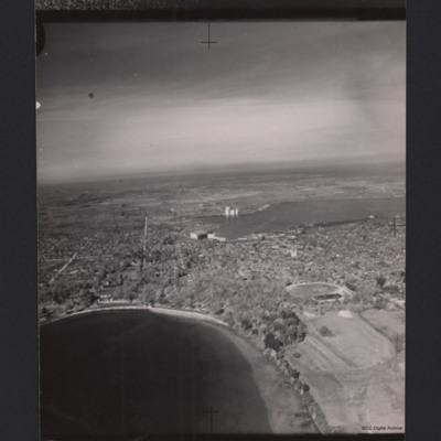
Midland, Ontario
A high oblique aerial photograph of Midland, Ontario with many trees. In the foreground is a lake and in the middle a second lake. There is a large building at the edge of the middle lake and an area of docks. There are also grain silos. In the…
Tags: aerial photograph
Toronto shore
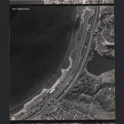
A vertical aerial photograph of a town at the edge of a bay. Parallel with the bay there is the Gardiner expressway and railway. In the bay are u-shaped structures. At the bottom there are between the road and the coast are holiday structures and the…
Tags: aerial photograph

