Air to ground photographs
Title
Air to ground photographs
Description
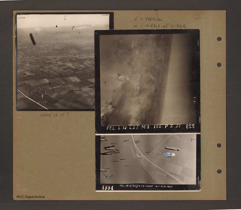
Top left an aerial inclined photograph of open countryside. A road runs up the left hand side and below to the right are fields. There are many unidentified small black objects over the whole area. Caption 'What is it'.
Top right caption 'V = Vertical, M = Mirror 45 degree to rear'. Aerial inclined photograph at 90 degrees with horizon running top to bottom on the right. At the bottom right part of a multistory building. Smoke from explosions on the left side. Photograph caption 'FEL 6.12.42//MB 150 ft PZ21 ESS'.
Bottom right aerial vertical photograph of a road junction with falling bombs. A road runs top to bottom right. Half way down road is a with a junction with road running up to top right. On the right a bomb annotated '30lb inc'. On the left many bombs of the same type with one at the bottom annotated '30 lb inc'. Photograph caption '4994 FEL 19-3-43 //V14 11000ft AS.464.'.
Date
1942-12-06
1943-03-19
Type
Format
Three b/w photographs mounted on an album page
Publisher
Rights
This content is available under a CC BY-NC 4.0 International license (Creative Commons Attribution-NonCommercial 4.0). It has been published ‘as is’ and may contain inaccuracies or culturally inappropriate references that do not necessarily reflect the official policy or position of the University of Lincoln or the International Bomber Command Centre. For more information, visit https://creativecommons.org/licenses/by-nc/4.0/ and https://ibccdigitalarchive.lincoln.ac.uk/omeka/legal.
Identifier
PBanksP15010099
Collection
Citation
“Air to ground photographs,” IBCC Digital Archive, accessed October 30, 2024, https://ibccdigitalarchive.lincoln.ac.uk/omeka/collections/document/1558.
Item Relations
This item has no relations.

