Le Havre and target photographs
Title
Le Havre and target photographs
Description
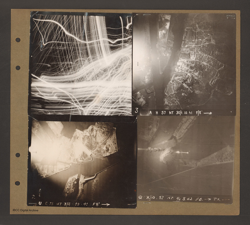
Top left aerial vertical photograph completely filled with anti-aircraft tracer trails.
Top right an aerial vertical photograph of a canal junction. A canal runs from bottom left to a junction and then up to the top. At the junction a branch diverges to the right and a narrow canal goes off at right angles to the left. There is a town along the right hand side of the right hand canal. Captioned 'A H 57 NT 30/1.10.41 F/8'.
Bottom left an aerial vertical photograph of a waterway running left to right. At the bottom middle is the entrance to a dock basin with a lock gate. There are two indentations on the upper side of the waterway. Captioned 'E75 NT 3/4.10.41 F8'.
Bottom right an aerial vertical photograph of Le Havre with the inlet to two waterways with a spit of land between them. Captioned 'Q X/10 57 NT 8/9.3.42 F/8 T.X.'.
Date
1941-10-30
1941-10-31
1941-10-03
1941-10-04
1942-03-08
1942-03-09
Coverage
Type
Format
Four b/w photographs mounted on an album page
Conforms To
Publisher
Rights
This content is available under a CC BY-NC 4.0 International license (Creative Commons Attribution-NonCommercial 4.0). It has been published ‘as is’ and may contain inaccuracies or culturally inappropriate references that do not necessarily reflect the official policy or position of the University of Lincoln or the International Bomber Command Centre. For more information, visit https://creativecommons.org/licenses/by-nc/4.0/ and https://ibccdigitalarchive.lincoln.ac.uk/omeka/legal.
Identifier
PBanksP15010098
Collection
Citation
“Le Havre and target photographs,” IBCC Digital Archive, accessed September 22, 2024, https://ibccdigitalarchive.lincoln.ac.uk/omeka/collections/document/1557.
Item Relations
This item has no relations.

