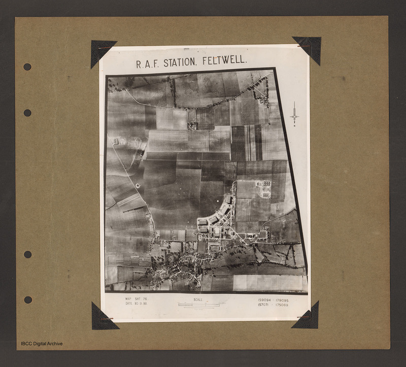
RAF Station Feltwell
Title
RAF Station Feltwell
Description
An aerial vertical photograph of a grass airfield. Airfield is in the centre. A curved line of four hangars are at the bottom of the grass on the right. There is another hangar underneath the left hand of the line and station building are in the bottom right corner of the airfield. To the right of the airfield a track leads to a bomb dump. Underneath the airfield is Feltwell village. Caption 'RAF Station Feltwell'. Photo caption 'Map SHT 76, DATE 30.9.38, 159094 179095, 157071 175069'.
Date
1938-09-30
Temporal Coverage
Coverage
Language
Type
Conforms To
Publisher
Rights
This content is available under a CC BY-NC 4.0 International license (Creative Commons Attribution-NonCommercial 4.0). It has been published ‘as is’ and may contain inaccuracies or culturally inappropriate references that do not necessarily reflect the official policy or position of the University of Lincoln or the International Bomber Command Centre. For more information, visit https://creativecommons.org/licenses/by-nc/4.0/ and https://ibccdigitalarchive.lincoln.ac.uk/omeka/legal.
Identifier
PBanksP15010143
Collection
Citation
“RAF Station Feltwell,” IBCC Digital Archive, accessed July 26, 2024, https://ibccdigitalarchive.lincoln.ac.uk/omeka/collections/document/1671.
Item Relations
This item has no relations.

