Browse Items (754 total)
- Tags: target photograph
Sort by:
Brunswick
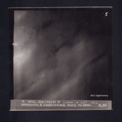
Target photograph of Braunschweig. No detail visible,some smoke or dust and light streaks. Captioned' 5', '16 SKELL. 14/15.1.44//NT 5" 21,000 [arrow] 145° 1924 BRUNSWICK. X. 1X4000+15X4+8X30. 31SECS. P.O.ORAM. X.50'. On the reverse '[underlined] P/O…
Brunswick
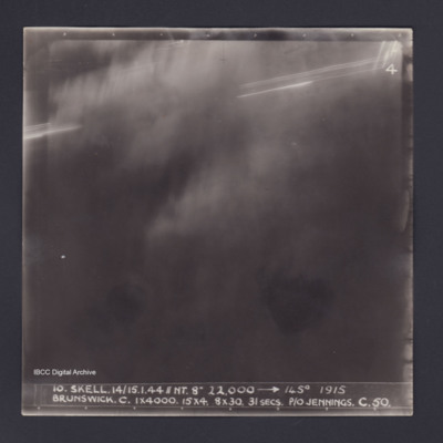
Target photograph of Brunswick. Totally obscured by dust and haze. Some light streaks. Captioned '4', '10 SKELL.14/15.1.44//NT. 8" 22,000 [arrow] 145° 1915 BRUNSWICK.C.1X4000. 15X4. 8X30. 31SECS. P/O JENNINGS. C. 50.'. On the reverse '[underlined]…
Brunswick
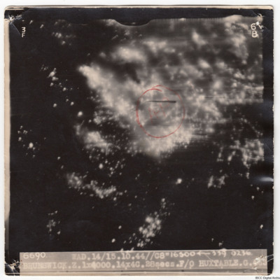
A vertical aerial photograph taken during an attack on Brunswick. It is a night photograph and much of the image is obscured by fires and explosions. An annotated red circle and 'AP' marks the aiming point. The image is captioned '6690 WAD…
Caen
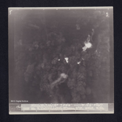
Target photograph of Caen. No detail visible area covered with smoke and dust from bomb explosions. Captioned '8°F', '6B', '1348 SKELL.18.7.44//8" 7000' [arrow] 182° 0547 CAEN RD.V.11X1000.4X500.C23secs.F/LT MOUAT. V.50.'. On the reverse…
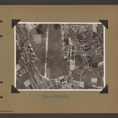
Caen Carpiquet airfield
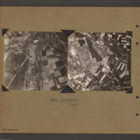
Two side by side vertical photographs of Caen Carpiquet Airfield.
On the left a reconnaissance photograph orientated with east at the top. On the left side of the airfield with a single runway 13/31 running from bottom left towards the centre. A…
On the left a reconnaissance photograph orientated with east at the top. On the left side of the airfield with a single runway 13/31 running from bottom left towards the centre. A…
Caen marshalling yard
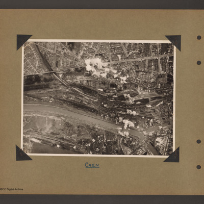
Aerial vertical photograph of a town with marshalling yard. A river/canal runs from halfway up on the left to bottom right. A railway line runs from top left into a large marshalling yard in the centre right which contains a large amount of rolling…
Caen marshalling yard
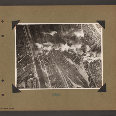
Aerial vertical photograph showing a large marshalling yard filled with rolling stock in a town. A canal/river runs up the left hand side with marshalling yard to the right. The main part of the town is to the right of the railway. A long line of…
Caen-Carpiquet Airfield
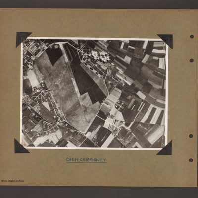
Aerial vertical photograph of an airfield. Airfield fills left hand side with runway 13/31 running from bottom to top and a perimeter track running all the way round. The is a square section of buildings off the top left of the airfield and a series…
Caen-Carpiquet Airfield
Aerial vertical photograph showing an airfield. Airfield fills left two thirds with runway running vertically up. Runway 31 is at the bottom with a square area of buildings just outside the perimeter track to the right. There is are complex of…
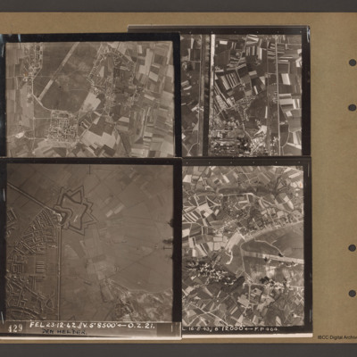
Caen-Carpiquet, Den Helder, Morlaix and unidentified canal
Top left an aerial vertical photograph of part of Caen-Carpiquet airfield. The runway runs from mid left to top right. The airfield is surrounded by a perimeter track and there is a square built up area at the bottom of the airfield.
Top right an…
Top right an…
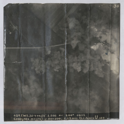
Cahagnes
LH page, target photograph rural area with road running left to right and several buildings in top left. Many bomb explosions visible, captioned '429.EWS.30.7.44.//8" 2500 200(degrees) 0832.CAHAGNES MTT/TGT. U. 20 X 500.C.23 secs. F/Lt Josey. U.103'.…
Cahagnes
Target photograph shows explosions with dust and smoke clouds. Some target indicator flares are to right. Rural area with some buildings visible in top left with track crossing left to right. Captioned '429.E.W.S. 30.7.44//8" 2.500 200(Degrees) 08.32…
Calais
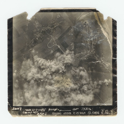
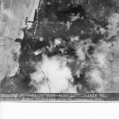
Target photograph of Calais. Much of the photograph is obscured by explosions. In the top right corner is a Lancaster. Captioned '2647 WKY 20-9-44//8" 9000' [arrow] 160° 17.01 1/2 Calais M/T A.P6 D. J 13x1000:4x500 C.25.secs. F/L Curtis J.12.'.
Calais
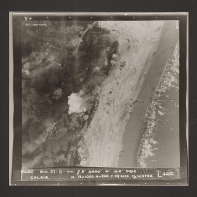
Vertical aerial photograph of Calais. Craters and bomb explosions are visible but no detail apart from a road junction and the coastline. 'Captioned '6262 BIN 27-9-44 //8 4000' [arrow] 142° 0912 Calais w. 13x1000. 4x500 c.19 secs. F/O Lester N 460'.
Calais
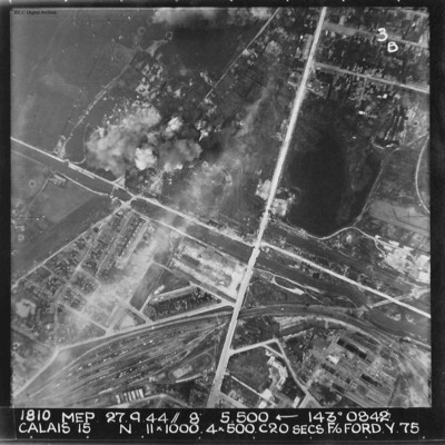
A vertical aerial photograph of Calais. The canal, Canal des Pierrettes, is visible and runs left to right, parallel to Rue Hoche and a marshalling yard. The yard services Les Fontinettes train station. Annotated '1810 MEP 27.9.44// 8” 5,500…
Calais
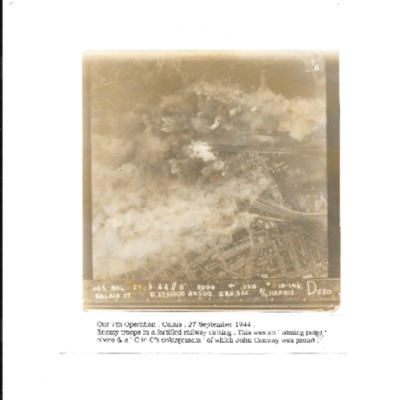
Vertical aerial photograph of Calais during a bombing operation, September 1944. It is captioned 'Our 7th Operation, Calais 27 September 1944. Enemy troops in a fortified railway cutting. This was an 'aiming point' photo & a C in C's enlargement of…
Calais
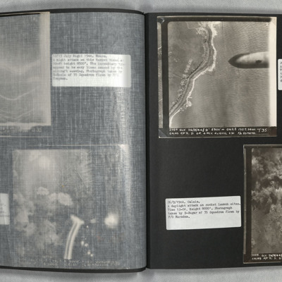
Photo 1 is a vertical aerial photograph of the coast with bomb craters. A 1000lb bomb cab be seen falling in the right of the image.
Photo 2 is a vertical aerial photograph of the Calais area. The operation is to destroy a rocket launch site. Many…
Photo 2 is a vertical aerial photograph of the Calais area. The operation is to destroy a rocket launch site. Many…
Calais
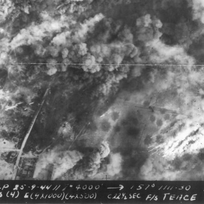
Three similar vertical aerial photographs of Calais during a bombing operation. Much of the detail is obscured by explosions. The first image is a cropped version of the full photograph.
It is captioned '2693 TLP 25-9-44// 8" 4000' --> 157° 1111.30…
It is captioned '2693 TLP 25-9-44// 8" 4000' --> 157° 1111.30…
Calais Batterie Oldenburg and Batterie Waldam
Target photograph of coastline and Batterie Oldenburg and Batterie Waldam. Port of Calais is just to bottom of the photograph Bomb explosions, smoke and target markers obscure the target. The beach is visible with many obstructions. Two Halifax III…
Cap Gris Nez
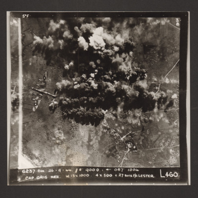
A daylight target photograph of Cap Gris Nez. Much of the target is obscured by smoke and explosions and the ground is pock marked with craters. On the left middle is a Lancaster. Captioned '6237 Bin 26-9-44 (date) //8" 9000' [arrow] 067° 1204 Cap…
Casarsa bridge
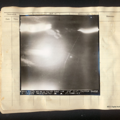
Vertical aerial photograph of the area around the Casarsa bridge on the Tagliamento river. The left half of the image is obscured by bright light. A road runs from top to bottom with side roads leading off. Captioned: 'A4 2009 40/46 Dec 26 44 F8//NT…
Castrop-Rauxel
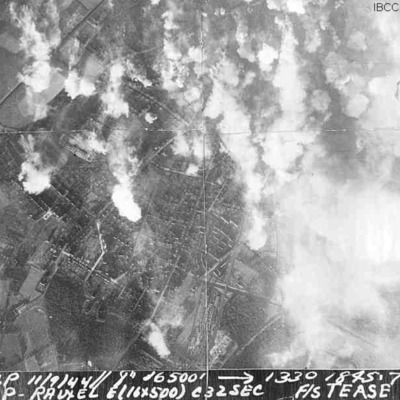
Three identical vertical aerial photographs of Castrop-Rauxel during an operation. The right side of the image is obscured by explosions. The street pattern is very clear on the left side.
It is captioned '2536 TLP 11/9/44//8" 16500' -->1330 1845 .7…
It is captioned '2536 TLP 11/9/44//8" 16500' -->1330 1845 .7…
Chemical works Cologne
Oblique aerial photograph of river valley with roads, railways and at bottom left, a open area of water. At lower right one road runs from middle left to bottom centre which splits into three from two junctions. Railway line runs along road and…
Cherbourg Docks
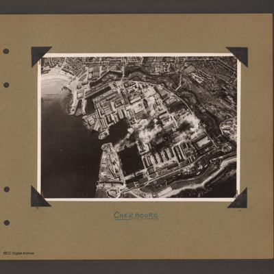
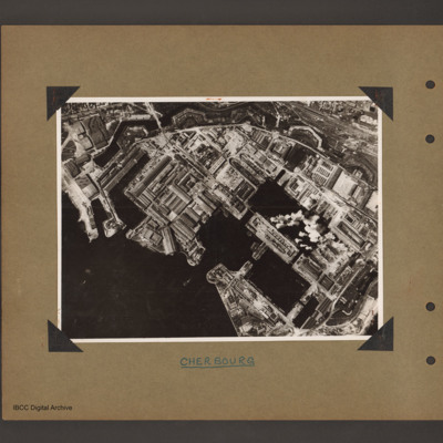
Aerial inclined photograph showing docks surrounded by town. To the left open sea with beach at the top. In the centre three interconnected dock basins, the bottom left one with a divider, surrounded by dockyard buildings and installations. A series…
Cherbourg docks
Aerial vertical photograph of docks. To the bottom left open sea. In the centre two interconnected dock basins the bottom one is divided into three by cross piers. There is a further basin above and to the left. All basins are surrounded by dockyard…

