Browse Items (754 total)
- Tags: target photograph
Sort by:
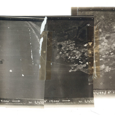
Le Havre
A mosaic of three target photographs of attack on Le Havre. Shows sea and cluster of bombs in the centre of left photograph and port area in the centre and right photograph. Caption '723, KLS, 14/6/44, 8", 1`9500, U. U625' Taken by Lancaster U of…
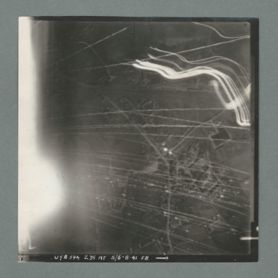
Target photograph
Target photograph showing a small built up area with road running bottom centre right to top right. Numerous tracer lines and flares. Caption 'UYB 594, Z35, NT, 5/6.8.41, F8'.
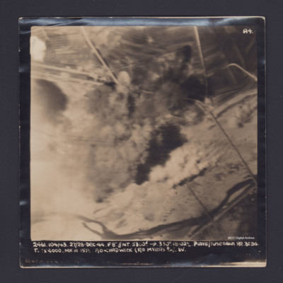
Piave/Susegana
Target photograph showing river along the bottom and roads with bomb explosions in the centre. Captioned '2461.104/43, 27/28 Dec 44, F8".//NT 5300' →, 330 degrees, 18.02, Piave/Susegana RR, BF,DG, T., [ ] x 4000 Mk III, 15 1/2, F/O Chadwick (F/O…
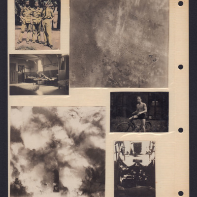
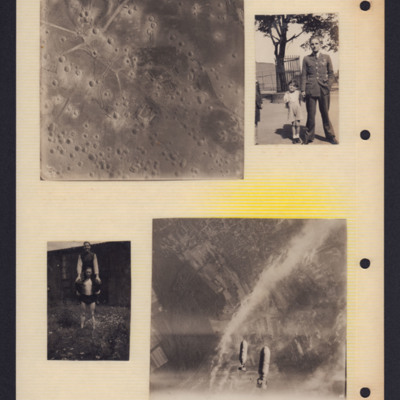
People and bombing
Top left - three airmen in khaki uniform with side caps standing in line with trees in the background.
Top right - air-to-ground view of landscape with many bomb craters.
Middle left - an airman on bed in barrack room.
Bottom left - air to…
Top right - air-to-ground view of landscape with many bomb craters.
Middle left - an airman on bed in barrack room.
Bottom left - air to…
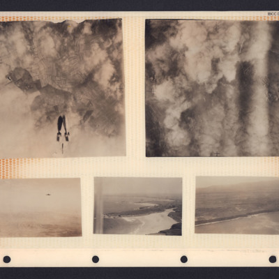
Bombs, hills and coastline
A collection of photographs in an album. From top left to bottom right:
1. Target photograph showing three bombs falling towards cloud and fields. There is no caption to identify the target.
2. Target photograph. The ground is mostly obscured by…
1. Target photograph showing three bombs falling towards cloud and fields. There is no caption to identify the target.
2. Target photograph. The ground is mostly obscured by…
Twenty Lancasters
Article by Carl Ollson from the Illustrated magazine published on 25 March 1944. The article covers the preparations made by the station staff to prepare the aircraft and equipment for an operation. There is a large photograph of twenty Lancasters in…
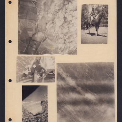
Bombing and people
Five photographs from an album page. From top left to bottom right:
1. A target photograph showing open countryside. On the left is a line of bomb craters in fields. Roads are also visible here as is a railway line. On the right, the ground is…
1. A target photograph showing open countryside. On the left is a line of bomb craters in fields. Roads are also visible here as is a railway line. On the right, the ground is…
Tags: aerial photograph; animal; bombing; target photograph
Bombing and people
Top left - target photograph showing open countryside with many bomb craters.
Top right - Arthur Pearce in uniform holding hand of young child on the left. Another child is partly visible to the left of the photography. In the background a tree…
Top right - Arthur Pearce in uniform holding hand of young child on the left. Another child is partly visible to the left of the photography. In the background a tree…
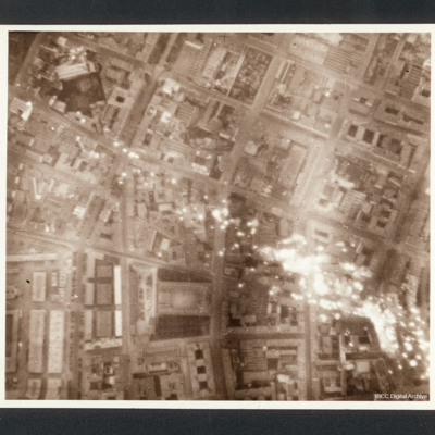
Milan
Target photograph of a Milan eastern district, between Piazza 5 giornate and the central fresh food market, with incendiaries falling down. Scuola di Villa Morosini is visible near the frame border.
Captioned between pages 36-37 of 1956 Memoir…
Captioned between pages 36-37 of 1956 Memoir…
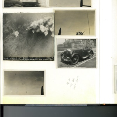
Page 10 of D C Bradbury Scrapbook
Photo 1 - view across the port wing of a Lancaster in flight. Mostly clouds.
Photo 2 - air-to-air view from the mid-upper turret looking aft towards five Lancasters.
Photo 3 - vertical aerial photograph of Wesel, Germany during a bombing…
Photo 2 - air-to-air view from the mid-upper turret looking aft towards five Lancasters.
Photo 3 - vertical aerial photograph of Wesel, Germany during a bombing…
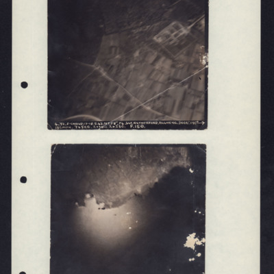
Target Photos, Alghero and Pantelleria
Photo 1 is Alghero, Italy taken at 3000'. It shows a rectangular compound, fields and roads. Caption: '4.Y2.F-CHAUD.17-18.5.43.NT.F8". P4.SGT.RUTHERFORD.ALGERO.3000'.190→180MPH.7x500.2xSBCS.2x250. F.150.'
Photo 2 is Pantelleria taken from 7000'…
Photo 2 is Pantelleria taken from 7000'…
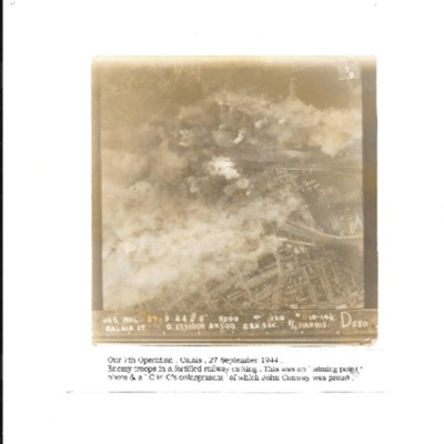
Calais
Vertical aerial photograph of Calais during a bombing operation, September 1944. It is captioned 'Our 7th Operation, Calais 27 September 1944. Enemy troops in a fortified railway cutting. This was an 'aiming point' photo & a C in C's enlargement of…
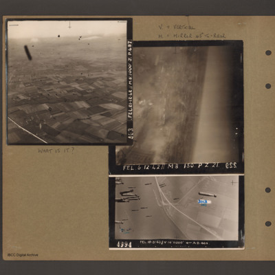
What is it?
Top left - oblique aerial photograph of open countryside with fields and a few woods, dotted with farms. Many dark 'blots' which could be anti-aircraft fire bursts. Captioned 'A03 FEL 21.12.42//M8:1000 J.p.48'. Top right - oblique aerial photograph -…
Tours
Photo 1 is a vertical aerial photograph of Tours. The city is visible but there are incendiary tracks blotting out much of the detail.
Photo 2 is a vertical aerial photograph taken during the bombing of Tours. Explosions can be seen and a…
Photo 2 is a vertical aerial photograph taken during the bombing of Tours. Explosions can be seen and a…
Calais
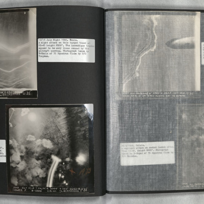
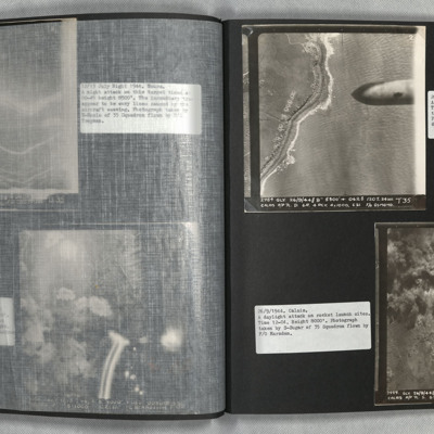
Photo 1 is a vertical aerial photograph of the coast with bomb craters. A 1000lb bomb cab be seen falling in the right of the image.
Photo 2 is a vertical aerial photograph of the Calais area. The operation is to destroy a rocket launch site. Many…
Photo 2 is a vertical aerial photograph of the Calais area. The operation is to destroy a rocket launch site. Many…
Osnabruck
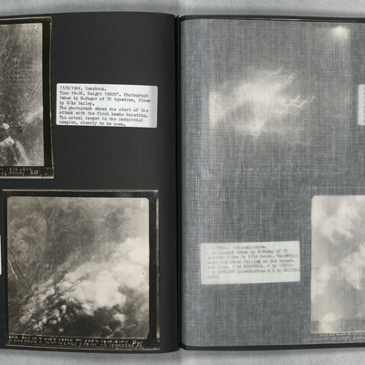
Photo 1 is a vertical aerial photograph of an industrial area at Osnabruck at the start of the attack.
Photo 2 is a vertical aerial photograph taken during the bombing, seven minutes later. Much of the target is obscured by smoke and explosions.
Photo 2 is a vertical aerial photograph taken during the bombing, seven minutes later. Much of the target is obscured by smoke and explosions.
Bochum and Gelsenkirchen
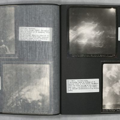
Photo 1 is a vertical aerial photograph of Bochum. Most of the image is obscured by incendiary explosions.
Photo 2 is a vertical aerial photography of Gelsenkirchen. Two bombs can be seen falling.
Photo 2 is a vertical aerial photography of Gelsenkirchen. Two bombs can be seen falling.
Duren
Photo 1 is a vertical aerial photo of Duren as the attack is underway. Two Lancasters can be seen on the right of the image. Photo 2 is a vertical aerial photo of the operation, one minute after the previous image. Two bombs are visible. Photo 3 is a…
Wesel
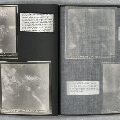
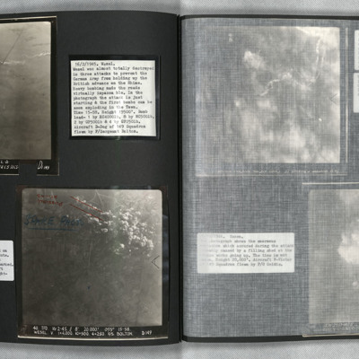
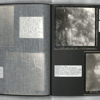
Photo 1 and 2 are vertical aerial photographs of Wesel during the attack. The first image is at the start of the bombing and one explosion can be seen. In the second image, one minute later, there are many explosions.
Wesel and Essen
Photo 1 is a vertical aerial photograph of Wesel during an attack. The town is obscured by cloud and the bombers used Gee-H. There are tracks of a bomber going down in flames and exploding on contact with the ground. Photo 2 is a vertical aerial…
Bonn
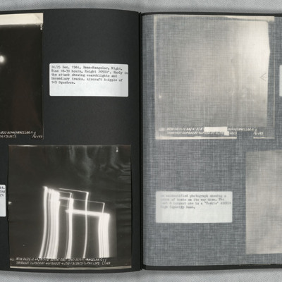
Photo 1, 2 and 3 are vertical aerial photographs of an attack on Bonn. No detail is visible on the ground. Searchlights and incendiary tracks are visible.
Photo 3 is slightly later and shows large fires gaining control. Cologne is at the top left of…
Photo 3 is slightly later and shows large fires gaining control. Cologne is at the top left of…
Homberg and Hohembudberg
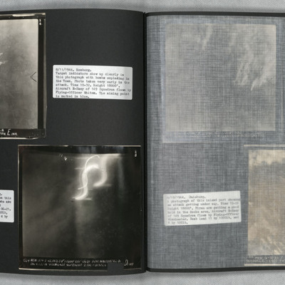
Photo 1 is a vertical aerial photograph of Homberg. Bombs can be seen exploding in the town at the early stages of the attack.
Photo 2 is a vertical aerial photograph of Hohembudberg, Duisberg. It shows a night attack with incendiary bombs burning…
Photo 2 is a vertical aerial photograph of Hohembudberg, Duisberg. It shows a night attack with incendiary bombs burning…
Bonn and Duisburg
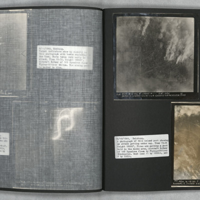
Photo 1 is a vertical aerial photograph of Bonn during an attack. Street patterns are clearly visible as are fires.
Photo 2 is a vertical aerial photograph of Duisburg. The river is visible but much detail is obscured by cloud and smoke.
Photo 2 is a vertical aerial photograph of Duisburg. The river is visible but much detail is obscured by cloud and smoke.
Koblenz and Homberg
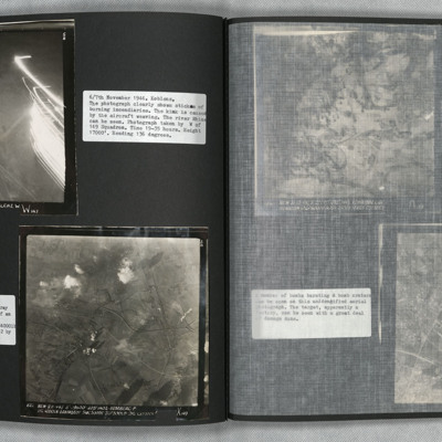
Photo 1 is a vertical aerial photograph of Koblenz. The river can be seen and falling sticks of incendiaries.
Photo 2 is a vertical aerial photograph of Homberg. The image is very clear with only a few explosions hiding the detail.
Photo 2 is a vertical aerial photograph of Homberg. The image is very clear with only a few explosions hiding the detail.
Vohwinkel
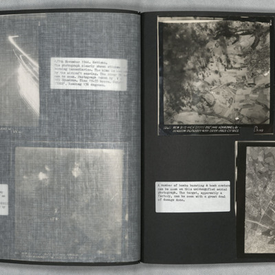
Photo 1 is a vertical aerial photograph of Vohwinkel. The left side of the image is obscured by explosions but there is a great deal of detail visible elsewhere.
Photo 2 is a vertical aerial photograph of an unidentified location. The image is very…
Photo 2 is a vertical aerial photograph of an unidentified location. The image is very…

