Browse Items (133 total)
- Contributor is exactly "Stuart Cummins"
Sort by:
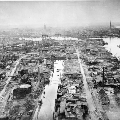
Hamburg Norderelbe
Oblique aerial photograph of Hamburg docks showing a destroyed port area with almost all buildings and facilities damaged. The spire of St Michels church is to left of centre and that of St Nikolai is to the right. In front of these, the large…
Tags: aerial photograph; bombing
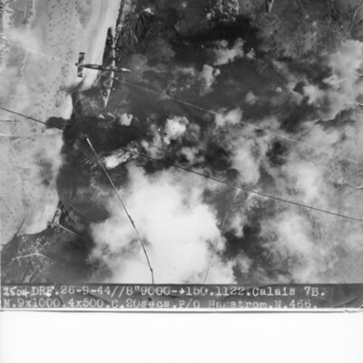
Calais Batterie Oldenburg and Batterie Waldam
Target photograph of coastline and Batterie Oldenburg and Batterie Waldam. Port of Calais is just to bottom of the photograph Bomb explosions, smoke and target markers obscure the target. The beach is visible with many obstructions. Two Halifax III…
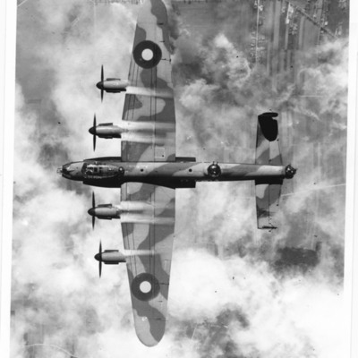
Lancaster in flight
An air-to-air view of a Lancaster from above flying over a largely rural area. Its bomb doors are open. From information kindly provided by the donor. 'Lancaster Over Target. This has appeared in publications since being lent out in the 1990's but…
Tags: 149 Squadron; 3 Group; aerial photograph; Gee; Lancaster; RAF Methwold
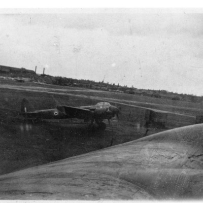
Ju 88 at Farnborough
Two photographs. First is of a captured Ju-88 with RAF markings parked on an airfield. The view is taken from over the wing of a Stirling. From information kindly provided by the donor. 'Ju-88 at Farnboro - September 1943 - Photo taken from within…
Tags: Ju 88; RAF Farnborough; RAF Hendon; Stirling
Görlitz
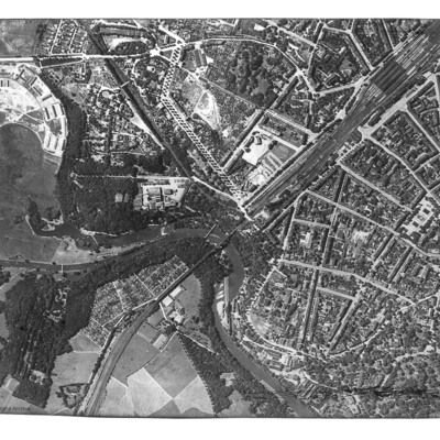
Reconnaissance photograph of Görlitz. In the centre is the Neisse Viaduct railway crossing the Neisse River. The main railway station is to the right, with St Jakobus Cathedral just above and to its left. Tree-lined boulevards are also well…
Tags: aerial photograph
Lancaster in Flight
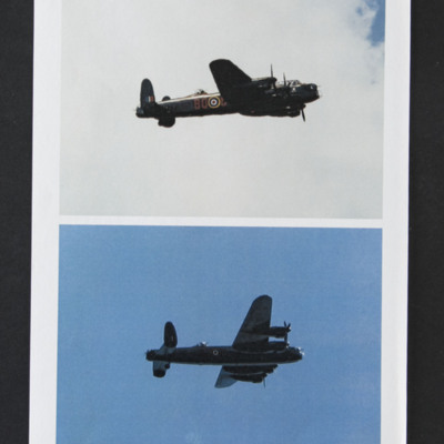
Two air-to-air photographs of a Lancaster, starboard side, in flight. Top photograph shows code "BQ-?" of 550 Squadron. Nose art in form of shield also visible
Tags: 550 Squadron; Lancaster
Anti-aircraft fire tower
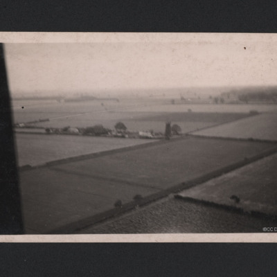
A oblique aerial photograph taken at low level. Fields and hedgerows are visible with some buildings to the centre including a tall structure described on reverse of photograph as "German Flak Tower, Holland." Part of the aircraft canopy is seen on…
Bomb damage
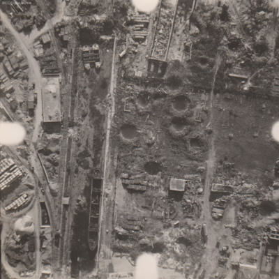
Reconnaissance photograph at low level of goods yard with significant bomb damage with craters and destroyed buildings throughout. A drained canal runs top to bottom with large barge aground against quay and another smaller pair tied together at top.…
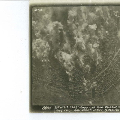
Cologne
Target photograph of Cologne orientated with North to the bottom left. The railway complex Koln-Neustadt-Nord is in the bottom left corner and the square outline of the lake known as Aachener Weiher is in the bottom right. The River Rhine and…
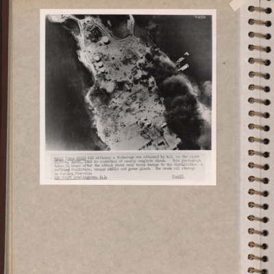
Vallo-Taneberg oil refinery
Reconnaissance photograph of an oil refinery on a peninsular with large plume of smoke from damaged oil tanks upper right area. Oslofjord is to the left with Prinds Christians Batterie just visible on the edge top left. Explanatory note underneath…
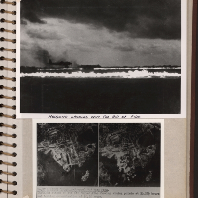
Mosquito landing and target photographs
Top - a runway with FIDO aflame on edges. A Mosquito is landing on left side. Submitted with description 'Mosquito landing with the aid of FIDO. Date and location not recorded'.
Bottom - side by side target photographs of port area showing aiming…
Bottom - side by side target photographs of port area showing aiming…
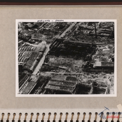
Krupps, Essen
Oblique aerial photograph of an industrial site with most buildings destroyed and many without roofs. Road runs through from bottom left corner to top centre. Tall chimney top right and building with several small chimneys top left. Captioned 'Krupps…
Tags: aerial photograph; bombing
Wesel Bomb damage
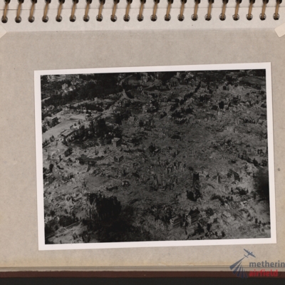
Oblique aerial photograph of a town totally destroyed. Large structure lower left, probably church. Submitted with description 'Oblique aerial photo showing bomb damage to an unidentified urban area'.
Tags: aerial photograph; bombing; Cook’s tour
Leuna synthetic oil plant
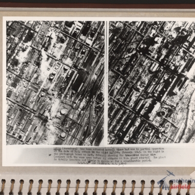
Side by side reconnaissance photographs showing an industrial area with buildings, roads and towards the right, some railway sidings. This industrial area is orientated from lower left to top right. Chimney smoke is seen on the left hand photograph.…
Aerial photograph with a Lancaster
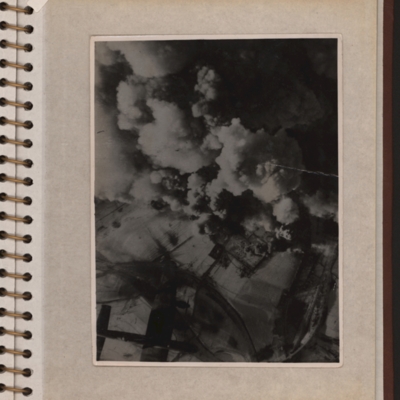
Vertical aerial photograph showing explosions and smoke coming up from what seems to be a power station or oil storage facility. There are two round towers or tanks partially visible through the smoke and the plant is surrounded by bomb-cratered open…
Zeitz Braunkohle-Benzin synthetic oil plant
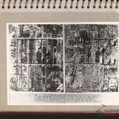
Vertical aerial photographs showing on the left an industrial area with roads and buildings and on the right the same area with most of the structures destroyed. Explanatory text underneath 'Zeitz. The left hand photograph shows this synthetic oil…
Bocholt
Left and right - side by side reconnaissance photographs showing the centre of the town of Bocholt with river Bocholter Aa flowing top to bottom with two distinctive bow’s to the right towards the top of the photograph. The large road crossing…
Flight engineer and Kembs dam
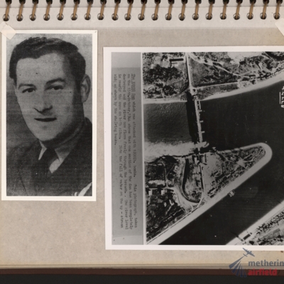
Left - full face portrait of an airman wearing tunic with flight engineer brevet. Submitted with description 'Full-face photo of unidentified flight engineer'. Right - reconnaissance photograph with text description of the Kembs dam across the Grand…
Mittelland Canal near Kloster Gravenhorst and aircrew
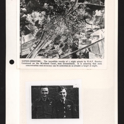
Top - a reconnaissance photograph of results of a bombing attack. From a newspaper article. The photograph shows the Mittelland canal running bottom left to top right and very many bomb craters concentrated in middle with canal edges and embankment…
Zeitz oil refinery
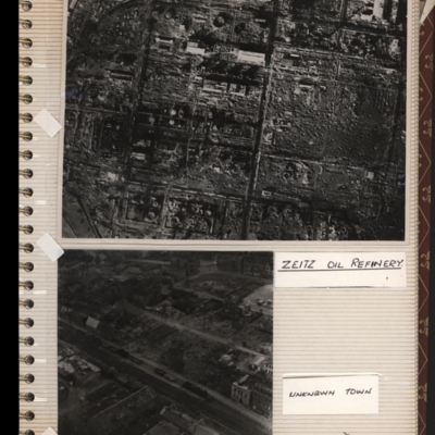
Top - reconnaissance photograph of a almost totally destroyed industrial facility. A few buildings towards the top of the photograph appear intact. Captioned 'Zeitz oil refinery. Submitted with description 'Aerial photo of Zeltz [sic] oil refinery…
Mulheim/Essen airfield
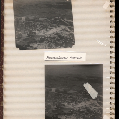
Top - oblique aerial photograph of an airfield with many bomb craters. Two wide grass runways forming a “V” at bottom left, with taxi-track running left to right across centre of photograph. Hardstanding leads off at top right with two or more…
Tags: aerial photograph; bombing; Cook’s tour; perimeter track; runway
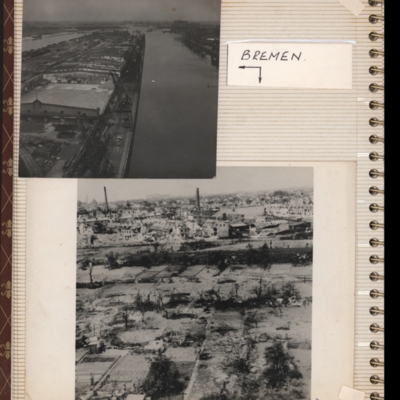
Bremen
Top - oblique aerial photograph of Bremen port with river Weser to the left running bottom to top with dock to the right. Pier in between has extensive railway sidings to the left, warehouses in the middle are mainly without roofs but cleared of…
Tags: aerial photograph; bombing; Cook’s tour
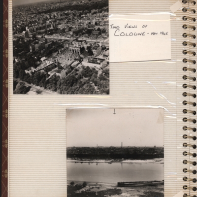
Two views of Cologne - May 1945
Top - oblique aerial photograph of a city with roads running left to right, the nearest one being tree lined and many damaged buildings
Bottom - oblique aerial photograph with the river Rhine running left to right and buildings including chimneys…
Bottom - oblique aerial photograph with the river Rhine running left to right and buildings including chimneys…
Tags: aerial photograph; bombing; Cook’s tour
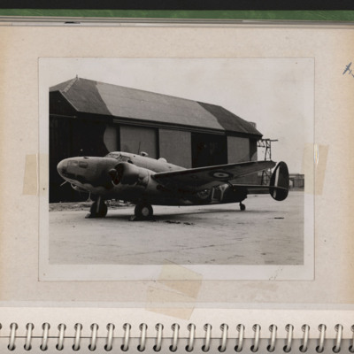
Hudson parked in front of a hangar
A RAF Hudson of 1 PRU (squadron code LY with early style roundel and tail fin markings) parked on hardstanding at RAF Wick with hangar in the background. Submitted with description 'RAF Hudson of No 1 Photographic Reconnaissance Unit in front of…
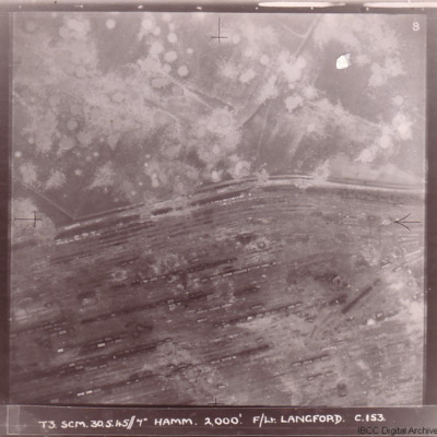
Bomb damage
Four photographs of damage to German cities taken on two of the 'Cooks Tours' flown by no 153 Squadron.
The first has the caption 'T3 SCM 30.5.45//7" HAMM 2,000'. F/LT LANGFORD C.153 and shows Hamm railway marshalling yard with tracks running from…
The first has the caption 'T3 SCM 30.5.45//7" HAMM 2,000'. F/LT LANGFORD C.153 and shows Hamm railway marshalling yard with tracks running from…

