Browse Items (134 total)
- Contributor is exactly "Stuart Cummins"
Sort by:
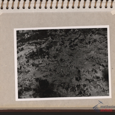
Wesel Bomb damage
Oblique aerial photograph of a town totally destroyed. Large structure lower left, probably church. Submitted with description 'Oblique aerial photo showing bomb damage to an unidentified urban area'.
Tags: aerial photograph; bombing; Cook’s tour
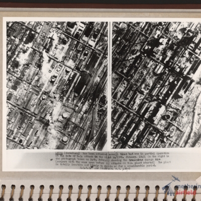
Leuna synthetic oil plant
Side by side reconnaissance photographs showing an industrial area with buildings, roads and towards the right, some railway sidings. This industrial area is orientated from lower left to top right. Chimney smoke is seen on the left hand photograph.…
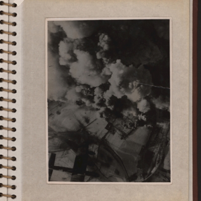
Aerial photograph with a Lancaster
Vertical aerial photograph showing explosions and smoke coming up from what seems to be a power station or oil storage facility. There are two round towers or tanks partially visible through the smoke and the plant is surrounded by bomb-cratered open…
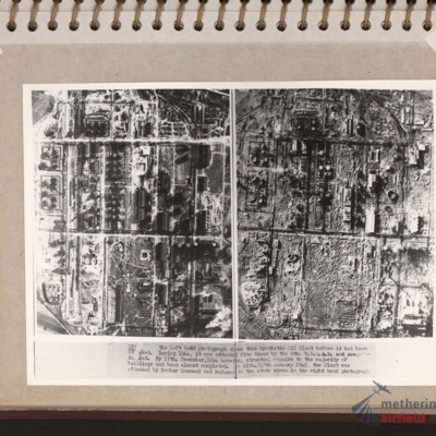
Zeitz Braunkohle-Benzin synthetic oil plant
Vertical aerial photographs showing on the left an industrial area with roads and buildings and on the right the same area with most of the structures destroyed. Explanatory text underneath 'Zeitz. The left hand photograph shows this synthetic oil…
Bocholt
Left and right - side by side reconnaissance photographs showing the centre of the town of Bocholt with river Bocholter Aa flowing top to bottom with two distinctive bow’s to the right towards the top of the photograph. The large road crossing…
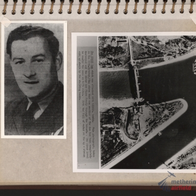
Flight engineer and Kembs dam
Left - full face portrait of an airman wearing tunic with flight engineer brevet. Submitted with description 'Full-face photo of unidentified flight engineer'. Right - reconnaissance photograph with text description of the Kembs dam across the Grand…
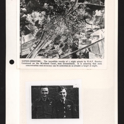
Mittelland Canal near Kloster Gravenhorst and aircrew
Top - a reconnaissance photograph of results of a bombing attack. From a newspaper article. The photograph shows the Mittelland canal running bottom left to top right and very many bomb craters concentrated in middle with canal edges and embankment…
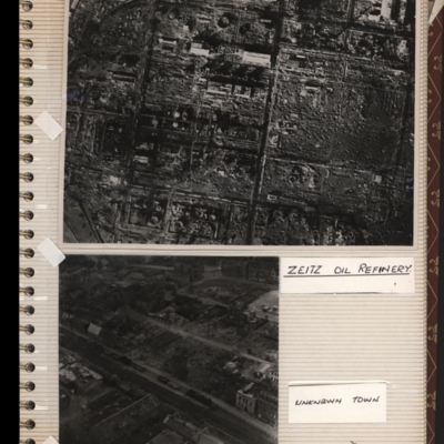
Zeitz oil refinery
Top - reconnaissance photograph of a almost totally destroyed industrial facility. A few buildings towards the top of the photograph appear intact. Captioned 'Zeitz oil refinery. Submitted with description 'Aerial photo of Zeltz [sic] oil refinery…
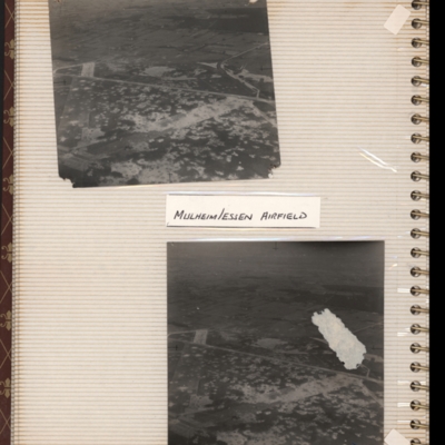
Mulheim/Essen airfield
Top - oblique aerial photograph of an airfield with many bomb craters. Two wide grass runways forming a “V” at bottom left, with taxi-track running left to right across centre of photograph. Hardstanding leads off at top right with two or more…
Tags: aerial photograph; bombing; Cook’s tour; perimeter track; runway
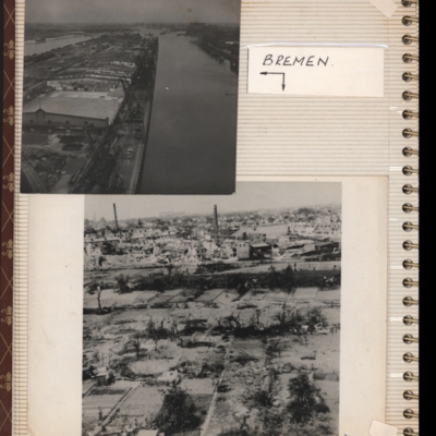
Bremen
Top - oblique aerial photograph of Bremen port with river Weser to the left running bottom to top with dock to the right. Pier in between has extensive railway sidings to the left, warehouses in the middle are mainly without roofs but cleared of…
Tags: aerial photograph; bombing; Cook’s tour
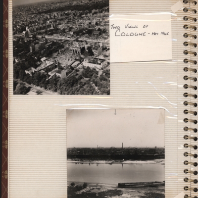
Two views of Cologne - May 1945
Top - oblique aerial photograph of a city with roads running left to right, the nearest one being tree lined and many damaged buildings
Bottom - oblique aerial photograph with the river Rhine running left to right and buildings including chimneys…
Bottom - oblique aerial photograph with the river Rhine running left to right and buildings including chimneys…
Tags: aerial photograph; bombing; Cook’s tour
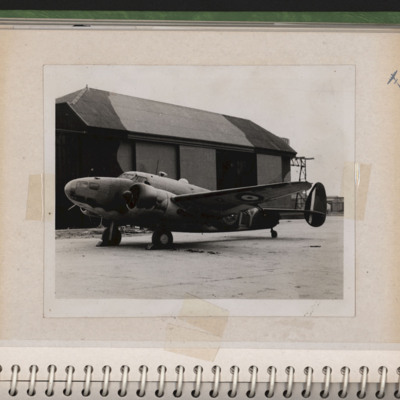
Hudson parked in front of a hangar
A RAF Hudson of 1 PRU (squadron code LY with early style roundel and tail fin markings) parked on hardstanding at RAF Wick with hangar in the background. Submitted with description 'RAF Hudson of No 1 Photographic Reconnaissance Unit in front of…
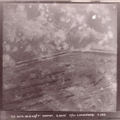
Bomb damage
Four photographs of damage to German cities taken on two of the 'Cooks Tours' flown by no 153 Squadron.
The first has the caption 'T3 SCM 30.5.45//7" HAMM 2,000'. F/LT LANGFORD C.153 and shows Hamm railway marshalling yard with tracks running from…
The first has the caption 'T3 SCM 30.5.45//7" HAMM 2,000'. F/LT LANGFORD C.153 and shows Hamm railway marshalling yard with tracks running from…
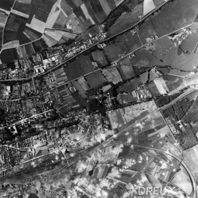
Dreux Rail Facilities
A vertical aerial photograph of Dreux, with rail facility in lower left quarter. Main line runs from rail facilities to top right, with secondary line veering off to the right and curving down to bottom right hand corner. Town is above the railway,…
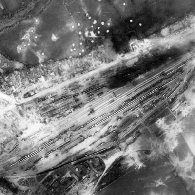
Argentan Marshalling Yard
A vertical aerial photograph showing rail marshalling yard at Argentan. Road running parallel to railway tracks from lower left to upper right (now D158) with another joining from top left (now D238A). Argentan railway station is visible opposite…
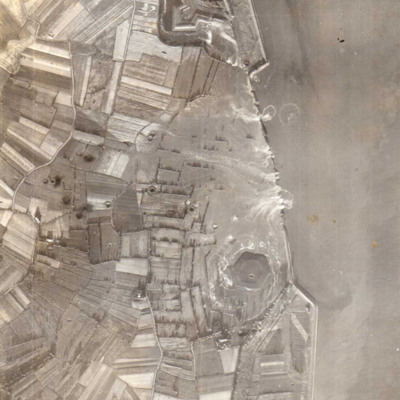
Vlissingen
A vertical aerial photograph showing several new breaches in the sea defences with areas of land in process of being flooded. Submitted with caption; “Sea wall broken at Flushing.” Fort Rammekens is at the top of the photograph, with village of…
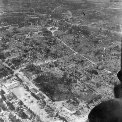
Wesel
An oblique aerial photograph, just catching the starboard engines of the aircraft, is labelled as Wesel, showing almost total destruction of buildings. The prominent building top middle is Berliner Tor. The cleared road leading to it and around it,…
Tags: aerial photograph; bombing; Cook’s tour
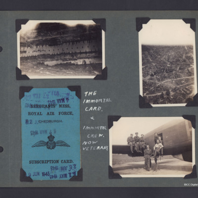
Aerial photographs, Mess Card and the Immortal Crew
Three photographs and copies plus One Mess Card from an album.
Photo 1 is an aerial photograph of part of the Hamburg docks, in the Steinwerder area. The lower dock is Kaiser Wilhelm Hafen, the dock above Is Kuhwerder, top right area series of…
Photo 1 is an aerial photograph of part of the Hamburg docks, in the Steinwerder area. The lower dock is Kaiser Wilhelm Hafen, the dock above Is Kuhwerder, top right area series of…
Tags: 218 Squadron; aerial photograph; bombing; Lancaster; mess; RAF Chedburgh
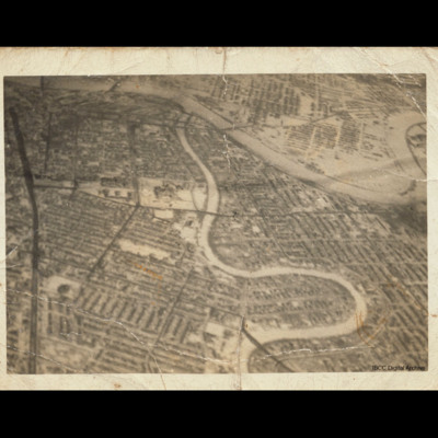
Winnipeg
Oblique aerial photograph of central Winnipeg looking due east with the Red River meandering top left to middle right and the Assiniboine River meandering from bottom centre to top centre joining it. The Trans Canada Highway runs top left to bottom…
Tags: aerial photograph
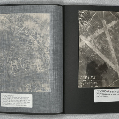
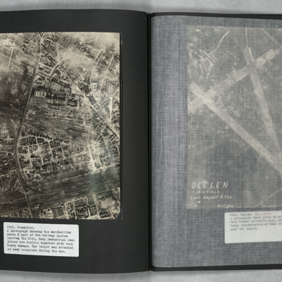
Deelen
A vertical aerial photograph showing the airfield, south-west of Deelen, Arnhem. Three runways in the “A” configuration are seen, with the two main runways forming the top of the “A” at lower right. Hangars and other airfield buildings are to…
Frankfurt
A vertical aerial photograph of Frankfurt showing extensive damage. Frankfurt Haupt-Bahnhof is shown lower right, with the main lines running across to lower left corner. In the centre of the photograph is a large industrial plant with extensive…
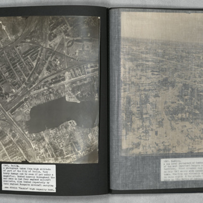
Berlin
A vertical aerial photograph of Berlin showing heavy bomb damage. The body of water is the Rummelsburger See, with the railway station of Ostkreuz to the left of it at the confluence of railway tracks running from lower left to top right and from…
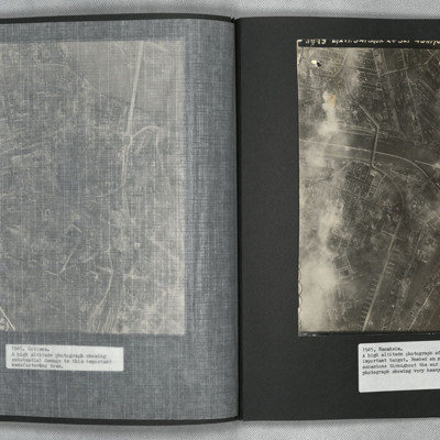
Mannheim
A vertical aerial photograph of Mannheim. The left of the image is shrouded by clouds. The main river running left to right is the Neckar. The spur below it being the Bonadieshafen and the one above it the Verbindungskanal. The road bridge crossing…
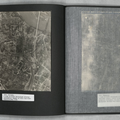
Coblenz
A vertical aerial photograph of Koblenz in early 1945 showing widespread damage to buildings with large areas completely destroyed. Bomb craters can be seen in several places. A railway marshalling yard is to centre left and the railway lines then…
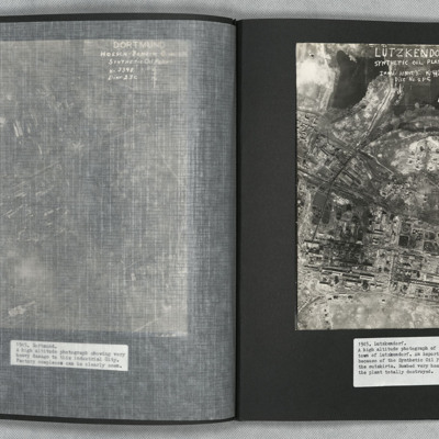
Lutzkendorf
A vertical aerial photograph of the synthetic oil plant at Lutzkendorf, near Leipzig. The Geiseltalsee is the body of water at the top of the image. A railway line with sidings runs through the image from left to right. Possibly more sidings to top…

