Mannheim
Title
Mannheim
Description
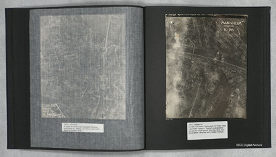
A vertical aerial photograph of Mannheim. The left of the image is shrouded by clouds. The main river running left to right is the Neckar. The spur below it being the Bonadieshafen and the one above it the Verbindungskanal. The road bridge crossing the river is the Jungbuschbrucke. Barges and other river craft can be seen against jetties in several locations. At least six are at odd angles in mid channel on the canal. Throughout the photograph, multiple sites of bomb damage span the urban industrial town.
Date
1945
Temporal Coverage
Language
Type
Format
One b/w photograph on an album page
Conforms To
Publisher
Rights
This content is available under a CC BY-NC 4.0 International license (Creative Commons Attribution-NonCommercial 4.0). It has been published ‘as is’ and may contain inaccuracies or culturally inappropriate references that do not necessarily reflect the official policy or position of the University of Lincoln or the International Bomber Command Centre. For more information, visit https://creativecommons.org/licenses/by-nc/4.0/ and https://ibccdigitalarchive.lincoln.ac.uk/omeka/legal.
Contributor
Identifier
PThomasAF20040042
Collection
Citation
“Mannheim,” IBCC Digital Archive, accessed July 26, 2024, https://ibccdigitalarchive.lincoln.ac.uk/omeka/collections/document/23040.
Item Relations
This item has no relations.

