Browse Items (304 total)
- Tags: Cook’s tour
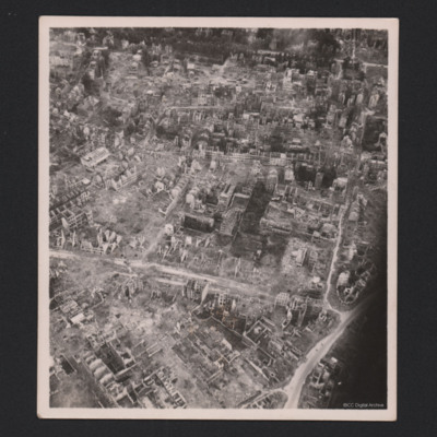
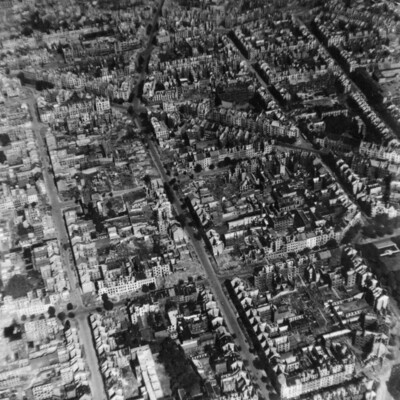
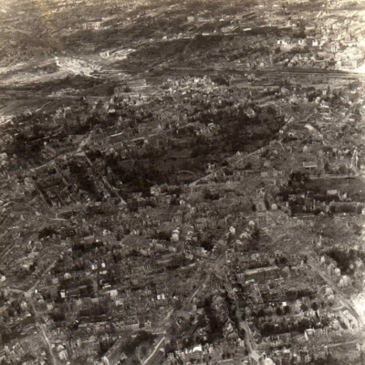
Dortmund
Identification kindly provided by Ludger Keiser of the Finding the location WW1 & WW2 Facebook group.
Tags: aerial photograph; bombing; Cook’s tour
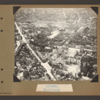
Dortmund
Tags: aerial photograph; bombing; Cook’s tour
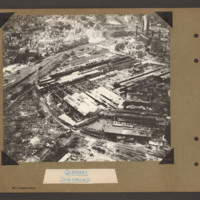
Dortmund
Tags: aerial photograph; bombing; Cook’s tour
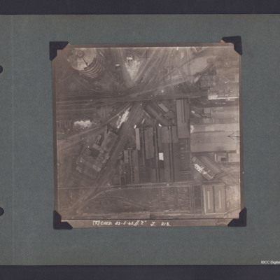
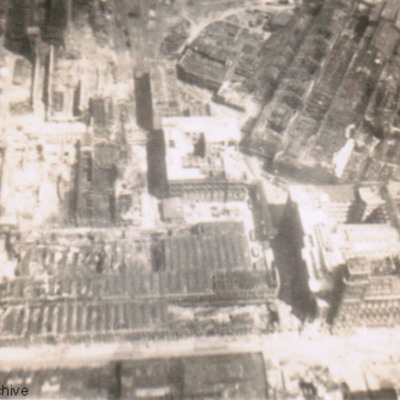
Dortmund Industrial Area
The photo is captioned '(T) Ched 23.5.45//7" J 218'.
On the reverse 'Crown Copyright Reserved' and 'Dortmund'.
Douglas Hudson's observer’s and air gunner’s flying log book
Tags: 100 Squadron; 1656 HCU; 1662 HCU; 1667 HCU; 28 OTU; Advanced Flying Unit; Air Observers School; aircrew; Anson; bombing; bombing of Nuremberg (30 / 31 March 1944); bombing of the Normandy coastal batteries (5/6 June 1944); Cook’s tour; Halifax; Heavy Conversion Unit; Lancaster; mine laying; navigator; Normandy campaign (6 June – 21 August 1944); Operational Training Unit; Pathfinders; RAF Blyton; RAF Grimsby; RAF Lindholme; RAF Sandtoft; RAF Staverton; RAF Wymeswold; training; Wellington
Douglas Ross Arrowsmith’s pilots flying log book
Tags: 1656 HCU; 21 OTU; 27 OTU; 460 Squadron; aircrew; Anson; bombing; bombing of Dresden (13 - 15 February 1945); Cook’s tour; Flying Training School; Halifax; Heavy Conversion Unit; Lancaster; Lancaster Finishing School; Operation Dodge (1945); Operational Training Unit; Oxford; pilot; RAF Binbrook; RAF East Kirkby; RAF Hemswell; RAF Lindholme; RAF Moreton in the Marsh; Tiger Moth; training; Wellington
Dusseldorf
Tags: aerial photograph; bombing; Cook’s tour
Edward Key’s flying log book for navigators, air bombers, air gunners and flight engineers
Tags: 1657 HCU; 514 Squadron; aircrew; B-24; bombing; bombing of Dresden (13 - 15 February 1945); C-47; Cook’s tour; flight engineer; Heavy Conversion Unit; Hudson; Initial Training Wing; Lancaster; Lancaster Finishing School; Lincoln; Operation Dodge (1945); Operation Exodus (1945); Operation Manna (29 Apr – 8 May 1945); RAF Bridlington; RAF Burn; RAF Eastleigh; RAF Feltwell; RAF Leconfield; RAF St Athan; RAF Stradishall; RAF Tuddenham; RAF Upwood; RAF Waterbeach; Stirling; training
Edward Mathews’ flying log book for navigators air bombers air gunners flight engineers
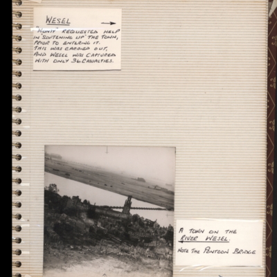
Emmerich
Bottom - oblique aerial photograph of Emmerich with the Rhine running top left to middle right. St. Martini church on near bank and a pontoon bridge across the Rhine. Captioned 'a town on the river…
Tags: aerial photograph; bombing; Cook’s tour
Eric Sinclair’s Royal Air Force Pilot’s Flying Log Book
Tags: 11 OTU; 35 Squadron; Advanced Flying Unit; aircrew; Anson; B-24; bombing of Helgoland (18 April 1945); C-47; Cook’s tour; Dominie; Flying Training School; Halifax; Lancaster; Lancaster Mk 3; Lincoln; Magister; Operation Dodge (1945); Operation Exodus (1945); Operation Manna (29 Apr – 8 May 1945); Operational Training Unit; Oxford; Pathfinders; pilot; RAF Fraserburgh; RAF Gamston; RAF Graveley; RAF Holme-on-Spalding Moor; RAF Lichfield; RAF Little Rissington; RAF Meir; RAF Oakley; RAF Ossington; RAF Silloth; RAF Warboys; RAF Westcott; RCAF Penhold; training; Wellington; Whitley
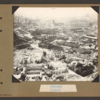
Essen
Tags: aerial photograph; bombing; Cook’s tour
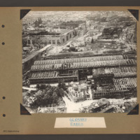
Essen
Tags: aerial photograph; bombing; Cook’s tour
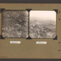
Essen
Tags: aerial photograph; bombing; Cook’s tour
Essen
Tags: aerial photograph; bombing; Cook’s tour
Essen
Bottom - oblique aerial photograph of industrial site with many damaged…
Tags: aerial photograph; bombing; Cook’s tour
Essen
Tags: aerial photograph; bombing; Cook’s tour
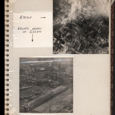
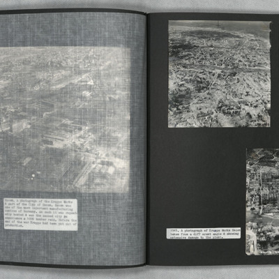
Essen (Krupps Works) Cooks tour
Tags: aerial photograph; bombing; Cook’s tour
EW Cropper's Log Books
Tags: 103 Squadron; 1651 HCU; 1656 HCU; 1662 HCU; 57 Squadron; 7 Squadron; Air Observers School; aircrew; Anson; Bombing of Mailly-le-Camp (3/4 May 1944); bombing of the Le Havre E-boat pens (14/15 June 1944); bombing of the Normandy coastal batteries (5/6 June 1944); Cook’s tour; Flying Training School; forced landing; Halifax; Halifax Mk 2; Halifax Mk 5; Heavy Conversion Unit; Lancaster; Lancaster Finishing School; Lancaster Mk 3; Lincoln; mid-air collision; mine laying; Mosquito; navigator; Normandy campaign (6 June – 21 August 1944); Operation Dodge (1945); Oxford; Proctor; RAF Blyton; RAF Elsham Wolds; RAF Hemswell; RAF High Wycombe; RAF Jurby; RAF Lindholme; RAF Mepal; RAF Oakington; RAF Scampton; RAF Shawbury; RAF Upwood; RAF Waddington; RAF Wratting Common; Stirling; tactical support for Normandy troops; Tiger Moth; training; V-1; V-weapon; Wellington
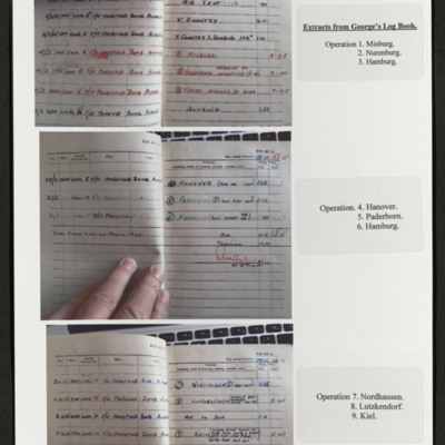
Extracts from George Royall's observer's and air gunner's flying log book
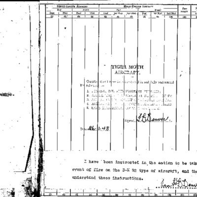
Extracts from Ian Denver's log book
Tags: 156 Squadron; 1667 HCU; 18 OTU; 625 Squadron; Advanced Flying Unit; bombing; bombing of Dresden (13 - 15 February 1945); Cook’s tour; Flying Training School; Heavy Conversion Unit; Lancaster; Lancaster Finishing School; Normandy campaign (6 June – 21 August 1944); Operation Exodus (1945); Operation Manna (29 Apr – 8 May 1945); Operational Training Unit; Oxford; Pathfinders; RAF Hemswell; RAF Kelstern; RAF Lindholme; RAF Sandtoft; RAF Warboys; Tiger Moth; training
Extracts from the log book of Flight Lieutenant Charles Martin
Tags: 166 Squadron; 1662 HCU; 61 Squadron; aircrew; bombing; Bombing of Mailly-le-Camp (3/4 May 1944); bombing of the Le Havre E-boat pens (14/15 June 1944); bombing of the Pas de Calais V-1 sites (24/25 June 1944); Cook’s tour; Halifax; Halifax Mk 3; Halifax Mk 5; Heavy Conversion Unit; Lancaster; Lancaster Mk 1; Lancaster Mk 3; navigator; Normandy campaign (6 June – 21 August 1944); Operation Dodge (1945); RAF Blyton; RAF Kirmington; RAF Sturgate; training
F T Jones’ navigator’s, air bomber’s and air gunner’s flying log book
Tags: 1659 HCU; 1666 HCU; 420 Squadron; aircrew; bombing; bombing of Nuremberg (30 / 31 March 1944); bombing of the Boulogne E-boats (15/16 June 1944); bombing of the Normandy coastal batteries (5/6 June 1944); Cook’s tour; flight engineer; forced landing; Halifax; Halifax Mk 2; Halifax Mk 3; Heavy Conversion Unit; Lancaster; Mosquito; Normandy campaign (6 June – 21 August 1944); Oxford; RAF Tholthorpe; RAF Topcliffe; RAF Wombleton; tactical support for Normandy troops; training
F/O CAH Darby No 154676 - Letters home
Tags: 16 OTU; 1661 HCU; 186 Squadron; 622 Squadron; Advanced Flying Unit; aircrew; Anson; bombing; Cook’s tour; Heavy Conversion Unit; Lancaster; Lancaster Finishing School; navigator; Operation Exodus (1945); Operation Manna (29 Apr – 8 May 1945); Operational Training Unit; RAF Acaster Malbis; RAF Barford St John; RAF Bishops Court; RAF Burn; RAF Heaton Park; RAF Mildenhall; RAF Scampton; RAF Stradishall; RAF Syerston; RAF Tuddenham; RAF Upper Heyford; RAF Winthorpe; Stirling; training; Wellington
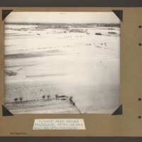
Flooded area around Walcheren
Tags: aerial photograph; bombing; Cook’s tour

