Browse Items (1459 total)
- Tags: aerial photograph
Sort by:
Noball Targets
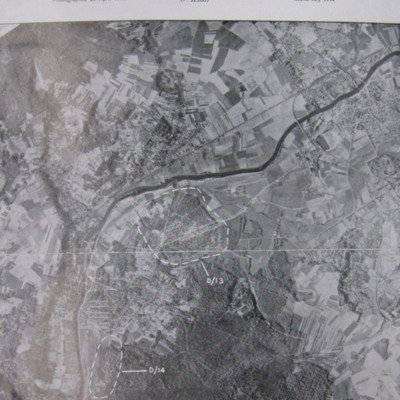
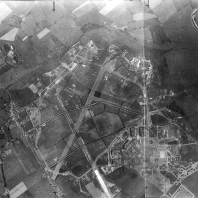
A vertical aerial photograph identifying two Noball targets at Bois de Cassan and Foret de l'Isle Adam,
Siracourt
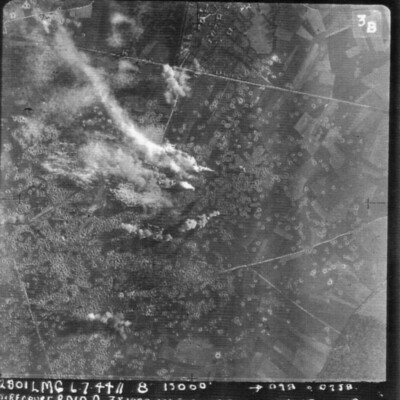
A vertical aerial photograph of Siracourt V-1 site. Smoke is rising from bomb explosions and the fields are littered with craters.
It is annotated '2801 LMG 6.7.44 // 8" 13000' --098° 0258 Siracourt Raid A 3 x 1000 10 x500 c 28secs WO Puskas A…
It is annotated '2801 LMG 6.7.44 // 8" 13000' --098° 0258 Siracourt Raid A 3 x 1000 10 x500 c 28secs WO Puskas A…
Metz
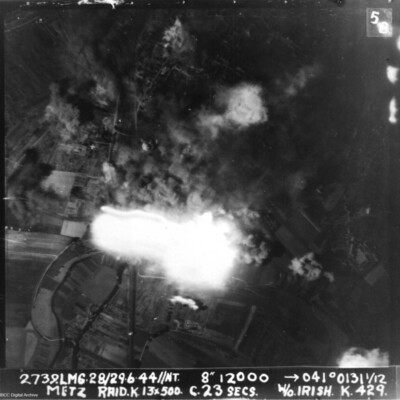
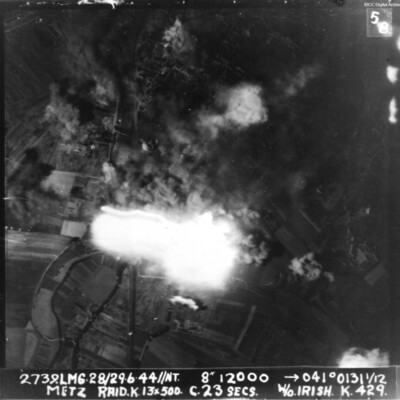
A vertical aerial photograph of Metz taken during a bombing operation. Much of the image is obscured by explosions.
It is annotated '2739.LMG. 28/29.6.44 // NT 8" 12000 --> 041°0131 1/12 Metz Raid. K. 13x 500 c.23 secs W/O Irish . K.429.'
It is annotated '2739.LMG. 28/29.6.44 // NT 8" 12000 --> 041°0131 1/12 Metz Raid. K. 13x 500 c.23 secs W/O Irish . K.429.'
Gorenflos
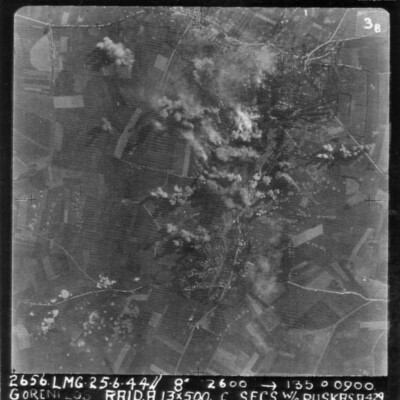
A vertical aerial photograph of an attack on Gorenflos V-1 base. Rows of bomb craters and explosions can be seen.
The image is annotated '26565. LMG. 25.6.44// 8" 12600 --135° 0900 Goenflos Raid .A. 13x500 c secs W/O Puskas .A.429'
The image is annotated '26565. LMG. 25.6.44// 8" 12600 --135° 0900 Goenflos Raid .A. 13x500 c secs W/O Puskas .A.429'
Tags: 429 Squadron; aerial photograph; aircrew; bombing; pilot; RAF Leeming; target photograph; V-1; V-weapon
RAF Leeming
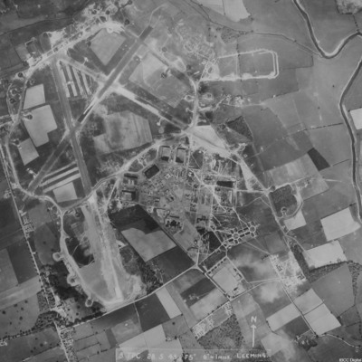
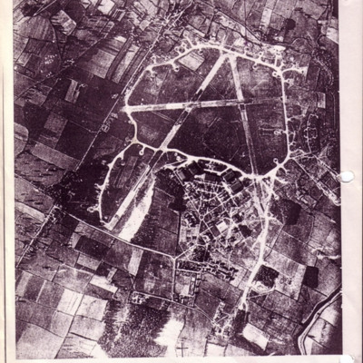
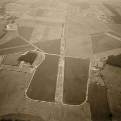
A vertical aerial photograph of Leeming. Camouflage markings can be seen on the airfield.
RAF Leeming
A vertical aerial photograph of Leeming showing the extension to two runways to the south and south east. Halifaxes can be seen on dispersals.
It is annotated '8 TPC 28.5.43// F5" 6" = 1 mile Leeming'.
It is annotated '8 TPC 28.5.43// F5" 6" = 1 mile Leeming'.
Ariel views
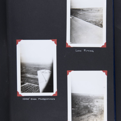
Top right - oblique aerial photograph over wing of open countryside at low level. Captioned 'Low flying'.
Middle left - oblique aerial photograph over wing of farmland. Captioned '1000' over Mindenmines'.
Bottom right - oblique aerial photograph…
Middle left - oblique aerial photograph over wing of farmland. Captioned '1000' over Mindenmines'.
Bottom right - oblique aerial photograph…
Tags: aerial photograph; training
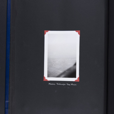
Miami Oklahoma
Oblique aerial photograph of fields. Railway runs up from bottom centre and crosses a road which curves away. Looking east towards Miami which is lost in the distance. At the bottom, part of aircraft. Captioned 'Miami through the mist'. Includes is a…
RAF Leeming
A copy of a vertical aerial photograph of Leeming with an annotation 'Dispersal for "A-Able" -429'.
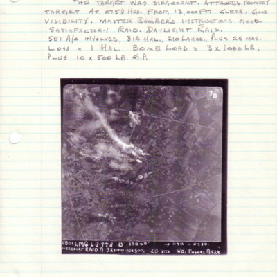
Siracourt
A vertical aerial photograph of Siracourt V-1 base. The entire image is filled with bomb craters. Above is a caption with details of the operation, aircraft taking part and bomb loads.
Under the image is a caption '2801 LMG 6.7.44//8" 13000' -->…
Under the image is a caption '2801 LMG 6.7.44//8" 13000' -->…
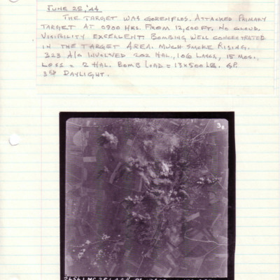
Gorenflos
A vertical aerial photograph taken during an operation at Gorenflos. The centre of the image is obscured by explosions.
Above is captioned with details of the operation.
The photograph is captioned '2656.LMG.25.6.44// 8" 12600 -->135° 0900…
Above is captioned with details of the operation.
The photograph is captioned '2656.LMG.25.6.44// 8" 12600 -->135° 0900…
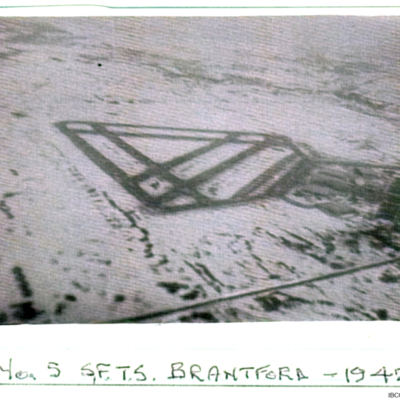
Brantford - 1942
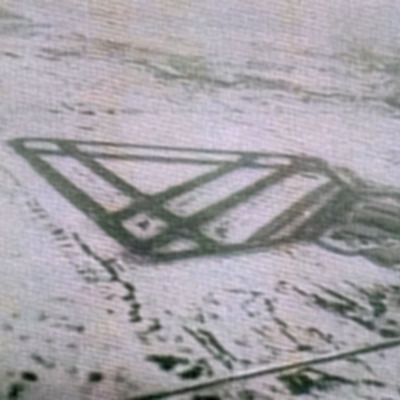
An oblique view of Brantford aerodrome captioned 'No 5 SFTS Brantford -1942'. The ground is snow covered.
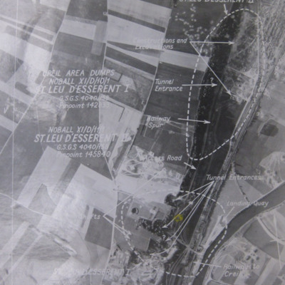
St Leu d'Esserent
Six aerial photographs of St Leu d'Esseent.
Photo 1 is a vertical target photograph with tunnels, railway and landing quay marked.
Photo 2 is a vertical aerial photograph taken during the operation. It is captioned '1962 TLP 5-8-44//8" 15000…
Photo 1 is a vertical target photograph with tunnels, railway and landing quay marked.
Photo 2 is a vertical aerial photograph taken during the operation. It is captioned '1962 TLP 5-8-44//8" 15000…
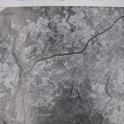
Noball Targets
A vertical aerial reconnaissance photograph of Bois de Cassan and Foret de l'Isle Adam with two target areas marked.
Tags: aerial photograph; bombing
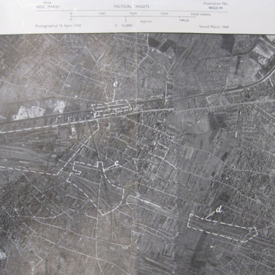
Noisy-le-Sec
A vertical aerial photograph of Noisy-le-Sec, Paris. Five targets are marked.
Berlin
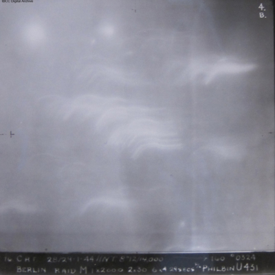
Three identical vertical aerial photographs of an attack on Berlin. There is no detail on the photograph. Some light flashes and tracer fire is visible. It is captioned '10 CRT 28/29.1.44//NT 8" 14000 -->100°0324 Berlin Raid M1 x 2000 2x30 6 x 4…
RAF Tholthorpe
An oblique aerial photograph of RAF Tholthorpe (disused) taken in the 1970s.
Metz
Vertical aerial photograph taken during an attack on Metz. The centre of the image is obscured by explosions. The caption reads '2739.LMG.28/29.6.44//NT. 8" 12000 -->041° 0131 1/12 Metz Raid. L 13*500 C.23 secs W/O Irish K 429'.
Gorenflos V-1 base
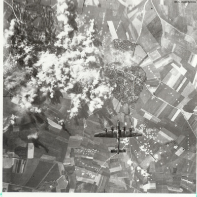
A vertical aerial photograph taken during a bombing run. Underneath is a Halifax. A town can be seen with many bomb craters. The left centre of the image is obscured by explosions.
Tags: aerial photograph; bombing; Halifax; target photograph
Strike to defend
A 25 page account of the preparation for, and carrying out of a maximum effort operation against Duisburg by Lancasters of 83 Squadron at RAF Wyton, part of 8 Group Bomber Command. Account provides detailed description of preparations, briefing and…
Tags: 5 Group; 8 Group; 83 Squadron; aerial photograph; air gunner; aircrew; anti-aircraft fire; Bennett, Donald Clifford Tyndall (1910-1986); bomb aimer; bombing; briefing; debriefing; ditching; flight engineer; Holocaust; Lancaster; navigator; Pathfinders; perception of bombing war; pilot; RAF Wyton; searchlight; target indicator; target photograph; wireless operator
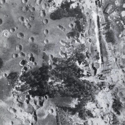
St Leu d'Esserent
Three images of St Leu d'Esserent taken after the attack.
Photo 1 is a vertical image showing bomb craters. It is annotated with 'C' and 'D's.
Photo 2 shows an entrance to an underground store.
Photo 3 show an entrance to an underground store. It…
Photo 1 is a vertical image showing bomb craters. It is annotated with 'C' and 'D's.
Photo 2 shows an entrance to an underground store.
Photo 3 show an entrance to an underground store. It…
RAF Tholthorpe
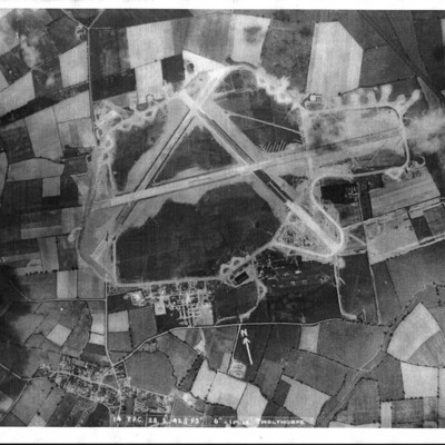
Three vertical aerial photographs of the airfield at Tholthorpe. The first is annotated 'Photo taken 28/5/43 before the photo on the wall in the Pub'. It is also captioned '14 TPC 28.5.43 //F 5" 6"- 1 mile Tholthorpe'.
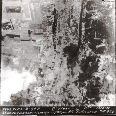
St Leu d'Esserent
A vertical aerial photograph of St Leu d'Esserent V-1 site during an operation.
The caption reads '1962 TLP 5-8-44 // 8" 15000 --> 117° 1315:30 St Leu d'Esserent A(9x1000)(4x500)f30sec P/O Johnston "A" 420'
The second image is identical.
The caption reads '1962 TLP 5-8-44 // 8" 15000 --> 117° 1315:30 St Leu d'Esserent A(9x1000)(4x500)f30sec P/O Johnston "A" 420'
The second image is identical.
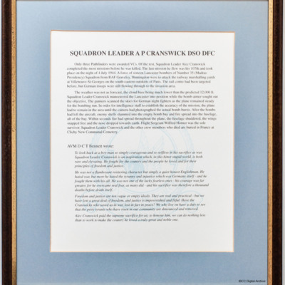
Squadron Leader AP Cranswick DSO DFC
A framed biography of Alec Cranswick's wartime service. It includes a tribute by AVM Bennett.

