Browse Items (4445 total)
- Tags: bombing
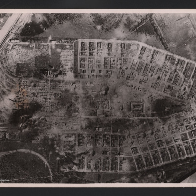
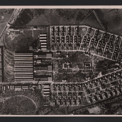
RAF attack on Salbris explosive works and depot
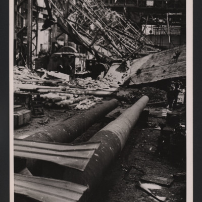
Captured Essen – first pictures inside Krupps
Tags: bombing
RAF attack on Salbris explosive works and depot
Kenneth Pope's flying log book for navigators, air bombers, air gunners and flight engineers
John Derek Bailey’s Royal Canadian Air Force flying log book for aircrew other than pilot
Tags: 103 Squadron; 1654 HCU; 166 Squadron; 1660 HCU; 1667 HCU; 20 OTU; 83 OTU; Advanced Flying Unit; aircrew; Anson; Bolingbroke; bomb aimer; bombing; Bombing and Gunnery School; Halifax; Halifax Mk 2; Halifax Mk 5; Heavy Conversion Unit; Initial Training Wing; Lancaster; Lancaster Finishing School; Lancaster Mk 3; mine laying; Operational Training Unit; RAF Acaster Malbis; RAF Bicester; RAF Blyton; RAF Catterick; RAF Elsham Wolds; RAF Heaton Park; RAF Hemswell; RAF Kirkham; RAF Kirmington; RAF Lindholme; RAF Llandwrog; RAF Lossiemouth; RAF Moreton in the Marsh; RAF Paignton; RAF Penrhos; RAF Peplow; RAF Sandtoft; RAF Scampton; RAF Swinderby; RAF Wickenby; RAF Wigsley; RAF Worksop; RCAF Moncton; training; Wellington
Arthur Atkins’ flying log book for pilots
Tags: 1662 HCU; 1667 HCU; 27 OTU; 625 Squadron; Advanced Flying Unit; aircrew; Anson; bombing; Flying Training School; Halifax; Halifax Mk 2; Halifax Mk 5; Heavy Conversion Unit; Lancaster; Lancaster Finishing School; Lancaster Mk 1; Lancaster Mk 3; Normandy campaign (6 June – 21 August 1944); Operational Training Unit; Oxford; pilot; RAF Andover; RAF Blyton; RAF Church Broughton; RAF Gamston; RAF Hemswell; RAF Kelstern; RAF Lichfield; RAF Sandtoft; RAF Westcott; tactical support for Normandy troops; Tiger Moth; training; V-1; V-weapon; Wellington
Jack Warner’s navigator's, air bomber's and air gunner's flying log book
Tags: 1659 HCU; 1664 HCU; 408 Squadron; 428 Squadron; aircrew; anti-aircraft fire; bombing; bombing of the Normandy coastal batteries (5/6 June 1944); C-47; flight engineer; Gneisenau; Halifax; Halifax Mk 2; Halifax Mk 5; Heavy Conversion Unit; mine laying; Normandy campaign (6 June – 21 August 1944); RAF Croft; RAF Leeming; RAF Middleton St George; RAF St Athan; RAF Topcliffe; Scharnhorst; training; Window
John Brittain's flying log book
Tags: 1653 HCU; 17 OTU; 195 Squadron; air gunner; Air Gunnery School; aircrew; Anson; bombing; bombing of Helgoland (18 April 1945); Cook’s tour; Heavy Conversion Unit; Lancaster; Operation Exodus (1945); Operation Manna (29 Apr – 8 May 1945); Operational Training Unit; RAF Chedburgh; RAF Feltwell; RAF Morpeth; RAF North Luffenham; RAF Silverstone; RAF Turweston; RAF Wratting Common; Stirling; training; Wellington
Andrew Deytrikh’s pilots flying log book. One
Tags: 66 Squadron; aircrew; B-17; B-25; B-26; bombing; Boston; Flying Training School; Fw 190; Hurricane; Magister; Me 109; Me 110; Operational Training Unit; pilot; RAF Brough; RAF Hornchurch; RAF Kenley; Spitfire; Tiger Moth; training; Typhoon; V-1; V-weapon
Angas M Hughes’ Royal Australian Air Force observer’s air gunner’s and wireless operator’s flying log book
Tags: 1660 HCU; 27 OTU; 467 Squadron; Advanced Flying Unit; Air Observers School; aircrew; Anson; Battle; bomb aimer; bombing; bombing of Luftwaffe night-fighter airfields (15 August 1944); bombing of the Creil/St Leu d’Esserent V-1 storage areas (4/5 July 1944); bombing of the Pas de Calais V-1 sites (24/25 June 1944); Bombing of Trossy St Maximin (3 August 1944); Heavy Conversion Unit; Lancaster; Lancaster Finishing School; Lancaster Mk 1; Lancaster Mk 3; missing in action; Normandy campaign (6 June – 21 August 1944); Operational Training Unit; RAF Lichfield; RAF Swinderby; RAF Syerston; RAF Waddington; RAF West Freugh; Stirling; tactical support for Normandy troops; training; V-1; V-weapon; Wellington
L Kirrage's flying log book for navigators, air bombers. air gunners and flight engineers
Robert McClement's Flying Log Book for Navigators, Air Bombers, Air Gunners, Flight Engineers
Tags: 10 Squadron; 1658 HCU; 20 OTU; air gunner; Air Gunnery School; aircrew; Anson; bombing; bombing of Luftwaffe night-fighter airfields (15 August 1944); FIDO; Halifax; Halifax Mk 2; Halifax Mk 3; Heavy Conversion Unit; Normandy campaign (6 June – 21 August 1944); Operation Manna (29 Apr – 8 May 1945); Operational Training Unit; RAF Lossiemouth; RAF Melbourne; RAF Pembrey; RAF Riccall; tactical support for Normandy troops; training; V-1; V-weapon; Wellington
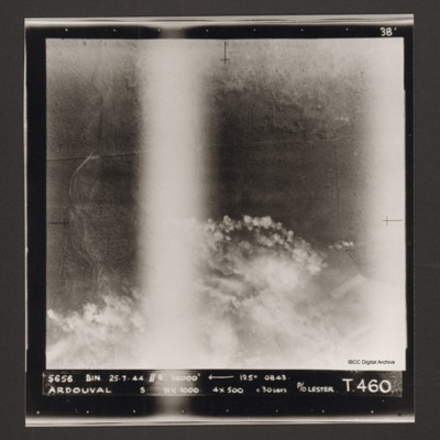
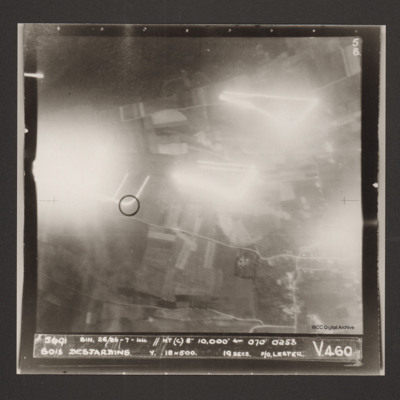
Ardouval
Bois Desjardins
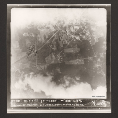
Trossy St Maximin
Richard Vipond’s flying log book for navigators, air bombers, air gunners and flight engineers
Tags: 1668 HCU; 514 Squadron; 61 Squadron; 85 OTU; 88 Squadron; air gunner; Air Gunnery School; aircrew; Anson; bombing; Cook’s tour; Heavy Conversion Unit; Lancaster; Lancaster Mk 2; Lancaster Mk 3; Lincoln; Operation Exodus (1945); Operation Manna (29 Apr – 8 May 1945); Operational Training Unit; RAF Barrow in Furness; RAF Bottesford; RAF Husbands Bosworth; RAF Jurby; RAF Lindholme; RAF Scampton; RAF Shallufa; RAF Waddington; RAF Waterbeach; Sunderland; training; Wellington
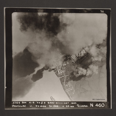
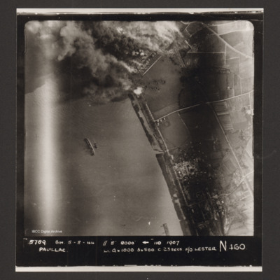
Pauillac
Pauillac
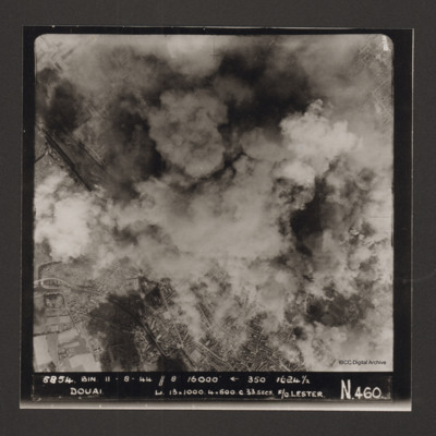
Douai
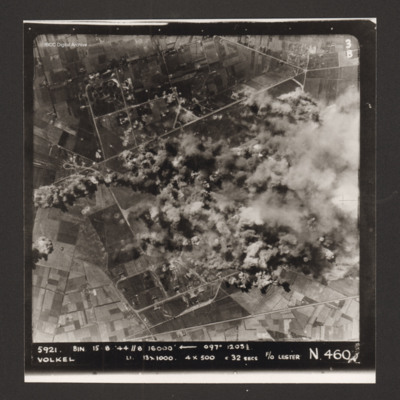
Volkel
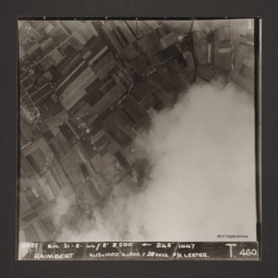
Raimbert
Captioned '6051 Bin. 31-8-44//8" 8,800'
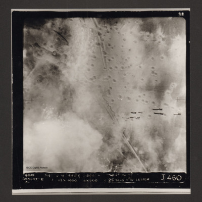
Sangatte
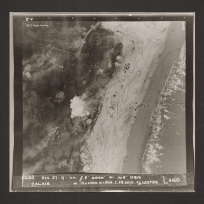
Calais
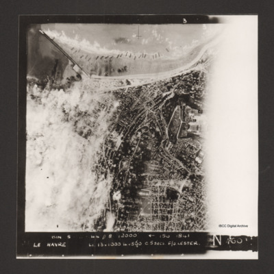
Le Havre
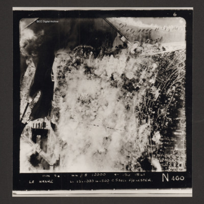
Le Havre
Captioned 'Captioned 'BIN 5-8-44 //8 12000' [arrow] 150 1841 Le Havre Li 13x1000 4x500 c5secs F/O Lester N 460'.

