Browse Items (139 total)
- Collection: Banks, Peter. Album one
Sort by:
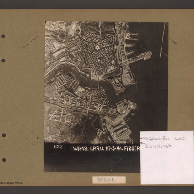
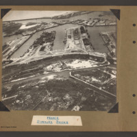
Scharnhorst and Gneisenau
Aerial vertical photograph showing a coastal town with docks on the coast and a river running through the middle. On the right open water with a breakwater in the top right corner pointing down. Above the river on the four large jetties point into…
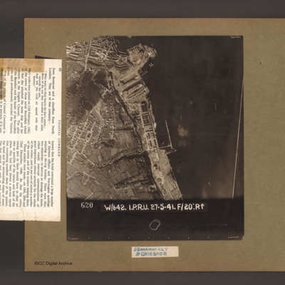
Scharnhorst and Gneisenau
An aerial vertical photograph of a coastline lined with docks and buildings. At the top and inlet with docks and town buildings to its left. Below a peninsular are three docks pointing down and left. A large warship is moored in the bottom dock. Just…
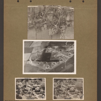
Feltwell village
Top an aerial vertical photograph of a village. Two roads lead in from the left joining a circular road running round the village. Roads lead off top and bottom right.
Middle an aerial inclined photograph of a diamond shaped aircraft dispersal…
Middle an aerial inclined photograph of a diamond shaped aircraft dispersal…
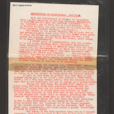
Introduction of Kodakcolor X 1941/1942
Account of problems of accurate bombing, introduction of pathfinders and use of marker flares. Relates use of cameras and photo-flash to obtain aiming point pictures. Goes on to talk on the introduction of colour film by attaching pieces colour film…
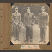
Royal review of Royal Air Force
Full length portrait of three senior officers in Royal Air Force Uniform standing side by side. On the left The Prince of Wales with Air Chief Marshall rank and pilot brevet with hands crossed in front holding gloves. In the centre King George V…
Tags: RAF Duxford
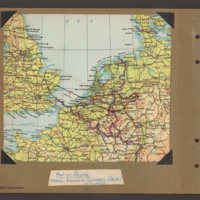
Route to the Ruhr via France, Belgium and Holland
Map showing route in black with red direction arrows from a base near Ely via Dunkirk, through Belgium to Maastricht, Aachen, Cologne, to the east of the Dortmund in the Ruhr and then return via Holland. Label 'Map of route, France, Belgium, Germany…
Tags: Cook’s tour
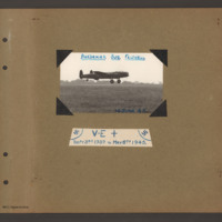
Baedeker Bus Feltwell
Lancaster at very low level with undercarriage down over grass airfield with row of trees on horizon. Captioned 'Baedecker Bus Feltwell, 14 June 45'.
Label below has swastikas at top left and right and text 'V-E +, Sept 3rd 1939 to May 8th 1945'.
Label below has swastikas at top left and right and text 'V-E +, Sept 3rd 1939 to May 8th 1945'.
Tags: Cook’s tour; Lancaster; RAF Feltwell
Dunkirk Docks
Oblique aerial photograph at low level showing docks, waterways, buildings and other port facilities. No vessels are visible. Across the centre four wide moles numbered 1 to 4 from right to left. The area has been heavily damaged with bomb craters,…
Dunkirk Docks
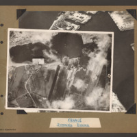
Target photograph of docks at Dunkirk. A body of water stretches from the left side to the top middle with a tidal flats at the left end. From the middle bottom up to the lower bank of the waters is Mole 6 with multiple railway sidings on the left…
Dunkirk Docks
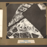
Oblique aerial photograph of Dunkirk docks. The entire area has been extensively bomb damaged. In the bottom half, a triangular shaped area of dockland with roads and railway lines. There are several damaged buildings without roofs and destroyed…
Dunkirk Docks
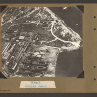
Oblique aerial photograph of docks. On the left side, docklands covered with buildings. On the right the land converges to a peninsular with water above and below. In the bottom centre a shipyard with two incomplete cargo ships with raised forecastle…
Tags: aerial photograph
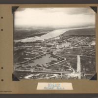
Antwerp Docks
Oblique aerial photograph of Antwerp docks with the river Scheldte running from middle left to right. On the far bank are town buildings. In the distance open countryside on both banks. In the centre a canal leads from the river inland leading to…
Tags: aerial photograph
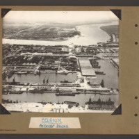
Antwerp Docks
The river Scheldt runs from top left to right with town buildings on the far bank on the left and open country beyond. In the centre on the near bank a waterway with a barrier at the top leads from the river into a series of interconnected water…
Tags: aerial photograph
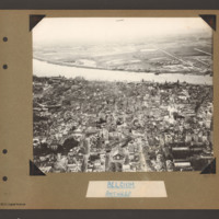
Antwerp
Oblique aerial photograph of Antwerp. The river Scheldt runs from left to right. On the far bank on the right there is a small built up area and a straight road runs from there into the distance. On the near bank a city with many multi storey…
Tags: aerial photograph
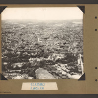
Aachen
Oblique aerial photograph of Aachen. The Stadtpark is in the foreground and the circular Roland Plasse in the bottom right. The Cathedral is centre right. A third of the way up a tree line boulevard runs from left to right with some large detached…
Tags: aerial photograph; Cook’s tour
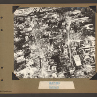
Aachen
Oblique aerial photograph of the town of Aachen with a large number of multistory buildings, the majority of which are damaged and without roofs. A railway runs from top left to centre top with some wagons on the left end, Two streets run slightly…
Tags: aerial photograph; bombing; Cook’s tour
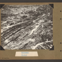
Düren
Oblique aerial photograph of Duren railway station and railway yards. In the centre a railway marshalling yard with multiple tracks towards the left side with many strings of railway rolling stock. In the centre slightly right is the main station…
Tags: aerial photograph; bombing; Cook’s tour
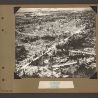
Düren
Oblique aerial photograph of Duren. A city landscape of largely destroyed buildings. A principle road runs from bottom left diagonally to top right. Another curved road runs from bottom left to the right side where it joins a further road running…
Tags: aerial photograph; bombing; Cook’s tour
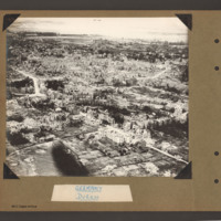
Düren
Oblique aerial photograph of destroyed city landscape with some standing multistory buildings, but primarily large areas reduced to rubble. A road runs from bottom right diagonally to centre left. Another runs from bottom left to middle right. Where…
Tags: aerial photograph; bombing; Cook’s tour
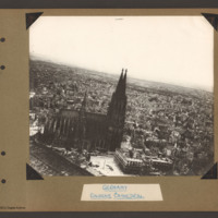
Cologne Cathedral
Aerial inclined photograph of Cologne Cathedral looking south. At the bottom left is part of the roof of the railway station. In the foreground a small open area with a tram in the centre. The cathedral is surrounded on all sides by multistory…
Tags: aerial photograph; bombing; Cook’s tour
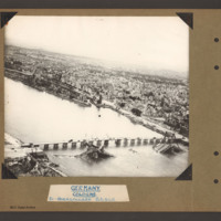
Cologne Hohenzollern bridge
Oblique aerial photograph of the Hohenzollern bridge over the Rhine at Cologne. The river Rhine runs from left diagonally to the right, On the far bank a narrow parallel canal, the Rheinauhafen, beyond which is a city landscape of multistory…
Tags: aerial photograph; bombing; Cook’s tour
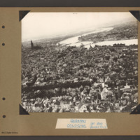
Cologne
Aerial inclined photograph of the city of Cologne looking north. The river Rhine goes from left to right with one large meander. Three bridges cross the river as to turns back to the right. The furthest bridge is destroyed with the right hand two…
Tags: aerial photograph; bombing; Cook’s tour
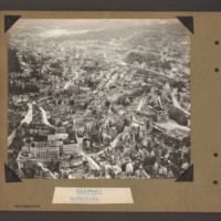
Wuppertal
Oblique aerial photograph of city landscape with multistory buildings and roads. The Wuppertal suspension railway follows the course of the Wupper river from lower right. A railway runs from top left in a slight curve to right middle keeping to the…
Tags: aerial photograph; bombing; Cook’s tour
Wuppertal suspension railway
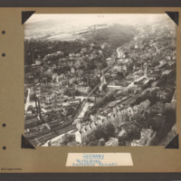
Oblique aerial photograph of Wuppertal with the suspension railway above and following the course of the river Wupper. The suspension railway runs from bottom left to top right. Above the river is a built up area amongst wooded hillside with open…
Tags: aerial photograph; bombing; Cook’s tour

