Düren
Title
Düren
Germany Duren
Description
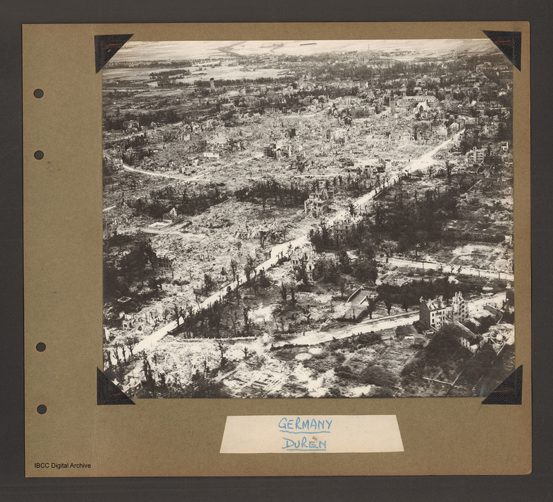
Oblique aerial photograph of Duren. A city landscape of largely destroyed buildings. A principle road runs from bottom left diagonally to top right. Another curved road runs from bottom left to the right side where it joins a further road running right to left. Along these roads are a small number of partially destroyed buildings, amongst large areas of rubble with interspersed trees. Beyond and to the left of the diagonal road a large area of rubble with just a few standing structures. The river Roer runs left to right near the top of the photograph with largely open farm land beyond. Captioned 'Germany Duren'.
Language
Type
Format
One b/w photograph mounted on an album page
Conforms To
Publisher
Rights
This content is available under a CC BY-NC 4.0 International license (Creative Commons Attribution-NonCommercial 4.0). It has been published ‘as is’ and may contain inaccuracies or culturally inappropriate references that do not necessarily reflect the official policy or position of the University of Lincoln or the International Bomber Command Centre. For more information, visit https://creativecommons.org/licenses/by-nc/4.0/ and https://ibccdigitalarchive.lincoln.ac.uk/omeka/legal.
Contributor
Identifier
PBanksP15010017
Collection
Citation
“Düren,” IBCC Digital Archive, accessed August 24, 2024, https://ibccdigitalarchive.lincoln.ac.uk/omeka/collections/document/1426.
Item Relations
This item has no relations.

