Browse Items (33 total)
- Temporal Coverage is exactly "1944-10-03"
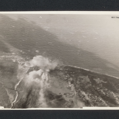
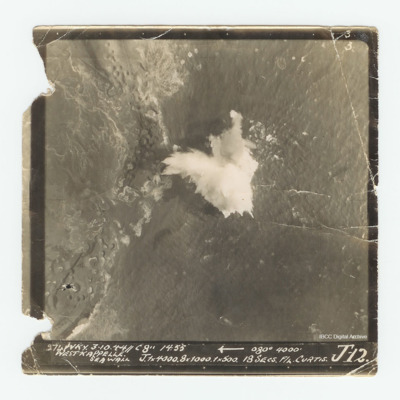
Westkapelle
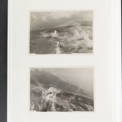
Westkapelle
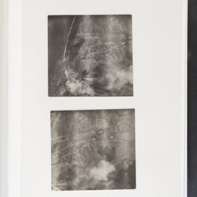
Tags: aerial photograph; bombing
Westkapelle
David Donaldson's pilot's flying log book. One
Tags: 100 Group; 149 Squadron; 15 OTU; 156 Squadron; 1667 HCU; 192 Squadron; 57 Squadron; Air Observers School; aircrew; Anson; bombing; Bombing and Gunnery School; Cook’s tour; Distinguished Flying Cross; Distinguished Service Order; Flying Training School; Gee; Halifax; Heavy Conversion Unit; Hudson; Lancaster; Magister; Operational Training Unit; Oxford; Pathfinders; pilot; Proctor; RAF Brize Norton; RAF Evanton; RAF Feltwell; RAF Foulsham; RAF Hampstead Norris; RAF Harwell; RAF Lindholme; RAF Mildenhall; RAF Warboys; RAF West Raynham; RAF Wyton; Tiger Moth; training; Wellington
Westkappelle
Arthur Loudon's flying log book for navigators
Tags: 12 Squadron; 1656 HCU; 1667 HCU; 30 OTU; Advanced Flying Unit; Air Observers School; aircrew; Anson; Battle; bombing; Bombing and Gunnery School; bombing of Dresden (13 - 15 February 1945); Halifax; Heavy Conversion Unit; Lancaster; Lancaster Finishing School; navigator; Operational Training Unit; Oxford; RAF Gamston; RAF Hemswell; RAF Lindholme; RAF Mona; RAF Sandtoft; RAF Seighford; RAF Wickenby; training; Wellington
Reg Woolgar's observer's and air gunner's flying log book
Tags: 16 OTU; 192 Squadron; 49 Squadron; air gunner; Air Gunnery School; aircrew; Anson; B-17; Battle; bombing; bombing of the Creil/St Leu d’Esserent V-1 storage areas (4/5 July 1944); C-47; Cook’s tour; crash; ditching; Dominie; Halifax; Halifax Mk 3; Hampden; Hudson; Lancaster; Lancaster Mk 1; Lancaster Mk 3; Manchester; Martinet; mine laying; Normandy campaign (6 June – 21 August 1944); Operational Training Unit; Oxford; RAF Barrow in Furness; RAF Foulsham; RAF Fulbeck; RAF Manby; RAF Peterborough; RAF Scampton; RAF Sutton Bridge; RAF Upper Heyford; RAF West Freugh; RAF Wigsley; RAF Yatesbury; Tiger Moth; training; Wellington; Whitley; wireless operator / air gunner; York
Herbert Gray's navigator's, air bomber's and air gunner's flying log book
Tags: 103 Squadron; 1657 HCU; 49 Squadron; aircrew; bombing; bombing of Luftwaffe night-fighter airfields (15 August 1944); bombing of the Le Havre E-boat pens (14/15 June 1944); bombing of the Pas de Calais V-1 sites (24/25 June 1944); Bombing of Trossy St Maximin (3 August 1944); flight engineer; Heavy Conversion Unit; Initial Training Wing; Lancaster; Lancaster Finishing School; Lancaster Mk 1; Lancaster Mk 3; Normandy campaign (6 June – 21 August 1944); RAF Elsham Wolds; RAF Hemswell; RAF Stradishall; Stirling; tactical support for Normandy troops; training; V-3; V-weapon

