Browse Items (1709 total)
- Creator is exactly "Great Britain. Royal air Force"
Sort by:
V T Hilton’s observer’s air gunner’s and w/t operators flying log book
Observer’s air gunner’s and w/t operators flying log book for V T Hilton, wireless operator, covering the period from 19 July 1943 to 16 April 1945. He was stationed at RAAF Parkes, RAAF Port Pririe, RAF Dumfries, RAF Lossiemouth, RAF Rufforth…
Uzice
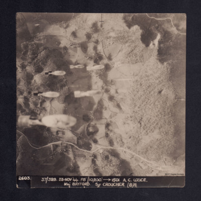
Four vertical aerial photographs taken during the bombing of Uzice, numbered 2603, 2604, 2605 and 2606. On 2603 bombs are seen dropping. Bomb explosions obscure part of the image. It is captioned '2603/2604/2605/2606. 37/329 23.Nov.44 F8//10,200'…
Uzice
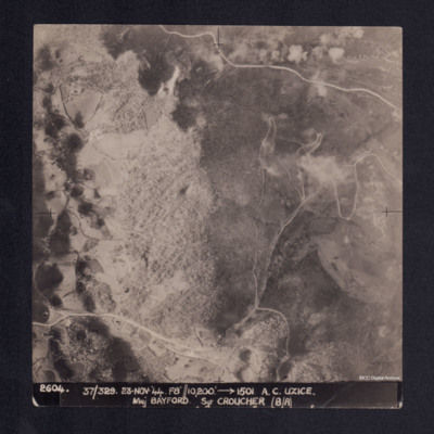
A vertical aerial photograph showing a hill, roads and some settlement in a valley. It is captioned '2604. 37/329 23.Nov.44 F8//10,200' --> 1501 A.C. UZICE. Maj BAYFORD Sgt CROUCHER (B/A)'
Urban area
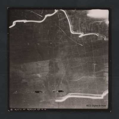
Vertical aerial photograph of unnamed location. The image is largely clear, only a few lines of tracer are visible with street patterns and buildings clearly visible. At the bottom it is captioned ‘A B (x7) 12 NT. 29/30/4/42 F/8” [arrow]…
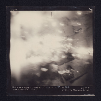
Ulm
A vertical aerial photograph taken during an operation at Ulm. Most of the image is obscured by cloud or explosions. It is annotated '4710 EWS 17/18.12.44//NT 7" 12500 118° 1932½ ULM C 1HC 4000IN 15X4 23SEC F/O MORGAN C 103'.
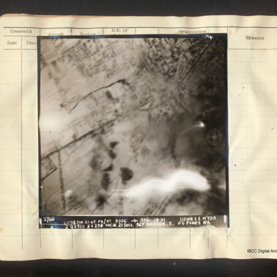
Udine marshalling yards
Vertical aerial photograph of Udine marshalling yards, centered on Porta Aquileia. The image is clear with the exception of an explosion in the lower right. Detail of the town and roads is visible. Captioned 'A4 2760 40/54 Jan 20 45 F8/NT 8000'…
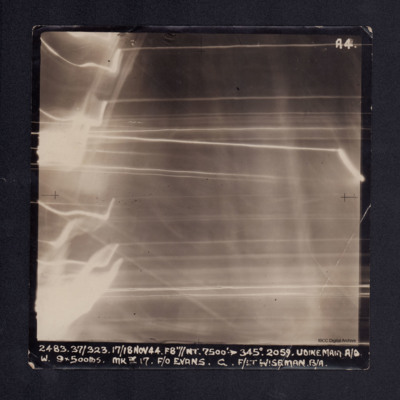
Udine main aerodrome
Vertical aerial photograph of Udine main aerodrome, taken during bombing operations. No detail is visible on the photograph due to anti-aircraft fire. It is captioned '2483 37/323 17/18 Nov 44. F8"//NT. 7500' -->345° 2059. UDINE MAIN A/D W. 9x500lbs…
Twenty-six airmen in front of a hut
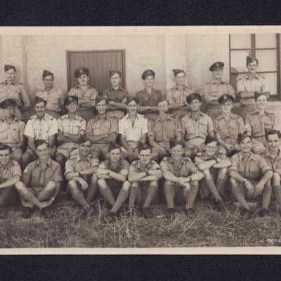
Twenty-six airmen in three rows sitting and standing in front of a building with door and window. Most are wearing khaki uniform with shorts and side or peaked caps.
Printed on back: 'This photograph was sold by RAF Station Aqir, date: 22.6.45…
Printed on back: 'This photograph was sold by RAF Station Aqir, date: 22.6.45…
Tags: RAF Aqir
Tuzla
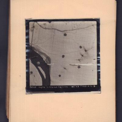
Target photograph showing snow-covered ground with a river middle left to bottom left. A parachute is visible over the river, and parachute shadows are visible on the open ground to the right. Captioned '2599, 104/58, 14 Feb 45, F8, 1000 ft,→…
Trossy St Maximin
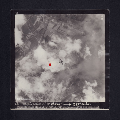
Target photograph of Trossy St Maximin. Red dot left of centre. Three Lancasters flying below. River Oise bottom right. Partially obscured by cloud smoke and dust but bomb explosions, bomb craters roads and field patterns visible. Captioned '3°F',…
Trossy St Maximin
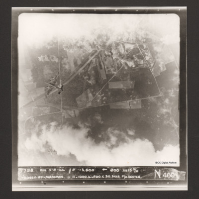
Vertical aerial photograph over Trossy St Maximin. The top and bottom sections are largely obscured by cloud and bomb explosions. Two Lancasters are visible, one directly below and one diving away in the bottom left corner of the…
Trossy St Maximin
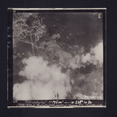
Target photograph of Trossy St Maximin. Majority of photograph obscured by smoke and dust, in area not obscured roads, woods and field boundaries clearly visible. Two Lancasters flying below also visible. Captioned '3°F', '4B', '1681 SKELL.3.8.44.//…
Trossy St Maximin
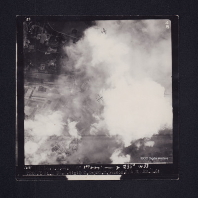
Target photograph of Trossy St Maximin. Partially obscured by cloud, smoke and dust. Runway intersection and many bomb craters clearly visible. Also visible are bomb explosions, roads, woods, field boundaries and a Lancaster flying below. Captioned…
Trossy St Maximin
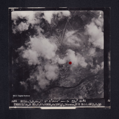
Target photograph of Trossy St Maximin. Both banks of the river Oise visible although partially obscured by smoke or cloud, red dot just right of centre. Very many craters. Captioned '3°F', '5B', '1652 SKELL.3.8.44// 8" 18000' [arrow] 230° 1432…
Trossy St Maximin
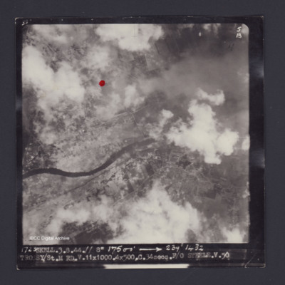
Target photograph of Trossy St Maximin. Red dot just left and higher than centre. Rural area, river Oise running across photograph, some smoke and dust, many craters. Captioned '3°F', '5B', '1723 SKELL.3.8.44.// 8" 17500' [arrow] 239° 1432…
Trieste and airmen with bomb
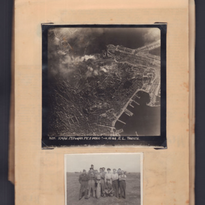
Top - target photograph of a large port city with land to the left side and port with piers bottom right. Bomb explosions top centre. Captioned '2625 104/61, 17 Feb 45, F8, 14200ft→ , 15.16 1/2. E.L. Trieste'.
Bottom - eleven airmen round a…
Bottom - eleven airmen round a…
Trieste
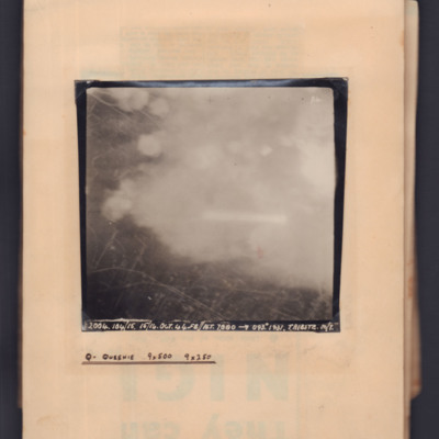
Target photograph showing streets on left side with clouds/bomb explosions centre and right side. Captioned 'P4' and '2004, 104/15, 15/16 Oct 44, F8, NT 7000 ft→ 093 degrees, 1931, Trieste M/Y'. Annotated on page 'Q - Queenie, 9x500, 9x250'.
Trier
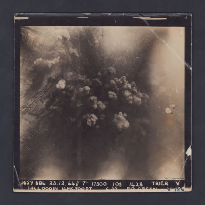
A vertical aerial photograph taken during a bombing operation at Trier. Some industrial buildings can be seen on the left. Details in the central area are obscured by smoke from explosions.
The photograph is captioned:'1659 SDL 23.12.44 // 7" 17500…
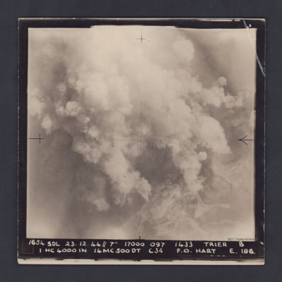
Trier
A vertical aerial photograph taken during a bombing operation at Trier. Much of the detail is obscured by bomb explosions but in the bottom right corner are fields and roads.
It is captioned :
'1654 SDL 23.12.44 // 7" 17000 097 1433 Trier B
1…
It is captioned :
'1654 SDL 23.12.44 // 7" 17000 097 1433 Trier B
1…
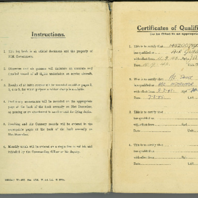
Trevor Saint air gunner's flying log book
Flying log book for T J Saint, air gunner, covering the period from 22 August 1943 to 10 May 1945. Detailing his flying training and operations flown. He was stationed at RAF Morpeth, RAF Wing, RAF Little Horwood, RAF Newmarket, RAF Stradishall, RAF…
Tags: 1657 HCU; 26 OTU; 514 Squadron; Advanced Flying Unit; air gunner; Air Gunnery School; aircrew; Anson; bombing; bombing of Nuremberg (30 / 31 March 1944); bombing of the Le Havre E-boat pens (14/15 June 1944); Heavy Conversion Unit; Lancaster; Lancaster Finishing School; Lancaster Mk 1; Lancaster Mk 2; Lancaster Mk 3; Normandy campaign (6 June – 21 August 1944); Operational Training Unit; RAF Feltwell; RAF Little Horwood; RAF Manby; RAF Morpeth; RAF Newmarket; RAF Stradishall; RAF Waterbeach; RAF West Freugh; RAF Wing; Stirling; tactical support for Normandy troops; training; Wellington
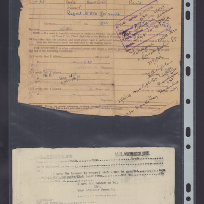
Travel document
A travel document issued to Liz Humphrey when she was posted to RAF Stradishall.
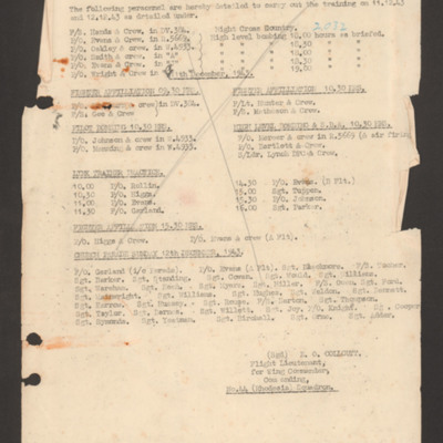
Training programme 11 December 1943
Details night flying training for six crews on 11 December. Details five crews for day training fighter affiliation and bombing for 12 December. Lists eight crews for link training. Details personnel for church parade on 12 December 1943.
Tours airfield
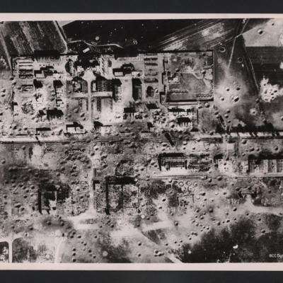
Vertical aerial photograph of an area showing severely destroyed buildings and large craters appearing throughout. A road is going through the middle of the buildings and the area is surrounded by fields, also covered with craters.
On the reverse…
On the reverse…

