Browse Items (1442 total)
- Tags: aerial photograph
Sort by:
Route National 158
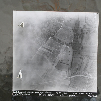
Image shows open countryside with Route National 158 between Caen and Falaise. Captioned '4425HLM.14-8-44//8" 6000 >140 degrees 1444 Tractable 22 RD, B16x500 c 23 secs F/S Jubb M76'.
Identification kindly provided by Ray Moroney of the Finding the…
Identification kindly provided by Ray Moroney of the Finding the…
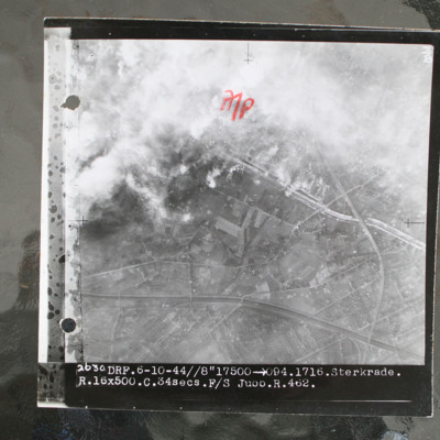
Sterkrade
Target photograph showing built up area in top half with road and railway running left to right. Smoke from bomb explosions top left. Captioned '2630 DRF.6-10-44//8"17500 >094.1716.Sterkrade. R.16x500.C.34 secs.F/S Jubb.R.462.'.
This item was sent…
This item was sent…
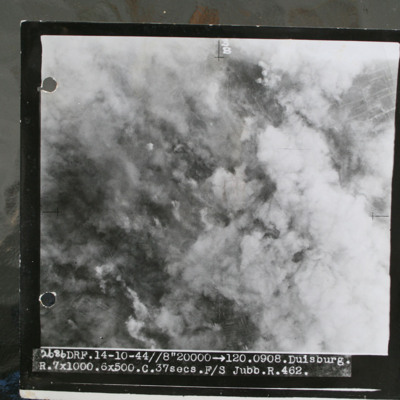
Duisburg
Target photograph showing smoke from bomb explosions and fires. Captioned '2686 DRF.14-10-44//8" 20000 >120.0908.Duisburg, R.7x1000.6x500.C.37 secs.F/S Jubb.R.462.".
This item was sent to the IBCC Digital Archive already in digital form. No better…
This item was sent to the IBCC Digital Archive already in digital form. No better…
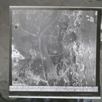
Domburg
Target photograph of open heathland with canalised ditch running top to bottom. The ditch has tracks either side and several crossing points. Craters are visible, particularly in lower left with one row crossing ditch with one crater visible within…
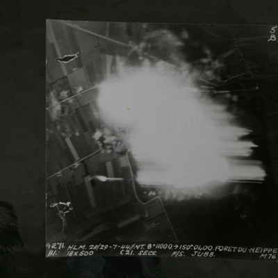
Foret Du Neippe
Night target photograph showing roads and glare in centre. Captioned '4271 HLM.28/29-7-44//NT8" 10000 >150.0400.Foret Du Neippe. B1. 18x500 c21secs F/S Jubb M76'.
This item was sent to the IBCC Digital Archive already in digital form. No better…
This item was sent to the IBCC Digital Archive already in digital form. No better…
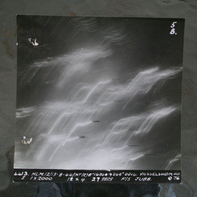
Rüsselsheim
Night target photograph showing tracer lines. Captioned '4413 HLM12/13-8-44//NT8" 16000 >060 degrees 0016. Russelsheim RD, S 1x2000 12x4 29 Secs F/S Jubb Q76'.This item was sent to the IBCC Digital Archive already in digital form. No better…
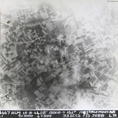
Tirlemont airfield
Target photograph taken during daylight attack on Tirlemont (Goetsenhoven) airfield. Patchwork of fields with aircraft dispersal hardstands to left and right of explosions and smoke centred on airfield itself. Village of Bost is to the bottom left…
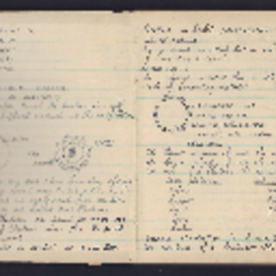
Ivor Cole's Wireless Course Notes
A notebook completed by Ivor during his training. At the end are eight pages of newspaper cuttings of operations that Ivor took part in.
Tags: aerial photograph; aircrew; B-17; B-24; bombing; Halifax; Lancaster; Me 262; Mosquito; P-51; Spitfire; target indicator; training; wireless operator
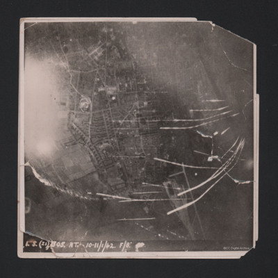
Wilhelmshaven
Target photograph showing built up area of Wilhelmshaven. Photograph is orientated with north to the left. Ems-Jade-Kanal is running from top to middle right of photograph. Railway goods yard towards bottom. Streaks of light and anti-aircraft fire…
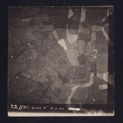
Wardley west of Uppingham
A vertical aerial photograph taken over fields. A road meanders from left to right.
It is annotated '2211 812. 6000 5" 11-6-44'
It is annotated '2211 812. 6000 5" 11-6-44'
Tags: aerial photograph
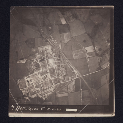
Royal Electrical & Mechanical Engineers (REME) Old Dalby, 35 Base Workshops
Aerial photograph of a newly constructed facility with rail tracks leading into at least two tunnels.
It is annotated '711 812 6000 5" 11-6-44'
It is annotated '711 812 6000 5" 11-6-44'
Tags: aerial photograph
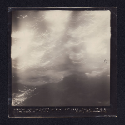
Bochum
A vertical aerial photograph taken over Bochum. No detail is visible due to light flashes.
It is annotated '4565 EWS 4/5.11.44// NT(8") 16500 145° 1944 BOCHUM A/P.A.C. 1HC 4000 [indecipherable] 29 SECS F/O MORGAN O 103'
It is annotated '4565 EWS 4/5.11.44// NT(8") 16500 145° 1944 BOCHUM A/P.A.C. 1HC 4000 [indecipherable] 29 SECS F/O MORGAN O 103'
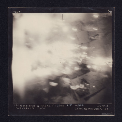
Ulm
A vertical aerial photograph taken during an operation at Ulm. Most of the image is obscured by cloud or explosions. It is annotated '4710 EWS 17/18.12.44//NT 7" 12500 118° 1932½ ULM C 1HC 4000IN 15X4 23SEC F/O MORGAN C 103'.
Nos Aviations
Victoires de la RAF en 1943
Air Marshal Sir Richard Peck describes large composition and successes of RAF during 1943 whilst underlining the threat still posed by Germany.
Les machines
Maintains Anglo-American aircraft production is four times…
Air Marshal Sir Richard Peck describes large composition and successes of RAF during 1943 whilst underlining the threat still posed by Germany.
Les machines
Maintains Anglo-American aircraft production is four times…
Tags: aerial photograph; aircrew; B-17; B-24; B-25; B-26; Beaufighter; Bennett, Donald Clifford Tyndall (1910-1986); bombing; Boston; Churchill, Winston (1874-1965); Eder Möhne and Sorpe operation (16–17 May 1943); Gibson, Guy Penrose (1918-1944); Halifax; Hudson; Lancaster; Mosquito; P-51; Pathfinders; pilot; propaganda; reconnaissance photograph; Spitfire; Stirling; Sunderland; target indicator; training; Typhoon; York
Bombing
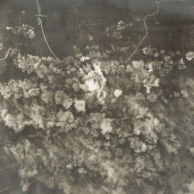
A vertical aerial photograph of a daylight bombing operation. Six Lancasters can be seen at lower levels. Below them are lots of explosions and smoke. Open countryside, with few buildings but several minor roads, can be seen around the bombing area.
RAF Bruntingthorpe
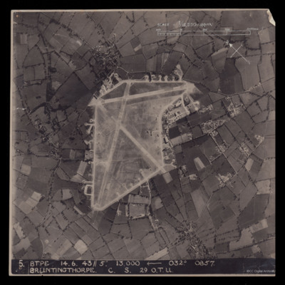
A vertical aerial photograph of Bruntingthorpe. An approximate scale and a north arrow has been annotated on the image. Also at the bottom is ' 5 BTPE 14.6.43//5" 13,000
Berlin Short Wave Station
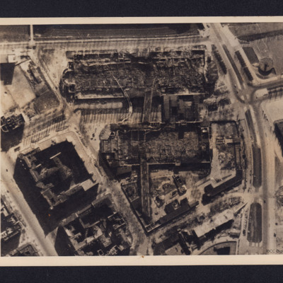
A vertical aerial photograph of bombed buildings. These are two exhibition buildings of the Charlottenburg Fairgrounds adjacent to the Berlin Short Wave Radio transmitter. On the reverse is a typed note dated 18 April 1944 explaining the function of…
Berlin Short Wave Station Charlottenburg
Reconnaissance photograph of the short wave radio station at Charlottenburg, Berlin. Small amount of bomb damage is visible, with a few roofless buildings, The radio mast (Funkturm) can be seen by its shadow from its base at the right towards the…
Heavy Damage After Big Allied Air Attack on Naples
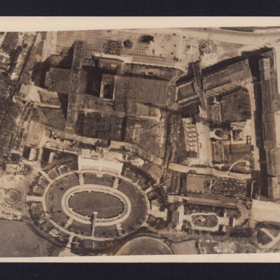
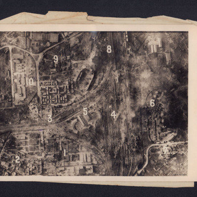
A reconnaissance photograph showing bomb damage to an industrial area of Naples centred on railway marshalling yard. Extensive bomb craters and damage to the railway yards and surrounding buildings is visible throughout. Ten numbers are marked on the…
Donges Oil Refinery, France
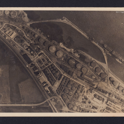
Two reconnaissance photographs of the Donges oil refinery, near Nantes in France before and after the bombing operations.
The photographs were released for publication in newspapers.
The second photograph shows extensive damage with many buildings,…
The photographs were released for publication in newspapers.
The second photograph shows extensive damage with many buildings,…
Gelsenkirchen Oil Plant
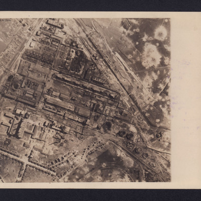
An aerial reconnaissance photograph of the oil plant at Gelsenkirchen. On the reverse is a typed note with brief details about the operation. It was intended for publication in newspapers. Bomb craters are visible throughout the photograph with much…
Tirpitz
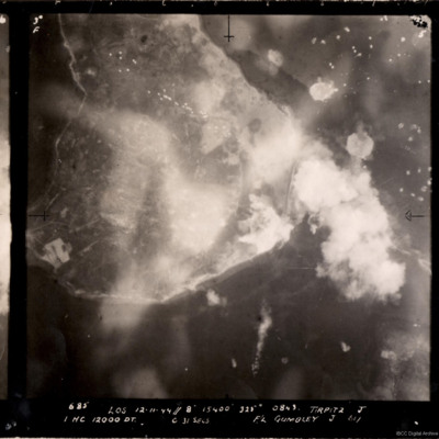
A vertical aerial photograph of the bombing of the Tirpitz. Much of the image is obscured by smoke and explosions. Tirpitz can be seen right of centre. Anti-aircraft fire can be seen to the top of the photograph. Three bomb explosions in the water…
Tirpitz
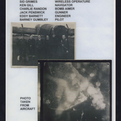
Top - six aircrew standing in line behind a Lancaster, Captioned 'Crew from left to right, Sid Grimes wireless operator, Ken Gill navigator, Charlie Randon bomb aimer, Jack Penswick gunner, Eddy Barnett engineer, Barney Gumbley pilot'.
Bottom target…
Bottom target…
Bergen Submarine Pen
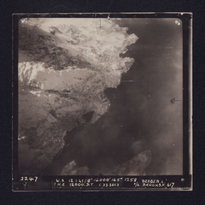
Target photograph of Bergen Submarine pen. Coastline runs bottom left to top right with sea to right. Ubåtbunkeren Bruno is the square structure in the centre of the image. The town of Bergen is in the left hand corner, with port facilities and…
Ijmuiden operation
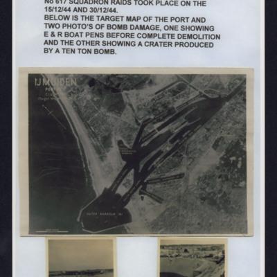
Top - description of ijmiden operations by 617 Squadron 15 and 30 December 1944.
Middle - reconnaissance photograph showing coast and port with harbour wall and basins in built up area.
Bottom left - b/w photograph of boat pens before…
Middle - reconnaissance photograph showing coast and port with harbour wall and basins in built up area.
Bottom left - b/w photograph of boat pens before…

![MRobertsEJH[See#-DoB]-170712-02.pdf MRobertsEJH[See#-DoB]-170712-02.pdf](https://ibccdigitalarchive.lincoln.ac.uk/omeka/files/square_thumbnails/1901/35228/MRobertsEJH[See -DoB]-170712-02.jpg)
