Browse Items (1442 total)
- Tags: aerial photograph
Sort by:
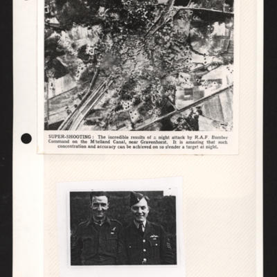
Mittelland Canal near Kloster Gravenhorst and aircrew
Top - a reconnaissance photograph of results of a bombing attack. From a newspaper article. The photograph shows the Mittelland canal running bottom left to top right and very many bomb craters concentrated in middle with canal edges and embankment…
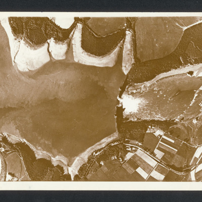
Mohne Dam
Reconnaissance photograph with lake on the left and a dam middle with breach with water flowing through. Captioned between pages 46-47 of 1956 Memoir [written vertically on LHS of page presumably for landscape orientation of photo] 'Mohne Dam. The…
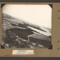
Mohne Dam
Oblique aerial photograph with Mohne Dam in the centre. Beyond is the Mohnesee and the Delecker Bridge crossing left to right with multiple piers. There are forests areas on the left side of the Mohnesee and in the foreground centre. At the bottom…
Tags: aerial photograph; Cook’s tour
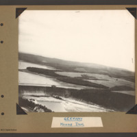
Mohne Dam
Oblique aerial photograph showing the southern two thirds of the Mohne Dam at the bottom left. On the near side of the spillway are two houses below a tree line bank. Beyond the dam is part of the Mohnesee surrounded by a mixture of open farmland and…
Tags: aerial photograph; Cook’s tour
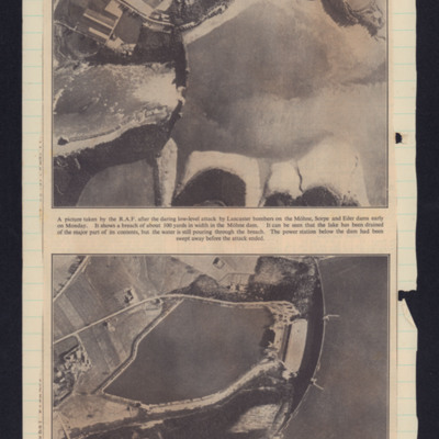
Mohne dam breached
Two photographs. Top showing Mohne dam breached in the centre with lake on the rights. Bottom photograph shows the dam before the attack.
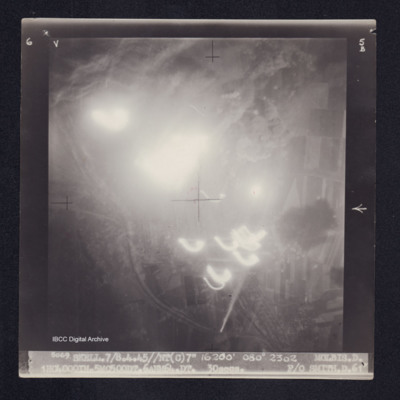
Molbis
Target photograph of Molbis. Mainly obscured by light streaks, balls of light and bomb explosions. Visible area mainly rural, no detail clearly visible. Captioned '6V', '5B', '5069. SKELL.7/8.4.45//NT(C)7" 16200' 080° 2302 MOLBIS.D.…
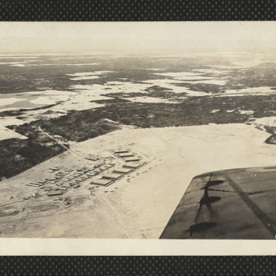
Moncton Airfield
An oblique aerial photograph of Moncton airfield in the snow. Seven hangars and many aircraft are visible. On the reverse 'We see Moncton 'Drome from the air. A marvellous sight. Dec 42'.
Tags: aerial photograph; hangar; RCAF Moncton; training
Monfalcone
Daylight vertical aerial photograph of an operation in progress on Porto Monfalcone with Solvay works and CRDA facilities, orientated with West at the upper edge. The ground detail is clear and explosions and smoke cover much of the port itself with…
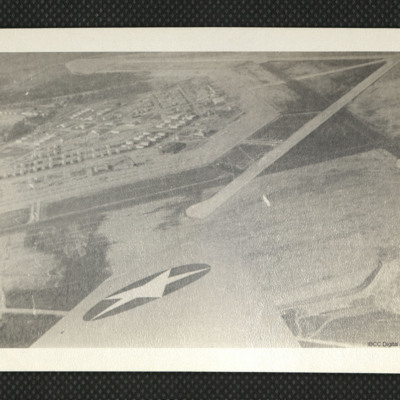
Moody Field
An aerial photograph showing runways and apron at Moody Field, as annotated on the reverse.
Tags: aerial photograph; runway
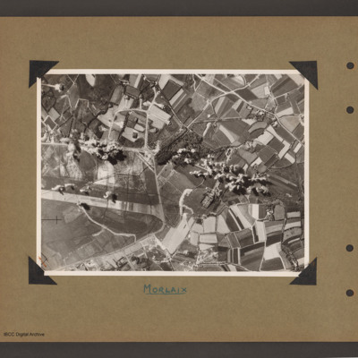
Morlaix airfield
Aerial vertical photograph of open countryside with an airfield marked out on the left side. A perimeter track runs from middle left around the airfield ending at bottom left. There is a loop taxiways from the top right of perimeter track leading to…
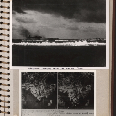
Mosquito landing and target photographs
Top - a runway with FIDO aflame on edges. A Mosquito is landing on left side. Submitted with description 'Mosquito landing with the aid of FIDO. Date and location not recorded'.
Bottom - side by side target photographs of port area showing aiming…
Bottom - side by side target photographs of port area showing aiming…
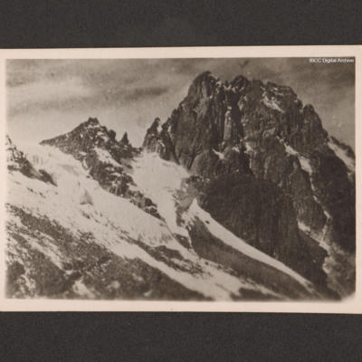
Mount Kenya
A view of Mount Kenya taken from an aircraft. On the reverse 'Mt. Kenya taken from 968.Wimp Kenya June 15th 1946'.
Tags: aerial photograph; Wellington
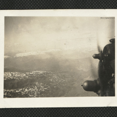
Mountain view
An oblique aerial view of some mountains, with a scattering of snow, taken from an aircraft. The two starboard engines of the aircraft are at the right edge of the photograph. An area of water is visible below the inboard propeller. On the reverse:…
Tags: aerial photograph; Resistance
Mulberry Harbour
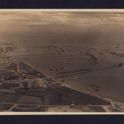
An oblique aerial photograph, taken looking west, of Mulberry B (Port Winston) and the coastline at Gold Beach.
At centre left is the town of Arromanches-les-Bains from which three floating piers lead to their pier heads. At lower centre is the…
At centre left is the town of Arromanches-les-Bains from which three floating piers lead to their pier heads. At lower centre is the…
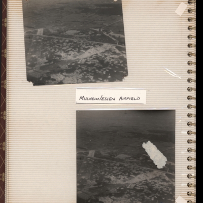
Mulheim/Essen airfield
Top - oblique aerial photograph of an airfield with many bomb craters. Two wide grass runways forming a “V” at bottom left, with taxi-track running left to right across centre of photograph. Hardstanding leads off at top right with two or more…
Tags: aerial photograph; bombing; Cook’s tour; perimeter track; runway
Munich
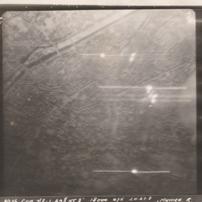
Target photograph showing city with river/canal middle left to top right. Caption '3936, CON 7/8.1.45//NT 8", 18000, 075 20.27.8 32 SECS, F/L WOOLNOUGH R97, MUNICH R'.
Photo is upside down; north is at the bottom. The river top left is the Isar,…
Photo is upside down; north is at the bottom. The river top left is the Isar,…
Munich
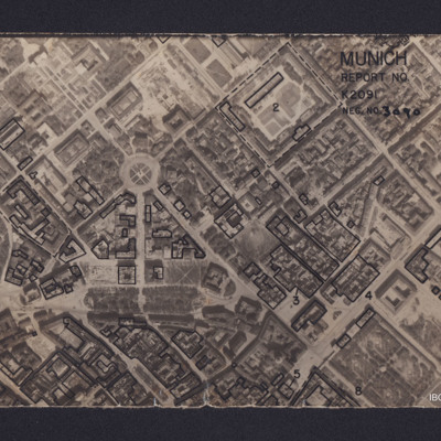
Vertical aerial reconnaissance photograph annotated 'Munich Report No K2091 Neg No 3090' and with a North arrow. No date. Photograph has been marked up to show bomb damage, with buildings outlined in black being those where the roof has been…
Munich
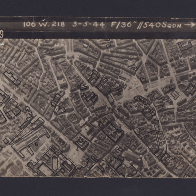
Reconnaissance photograph of Munich. Some buildings have been marked and annotated with numbers. The Frauenkirche is visible in the bottom right corner. Captioned '3139 106 W.218 3-5-44 F/36” // 540SQDN→ '.
Munich
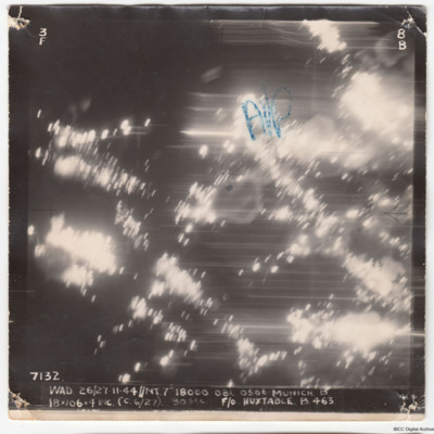
A vertical aerial photograph of Munich, taken during an operation. There is no detail visible but the aiming point is marked, 'A/P'.
The image is captioned '7132 WAD 26/27.11.44//NT 7" 18000 081. 0500 Munich B 18x106x4 inc (c 6/27) 30 sec F/O…
The image is captioned '7132 WAD 26/27.11.44//NT 7" 18000 081. 0500 Munich B 18x106x4 inc (c 6/27) 30 sec F/O…
Munich
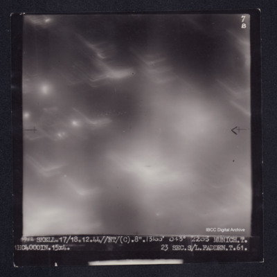
Target photograph of Munich. Obscured by haze, light streaks and balls of light. Captioned '7B', '1952 SKELL.17/18.12.44//NT/(C).8".13100' 043° 2205 MUNICH.T. 1HC4000IN.15X4. 23SEC.S/L.FADDEN.T.61.'. On the reverse ' S/L. FADDEN. MUNICH…
Munich and of the Tirpitz
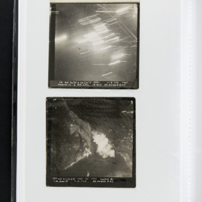
A vertical target photograph of Munich being bombed. Much of the detail is obscured by anti-aircraft fire. Captioned '66 WS. 24/25.4.44 // NT8” 18500 [arrow] 026 0145 Munich.RD. A 6RS. 6JCL 29 SECS F/O KNIGHTS A 617.'
A target photograph of the…
A target photograph of the…
Munich Residenz
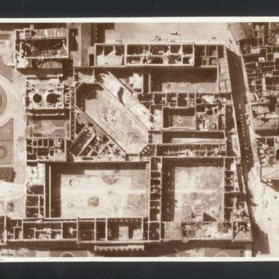
Reconnaissance photograph showing the Munich Residenz gutted. Captioned between pages 66-67 of 1956 Memoir '[underlined] Munich [/underlined] after 5 Group of Bomber Command raid 24th April 1944 [written vertically down left hand side of page]'. On…
Munster
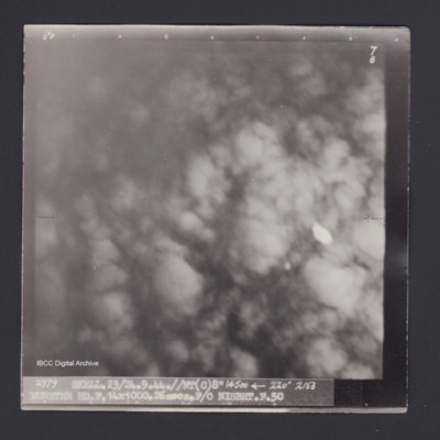
Target photograph of Münster. Totally obscured by smoke and dust. Captioned '5°F', '7B', '2979 SKELL.23/24.9.44.//NT(C)8" 14500 [arrow] 2153 MUNSTER RD.F.14X1000.26secs.F/O NISBET.F.50'. 'On the reverse 'F/O NISBET 23/24.9.44 DORTMUND-EMS.'.
Munster Marshalling Yards
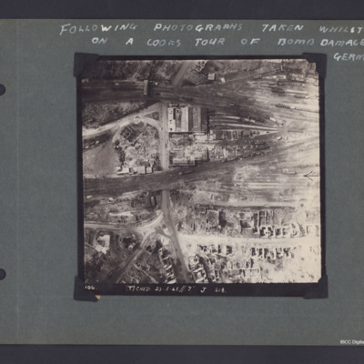
A vertical aerial photograph of Munster captioned 'Following photographs taken whilst on a Cook's tour of Bomb damaged Germany'.
The photo is captioned '(T) Ched 23.5.45//7" J 218'.
On the reverse 'Crown Copyright Reserved' and 'Munster'.
The photo is captioned '(T) Ched 23.5.45//7" J 218'.
On the reverse 'Crown Copyright Reserved' and 'Munster'.
Nürnberg-Langwasser
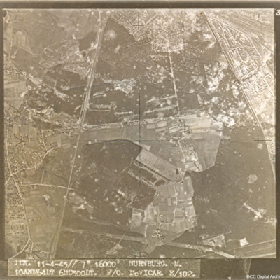
A target aerial photograph of Nürnberg-Langwasser, adjacent to Moorenbrunn, Nuremberg. Bomb craters are visible throughout.
Captioned 'PCK. 11-4-45//7" 16000' NURNBURG. M. 10ANM64IN 6MO500DT. F/O McVICAR. E/102.'
Captioned 'PCK. 11-4-45//7" 16000' NURNBURG. M. 10ANM64IN 6MO500DT. F/O McVICAR. E/102.'

