Munich
Title
Munich
Description
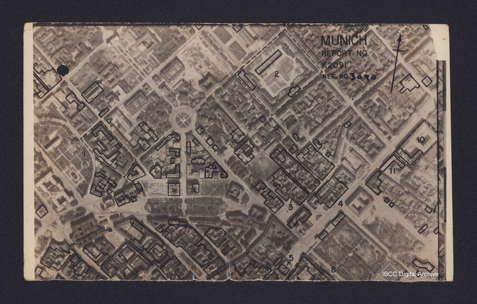
Vertical aerial reconnaissance photograph annotated 'Munich Report No K2091 Neg No 3090' and with a North arrow. No date. Photograph has been marked up to show bomb damage, with buildings outlined in black being those where the roof has been destroyed. Some of these are numbered.
The road hub in the centre is Karolinen Platz with the arc of trees below that being Maximilans Platz. Number 2 is the Turkenkaserne Infantry barracks (Infanterie Kaserne). Number 8 is the Hofgarten and Number 10 the Bavarian State Library. The wide road running diagonally across the lower right corner and through the Number 4, is Ludwig Strasse.
The road hub in the centre is Karolinen Platz with the arc of trees below that being Maximilans Platz. Number 2 is the Turkenkaserne Infantry barracks (Infanterie Kaserne). Number 8 is the Hofgarten and Number 10 the Bavarian State Library. The wide road running diagonally across the lower right corner and through the Number 4, is Ludwig Strasse.
Creator
Language
Type
Format
One b/w photograph with hand-drawn outlines
Conforms To
Publisher
Rights
This content is available under a CC BY-NC 4.0 International license (Creative Commons Attribution-NonCommercial 4.0). It has been published ‘as is’ and may contain inaccuracies or culturally inappropriate references that do not necessarily reflect the official policy or position of the University of Lincoln or the International Bomber Command Centre. For more information, visit https://creativecommons.org/licenses/by-nc/4.0/ and https://ibccdigitalarchive.lincoln.ac.uk/omeka/legal.
Identifier
PAnsellHT1609
Collection
Citation
Great Britain. Royal Air Force, “Munich,” IBCC Digital Archive, accessed July 26, 2024, https://ibccdigitalarchive.lincoln.ac.uk/omeka/collections/document/7061.
Item Relations
This item has no relations.

