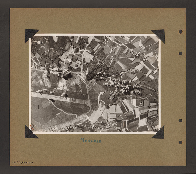
Morlaix airfield
Title
Morlaix airfield
Description
Aerial vertical photograph of open countryside with an airfield marked out on the left side. A perimeter track runs from middle left around the airfield ending at bottom left. There is a loop taxiways from the top right of perimeter track leading to a number of dispersal buildings . There is a runway running left to right in the centre of the airfield. There are bomb explosions along the top portion of the perimeter track as well as just above the top of the runway. There is a cluster of buildings to the right of the airfield beyond a wood which are also covered with bomb explosions. Captioned 'Morlaix'.
Type
Format
On b/w photograph mounted on an album page
Conforms To
Publisher
Rights
This content is available under a CC BY-NC 4.0 International license (Creative Commons Attribution-NonCommercial 4.0). It has been published ‘as is’ and may contain inaccuracies or culturally inappropriate references that do not necessarily reflect the official policy or position of the University of Lincoln or the International Bomber Command Centre. For more information, visit https://creativecommons.org/licenses/by-nc/4.0/ and https://ibccdigitalarchive.lincoln.ac.uk/omeka/legal.
Identifier
PBanksP15010076
Collection
Citation
“Morlaix airfield,” IBCC Digital Archive, accessed July 26, 2024, https://ibccdigitalarchive.lincoln.ac.uk/omeka/collections/document/1524.
Item Relations
This item has no relations.

