Browse Items (754 total)
- Tags: target photograph
Sort by:
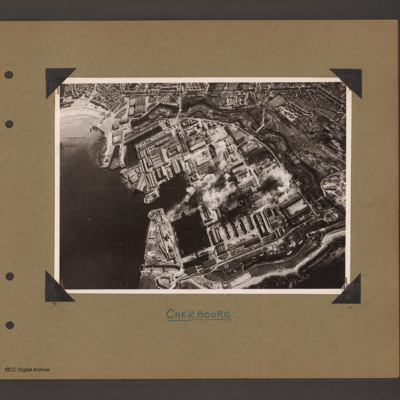
Cherbourg Docks
Aerial inclined photograph showing docks surrounded by town. To the left open sea with beach at the top. In the centre three interconnected dock basins, the bottom left one with a divider, surrounded by dockyard buildings and installations. A series…
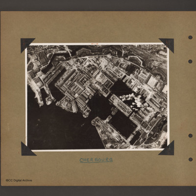
Cherbourg docks
Aerial vertical photograph of docks. To the bottom left open sea. In the centre two interconnected dock basins the bottom one is divided into three by cross piers. There is a further basin above and to the left. All basins are surrounded by dockyard…
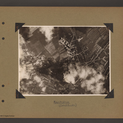
Maupertus airfield Cherbourg
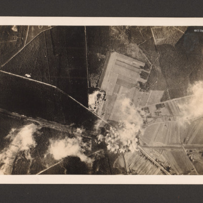
Aerial vertical photograph showing open countryside. A road runs from left diagonally slightly up to the right side middle. There is a junction half way along where another road leads off upward to the top. Bomb explosions are visible. Captioned…
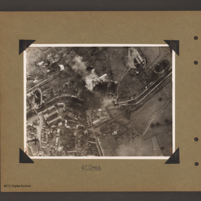
St Omer Canal
Aerial vertical photograph of a canal and town. A canal meanders from mid left to right. There is a road bridge on the left side leading to an industrial area and town below the canal. A railway runs from just above the canal on the left to top…
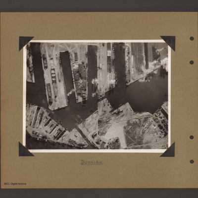
Dunkirk docks
Aerial vertical photograph of docks. Along the top four moles below which an interconnected water way. Below is land with a narrow water passage slanting down towards the centre bottom. The moles and land have various scattered dockyard…
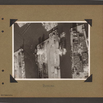
Dunkirk docks
Aerial vertical photograph of docks. Three moles extend from the bottom to just over half way up. The right hand mole is covered with dockyard installations, the other two are mostly bare. Bomb impacts are visible in the water between the right hand…
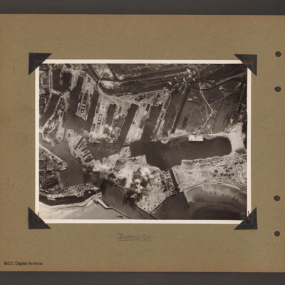
Dunkirk docks
Aerial vertical photograph of interconnected dock basins. At the bottom centre an inlet slanting left. To its left a canal. To its right a spit of land with a narrow waterway leading to a large basin. To the right of the waterway a beach with…
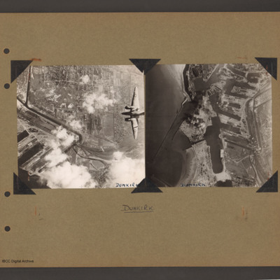
Ventura over Dunkirk and Dunkirk docks
On the left an aerial vertical photograph of town, canal and docks. A canal zigzags from top left down, right and the left back towards dockyard in the bottom left. A town with dwellings and industrial areas lies mostly to the right of canal. The…
Tags: aerial photograph; bombing; target photograph; Ventura
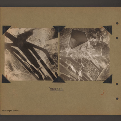
Ijmuiden Holland
On the left an aerial vertical photograph of canals and locks. Multiple canal channels go from top left to bottom centre which are at the North Sea end of the Noordzeekanaal at Ijmuiden. There are various lock gates on each canal. There is a possible…
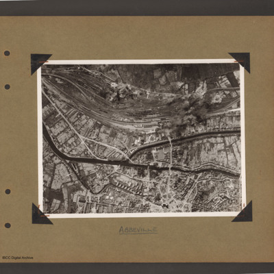
Abbeville
Aerial vertical photograph of town with canals and marshalling yard. A river/canal runs from mid left slanting down initially and then right across to the right hand side. In the middle another canal splits off upwards then goes right to middle right…
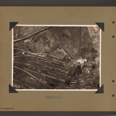
Abbeville marshalling yard
Aerial vertical photograph of a marshalling yard running from left slanting down to the right. The yard has a large number of goods wagons and locomotives spread throughout. To the top right is open countryside. There are bomb explosions at the…
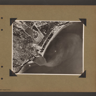
Dieppe
Aerial vertical photograph of a coastal port. Coastline runs from top right to bottom left with open sea to the right. One quarter way up from left there is an inlet with breakwaters which leads into inland dock basins surrounded by a town. There are…
Le Havre and target photographs
Top left aerial vertical photograph completely filled with anti-aircraft tracer trails.
Top right an aerial vertical photograph of a canal junction. A canal runs from bottom left to a junction and then up to the top. At the junction a branch…
Top right an aerial vertical photograph of a canal junction. A canal runs from bottom left to a junction and then up to the top. At the junction a branch…
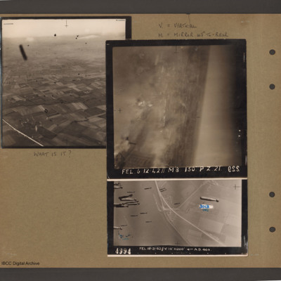
Air to ground photographs
Top left an aerial inclined photograph of open countryside. A road runs up the left hand side and below to the right are fields. There are many unidentified small black objects over the whole area. Caption 'What is it'.
Top right caption 'V =…
Top right caption 'V =…
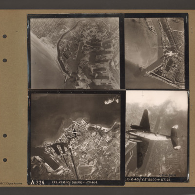
Dunkirk, Den Helder, Vlissingen and Ventura over Ijmuiden
Top left an aerial vertical photograph of Dunkirk docks. A river runs from the sea bottom centre in a curve to top centre. Docks with moles and basins are to the right and the town is to the left of the river.
Top right an aerial vertical…
Top right an aerial vertical…
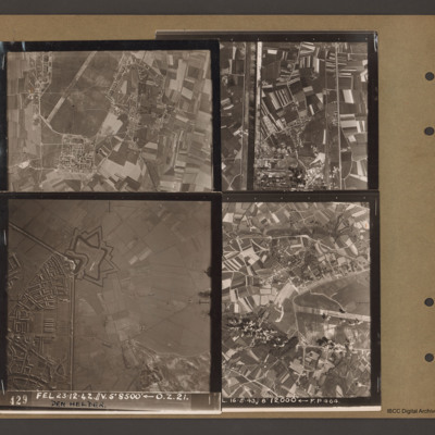
Caen-Carpiquet, Den Helder, Morlaix and unidentified canal
Top left an aerial vertical photograph of part of Caen-Carpiquet airfield. The runway runs from mid left to top right. The airfield is surrounded by a perimeter track and there is a square built up area at the bottom of the airfield.
Top right an…
Top right an…
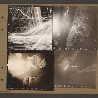
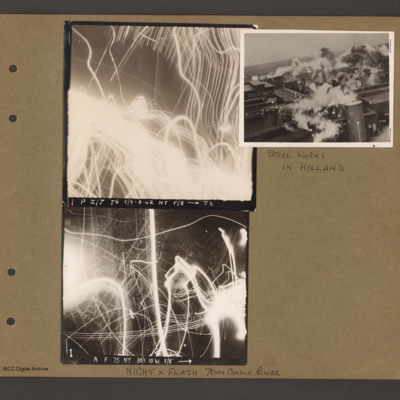
Images of night anti-aircraft tracer and a day attack on Philips radio and valve works in Eindhoven
On the left two aerial vertical photographs showing night anti-aircraft tracer tracks. Top photograph caption 'P Z/7 75 8/9-3-42 NT f/8 TX'. Bottom photograph caption ' A F 75 NT 30/1.10.41 F/8' Page caption 'Night x Flash 70xM candle power'.
To…
To…
Heligoland under attack
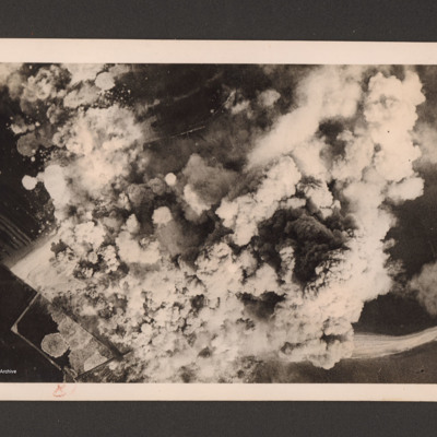
Target photograph showing a very large number of bomb explosions covering most of the image. On the reverse 'Heligoland 18.4.45. The airfield under intense R.A.F. Bomber Command attacks, 27 April 1945'.
Dortmund-Ems canal at Ladbergen
Target photograph showing the Canal running from middle left to bottom right. A road runs from two thirds way up left side and crosses the canal in the bottom right quarter before running to bottom edge. There are minor roads and open country and…
Gilze Rijen
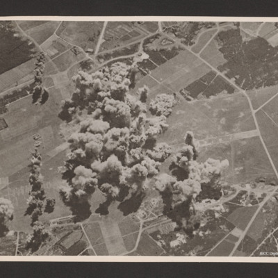
Oblique aerial photograph of an Gilze Rijen airfield. Runways going from bottom middle to top and left to middle. A large number of bomb explosion visible in the centre of the airfield with one string of bombs offset to the left running bottom to…
Gnome Rhone works
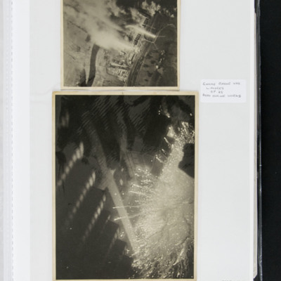
Aerial photographs of the bombing of the Gnome Rhone aero engine works. Photograph 1 is a vertical aerial photograph of a bombing attack on the Gnome Rhone works. Much of the image is obscured by smoke and explosions. On the reverse 'Raid on Gnome…
Munich and of the Tirpitz
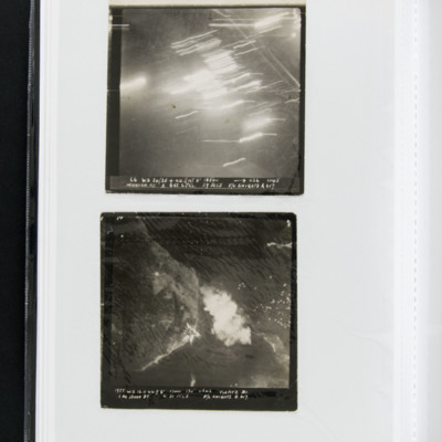
A vertical target photograph of Munich being bombed. Much of the detail is obscured by anti-aircraft fire. Captioned '66 WS. 24/25.4.44 // NT8” 18500 [arrow] 026 0145 Munich.RD. A 6RS. 6JCL 29 SECS F/O KNIGHTS A 617.'
A target photograph of the…
A target photograph of the…
Bob Knights' target photograph of the Tirpitz
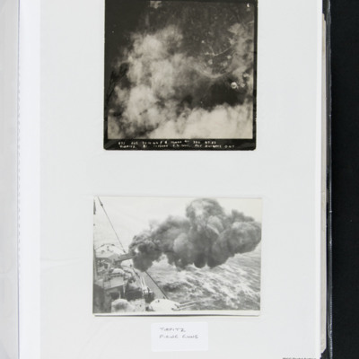
A vertical aerial photograph much obscured by cloud, smoke and explosions. Captioned '671 LOS. 29.10.44 14000 330 07.52 TIRPITZ B1 1x12000 C.31 Secs F/Lt KNIGHTS 0.617'.
The Tirpitz firing its guns, taken from onboard the vessel.
The Tirpitz firing its guns, taken from onboard the vessel.
Merseburg
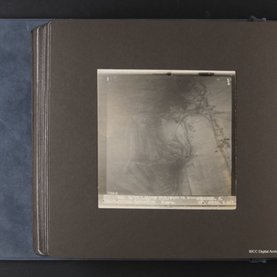
Target photograph of Merseburg. Captioned '3F', '5B', 7549 Wed. 14/15.1.45//NT 8"/O.18400 118 2100 MERSEBURG. S. 1x4000(Min) 9x500 GP (DT. 30secs. F/O CROSS. S. 467'.
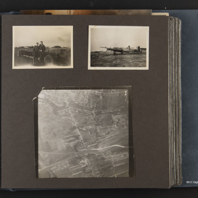
Lancaster PO-Y and bombs
Three photographs, one shows a loaded bomb trolley with two ground personnel with four dispersed Lancasters in background. Second shows Lancaster PO-Y on it's dispersal, row of bombs on grass, two dispersed Lancasters in background. Third is a target…

