Browse Items (133 total)
- Contributor is exactly "Stuart Cummins"
Sort by:
Ramsey
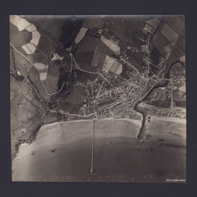
Vertical aerial photograph of Ramsey, Isle of Man. Queen’s Pier is in centre of photograph, with Sulby River and Ramsey Harbour to the right. On the reverse is handwritten 'B/A Allen Nav Beyak 15/5/43'.
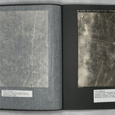
Rambouillet
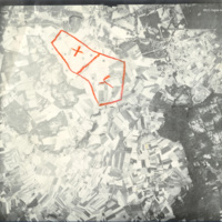
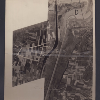
Reconnaissance photograph taken at high altitude showing fields and woods with Rambouillet and the Jardin Anglais in the top right-hand corner. The settlements of Gazeran, Saint-Hilarion, Orcemont and Orphin are also visible. Two areas are outlined…
Port Albert airfield
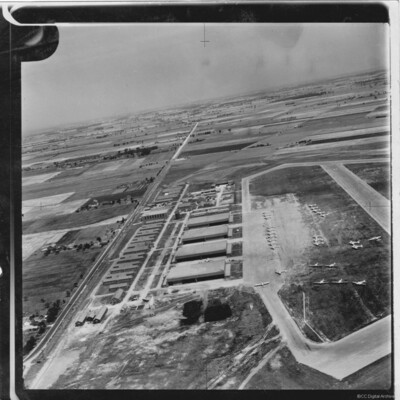
Oblique aerial photograph showing Port Albert Airfield in Ontario Canada with taxiways and hardstanding. Many Avro Anson aircraft in silver finish and lacking dorsal turrets, parked on airfield. Hangars and buildings to the left and a road (Bluewater…
Tags: aerial photograph; Anson; hangar; taxiway
Pas de Calais
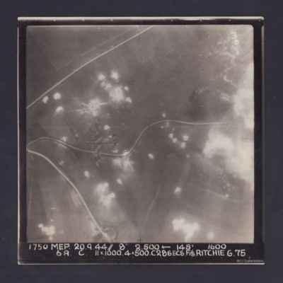
Target photograph. Fields and several minor roads visible. Much of the image is dotted with smoke from bomb bursts or Anti-aircraft fire and glare obscures right hand side. A Lancaster can be seen flying below. Annotated '3B' and captioned '1750 MEP…
Panzano Bagni
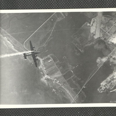
Air-to-air view looking down at B-24 KK320/Vwith smoke issuing from port inner engine from which the propeller is missing. Below is Panzano Bagni coastline and Monfalcone docks with smoke and explosions. The entrance to the Canale Navigabile is just…
Tags: 37 Squadron; aerial photograph; B-24
Ouistreham and Port de L'Orne
Two reconnaissance photographs of the area to the south and east of Ouistreham and Port de L'Orne. The two photographs overlap.
#1 which is marked "Neg No 38858" shows the Ouistreham Estuary at the top with the Canal de Caen a la Mer running top to…
#1 which is marked "Neg No 38858" shows the Ouistreham Estuary at the top with the Canal de Caen a la Mer running top to…
Nieuwerkerk
Oblique aerial photograph of the village of Nieuwerkerk on the island of Schouwen-Duiveland. The church of Johanneskerk and its surrounding road is visible in the centre but the surrounding buildings, streets and farmland are flooded. Over the…
Tags: aerial photograph; C-47
Nevers Railway Yards
Target photograph of Nevers railway yards. Flak burst or photoflash obscures middle of photograph. Railway sidings and three roundhouses can be seen together with main railway line running from lower left to top right surrounded by built-up areas and…
Neuss
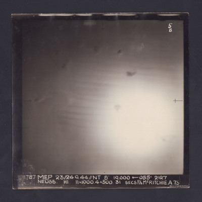
Target photograph of an operation to Neuss. Only a large area of glare, roughly in the middle, is visible. It is annotated '5B' and captioned:
'1787 MEP 23/24.9.44//NT 8" 19,000 ← 055 º 2127
NEUSS. H1. 11 x 1000. 4 x 500. 31 SECS. F/S…
'1787 MEP 23/24.9.44//NT 8" 19,000 ← 055 º 2127
NEUSS. H1. 11 x 1000. 4 x 500. 31 SECS. F/S…
Munich
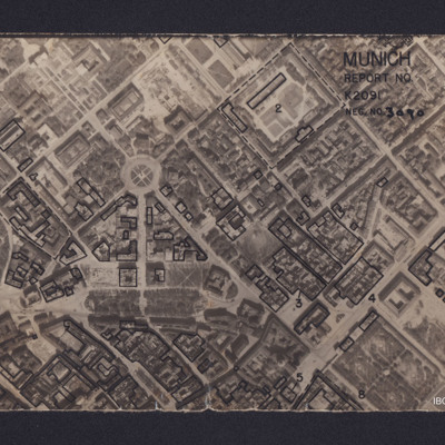
Vertical aerial reconnaissance photograph annotated 'Munich Report No K2091 Neg No 3090' and with a North arrow. No date. Photograph has been marked up to show bomb damage, with buildings outlined in black being those where the roof has been…
Mulheim/Essen airfield
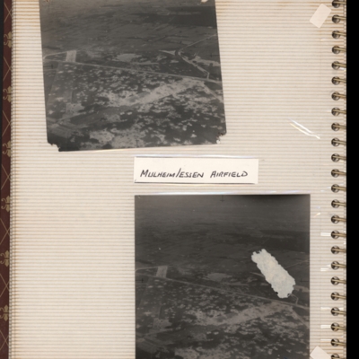
Top - oblique aerial photograph of an airfield with many bomb craters. Two wide grass runways forming a “V” at bottom left, with taxi-track running left to right across centre of photograph. Hardstanding leads off at top right with two or more…
Tags: aerial photograph; bombing; Cook’s tour; perimeter track; runway
Mosquitoes under Service
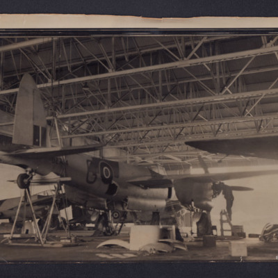
Three Mosquitoes being serviced in a hangar. Nearest aircraft is DZ744, code "G" a Mk II belonging to 333 (Norwegian) Squadron.
Tags: 333 Squadron; ground crew; ground personnel; hangar; Mosquito
Mosquito landing and target photographs
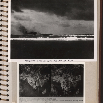
Top - a runway with FIDO aflame on edges. A Mosquito is landing on left side. Submitted with description 'Mosquito landing with the aid of FIDO. Date and location not recorded'.
Bottom - side by side target photographs of port area showing aiming…
Bottom - side by side target photographs of port area showing aiming…
Mohne Dam
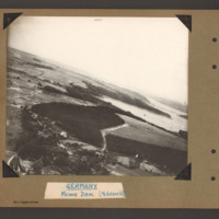
Oblique aerial photograph with Mohne Dam in the centre. Beyond is the Mohnesee and the Delecker Bridge crossing left to right with multiple piers. There are forests areas on the left side of the Mohnesee and in the foreground centre. At the bottom…
Tags: aerial photograph; Cook’s tour
Mohne Dam
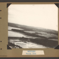
Oblique aerial photograph showing the southern two thirds of the Mohne Dam at the bottom left. On the near side of the spillway are two houses below a tree line bank. Beyond the dam is part of the Mohnesee surrounded by a mixture of open farmland and…
Tags: aerial photograph; Cook’s tour
Mittelland Canal near Kloster Gravenhorst and aircrew
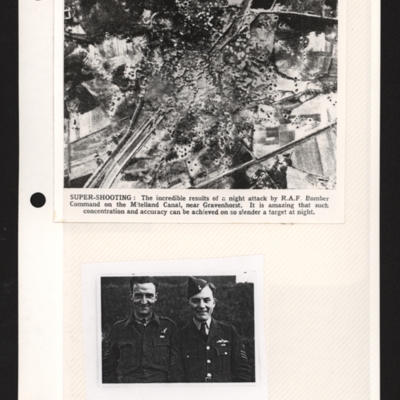
Top - a reconnaissance photograph of results of a bombing attack. From a newspaper article. The photograph shows the Mittelland canal running bottom left to top right and very many bomb craters concentrated in middle with canal edges and embankment…
Mannheim
A vertical aerial photograph of Mannheim. The left of the image is shrouded by clouds. The main river running left to right is the Neckar. The spur below it being the Bonadieshafen and the one above it the Verbindungskanal. The road bridge crossing…
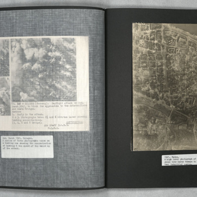
Mainz
A vertical aerial photograph of Mainz. The
top right of the image shows the Rhine. The
bridge is Theodor-Heuss Brucke. The large
L shaped building to its left is Kurfurstliches
Schloss with various large government
buildings below it. The wide…
top right of the image shows the Rhine. The
bridge is Theodor-Heuss Brucke. The large
L shaped building to its left is Kurfurstliches
Schloss with various large government
buildings below it. The wide…
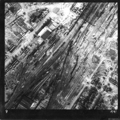
Münster railway station
Reconnaissance photograph of Münster railway station and marshalling yard. Entire area extensively damaged, with tracks destroyed and at odd angles, goods and passenger carriages blown over. Majority of buildings seen are without roofs. The main…
Tags: aerial photograph; bombing
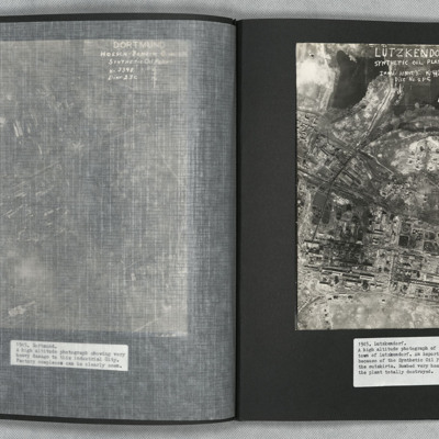
Lutzkendorf
A vertical aerial photograph of the synthetic oil plant at Lutzkendorf, near Leipzig. The Geiseltalsee is the body of water at the top of the image. A railway line with sidings runs through the image from left to right. Possibly more sidings to top…
Ludwigshafen
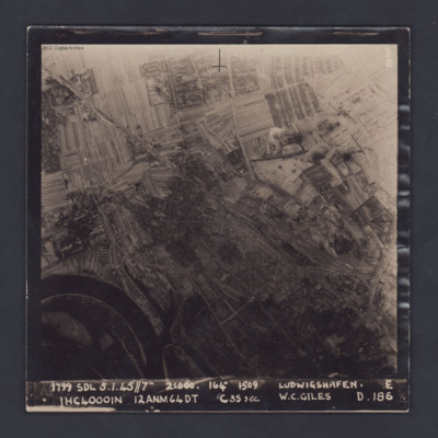
A vertical target photograph of Ludwigshafen, orientated with the south west at the top. In the lower left corner is a bend in the River Rhine and the entrance to Kaiserworthhafen docks. Just visible at the bottom edge is the end of Luitpoldhafen…
Llandudno
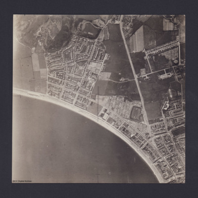
Vertical aerial photograph of Llandudno and Llandudno Bay taken during training operations. Craig-Y-Don Paddling Pool is the oval feature at left end of North Shore beach. Main road running top to bottom is Conway Road. Llandudno railway station and…
Lincoln Cathedral and airmen
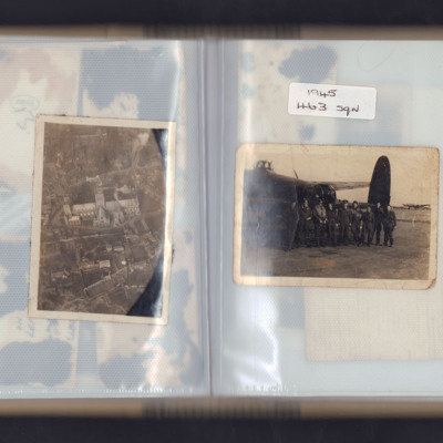
Left page - Oblique aerial photograph of Lincoln cathedral.
Right page - nine airmen standing in front of the rear turret of a Lancaster with another Lancaster in the background. Captioned '1945 463 sqn'.
Right page - nine airmen standing in front of the rear turret of a Lancaster with another Lancaster in the background. Captioned '1945 463 sqn'.
Tags: 463 Squadron; aerial photograph; aircrew; ground crew; Lancaster
Ligescourt V-1 site
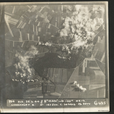
A target photograph during an operation at Ligescourt V-1 site. The village, tracks and woods to the south are visible. Explosions and smoke are seen on the village at top right and bottom left in the woodlands. Many craters in the fields around are…
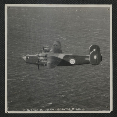
Liberator in Flight
Air-to-air view of the port side of a Liberator flying over the sea. Serial AL553. It is annotated '91 Nut.120.25.11.41. F/8 Liberator II A/G'

