Browse Items (139 total)
- Contributor is exactly "Stuart Cummins"
Sort by:
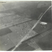
Glider landing zone at Arnhem
Oblique aerial photograph of glider landing zone LZ-S at Arnhem with Horsas scattered across four fields with a well defined track crossing from bottom left to top right (A12) and the railway embankment upper left running to top right.
The photo…
The photo…
Tags: aerial photograph; Horsa
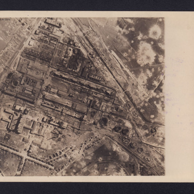
Gelsenkirchen Oil Plant
An aerial reconnaissance photograph of the oil plant at Gelsenkirchen. On the reverse is a typed note with brief details about the operation. It was intended for publication in newspapers. Bomb craters are visible throughout the photograph with much…
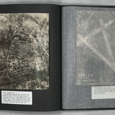
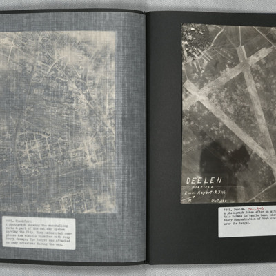
Frankfurt
A vertical aerial photograph of Frankfurt showing extensive damage. Frankfurt Haupt-Bahnhof is shown lower right, with the main lines running across to lower left corner. In the centre of the photograph is a large industrial plant with extensive…
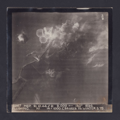
Flushing
Target photograph taken during an operation to Flushing, Netherlands. Several bomb splashes in the water and smoke from explosions on the ground. Water is flowing through the sea wall at one point. The photograph is captioned:
2007 MEP 21.10.44 //…
2007 MEP 21.10.44 //…
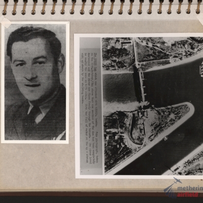
Flight engineer and Kembs dam
Left - full face portrait of an airman wearing tunic with flight engineer brevet. Submitted with description 'Full-face photo of unidentified flight engineer'. Right - reconnaissance photograph with text description of the Kembs dam across the Grand…
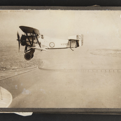
Fairey Flycatcher in flight
Air-to-air view of an aircraft flying over the Tay Bridge, wingtip of camera aircraft in bottom left corner, captioned 'Fairey Flycatcher 1929'. Aircraft serial is N9905
Tags: aerial photograph
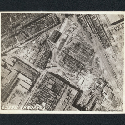
Essen, Krupps
Vertical aerial photograph of bombed workshops. It is captioned 'Essen (Krupps)'. Majority of buildings shown are damaged or severely damaged, many are entirely without roofs. One smaller building to upper centre with a clerestory roof appears…
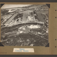
Dunkirk Docks
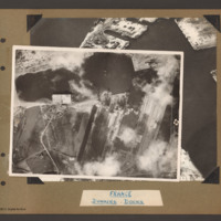
Oblique aerial photograph at low level showing docks, waterways, buildings and other port facilities. No vessels are visible. Across the centre four wide moles numbered 1 to 4 from right to left. The area has been heavily damaged with bomb craters,…
Dunkirk Docks
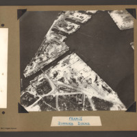
Target photograph of docks at Dunkirk. A body of water stretches from the left side to the top middle with a tidal flats at the left end. From the middle bottom up to the lower bank of the waters is Mole 6 with multiple railway sidings on the left…
Dunkirk Docks
Oblique aerial photograph of Dunkirk docks. The entire area has been extensively bomb damaged. In the bottom half, a triangular shaped area of dockland with roads and railway lines. There are several damaged buildings without roofs and destroyed…
Dunkirk Docks
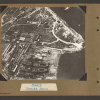
Oblique aerial photograph of docks. On the left side, docklands covered with buildings. On the right the land converges to a peninsular with water above and below. In the bottom centre a shipyard with two incomplete cargo ships with raised forecastle…
Tags: aerial photograph
Duisberg
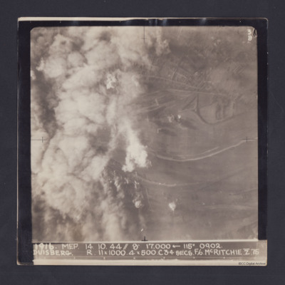
Target photograph taken on an operation to Duisberg. Left hand side is obscured by smoke or cloud and several bomb explosions can be seen. The Rhine river runs across the image, just below half height and there is built up area towards top of…
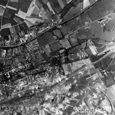
Dreux Rail Facilities
A vertical aerial photograph of Dreux, with rail facility in lower left quarter. Main line runs from rail facilities to top right, with secondary line veering off to the right and curving down to bottom right hand corner. Town is above the railway,…
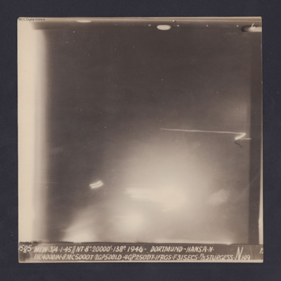
Dortmund-Hansa
Target photograph for an operation to Dortmund - Hansa. An area of glare occupies the lower part of the image and there is another down the left side. The rest is in darkness and n ground detail is visible. The photograph is annotated '6' and…
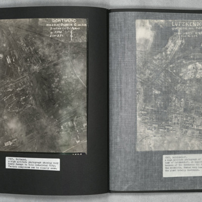
Dortmund
A vertical aerial photograph of Mainz Hoesch Benzin Synthetic Oil Plant, and Westfalenhutte steelworks located north-east of Dortmund city. The image shows cloud, craters, and extensive bomb damage amongst the predominately factory and other…
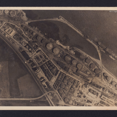
Donges Oil Refinery, France
Two reconnaissance photographs of the Donges oil refinery, near Nantes in France before and after the bombing operations.
The photographs were released for publication in newspapers.
The second photograph shows extensive damage with many buildings,…
The photographs were released for publication in newspapers.
The second photograph shows extensive damage with many buildings,…
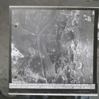
Domburg
Target photograph of open heathland with canalised ditch running top to bottom. The ditch has tracks either side and several crossing points. Craters are visible, particularly in lower left with one row crossing ditch with one crater visible within…
Deelen
A vertical aerial photograph showing the airfield, south-west of Deelen, Arnhem. Three runways in the “A” configuration are seen, with the two main runways forming the top of the “A” at lower right. Hangars and other airfield buildings are to…
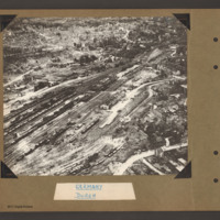
Düren
Oblique aerial photograph of Duren railway station and railway yards. In the centre a railway marshalling yard with multiple tracks towards the left side with many strings of railway rolling stock. In the centre slightly right is the main station…
Tags: aerial photograph; bombing; Cook’s tour
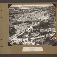
Düren
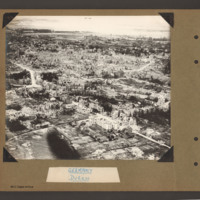
Oblique aerial photograph of Duren. A city landscape of largely destroyed buildings. A principle road runs from bottom left diagonally to top right. Another curved road runs from bottom left to the right side where it joins a further road running…
Tags: aerial photograph; bombing; Cook’s tour
Düren
Oblique aerial photograph of destroyed city landscape with some standing multistory buildings, but primarily large areas reduced to rubble. A road runs from bottom right diagonally to centre left. Another runs from bottom left to middle right. Where…
Tags: aerial photograph; bombing; Cook’s tour
Crew of RAF Liberator
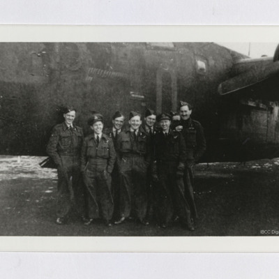
Eight airmen standing in front of nose of an RAF Liberator B. Mk VI. Considerable number of completed mission markers can be seen on the aircraft, which is coded "O" or "Q".
Tags: 223 Squadron; aircrew; B-24
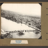
Cook's tour Cologne
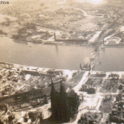
Oblique aerial photograph of a city with river running left to right with destroyed bridge. Cathedral and railway station on near bank. Submitted with caption 'Cologne Cooks tour'. River is river Rhine, destroyed and collapsed railway bridge is the…
Tags: aerial photograph; bombing; Cook’s tour
Cologne in ruins
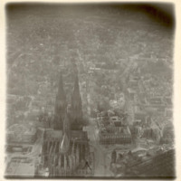
Oblique aerial photograph of Köln cathedral and surrounding area all showing heavy bomb damage. Photograph is looking west with railway station in the right hand corner.
Tags: aerial photograph; bombing; Cook’s tour
Cologne Hohenzollern bridge
Oblique aerial photograph of the Hohenzollern bridge over the Rhine at Cologne. The river Rhine runs from left diagonally to the right, On the far bank a narrow parallel canal, the Rheinauhafen, beyond which is a city landscape of multistory…
Tags: aerial photograph; bombing; Cook’s tour

