Browse Items (161 total)
- Tags: reconnaissance photograph
Sort by:
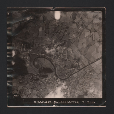
Hereford
A vertical aerial photograph showing the city. River Wye meanders through the left side. Two railway lines run from the bottom and meet halfway to the top. The image is annotated 'Recco.519 P/O Leadbetter 9.9.44'.
On the reverse -
'Assumed Posn…
On the reverse -
'Assumed Posn…
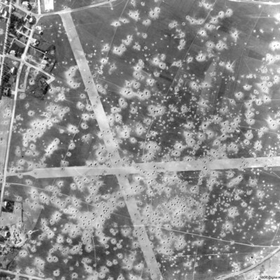
Le Culot Airfield
A vertical aerial photograph showing bomb damage to runways and surrounding area of airfield, submitted with caption; “Le Culot airfield in Belgium”.
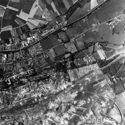
Dreux Rail Facilities
A vertical aerial photograph of Dreux, with rail facility in lower left quarter. Main line runs from rail facilities to top right, with secondary line veering off to the right and curving down to bottom right hand corner. Town is above the railway,…
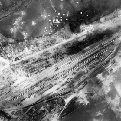
Argentan Marshalling Yard
A vertical aerial photograph showing rail marshalling yard at Argentan. Road running parallel to railway tracks from lower left to upper right (now D158) with another joining from top left (now D238A). Argentan railway station is visible opposite…
Vlissingen
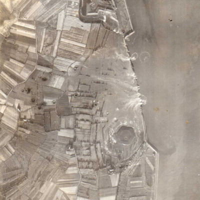
A vertical aerial photograph showing several new breaches in the sea defences with areas of land in process of being flooded. Submitted with caption; “Sea wall broken at Flushing.” Fort Rammekens is at the top of the photograph, with village of…
Bohlen Synthetic Oil Plant
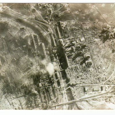
A vertical aerial photograph of a severely damaged oil plant at Bohlen. On the reverse 'Synthetic oil plant at Bohlen taken by recce aircraft 20/2/1945'.
St Leu d'Esserent
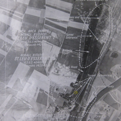
Four photographs of St. Leau d'Esserent.
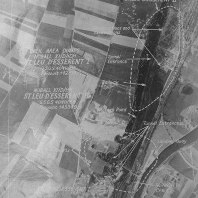
Photo 1 is a target aerial photograph with areas to be bombed. Tunnel entrances, constructions, excavations, railway and a landing quay are marked.
Photo 2 is a vertical aerial photograph taken during the…
Photo 1 is a target aerial photograph with areas to be bombed. Tunnel entrances, constructions, excavations, railway and a landing quay are marked.
Photo 2 is a vertical aerial photograph taken during the…
Noball Targets
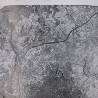
A vertical aerial photograph identifying two Noball targets at Bois de Cassan and Foret de l'Isle Adam,
St Leu d'Esserent
Six aerial photographs of St Leu d'Esseent.
Photo 1 is a vertical target photograph with tunnels, railway and landing quay marked.
Photo 2 is a vertical aerial photograph taken during the operation. It is captioned '1962 TLP 5-8-44//8" 15000…
Photo 1 is a vertical target photograph with tunnels, railway and landing quay marked.
Photo 2 is a vertical aerial photograph taken during the operation. It is captioned '1962 TLP 5-8-44//8" 15000…
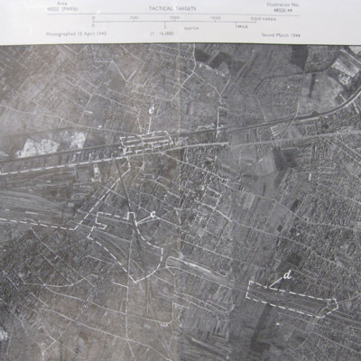
Noisy-le-Sec
A vertical aerial photograph of Noisy-le-Sec, Paris. Five targets are marked.
St Leu d'Esserent
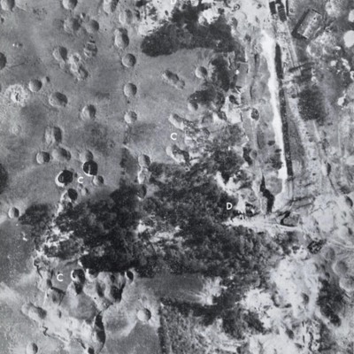
Three images of St Leu d'Esserent taken after the attack.
Photo 1 is a vertical image showing bomb craters. It is annotated with 'C' and 'D's.
Photo 2 shows an entrance to an underground store.
Photo 3 show an entrance to an underground store. It…
Photo 1 is a vertical image showing bomb craters. It is annotated with 'C' and 'D's.
Photo 2 shows an entrance to an underground store.
Photo 3 show an entrance to an underground store. It…
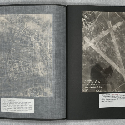
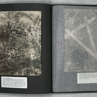
Deelen
A vertical aerial photograph showing the airfield, south-west of Deelen, Arnhem. Three runways in the “A” configuration are seen, with the two main runways forming the top of the “A” at lower right. Hangars and other airfield buildings are to…
Frankfurt
A vertical aerial photograph of Frankfurt showing extensive damage. Frankfurt Haupt-Bahnhof is shown lower right, with the main lines running across to lower left corner. In the centre of the photograph is a large industrial plant with extensive…
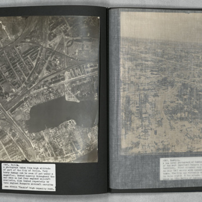
Berlin
A vertical aerial photograph of Berlin showing heavy bomb damage. The body of water is the Rummelsburger See, with the railway station of Ostkreuz to the left of it at the confluence of railway tracks running from lower left to top right and from…
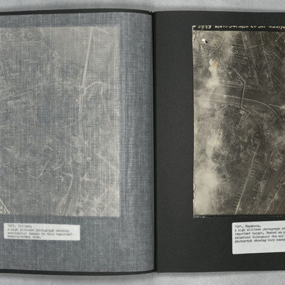
Mannheim
A vertical aerial photograph of Mannheim. The left of the image is shrouded by clouds. The main river running left to right is the Neckar. The spur below it being the Bonadieshafen and the one above it the Verbindungskanal. The road bridge crossing…
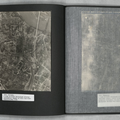
Coblenz
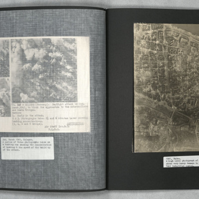
A vertical aerial photograph of Koblenz in early 1945 showing widespread damage to buildings with large areas completely destroyed. Bomb craters can be seen in several places. A railway marshalling yard is to centre left and the railway lines then…
Lutzkendorf
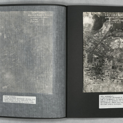
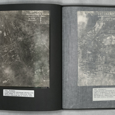
A vertical aerial photograph of the synthetic oil plant at Lutzkendorf, near Leipzig. The Geiseltalsee is the body of water at the top of the image. A railway line with sidings runs through the image from left to right. Possibly more sidings to top…
Dortmund
A vertical aerial photograph of Mainz Hoesch Benzin Synthetic Oil Plant, and Westfalenhutte steelworks located north-east of Dortmund city. The image shows cloud, craters, and extensive bomb damage amongst the predominately factory and other…
Mainz
A vertical aerial photograph of Mainz. The
top right of the image shows the Rhine. The
bridge is Theodor-Heuss Brucke. The large
L shaped building to its left is Kurfurstliches
Schloss with various large government
buildings below it. The wide…
top right of the image shows the Rhine. The
bridge is Theodor-Heuss Brucke. The large
L shaped building to its left is Kurfurstliches
Schloss with various large government
buildings below it. The wide…
Hamm and Brest
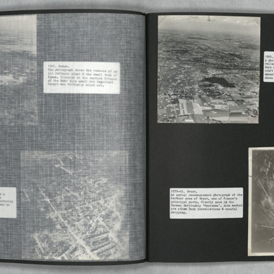
Photograph one is an oblique aerial photograph of Hamm, showing extensive damage and bomb craters throughout.
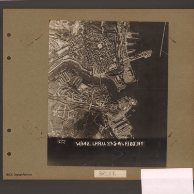
Photograph two is a vertical aerial photograph of Brest naval base and ports, with numbered annotation.
Photograph two is a vertical aerial photograph of Brest naval base and ports, with numbered annotation.
Heligoland
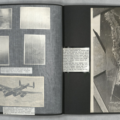
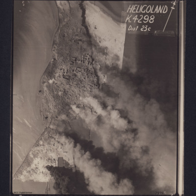
An annotated vertical aerial photograph of naval facilities at Heligoland. U boat pens and a burnt out oil storage facility are marked.
Westkapelle
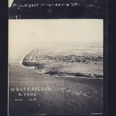
Photograph shows coastline with breached sea wall, captioned 'WESTKAPELLE K3300, Dist 23B, 0017 106G3369.18 Oct .44 F/8".115 Degrees'. Reverse, captioned 'Oblique Westkapelle Netherlands'.
Dieppe and Ostend
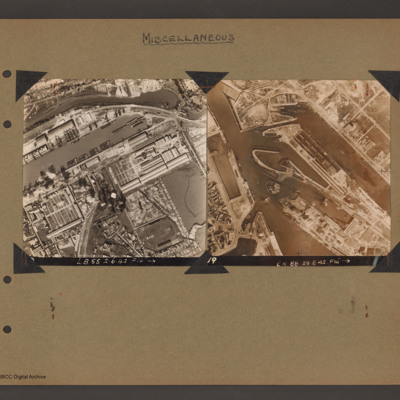
Top left - reconnaissance photograph showing the port of Dieppe. Basin running middle left to top right with many barges tied up. River runs above top edge of basin with industrial building between. Below basin more industrial buildings and a further…
Brest
Reconnaissance photograph of a port city with sea to the right and a river running centre right to left. Docks above and below river mouth. Photograph caption '622 W/642. I.P.R.U. 27.5.41. F/20:R↑'. Page caption 'Brest'.
Heligoland
Photograph shows coastline with fires burning, captioned 'Heligoland K4298, Dist 23c' including directional arrow. Caption at top of photograph: '4008 106G.5377.18.APR.45.F/36"//542 SQDN→ 4'. Caption in right hand bottom corner of photograph:…

