Browse Items (120 total)
- Conforms To is exactly "Geolocated (cumulative polygon)"
Sort by:
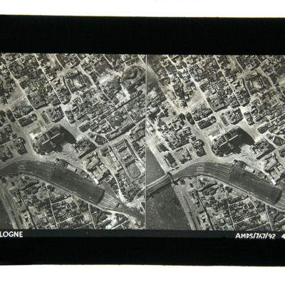
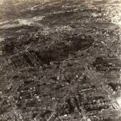
Cologne 1943
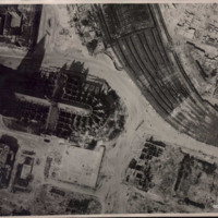
Aerial photographs taken from directly above showing damaged buildings, the railway station, rail bridge over the Rhine and the cathedral. Captioned 'Cologne, AMPS/767/92 4-7-43'.
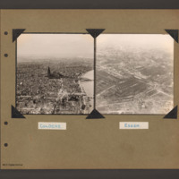
Cologne and Essen
On the left an aerial inclined photograph looking north showing a city with a river on the right. In the centre Cologne Cathedral with the railway station just beyond. In the foreground several damaged multistory buildings and areas of rubble. In the…
Tags: aerial photograph; bombing; Cook’s tour
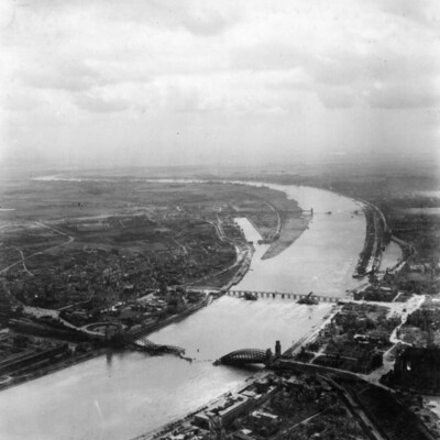
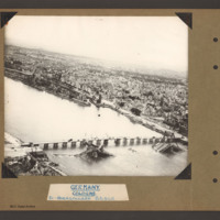
Cologne Bridges
An oblique aerial photograph of Cologne, showing destroyed bridges, submitted with caption; “Damage to bridges over the Rhine.”
Tags: aerial photograph; bombing; Cook’s tour
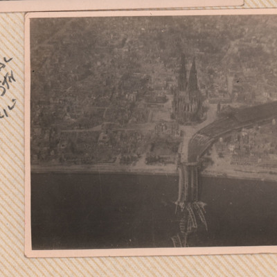
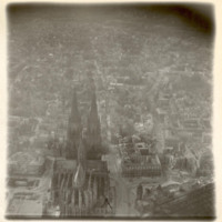
Cologne Cathedral
An oblique aerial photograph of Cologne Cathedral showing bomb damage and the destroyed railway bridge. It is captioned 'Cologne Cathedral, Railway Stn & Bridge'.
Tags: aerial photograph; bombing; Cook’s tour
Cologne Cathedral
Black and white aerial photograph of Cologne showing cathedral and damage to surrounding areas as result of Allied bombing campaign, submitted with caption; “207 Sqdn given permission to take ground staff for low level flights over Germany to see…
Tags: 207 Squadron; bombing; Cook’s tour
Cologne Cathedral
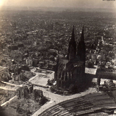
Aerial inclined photograph of Cologne Cathedral looking south. At the bottom left is part of the roof of the railway station. In the foreground a small open area with a tram in the centre. The cathedral is surrounded on all sides by multistory…
Tags: aerial photograph; bombing; Cook’s tour
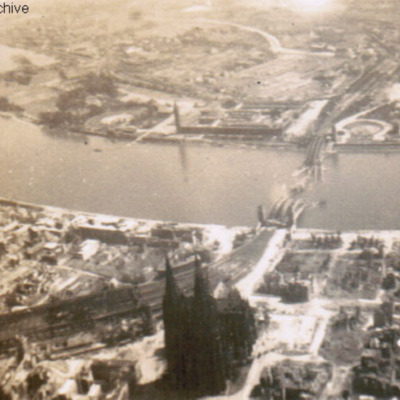
Cologne cathedral
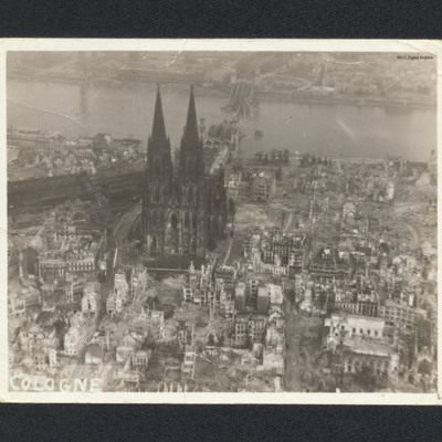
Aerial oblique photograph of Cologne cathedral showing destroyed buildings and river bridge. Captioned 'Cologne'.
Tags: aerial photograph; bombing
Cologne cathedral
Low altitude aerial reconnaissance photograph showing damage to and around Cologne cathedral: the railway station is partially visible on the right with extensive damage to canopy and some track damage. Rubble has been cleared, several tramcars can…
Cologne Hohenzollern bridge
Oblique aerial photograph of the Hohenzollern bridge over the Rhine at Cologne. The river Rhine runs from left diagonally to the right, On the far bank a narrow parallel canal, the Rheinauhafen, beyond which is a city landscape of multistory…
Tags: aerial photograph; bombing; Cook’s tour
Cologne in ruins
Oblique aerial photograph of Köln cathedral and surrounding area all showing heavy bomb damage. Photograph is looking west with railway station in the right hand corner.
Tags: aerial photograph; bombing; Cook’s tour
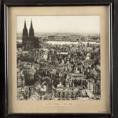
Cologne, Germany - May 1945
A low level oblique aerial photograph of Cologne showing the cathedral, severely damaged building and a destroyed bridge. It is mounted in a frame with the caption 'Cologne, Germany - May 1945'.
Tags: aerial photograph; bombing
Cook's tour Cologne
Oblique aerial photograph of a city with river running left to right with destroyed bridge. Cathedral and railway station on near bank. Submitted with caption 'Cologne Cooks tour'. River is river Rhine, destroyed and collapsed railway bridge is the…
Tags: aerial photograph; bombing; Cook’s tour
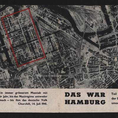
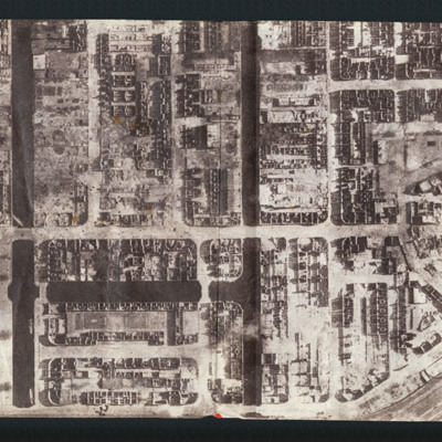
Das War Hamburg
Propaganda leaflet featuring an aerial vertical photograph of Hamburg after a Royal Air Force operation. Buildings are either completely destroyed or gutted, light falling through the gaping windows. Text describes fronts closing in, the Royal Air…
Das war Hamburg
Propaganda leaflet featuring an aerial vertical photograph of Hamburg after a Royal Air Force operation. Buildings are either completely destroyed or gutted, light falling through the gaping windows. Text describes fronts closing in, the Royal Air…
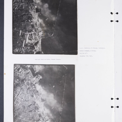
Daylight attack on Brest docks
Two vertical aerial photographs of the docks at Brest. The upper photographs shows some of the bombs being dropped. Captioned: 'Daylight raid on Docks, Breast [sic] France. R.A.F. Middleton St George, Yorkshire. Bomber Command, 4 Group. Halifax A/C.…
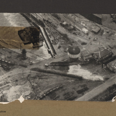
Dry dock at Brest
Aerial incline view of railway lines and dock. Top left is a dock basin containing a large floating object with a small boat alongside the bottom side. Three railway lines go from left to right each with lines of goods wagons.Right centre is tower…
Dunkirk docks
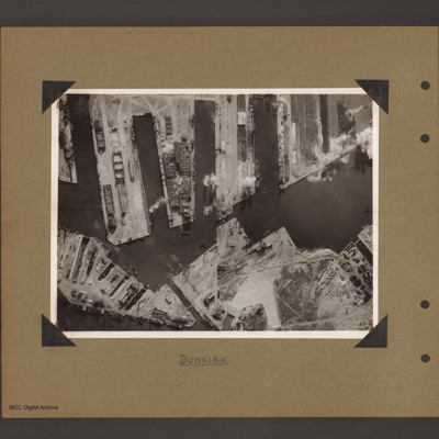
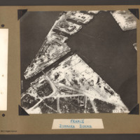
Aerial vertical photograph of docks. Along the top four moles below which an interconnected water way. Below is land with a narrow water passage slanting down towards the centre bottom. The moles and land have various scattered dockyard…
Dunkirk docks
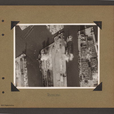
Aerial vertical photograph of docks. Three moles extend from the bottom to just over half way up. The right hand mole is covered with dockyard installations, the other two are mostly bare. Bomb impacts are visible in the water between the right hand…
Dunkirk Docks
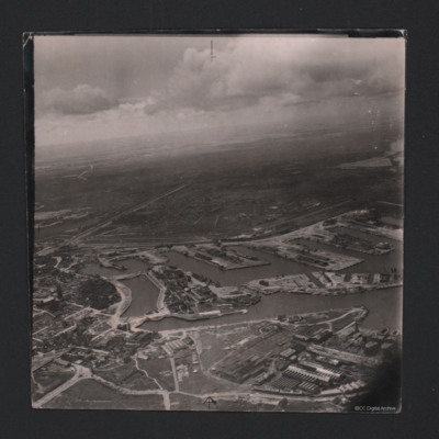
Oblique aerial photograph at low level showing docks, waterways, buildings and other port facilities. No vessels are visible. Across the centre four wide moles numbered 1 to 4 from right to left. The area has been heavily damaged with bomb craters,…
Dunkirk Docks
Target photograph of docks at Dunkirk. A body of water stretches from the left side to the top middle with a tidal flats at the left end. From the middle bottom up to the lower bank of the waters is Mole 6 with multiple railway sidings on the left…
Dunkirk Docks
Oblique aerial photograph of Dunkirk docks. The entire area has been extensively bomb damaged. In the bottom half, a triangular shaped area of dockland with roads and railway lines. There are several damaged buildings without roofs and destroyed…
Dunkirk Docks
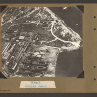
Oblique aerial photograph of docks. On the left side, docklands covered with buildings. On the right the land converges to a peninsular with water above and below. In the bottom centre a shipyard with two incomplete cargo ships with raised forecastle…
Tags: aerial photograph
Dunkirk Dockyard
Oblique aerial photograph of Dunkirk docks. Incomplete hulls of two oil tankers at bottom right, likely to be La Saône and La Seine. Extensive damage visible in the bottom left corner.
Identification kindly provided by Gareth Hughes, Christopher…
Identification kindly provided by Gareth Hughes, Christopher…
Tags: aerial photograph
Dunkirk, Den Helder, Vlissingen and Ventura over Ijmuiden
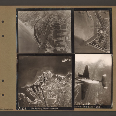
Top left an aerial vertical photograph of Dunkirk docks. A river runs from the sea bottom centre in a curve to top centre. Docks with moles and basins are to the right and the town is to the left of the river.
Top right an aerial vertical…
Top right an aerial vertical…
Essen
An oblique aerial photograph of Essen, photograph shows damage to buildings, submitted with caption; “Bomb damage to Essen.”
Tags: aerial photograph; bombing; Cook’s tour

