Browse Items (1442 total)
- Tags: aerial photograph
Sort by:
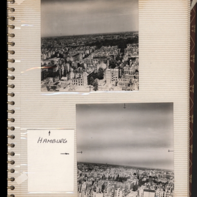
Hamburg
Top - oblique aerial photograph of a city showing damaged multi-storey buildings. Captioned 'Hamburg'.
Bottom - oblique aerial photograph of a city showing damaged multi-storey buildings at the bottom. Both submitted with description 'Oblique…
Bottom - oblique aerial photograph of a city showing damaged multi-storey buildings at the bottom. Both submitted with description 'Oblique…
Tags: aerial photograph; bombing; Cook’s tour
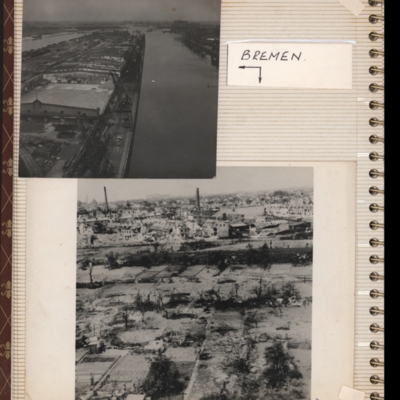
Bremen
Top - oblique aerial photograph of Bremen port with river Weser to the left running bottom to top with dock to the right. Pier in between has extensive railway sidings to the left, warehouses in the middle are mainly without roofs but cleared of…
Tags: aerial photograph; bombing; Cook’s tour
Emmerich
Top - a note referring to a missing photograph.
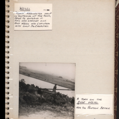
Bottom - oblique aerial photograph of Emmerich with the Rhine running top left to middle right. St. Martini church on near bank and a pontoon bridge across the Rhine. Captioned 'a town on the river…
Bottom - oblique aerial photograph of Emmerich with the Rhine running top left to middle right. St. Martini church on near bank and a pontoon bridge across the Rhine. Captioned 'a town on the river…
Tags: aerial photograph; bombing; Cook’s tour
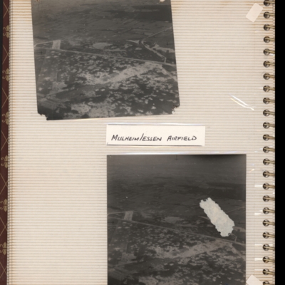
Mulheim/Essen airfield
Top - oblique aerial photograph of an airfield with many bomb craters. Two wide grass runways forming a “V” at bottom left, with taxi-track running left to right across centre of photograph. Hardstanding leads off at top right with two or more…
Tags: aerial photograph; bombing; Cook’s tour; perimeter track; runway
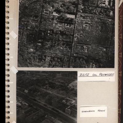
Zeitz oil refinery
Top - reconnaissance photograph of a almost totally destroyed industrial facility. A few buildings towards the top of the photograph appear intact. Captioned 'Zeitz oil refinery. Submitted with description 'Aerial photo of Zeltz [sic] oil refinery…
Unknown town
Bottom left - oblique aerial photograph of a town with destroyed and damaged buildings. Captioned 'Unknown town'. Submitted with description 'Oblique "Cook's tour" aerial photo of unknown town showing bomb damage'.
Tags: aerial photograph; bombing; Cook’s tour
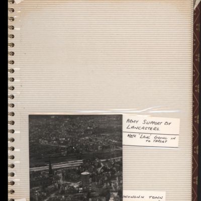
West Essen
Bottom - oblique aerial photograph of town with railway running left to right through middle. Captioned 'Unknown town'. Submitted with description 'Oblique "Cook's tour" aerial photo of unknown town.'.
This is West Essen, the photo is taken…
This is West Essen, the photo is taken…
Tags: aerial photograph; bombing; Cook’s tour
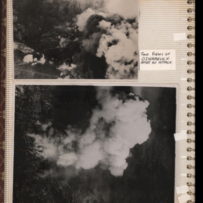
Osnabrück
Top - target photograph showing smoke from bomb explosions, small area of buildings visible bottom left corner. Submitted with description 'Aerial photo of Osnabruck after a bombing attack, showing smoke. Ministry No. C5130'.
Bottom - target…
Bottom - target…
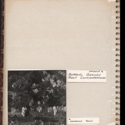
Unknown damaged town
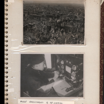
Top - oblique aerial photograph of a town with damaged multi-story buildings. Submitted with description 'Oblique "Cook's tour" aerial photo of unknown town showing bomb damage. Ministry No. CL 2173'.
Bottom - a man sitting in front of a wireless…
Bottom - a man sitting in front of a wireless…
Tags: aerial photograph; bombing; Cook’s tour
Clearing snow and Joigny-la-Roche
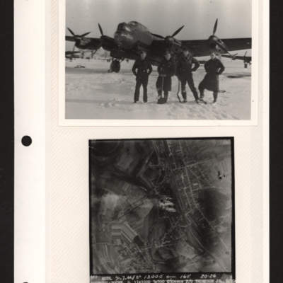
Top - four airmen, two wearing greatcoats, one battledress and one flying jacket, two with shovels, standing in line in snow in front of a Lancaster. Other aircraft parked in the distance behind. Submitted with description 'Clearing snow, RAF…
Bohlen synthetic oil refinery
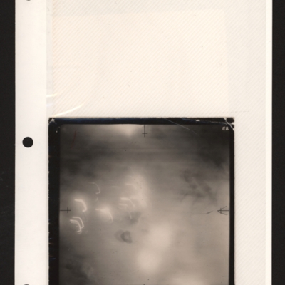
Hazy target photograph showing tracer on left and an arrow middle right side. Captioned '4039METH 20/21.3.45//NT08", 1 HC4000 IN 15 GP 500 DT22 Sec W/C LEVIS'. Submitted with description 'Target photo of Bohlen synthetic oil refinery, dated…
Signa aero engine works
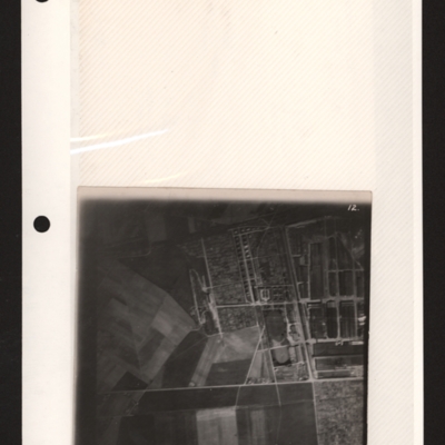
Target photograph of industrial area top right with roads and buildings. Captioned '324 METH. 25/26.3.44//NT 5", 6,600 ft, LYONS RD.W.18x30, W/C PIERCY. Z/106'. Submitted with description 'Target photo of of the Signa aero engine works, Lyons, taken…
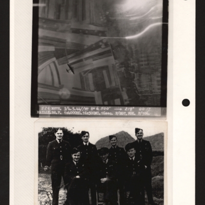
Mailly-le-Camp and aircrew
Top - target photograph showing fields on the left and a built up area with rows of buildings on the right. There is a four engine bomber below bottom left. Captioned '529 METH. 3/4.5.44//NT 8" 6,500' 219 degrees 00.17, MAILY.Rd.F 1x4000HC 16x500MC.…
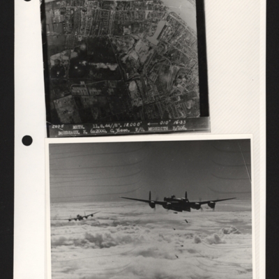
Bordeaux and Lancasters bombing
Top - target photograph showing Bordeaux with Garonne river top right. Captioned '2005 METH 11.8.44//8". 18,000" 010 degrees, `16.33, BORDEAUX E. 6x2000. C. 36 sec. F/O MEREDITH E/106'. Submitted with description 'Target photo of Bordeaux on 11th Aug…
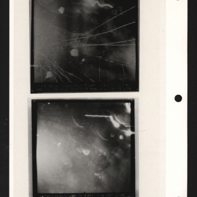
Gennevilliers
Top - target photograph showing tracer lines and explosions. Caption too faint to read. Submitted with description 'Target photo of Gnome-Rhone factory at Gennevilliers on 9/10 May 1944. Photo taken from Lancaster ND682, ZN-K. Captain: P/O…
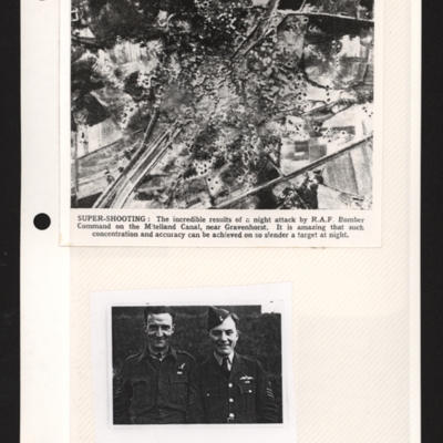
Mittelland Canal near Kloster Gravenhorst and aircrew
Top - a reconnaissance photograph of results of a bombing attack. From a newspaper article. The photograph shows the Mittelland canal running bottom left to top right and very many bomb craters concentrated in middle with canal edges and embankment…
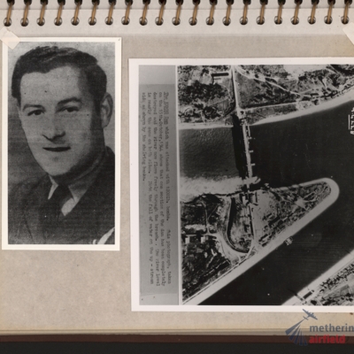
Flight engineer and Kembs dam
Left - full face portrait of an airman wearing tunic with flight engineer brevet. Submitted with description 'Full-face photo of unidentified flight engineer'. Right - reconnaissance photograph with text description of the Kembs dam across the Grand…
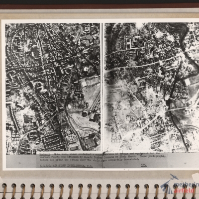
Bocholt
Left and right - side by side reconnaissance photographs showing the centre of the town of Bocholt with river Bocholter Aa flowing top to bottom with two distinctive bow’s to the right towards the top of the photograph. The large road crossing…
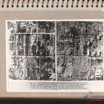
Zeitz Braunkohle-Benzin synthetic oil plant
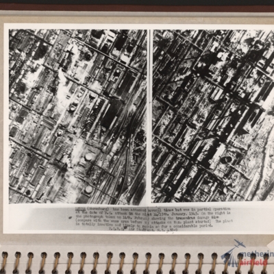
Vertical aerial photographs showing on the left an industrial area with roads and buildings and on the right the same area with most of the structures destroyed. Explanatory text underneath 'Zeitz. The left hand photograph shows this synthetic oil…
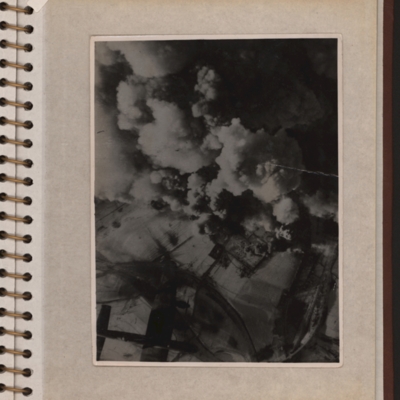
Aerial photograph with a Lancaster
Vertical aerial photograph showing explosions and smoke coming up from what seems to be a power station or oil storage facility. There are two round towers or tanks partially visible through the smoke and the plant is surrounded by bomb-cratered open…
Leuna synthetic oil plant
Side by side reconnaissance photographs showing an industrial area with buildings, roads and towards the right, some railway sidings. This industrial area is orientated from lower left to top right. Chimney smoke is seen on the left hand photograph.…
Wesel Bomb damage
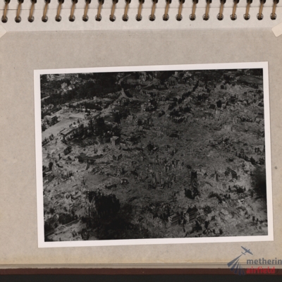
Oblique aerial photograph of a town totally destroyed. Large structure lower left, probably church. Submitted with description 'Oblique aerial photo showing bomb damage to an unidentified urban area'.
Tags: aerial photograph; bombing; Cook’s tour
Nienburg Bridge after attack by 617 Sqn with Tallboys and Grand Slams
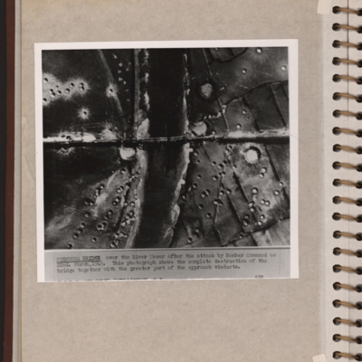
Reconnaissance photograph showing a river running top to bottom and a bridge crossing in the middle with several spans down. There are many craters on both sides of the river. Explanatory note 'NIENBURG BRIDGE over the river Weser after the attack by…
Rocket attack
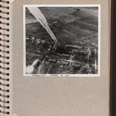
Oblique aerial photograph showing a built up area on bottom half and open countryside above. Rocket trails from top left to centre. Submitted with description 'Target photo of rocket attack on an unidentified group of buildings. The handwritten…
Tags: aerial photograph; Mosquito
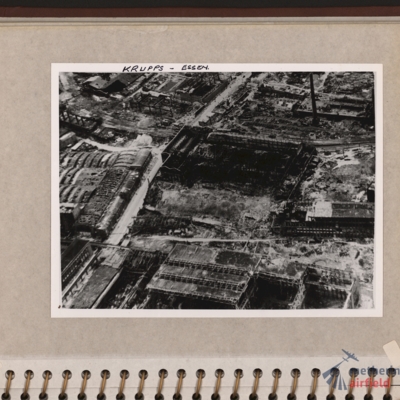
Krupps, Essen
Oblique aerial photograph of an industrial site with most buildings destroyed and many without roofs. Road runs through from bottom left corner to top centre. Tall chimney top right and building with several small chimneys top left. Captioned 'Krupps…
Tags: aerial photograph; bombing

