Browse Items (1459 total)
- Tags: aerial photograph
Sort by:
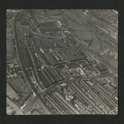
Industrial complex to the south of Lincoln
An oblique aerial photograph of a large industrial complex to the south of the city of Lincoln. The industrial area to the top of the photograph became known as New Boultham, whereas the buildings in the centre, a mix of industrial and residential,…
Tags: aerial photograph
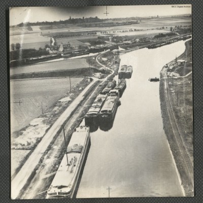
Canal d'Aire near Béthune
Three low level aerial oblique photographs of the Canal d'Aire.
Photo 1 is barges on the canal, close to a junction, on the reverse is typed 'Continuation of bombing-run. France 1945'.
Photo 2 is a bridge over a canal junction, on the reverse is…
Photo 1 is barges on the canal, close to a junction, on the reverse is typed 'Continuation of bombing-run. France 1945'.
Photo 2 is a bridge over a canal junction, on the reverse is…
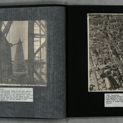
Dusseldorf
A low angle oblique aerial photograph of Dusseldorf showing heavy bomb damage to urban residential and industrial areas.
Tags: aerial photograph; bombing
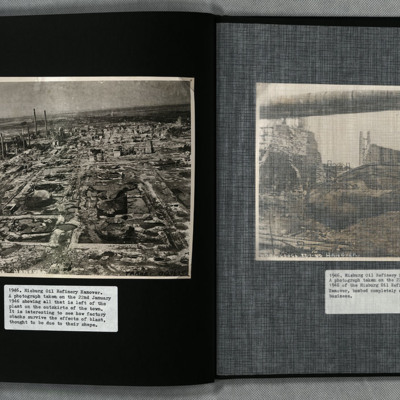
Misburg Oil Refinery
Two photographs showing the remains of the heavily bombed Misburg oil refinery, Hanover. Situated between Misburg-Nord and Misburg-Süd, the site is located west of Anderter Straße. Nearby there are two adjoining canals, Mittelland and Stichkanal…
Tags: aerial photograph; bombing
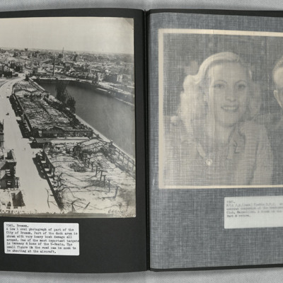
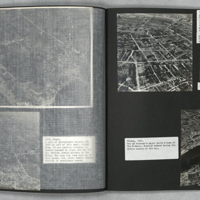
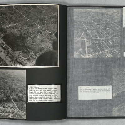
Bremen
A low level oblique aerial photograph of Bremen showing extensive bomb damage.
Tags: aerial photograph; bombing
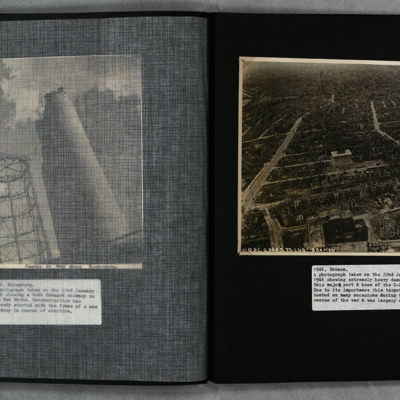
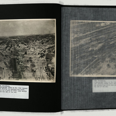
Nuremburg
Photo 1 and 2 are the marshalling yards still showing a huge amount of damage.
Photo 3 is a view of the heavily damaged Apprentice Shop of the Man works.
Photo 4 is the heavily damaged Searchlight Mirror Shop of the Fiems-Schuchorp Works.
Photo 5…
Photo 3 is a view of the heavily damaged Apprentice Shop of the Man works.
Photo 4 is the heavily damaged Searchlight Mirror Shop of the Fiems-Schuchorp Works.
Photo 5…
Tags: aerial photograph; bombing; searchlight
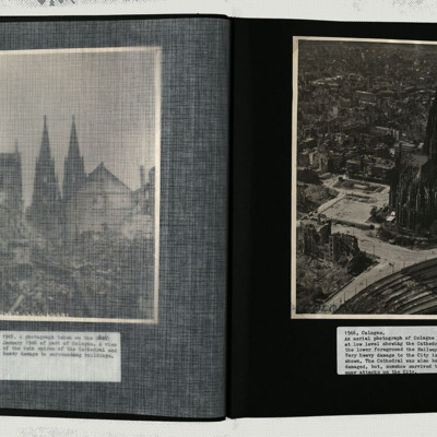
Cologne
A low level oblique image centred on the cathedral, showing damage to every building in its vicinity.
Tags: aerial photograph; bombing
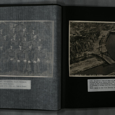
Aerial View of Berlin
A low level oblique aerial photograph of Berlin and the River Spree, showing extensive damage to the city and Hugo-Preuß-Brücke.
Tags: aerial photograph; bombing
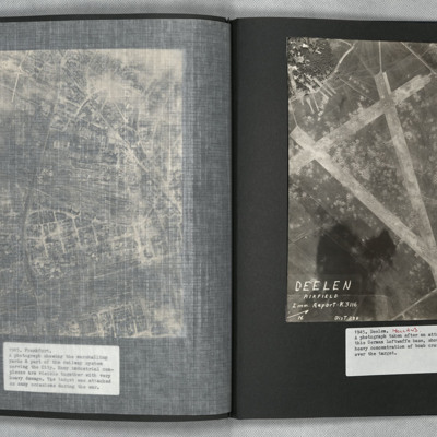
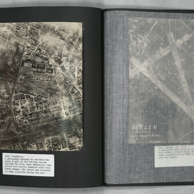
Deelen
A vertical aerial photograph showing the airfield, south-west of Deelen, Arnhem. Three runways in the “A” configuration are seen, with the two main runways forming the top of the “A” at lower right. Hangars and other airfield buildings are to…
Frankfurt
A vertical aerial photograph of Frankfurt showing extensive damage. Frankfurt Haupt-Bahnhof is shown lower right, with the main lines running across to lower left corner. In the centre of the photograph is a large industrial plant with extensive…
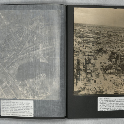
Hamburg
A low level aerial oblique photograph of Hamburg showing extensive bomb damage.
Tags: aerial photograph; bombing
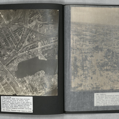
Berlin
A vertical aerial photograph of Berlin showing heavy bomb damage. The body of water is the Rummelsburger See, with the railway station of Ostkreuz to the left of it at the confluence of railway tracks running from lower left to top right and from…
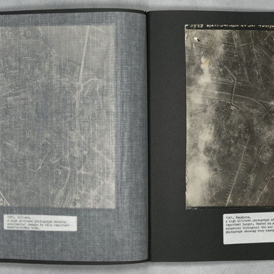
Mannheim
A vertical aerial photograph of Mannheim. The left of the image is shrouded by clouds. The main river running left to right is the Neckar. The spur below it being the Bonadieshafen and the one above it the Verbindungskanal. The road bridge crossing…
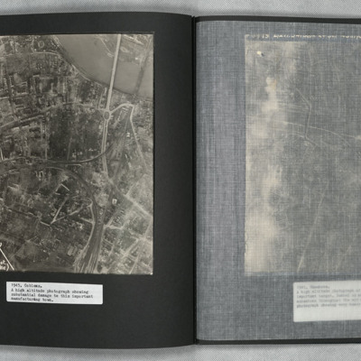
Coblenz
A vertical aerial photograph of Koblenz in early 1945 showing widespread damage to buildings with large areas completely destroyed. Bomb craters can be seen in several places. A railway marshalling yard is to centre left and the railway lines then…
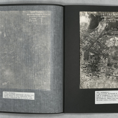
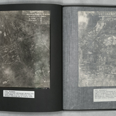
Lutzkendorf
A vertical aerial photograph of the synthetic oil plant at Lutzkendorf, near Leipzig. The Geiseltalsee is the body of water at the top of the image. A railway line with sidings runs through the image from left to right. Possibly more sidings to top…
Dortmund
A vertical aerial photograph of Mainz Hoesch Benzin Synthetic Oil Plant, and Westfalenhutte steelworks located north-east of Dortmund city. The image shows cloud, craters, and extensive bomb damage amongst the predominately factory and other…
Mainz
A vertical aerial photograph of Mainz. The
top right of the image shows the Rhine. The
bridge is Theodor-Heuss Brucke. The large
L shaped building to its left is Kurfurstliches
Schloss with various large government
buildings below it. The wide…
top right of the image shows the Rhine. The
bridge is Theodor-Heuss Brucke. The large
L shaped building to its left is Kurfurstliches
Schloss with various large government
buildings below it. The wide…
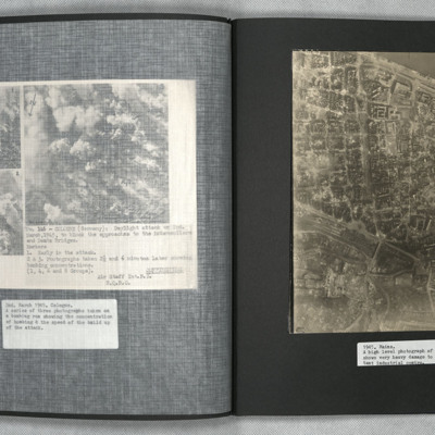
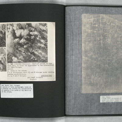
Cologne
A confidential document. Three aerial photographs showing the development of a daylight bombing attack on Cologne. All images are taken at timed intervals during the attack, at the start, then after 2.5 and 6 minutes. The location is adjacent to the…
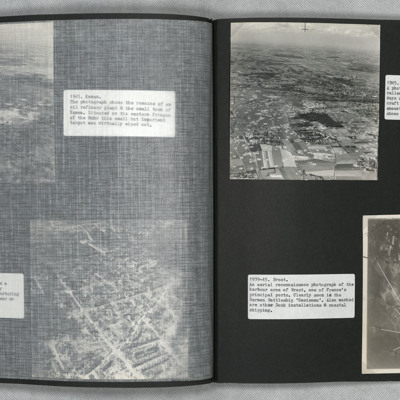
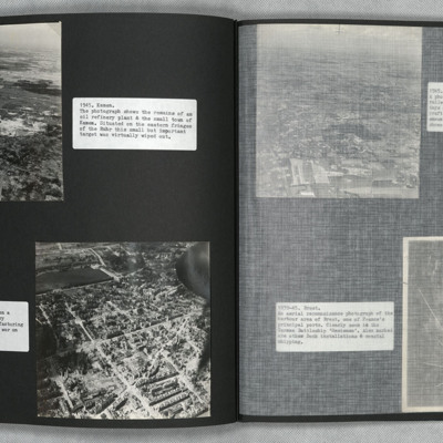
Hamm and Brest
Photograph one is an oblique aerial photograph of Hamm, showing extensive damage and bomb craters throughout.
Photograph two is a vertical aerial photograph of Brest naval base and ports, with numbered annotation.
Photograph two is a vertical aerial photograph of Brest naval base and ports, with numbered annotation.
Kamen and Hanover
Two low level oblique aerial photographs.
Photograph one shows the remains of an oil refinery at Kamen. Bomb damage is visible throughout.
Photograph two was taken during a Cook's tour. It shows the urban, manufacturing centre of Hanover with…
Photograph one shows the remains of an oil refinery at Kamen. Bomb damage is visible throughout.
Photograph two was taken during a Cook's tour. It shows the urban, manufacturing centre of Hanover with…
Tags: aerial photograph; bombing; Cook’s tour
Hamburg and Bremen
Photograph one is a low level oblique aerial view of Hamburg. The urban industrial and residential areas have considerable visible bomb and fire damage.
Photograph two is a Brownie Box camera view of Hamburg.
Photograph three is a low level oblique…
Photograph two is a Brownie Box camera view of Hamburg.
Photograph three is a low level oblique…
Wesel
Low level oblique aerial photographs of Wesel. Extensive bomb damage is visible in both images.
Tags: aerial photograph; bombing; Cook’s tour
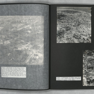
Essen
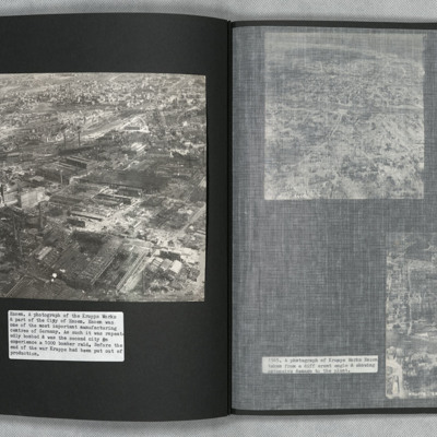
Two oblique aerial photographs of Essen. Extensive bomb damage is visible in both images. Photograph one details indecipherable road networks. Photograph two is taken at a different angle and shows Krupps Works, Essen.
Tags: aerial photograph; bombing; Cook’s tour
Krupps Works, Essen
Low level oblique aerial photograph of the Krupps Works, Essen. Most buildings show signs of damage.
Tags: aerial photograph; bombing; Cook’s tour

