Browse Items (1459 total)

  • Tags: aerial photograph

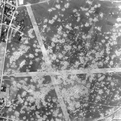
PEleyNJ1624.jpg
A vertical aerial photograph showing bomb damage to runways and surrounding area of airfield, submitted with caption; “Le Culot airfield in Belgium”.

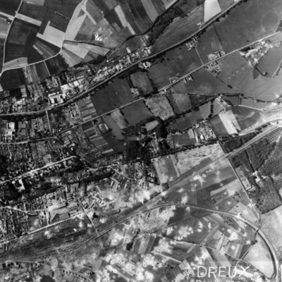
PEleyNJ1623.jpg
A vertical aerial photograph of Dreux, with rail facility in lower left quarter. Main line runs from rail facilities to top right, with secondary line veering off to the right and curving down to bottom right hand corner. Town is above the railway,…

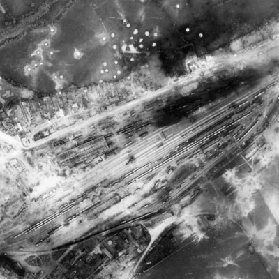
PEleyNJ1622.jpg
A vertical aerial photograph showing rail marshalling yard at Argentan. Road running parallel to railway tracks from lower left to upper right (now D158) with another joining from top left (now D238A). Argentan railway station is visible opposite…

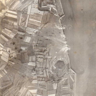
PEleyNJ1621.jpg
A vertical aerial photograph showing several new breaches in the sea defences with areas of land in process of being flooded. Submitted with caption; “Sea wall broken at Flushing.” Fort Rammekens is at the top of the photograph, with village of…

PEleyNJ1620.jpg
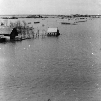
A very low level oblique aerial photograph of Walchern Floods, shows buildings partially submerged in water, submitted with caption; “Part of Holland flooded by Germans at Walchern.”

PEleyNJ1619.jpg
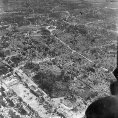
An oblique aerial photograph, just catching the starboard engines of the aircraft, is labelled as Wesel, showing almost total destruction of buildings. The prominent building top middle is Berliner Tor. The cleared road leading to it and around it,…

PEleyNJ1618.jpg
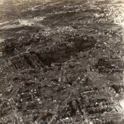
An oblique aerial photograph of Essen, photograph shows damage to buildings, submitted with caption; “Bomb damage to Essen.”

PEleyNJ1617.jpg
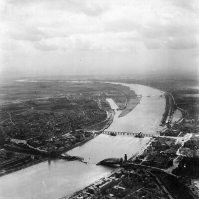
An oblique aerial photograph of Cologne, showing destroyed bridges, submitted with caption; “Damage to bridges over the Rhine.”

PEleyNJ1616.jpg
An oblique aerial photograph showing damage to buildings in Dusseldorf, as indicated by label at the bottom of the image, submitted with caption; “Bomb damage on Dusseldorf”.

PEleyNJ1603.jpg
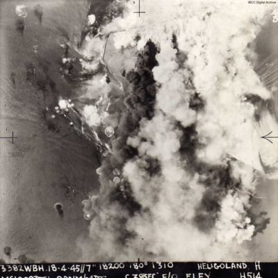
A vertical aerial photograph of the attack on Heligoland island. Most of the island is obscured by bomb explosions. Submitted with caption; “Actual photo taken over Heligoland submarine pens during 1000 bomber raid April 1945.”
The image is…

PHarveyW1810.jpg
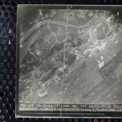
A vertical aerial photograph of Oostkapelle. Much detail is visible on the ground. It is captioned '2441 LCF 28-10-44//7" 4000 104 1149 Oostkapelle W19.Z. 1 HC 2000 In.7 ANM59DN. 4 MC 500DT. C24 secs. P/O Goodrum Z640'.

PHarveyW1809.jpg
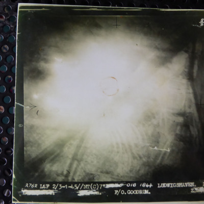
A vertical aerial photograph of an attack on Ludwigshaven. The central part of the image is obscured by light, however the Rhine and tributaries are clearly visible. The caption reads '2762 LCF 2/3-1-45//NT (C) 7" [deleted] 018 1844 Ludwigshaven Z.…

PHarveyW1808.jpg
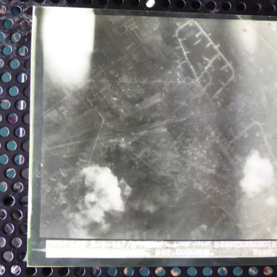
A vertical aerial photograph of an attack on Soesterberg airfield. The image is mostly clear and shows many bomb craters. The caption underneath is overexposed and apart from the airfield name and 'Sgt Goodrum' is indecipherable.

PHarveyW1807.jpg
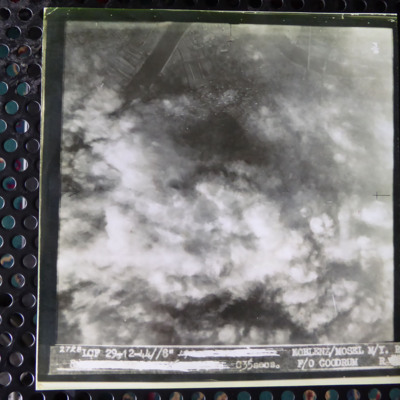
A vertical aerial photograph of an attack on Koblenz. Most of the image is obscured by cloud and bomb explosions. In the top left corner is a wide river. It is captioned '2728 LCF 29-12-44// 8" [deleted] Koblenz/Mosel M/Y R [deleted] C35 secs F/O…

PHarveyW1806.jpg
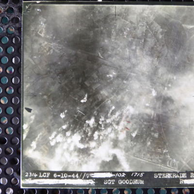
A vertical aerial photograph of an attack on Sterkrade. Road patterns and housing are clearly visible. It is captioned '2314 LCF 6-10-44 // 7 [deleted]/02 1715 Sterkrade Rd [deleted] Sgt Goodrum R [deleted]'

PHarveyW1805.jpg
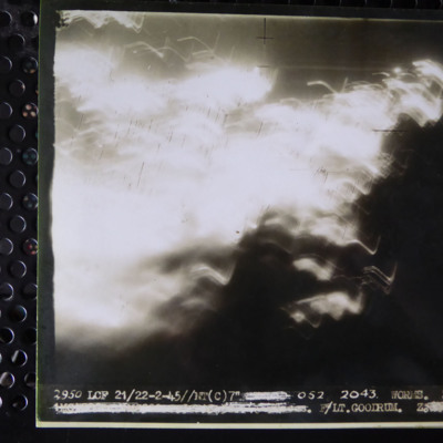
A vertical aerial photograph of an operation on Worms. Most of the image is obscured by light. It is captioned '2950 LCF 21/22-2-45//NT (C) 7" [deleted] 052 2043 Worms Z. [deleted] F/Lt. Goodrum Z. [deleted]'

PJeziorskiAFK17010017.jpg
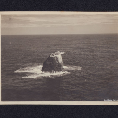
An aerial photograph of Rockall taken during a training flight. Information supplied with the collection states 'Coastal Command; Nr. 6 OTU, RAF Silloth 1945. Training flight to Rockall'.

PArthurEG1623.jpg
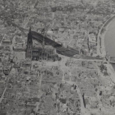
Shows bomb damage of area around the cathedral, railway station and bridge over the Rhine. The photograph taken from a 627 Squadron Mosquito.

Additional information about this item has been kindly provided by the donor.

PMcDermottC16100006.pdf
13 photographs showing bomb damage and aircraft.
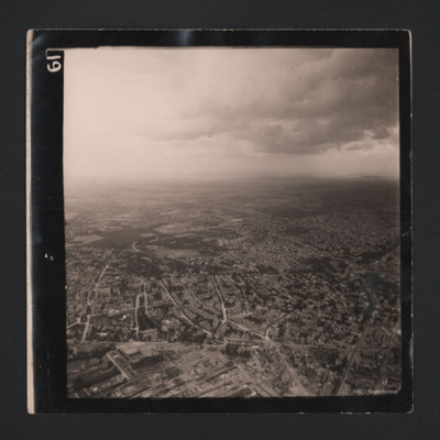
Three photographs of Dortmund residential areas. Only skeletons of buildings are remaining.
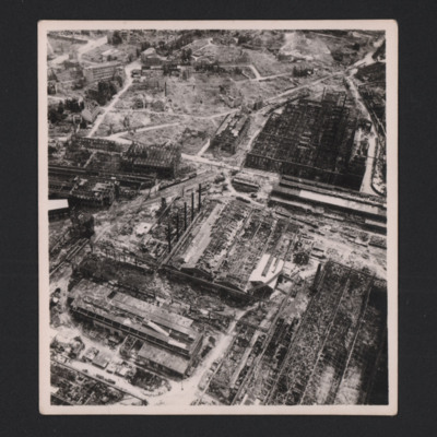
Heavily bombed Krupp works
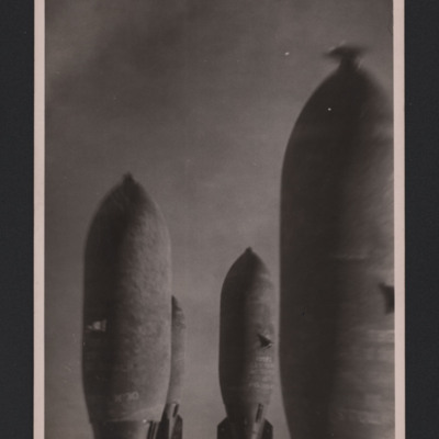
Four bombs in flight
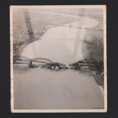
Hamm Railway bridge. In the foreground is the destroyed…

PMcDermottC16020084.jpg
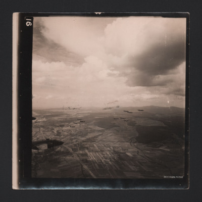
An air-to-air photograph of 14 B-25 Mitchells in flight. They are flying over a cultivated valley, set between low hills.

PMcDermottC16020083.jpg
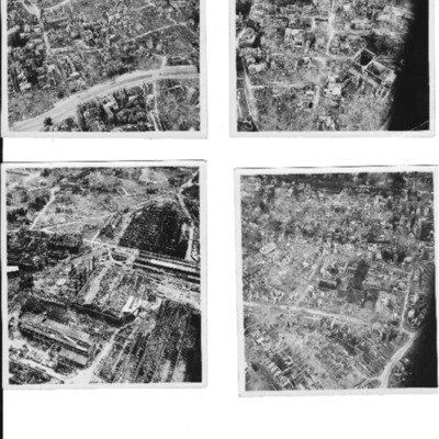
A sequence of two aerial photographs of Frankfurt, with an heavily bombed industrial area.


Identification kindly provided by Andrew Gordon of the Finding the location WW1 & WW2 Facebook group.

PMcDermottC16020073.jpg
Four photographs of a cluster of bombs in flight.
Photo 1 shows four bombs in flight. On the reverse is a stamp with
'F220 Neg 1 Geldern 9/2/45 98/180/320 Mitchell 16.00 W/Cdr Marshall 11,000' Not distributed as OP considered u/s from film…

PMcDermottC16020072.jpg
In the foreground is the destroyed Südbrücke Hamm railway bridge with four spans over the Rhine. The Düsseldorf suburb of Hamm is partially visible. The Südbrücke is in the distance, also destroyed.

Identification kindly provide by Mariano…

PMcDermottC16020071.jpg
Heavily bombed Krupp works
Output Formats

atom, dc-rdf, dcmes-xml, json, omeka-xml, rss2