Browse Items (1442 total)
- Tags: aerial photograph
Sort by:
Farmland
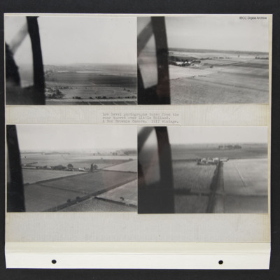
Four low level aerial oblique photographs of farmland. They are captioned 'Low level photographs taken from the rear turret over Little Holland. A Box Brownie Camera. 1917 vintage.'
Farms in the Snow
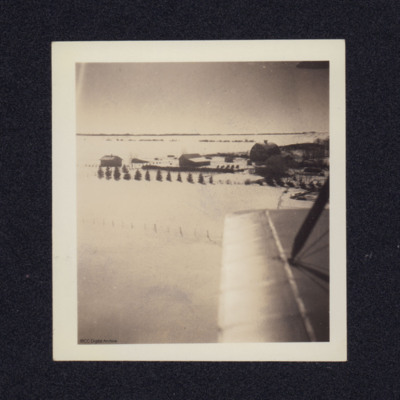
Two aerial views.
Photo 1. A low level aerial photograph of farms set in snowy fields. On the reverse 'Catching a scene on the port side of Maggie Moth [indecipherable]'.
Photo 2. A different view from a biplane with rigging wires.
Photo 1. A low level aerial photograph of farms set in snowy fields. On the reverse 'Catching a scene on the port side of Maggie Moth [indecipherable]'.
Photo 2. A different view from a biplane with rigging wires.
Tags: aerial photograph
Feltwell village
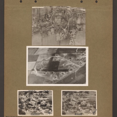
Top an aerial vertical photograph of a village. Two roads lead in from the left joining a circular road running round the village. Roads lead off top and bottom right.
Middle an aerial inclined photograph of a diamond shaped aircraft dispersal…
Middle an aerial inclined photograph of a diamond shaped aircraft dispersal…
Ferme D'Urville
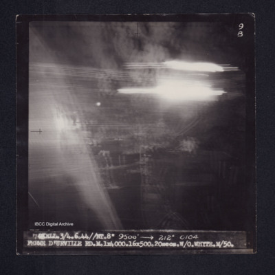
Target photograph of Ferme D'Urville. Rather dark photograph, what appears to be smoke and dust visible, no detail. Light streaks. Captioned '9B', '7 SKELL.3/4.6.44//NT.8" 9500' [arrow] 212° 0104 FERME D'URVILLE RD.M.1X4000.16X500.20secs.W/O…
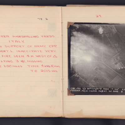
Ferrara Marshalling Yards
A target photograph taken during an operation to the marshalling yards in Ferrara with supporting handwritten information. In the photograph smoke and glare obscures the marshalling yards in the left part of the image. Below there are numerous bomb…
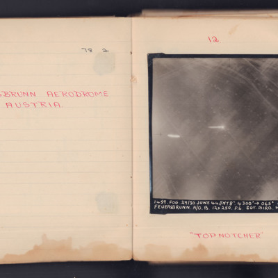
Feuersbrunn Aerodrome Austria
Two target photographs taken on separate operations to Feuersbrunn in Austria.
First photograph shows the grass field but no runways stand out. Vehicle tracks and small bomb craters can be seen. It is annotated 'A4' and captioned:
'1459 FOG. 29/30…
First photograph shows the grass field but no runways stand out. Vehicle tracks and small bomb craters can be seen. It is annotated 'A4' and captioned:
'1459 FOG. 29/30…
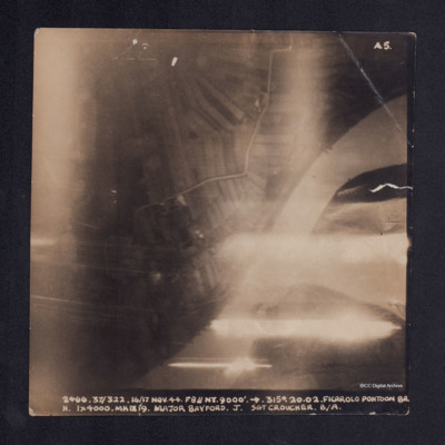
Ficarolo Pontoon Bridge
A vertical aerial photograph taken during the bombing of Ficarolo pontoon bridge. Some of the image is obscured by anti-aircraft fire. It is captioned '2466 37/322. 16/17 Nov. 44. F8//NT. 9000' --> 315°. 20.02 FICAROLO PONTOON BR. H. 1 x 4000. Mk…
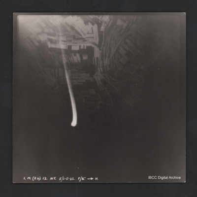
Fields and roads
Vertical aerial photograph of unnamed location. The image is very dark with fields and roads visible at the top. In the centre is anti-aircraft fire. At the bottom it is captioned ‘3A B (X7) 12 NT 29/30/4/42 F/8” [arrow] TX’.
Fighter base North end of Saipan
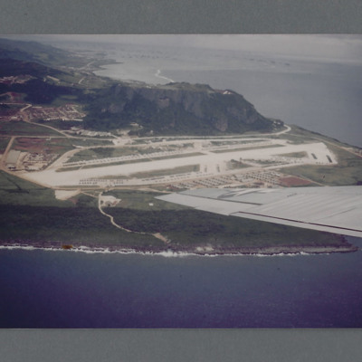
Air to ground view of airbase at the end of an island with a hill beyond, On the reverse 'Fighter base north end of Saipan August 1945' but not in Group Captain Leonard Cheshire's writing. Circa 1980s reprint of a 1945 colour photograph. Additional…
Tags: aerial photograph
Finse resort
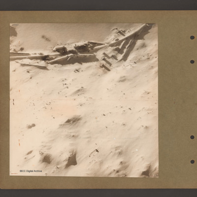
Aerial vertical photograph of a snow covered scene with railway line running left to right at the top. The railway has buildings on either side. There is possible damage in the centre. Three bomb craters are visible above the railway on the left…
Tags: aerial photograph; bombing
Finse resort
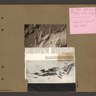
Top right a note on pink paper 'A/C from RAF Wick, 1 PRU were there, "Warner Lesure [sic] 50% off"'.
Top left an aerial vertical photograph of a snow covered landscape with a railway line with numerous protective snow shed running from right to…
Top left an aerial vertical photograph of a snow covered landscape with a railway line with numerous protective snow shed running from right to…
Fires & Ack Ack at El Alamein
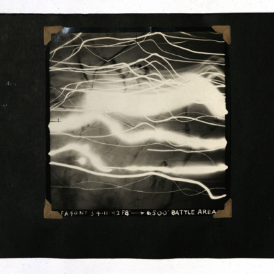
A vertical aerial photograph of the El Alamein area. Much of the image is obscured by tracer and fires. It is captioned 'FA 40 NT 3/4.11.42 F8" -->6,500' Battle Area'.
First bomb
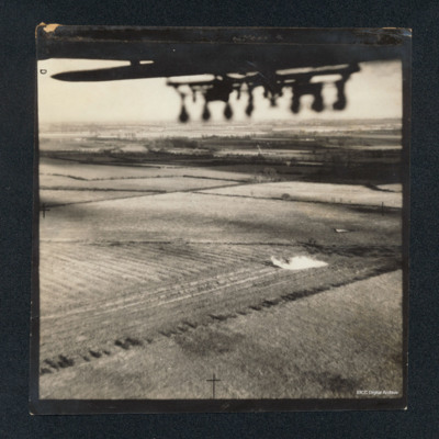
Air to ground photograph showing fields and hedges. There is a target triangle half way up on the right side. There is smoke from a practice bomb below and to its left. At the top, the bottom of a fuselage. On the reverse '1st bomb'. Captioned '102…
Tags: 102 Squadron; aerial photograph; bombing; training; Whitley
First Flight
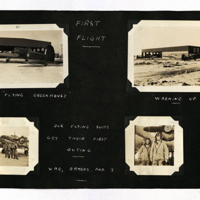
19 photographs from an album.
Photo 1 is an Anson viewed from the port/rear, captioned 'The "Flying Greenhouse" '.
Photo 2 is three Ansons outside a hangar, captioned 'Warming Up'.
Photo 3 is three airmen standing at the front of an Anson,…
Photo 1 is an Anson viewed from the port/rear, captioned 'The "Flying Greenhouse" '.
Photo 2 is three Ansons outside a hangar, captioned 'Warming Up'.
Photo 3 is three airmen standing at the front of an Anson,…
Fiume
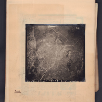
Target photograph showing a town with a main road running through from top right to bottom left. Captioned '641, FOG, 1, 21/22 Jan 44, NT 8", 8100ft→ , 330 degrees, [...]'. 'A4' Annotated 'Fiume'.
Fiume and Brück
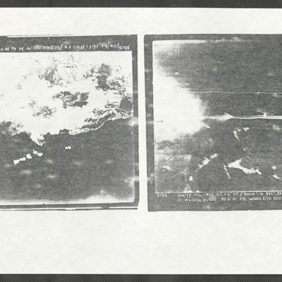
Two low quality copies of target photographs of Brück and Fiume (Rijeka).
The Fiume image (upside down). Captioned:
'2615 104/60 16 Feb 45 F8//12,500ft → 14.32 G A FIUME
Fiume was before Powell stated operations on 104 Squadron.
The Brück…
The Fiume image (upside down). Captioned:
'2615 104/60 16 Feb 45 F8//12,500ft → 14.32 G A FIUME
Fiume was before Powell stated operations on 104 Squadron.
The Brück…
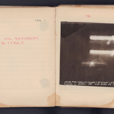
Fiume Oil Refinery
A target photograph for an operation to Fiume. No detail is visible on the ground and there are three streaks of light. It is annotated 'A4' and captioned:
'1598. FOG. 19/20 JULY 44 // NT 8" 9,800' ->305° 2249.
FIUME. L. 9x500. P8. SGT BIRD. M.…
'1598. FOG. 19/20 JULY 44 // NT 8" 9,800' ->305° 2249.
FIUME. L. 9x500. P8. SGT BIRD. M.…
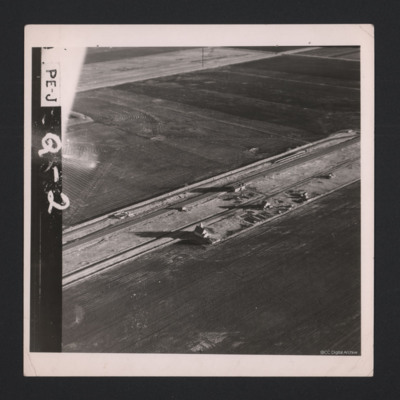
Flat Farmland
A low level aerial oblique of flat farmland. A road crosses left to right with a few houses. On the image is annotated 'PE-J Q-2'.
Tags: aerial photograph
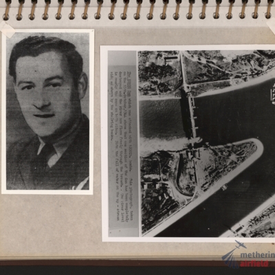
Flight engineer and Kembs dam
Left - full face portrait of an airman wearing tunic with flight engineer brevet. Submitted with description 'Full-face photo of unidentified flight engineer'. Right - reconnaissance photograph with text description of the Kembs dam across the Grand…
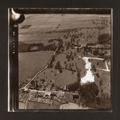
Flitcham
Oblique aerial photograph Flitcham. There is a country house with formal garden and estate in the top right quadrant with lake below and village in the bottom left quadrant. A road runs from bottom left to top centre.
Tags: aerial photograph
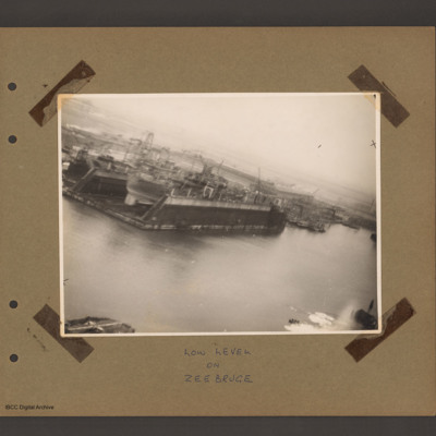
Floating dock at Zeebrugge
An aerial inclined photograph of docks. In the centre left a floating dock containing a ship. To the right of dock other floating dockyard machinery and some small moored boats. Various cranes and other unloading equipment are visible. Captioned 'Low…
Tags: aerial photograph
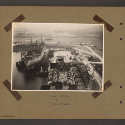
Floating Dock at Zeebrugge
An aerial inclined photograph of two floating docks with ships. At the bottom centre the rear half of a ship in a floating dock with an open cargo hold at the rear. There are cranes bottom right and at the rear left side. To the left and further back…
Tags: aerial photograph
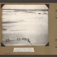
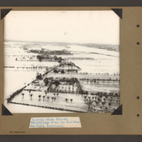
Flooded area around Walcheren
Aerial inclined photograph showing snow covered flat open countryside with a few marked field boundaries. In the foreground on the left part of a fenced field with a few boundary trees. In the distance more wooded countryside. Captioned 'Flooded area…
Tags: aerial photograph; bombing; Cook’s tour
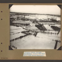
Flooded areas around Walcheren
Aerial inclined photograph showing flooded fields with some boundary hedges and isolated buildings in the foreground. In the middle is a village orientated left to right across the scene. At the left end is a church surrounded by houses. In the…
Tags: aerial photograph; bombing; Cook’s tour
Flooded areas around Walcheren
Aerial inclined photograph showing flooded farmland. In the foreground a farmhouse with hedge lined fields/orchards to the right. A flooded road runs from bottom left towards the middle when it bends back towards the top left. Along the road are…
Tags: aerial photograph; bombing; Cook’s tour

