Browse Items (4469 total)
- Tags: bombing
Sort by:
St Leu D'Esserent
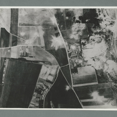
Reconnaissance photograph showing open countryside with fields. Road railway runs top right to bottom right. Road runs from bottom centre/right and splits, one going top top centre and the other to top left. There are a large number of craters on…
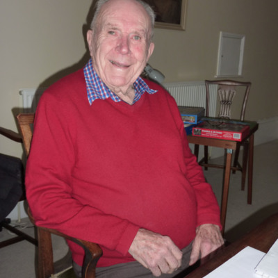
Interview with Jack Harris. One
Jack Harris was born in Gillingham, Kent. At sixteen, he undertook employment as a clerk in the intelligence department of the Air Ministry. He describes the brief evacuation of his department to Harrow in 1939 and receiving permission to leave his…
Tags: 30 OTU; 550 Squadron; aircrew; anti-aircraft fire; bombing; bombing of Dresden (13 - 15 February 1945); C-47; Flying Training School; H2S; Halifax; Heavy Conversion Unit; Initial Training Wing; Lancaster; Lancaster Finishing School; navigator; Operational Training Unit; Oxford; pilot; RAF Cranage; RAF Fairoaks; RAF Grantham; RAF Harlaxton; RAF Hemswell; RAF Hixon; RAF Ingham; RAF North Killingholme; RAF North Luffenham; RAF Sandtoft; RAF South Cerney; RAF Torquay; recruitment; Tiger Moth; training; Ventura; Wellington
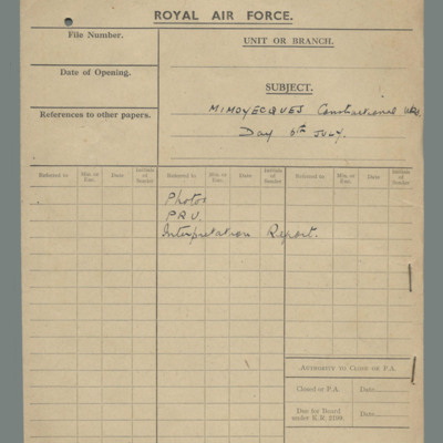
Royal Air Force file cover - Mimoyecques constructional works, day 6 July
Buff file cover with contents: photos, Photographic Reconnaissance Unit and Interpretation report.
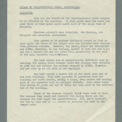
Attack on constructional works Mimoyecques, narrative
Reports that this was the fourth constructional works target for the squadron. One P-51, one Mosquito and 17 Lancasters were detailed. States it was another difficult target and describes marking efforts. Reports difficultly in finding aiming point…
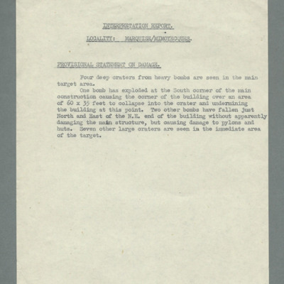
Interpretation report, locality, Marquise/Mimoyecques, provisional statement of damage
Reports four craters from heavy bombs in target area and details damage done by each.
Mimoyecques
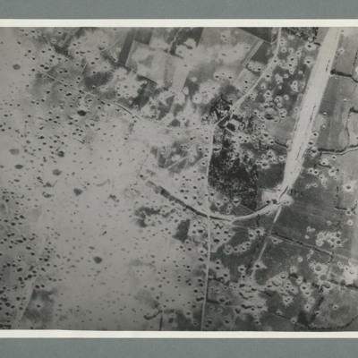
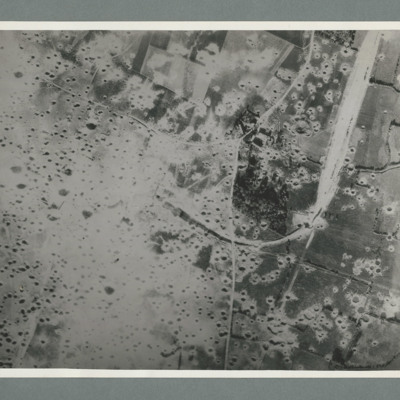
Reconnaissance photograph showing open countryside with fields. A railway runs from top right downwards then loops to the left, culminating in the centre, The left side is covered in multiple craters. Craters on the right side are less concentrated.…
Mimoyecques
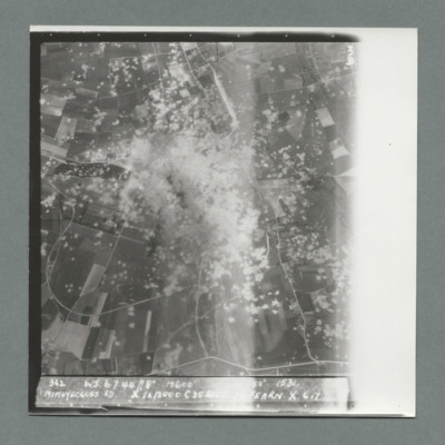
Target photograph showing open countryside with heavily cratered area in the centre. Caption '362, WS, 6.7.44, 8", 15600, [....], 1534, Mimoyecques RD, X, 1 x 12000, C, 35 secs, [..]earn, X, 617'. On the reverse '5:99/5, Photo 282'.
Mimoyecques
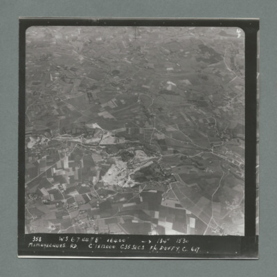
Target photograph showing open countryside with fields and roads. Village on the right side edge just below centre. Caption '358, W.S., 6.7.44, 8", 16400, 134 degrees, 1530, Mimoyecques RD, C, 1 x 12000, C35 secsa, F?O Duffy, C, 617' On the reverse…
Mimoyecques
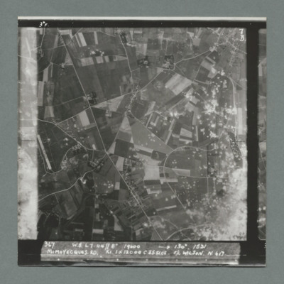
Target photograph showing open countryside with area covered in craters bottom right. There is an airfield on the left edge just below centre. Caption '367, W.S., 6.7.44, 8", 19000, 130 degrees, 1531, Mimoyecques RD, K1, 1 x 12000, C, 235 secs, F/L…
Mimoyecques
Target photograph showing open countryside with fields and roads. There is a large area with craters bottom right extending towards the top.There are other scattered craters throughout the image. Caption '367, W.S.,6.7.44, 8", 130 degrees, 1531,…
Mimoyecques
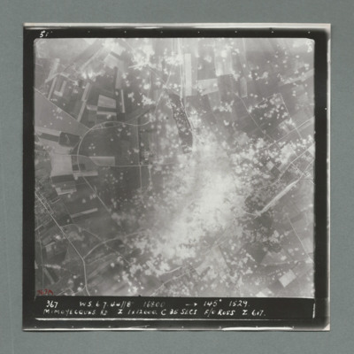
Target photograph showing open countryside with a large area on dense craters in the centre. Caption '367, W.S., 6.7.44, 8", 16800, 145 degrees, 1529, Mimoyecques RD, Z, 1 x 12000, C, 25 secs, F/O Ross, Z, 617'. On the reverse '51:97/7'.
Mimoyecques
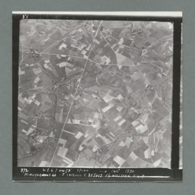
Target photograph showing open countryside with fields. There are prominent roads running bottom left to top centre and top right to left. Caption '372, W.S, 6.7.44, 8", 17000, 140 degree, 1530, Mimoyecques RD, T, 1 x 12000, C, 35 secs, F/L Willsher,…
Mimoyecques
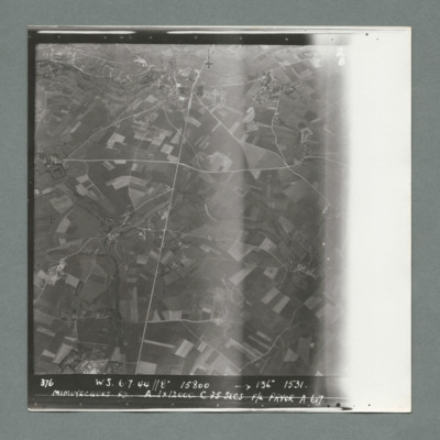
Target photograph showing open countryside with fields. Prominent roads run from top centre to bottom and left centre to right. Caption '376, W.S., 6.7.44, 8", 15800, 136 degrees, 1531, Mimoyecques RD, A, 1 x 12000, F/L Pryor, A, 617'. On the reverse…
Mimoyecques
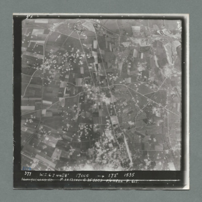
Target photograph showing open countryside with fields. Prominent road runs top centre to bottom and left centre to right. Craters are scattered over most of the image mostly left of centre line. Caption '377, W.S., 7.7.44, 17000, 178 degrees, 1535,…
Mimoyecques
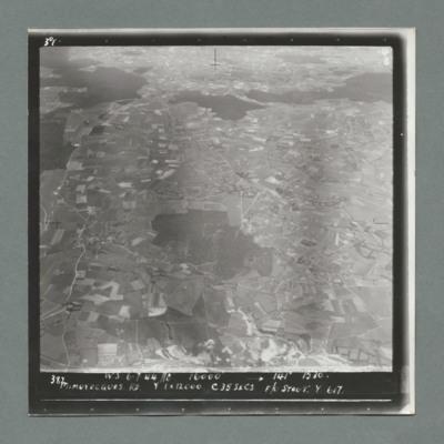
Target photograph showing open countryside with fields. There are forests in the centre and from left to right across the top. Caption '387, W.S., 6.7.44. 8", 16000, 141 degrees 1530, Mimoyecques RD, Y, 1 x 12000, C, 35 secs, F?L Stout, Y, 617'. On…
Mimoyecques
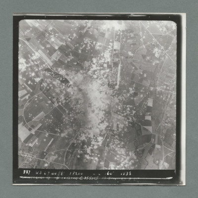
Target photograph showing open countryside with a large area with dense craters in the centre.Smoke can be seen in centre and top centre. Caption '387. W.S. 6.7.44, 8", 18200, 160 degrees, 1538, Mimoyecques RD, B, 1 x 12000, C, 35 secs, F/L Stanford.…
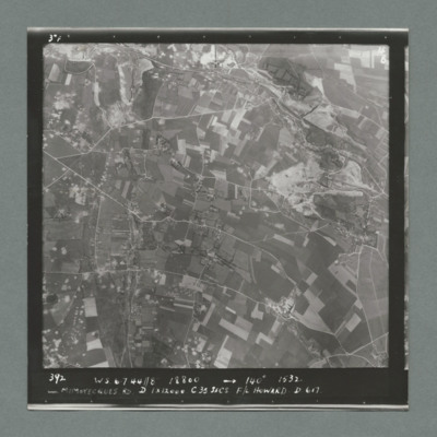
Mimoyecques
Target photograph showing open countryside with fields. Prominent roads run left to right. There are some craters scattered over the image. Caption '392, W.S., 6.7.44., 8", 18800, 140 degrees, 1532, Mimoyecques RD, D, 1 x 12000, C, 35 secs, F/L…
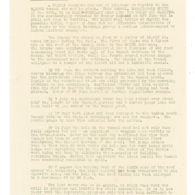
Bomber Command Intelligence Digest No 15 - Saumur Tunnel
Account of repairs to tunnel which was attached by Bomber Command on 8/9 June 1944 which is still not open to traffic. Describes damage and provides account of repairs to craters. railway tracks and hole in the roof of tunnel.
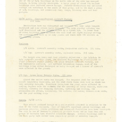
Abstract from Bomber Command quarterly review, June 1944
Provides results of attacks on Mailly le Camp military depot and tank park 3/4 May, Clerment-Ferrand aircraft factory 29/30 April, Toulouse aircraft assembly works and Montaudran airfield 5/6 April and 1/2 May, Lyon Motor vehicle works 1/2 May,…
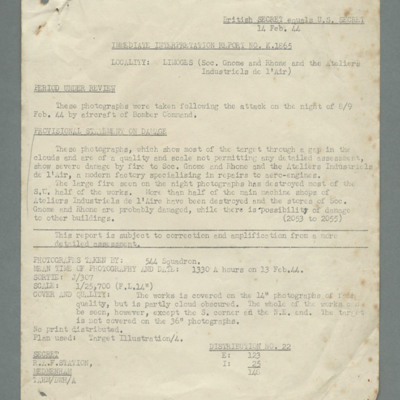
Immediate interpretation report no. K.1665, locality Limoge Gnome and Rhone and Ataliers Industrels de l'air'
Mentions photographs taken the day after the attack by bomber command on 8/9 February 1944 do not permit detailed assessment. Damage is seen to south west half of the works and more than half the main machine shops have been destroyed. States that…
Tags: 544 Squadron; bombing; RAF Medmenham
Limoges
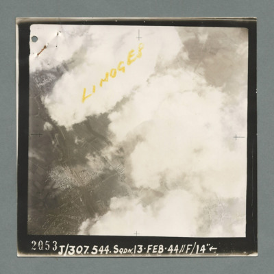
Reconnaissance photograph showing buildings on the left through a gap in clouds. Captioned 'Limoges' On the bottom '2053, J/307.544 Sqdn. 13.Feb.44, //F/14"'. On the reverse 'K144'.
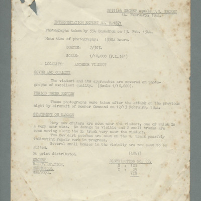
Interpretation report no. K.1871 - Antheor Viaduct
Refers to photographs taken on 13 February 1944 after the attack by bomber command on 12/13 February. Reports excellent quality photographs showing many new craters and one very near miss but no damage viable to viaduct.
Tags: 544 Squadron; bombing; RAF Medmenham
Gnome Rhone works, Limoges
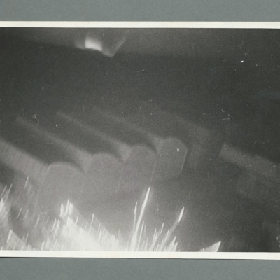
Inclined aerial photograph showing a line of buildings with flare bloom on bottom edge and a smaller one top centre, On the reverse '139 Neg 1, Rhone Gnome Wks Limoges, 8.2.44, 617, W/C Cheshire DSO, DFC, W/C Cheshire marking target, mirror camera'.
Gnome Rhone works Limoges
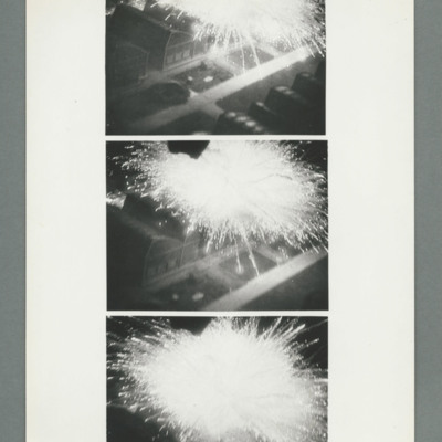
A sequence of three inclined aerial photographs showing a group of buildings with a large flare bloom above them. Cheshire's aircraft is moving towards the top of the images with final image just showing flare. On the reverse '[..] 4086B'
Gnome Rhone works Limoges
Inclined aerial photograph showing completely dark image with fire centre right. There are a few spots of light around the fire. On the reverse 'Neg 1 Cam 1, 139, run 3, Night attack on Gnome Rhone Wks, Limoges, Date 8.2.44, Sqdn 617, W/C Cheshire…

