Browse Items (754 total)
- Tags: target photograph
Sort by:
Le Havre
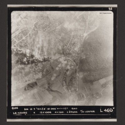
Vertical aerial photograph of Le Havre. There are large numbers of bomb craters and smoke and explosions. Captioned '6106 BIN 10-9-44 //8 10000' [arrow] 115° 1840 Le Havre X 13x1000 4x500 c 24 secs F/O Lester L 460'.
Le Havre
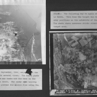
Two vertical aerial photographs from an album.
Photo 1 is bombing of the centre of Le Havre.
Photo 2 is taken on the next day and German Army positions on the outskirts were attacked.
Photo 1 is bombing of the centre of Le Havre.
Photo 2 is taken on the next day and German Army positions on the outskirts were attacked.
Le Havre
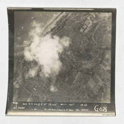
A target photograph taken during an operation at Le Havre. The left-centre of the image is obscured by cloud. The coastline and beaches north of the port is shown. A mix of urban and rural landscape with roads are visible, including the distinctive S…
Le Havre and target photographs
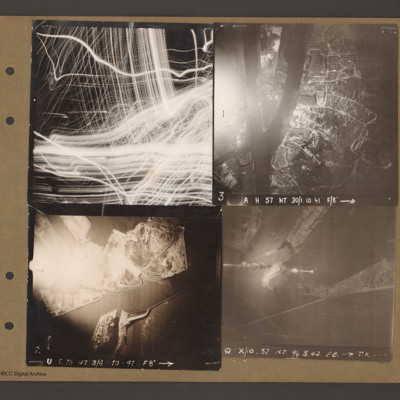
Top left aerial vertical photograph completely filled with anti-aircraft tracer trails.
Top right an aerial vertical photograph of a canal junction. A canal runs from bottom left to a junction and then up to the top. At the junction a branch…
Top right an aerial vertical photograph of a canal junction. A canal runs from bottom left to a junction and then up to the top. At the junction a branch…
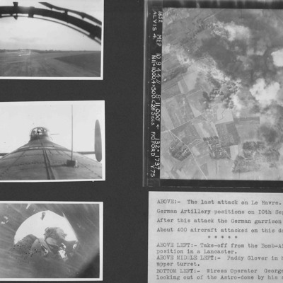
Le Havre and Terry Ford's crew
Four photographs from an album.
Photo 1 is a view during take off from the bomb aimer's station.
Photo 2 is air gunner Paddy Glover in his mid-upper turret.
Photo 3 is wireless operator George Tredinnick looking out of the astro-dome.
Photo 4 is…
Photo 1 is a view during take off from the bomb aimer's station.
Photo 2 is air gunner Paddy Glover in his mid-upper turret.
Photo 3 is wireless operator George Tredinnick looking out of the astro-dome.
Photo 4 is…
Le Havre docks
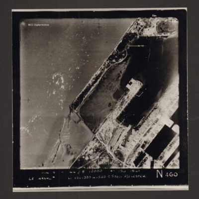
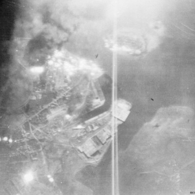
Vertical aerial photograph of Le Havre showing end of breakwater around dock area. Numerous bomb craters visible throughout together with damaged or destroyed dockside buildings. Warship in dock lower right. Rectangular structure to top left of…
Le Havre Harbour
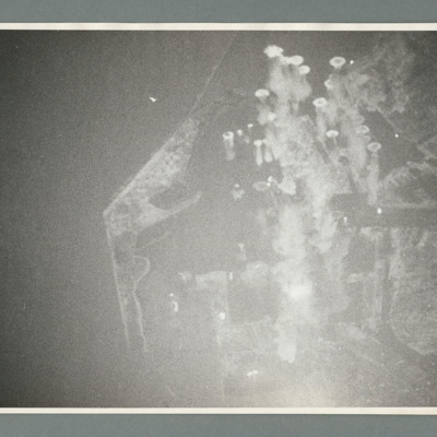
Target photograph showing sea to the left and a point of land left centre with harbour to the right. There are a large number of bomb explosions in the harbour area top right. On the reverse 'Ops 162, cam 1, neg 9, daylight/night attack of Harbour -…
Le Havre harbour
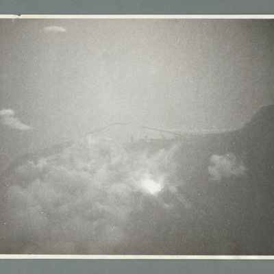
Target photograph showing coastline runs from left to right with harbour behind breakwaters in the centre. On the reverse '162, cam 1, neg 19, daylight/night attack on harbour Le Havre, date 14.6.44, squadron 463, 617, pilot F/O Schultz, a/c…
Ligescourt V-1 site
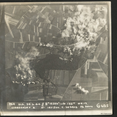
A target photograph during an operation at Ligescourt V-1 site. The village, tracks and woods to the south are visible. Explosions and smoke are seen on the village at top right and bottom left in the woodlands. Many craters in the fields around are…
Lille
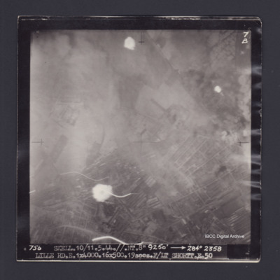
Target photograph of Lille. Partially obscured by smoke and dust, small number of light streaks. Urban area, street patterns and buildings visible. Captioned '7B', '756 SKELL.10/11.5.44.//NT.8" 9250' [arrow] 284° 2358 LILLE…
Lincoln Cathedral and Two Target Photos
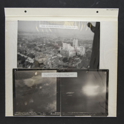
Three photos from an album.
Photo 1 is a low level oblique aerial photo of Lincoln Cathedral, captioned 'Photo of Lincoln Minster taken from rear turret'.
Photo 2 is a vertical aerial photograph of Royan during a bombing operation. The coastline is…
Photo 1 is a low level oblique aerial photo of Lincoln Cathedral, captioned 'Photo of Lincoln Minster taken from rear turret'.
Photo 2 is a vertical aerial photograph of Royan during a bombing operation. The coastline is…
Lorient docks
A vertical aerial photograph taken during the bombing of a dockyard. An aircraft is visible as a silhouette below. The dock is identified in the inventory as Lorient.
Low level bombing over Orleans
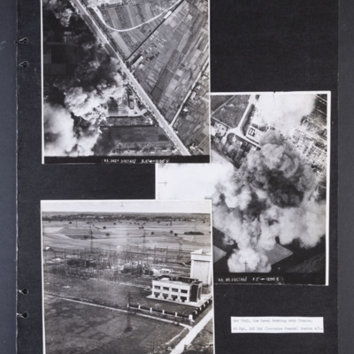
Photograph 1 is a vertical aerial photograph of a transformer and switching station at Orleans. Most of it is obscured by bomb explosions and smoke. A wide road runs diagonally across the image. Captioned 'R1.342F 3 OCT 43//…
Ludwigshafen
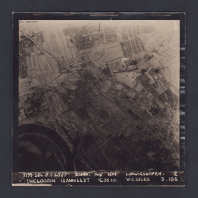
A vertical target photograph of Ludwigshafen, orientated with the south west at the top. In the lower left corner is a bend in the River Rhine and the entrance to Kaiserworthhafen docks. Just visible at the bottom edge is the end of Luitpoldhafen…
Ludwigshaven
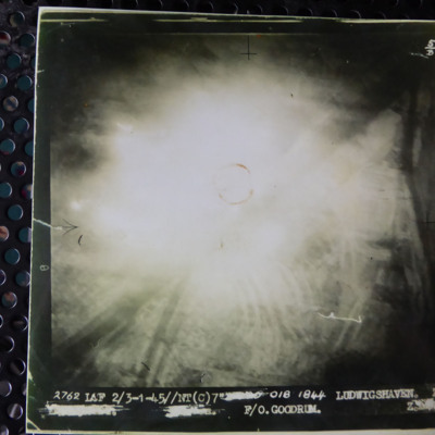
A vertical aerial photograph of an attack on Ludwigshaven. The central part of the image is obscured by light, however the Rhine and tributaries are clearly visible. The caption reads '2762 LCF 2/3-1-45//NT (C) 7" [deleted] 018 1844 Ludwigshaven Z.…
Maassluis
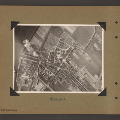
Aerial vertical photograph of a town with dock basin. The river Maas runs down the left side. A canal runs from the river on left to the centre where it turns left into a doack basin surrounded by a town. A narrow canal leads from the top right…
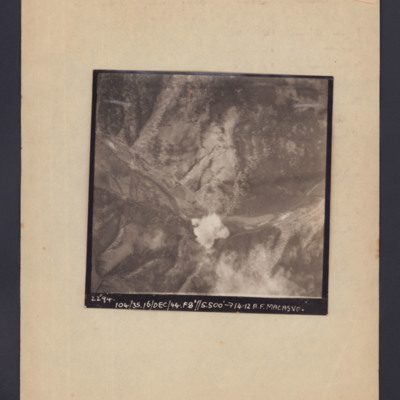
Macasvo
Target photograph showing open countryside with a bomb explosion centre bottom in a valley. Captioned '2294, 104/35, 16/Dec/44, F8, 5500 ft,→14.12, A.F. Macasvo'.
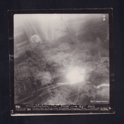
Mailly le Camp
Target photograph of Mailly-le-Camp. Rural area, centre obscured by smoke, dust and light streaks, field patterns and roads visible. Captioned '7B', '691 SKELL.3/4.5.44//NT.8" 8000' [arrow] 165° 0010 MAILLEY le…
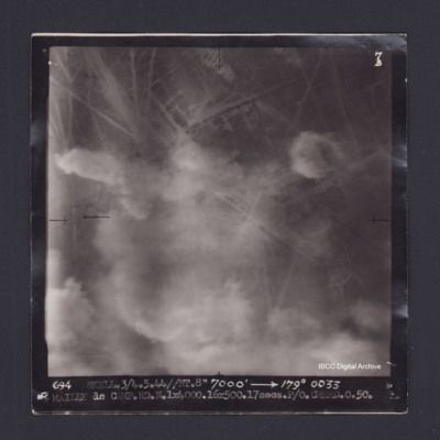
Mailly-le-Camp
Target photograph of Mailly le Camp. Partially obscured by smoke and dust, no clear detail visible. Captioned '7B', '694 SKELL.3/4.5.44//NT.8" 7000' [arrow] 179° 0033 MAILLY le CAMP.RD.N.1X4000.16X500.17secs.P/O CREED.O.50.'. On the reverse…
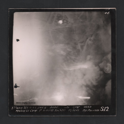
Mailly-le-Camp
Vertical aerial photograph of Mailly-le-Camp. Street patterns are visible but most of the image is obscured. Captioned ‘4B 4B’ and ‘831 WKY 3/4.5.44 // NT 8” 9000’ [arrow] 208° 0030 Mailly-le-Camp P 1 x 4000 16 x 500 17secs P/O…
Mailly-le-Camp
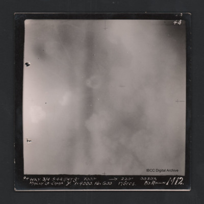
Vertical aerial photograph of Mailly-le-Camp. Most of the image is obscured by clouds and smoke. Captioned ‘4B 4B’ and '841 WKY 3/4.5.44 // NT 8” 7000’ [arrow] 220° 0030 1/2 Mailly-le-Camp Y 1 x 4000 16 x 500 17secs P/O Rollin …
Mailly-le-Camp
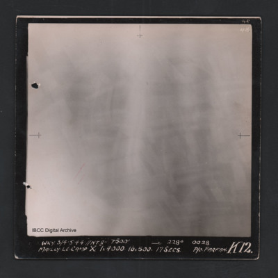
Vertical aerial photograph of Mailly-le-Camp. All of the image is obscured by bombs and smoke. Captioned ‘4B 4B’ and 'WKY 3/4.5.44 // NT 8” 7500’ [arrow] 228° 0028 Mailly-le-Camp X 1 x 4000 16 x 500 17secs P/O Farfan K12’.
Mailly-le-Camp
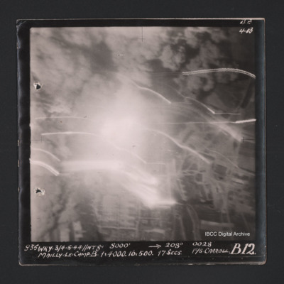
Vertical aerial photograph of Mailly-le-Camp. Most of the image is obscured by bombs and smoke. Some roads and the camp can be seen. Captioned ‘4B 4B’ and '835 WKY 3/4.5.44 // NT 8” 8000’ [arrow] 208° 0028 Mailly-le-Camp X 1 x 4000…
Mailly-le-Camp
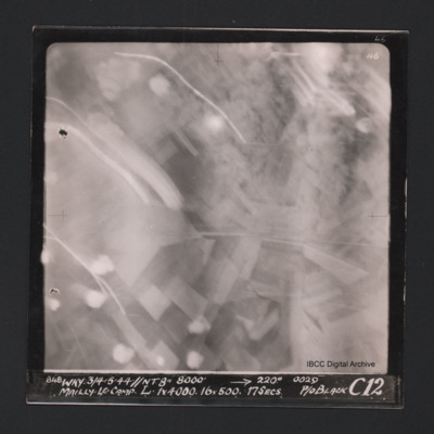
Vertical aerial photograph of Mailly-le-Camp. Most of the image is obscured by anti-aircraft fire. Some roads and fields can be seen. Captioned at top right ‘4B 4B’. Captioned along the bottom ‘‘848 WKY 3/4.5.44 // NT 8” 8000’ [arrow]…
Mailly-le-Camp and aircrew
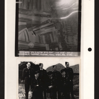
Top - target photograph showing fields on the left and a built up area with rows of buildings on the right. There is a four engine bomber below bottom left. Captioned '529 METH. 3/4.5.44//NT 8" 6,500' 219 degrees 00.17, MAILY.Rd.F 1x4000HC 16x500MC.…

