Browse Items (680 total)
- Conforms To is exactly "Geolocated"
Sort by:
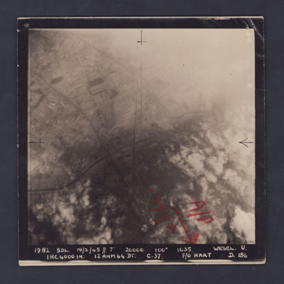
Wesel
A vertical aerial photograph of Wesel, orientated with south to the top. Wesel is not covered by the photograph but lies below the bottom edge. However, the Wesel-Datteln Kanal is clearly visible, cutting across the middle of the frame, as are the…
Navigation log, plotting map and target photograph for operation to Paris (Vairies)
This is the crews second operation, two navigation log sheets, part of a plotting map and a target photograph.
The target photograph shows a railway marshalling yard running top to bottom, bomb explosions, smoke and craters visible. Caption for the…
The target photograph shows a railway marshalling yard running top to bottom, bomb explosions, smoke and craters visible. Caption for the…
Navigation log, plotting map and target photograph for operation to Foret de Nieppe.
This is the crews sixth operation, three plotting sheets, part of a plotting map, a sheet of paper with his air miles calculations and a target photograph.
The photograph shows a rural area, an area of forest top left third of the photograph. A…
The photograph shows a rural area, an area of forest top left third of the photograph. A…
Navigation log and plotting map for operation to Eindhoven
This is the crews 12th operation, three navigation log sheets and part of a plotting map. Target photograph showing fields and rural settlements. Captioned '2005 DRF. 15-8-44//8" 15000-090.1203.Eindhoven A/F. U.9x1000. 4x500.C.32secs.F/O…
Stettin
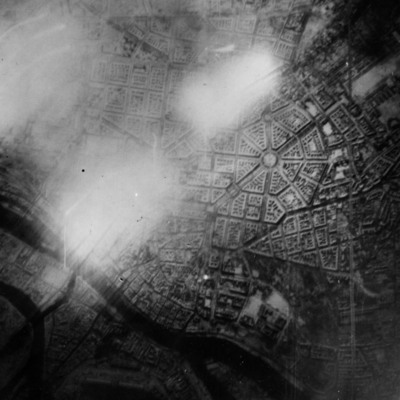
Reconnaissance photograph of Stettin. Urban area shown with the Centrum being clearly visible right of centre with roads radiating out. The West Oder river is to the middle left to bottom right of the photograph and parkland lower right above the…
Julich
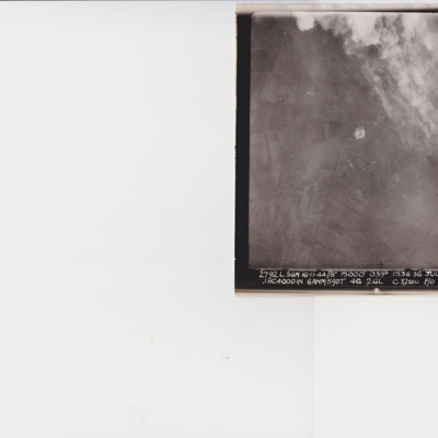
A vertical aerial photograph taken during an operation at Julich. The top right quarter is obscured by smoke and explosions. In the bottom right is a Halifax. The image is captioned ' 2792 L.SGN 16-11-44 // 8" 15000' 1536.36 Julich R .1 HC4000 IN…
Berlin
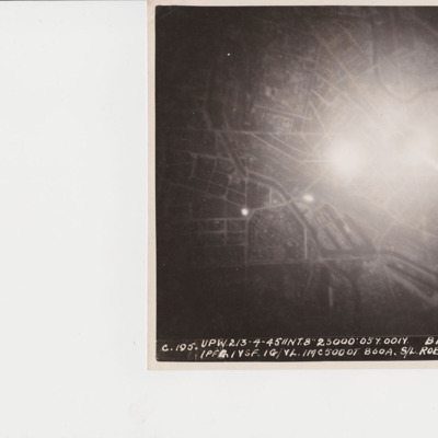
A target photograph of Berlin orientated with south-east to the top. In the upper right corner the Spree river winds it way through the city. In the middle of the photograph is a significant area of glare and just below this are the docks of…
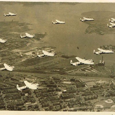
12 Lancasters of 35 Squadron in flight
12 Lancasters from 35 Squadron flying over New York. North Brother Island and Rikers Island can be seen in the top left of the photograph.The aircraft are in the post-war black and white colour scheme.
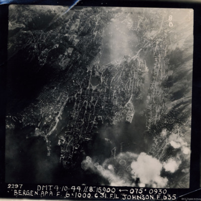
Bergen
A near vertical aerial photograph of Bergen Harbour, showing its entire layout, with the town in the centre. In the town the seven-sided lake, Lille Lungegardsvannet, next to the Festplassen can be identified. Above this is the large body of water…
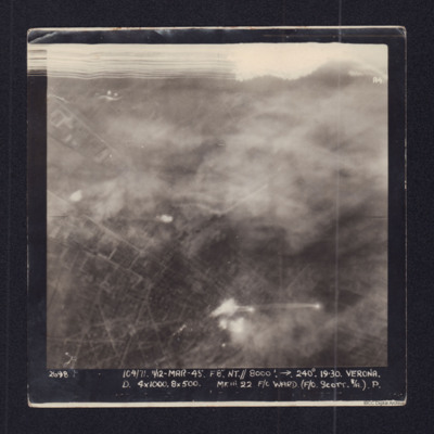
Verona
Target photograph showing town streets and explosions centre and bottom centre. Captioned '2698 104/71 11/12 Mar 45 F8 NT//8000 ft 240 degrees Verona, D 4x1000, 8x500 Mk III 22 F/O Ward (F/O Scott B/A) P.'.
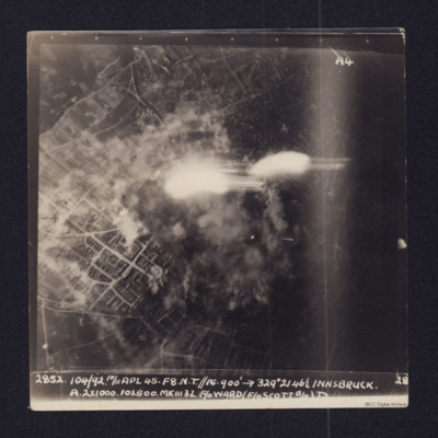
Innsbruck
Vertical aerial target photograph of Innsbruck. The ground detail shows mainly residential areas while in the centre of the image there is smoke from explosions and a number of flashes from ordnance. It is captioned:
2852 104/92 10/11 APL 45…
2852 104/92 10/11 APL 45…
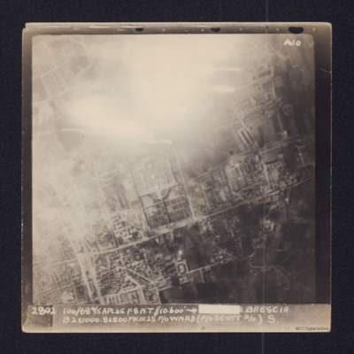
Brescia
Aerial vertical target photograph of Brescia, orientated with south west at the top edge. The image shows
good detail of the town's streets with the distinctive Cimitero Vantiniano in the centre. In the upper centre is a glare from a large fire or…
good detail of the town's streets with the distinctive Cimitero Vantiniano in the centre. In the upper centre is a glare from a large fire or…
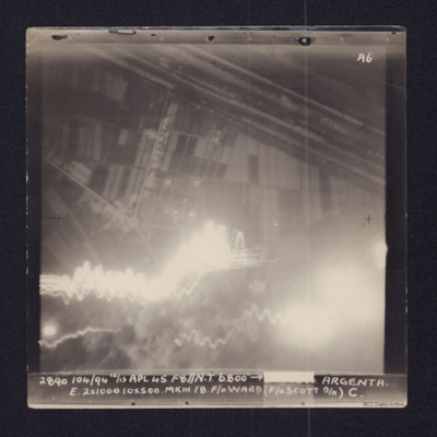
Argenta
Target photograph showing fields in top half and town and roads below. Straight lines running top left to middle right are the River Reno and beyond it, the wider Canale Della Botte. Tracer lines in bottom left and explosions left and right bottom.…
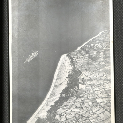
SS Rex near Semedella
Oblique aerial photograph of coastline running bottom left to top right with sea to left. Middle left a passenger liner is seen rolled over and on its side. On the reverse 'Italian [....] sunk by Beaufighters off NE coast near Trieste. Planes were…
Tags: aerial photograph; Beaufighter
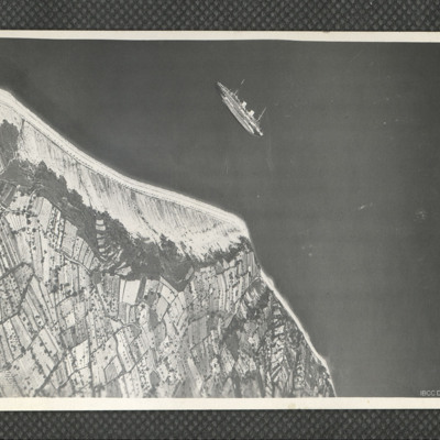
SS Rex near Semedella
Oblique aerial photograph of a passenger ship lying on her port side just off the Adriatic coastline to the west of Koper, Slovenia. The ship is the Italian ocean liner SS Rex, which was sunk in shallow water by the RAF and SAAF on 8 September 1944.…
Tags: aerial photograph
Panzano Bagni
Air-to-air view looking down at B-24 KK320/Vwith smoke issuing from port inner engine from which the propeller is missing. Below is Panzano Bagni coastline and Monfalcone docks with smoke and explosions. The entrance to the Canale Navigabile is just…
Tags: 37 Squadron; aerial photograph; B-24
Monfalcone
Daylight vertical aerial photograph of an operation in progress on Porto Monfalcone with Solvay works and CRDA facilities, orientated with West at the upper edge. The ground detail is clear and explosions and smoke cover much of the port itself with…
Bergen harbour
An oblique aerial photograph of Bergen Harbour showing a number of vessels operating in the waters surrounding the town. Bergen occupies the central part of the image and in the centre left of the image can be seen the water of Lille…
Tags: aerial photograph; bombing
Foggia
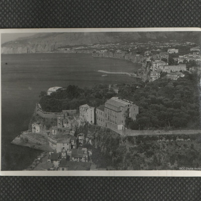
Oblique aerial photograph of part of the town showing Palazzo degli Uffici Statali with Palazzo degli Studi further out. In the upper left corner is an area of open ground while in the right upper corner there is a large arrangement of buildings.…
Tags: aerial photograph
Gelsenkirchen (Buer) and Le Havre
Information for two operations. The first has navigation logs and a plotting map for the operation to Le Havre on the 11th September, this is the crews 21st operation. The second has navigation logs, a plotting map and a target photograph for an…
Nordstern
The three navigation sheets give details of the planned routes out and back as well as observations and events during the operation. The map plots the routes to be flown.
Note from the Navigation Officer 'Satisfactory. Why not use 40[degree] method…
Note from the Navigation Officer 'Satisfactory. Why not use 40[degree] method…
Trieste
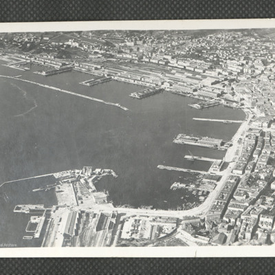
A clear oblique aerial photograph of Trieste ports, orientated with the NE at the upper edge. In the upper part of the photograph are the railway marshalling yard and quays of Porto Vecchio, together with the long breakwater. In the right hand area…
Tags: aerial photograph
Sterkade
Operation 26 for the crew. Three navigation log sheets showing the route to be taken and the observations made throughout the operation. The plotting map shows the coasts of England and Holland and the route to Sterkrade.
The target photograph…
The target photograph…
Domburg/Westkapelle, Walcheren Island
Operation 31 for the crew. Three sheets of a Navigation Log showing the route to be taken to and from the target and the Observations made along the way. Part of a Plotting Map showing the route to and from Domburg on Walcheren Island. On the reverse…

