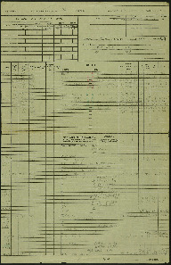
Navigation log and plotting map for operation to Eindhoven
Title
Navigation log and plotting map for operation to Eindhoven
Description
This is the crews 12th operation, three navigation log sheets and part of a plotting map. Target photograph showing fields and rural settlements. Captioned '2005 DRF. 15-8-44//8" 15000-090.1203.Eindhoven A/F. U.9x1000. 4x500.C.32secs.F/O Hickey.Z.466.'
Creator
Temporal Coverage
Language
Format
Two navigation log sheets, part of a plotting map, target photograph
Conforms To
Publisher
Rights
This content is available under a CC BY-NC 4.0 International license (Creative Commons Attribution-NonCommercial 4.0). It has been published ‘as is’ and may contain inaccuracies or culturally inappropriate references that do not necessarily reflect the official policy or position of the University of Lincoln or the International Bomber Command Centre. For more information, visit https://creativecommons.org/licenses/by-nc/4.0/ and https://ibccdigitalarchive.lincoln.ac.uk/omeka/legal.
Identifier
SCockramJC419379v10012
Collection
Citation
JC Cockram, “Navigation log and plotting map for operation to Eindhoven,” IBCC Digital Archive, accessed October 22, 2024, https://ibccdigitalarchive.lincoln.ac.uk/omeka/collections/document/39594.
Item Relations
This item has no relations.

