Browse Items (700 total)
- Conforms To is exactly "Geolocated"
Sort by:
St Albert
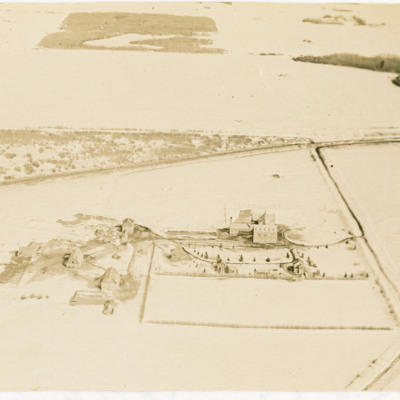
Two oblique aerial photographs of a large school with some outbuildings in a snowy landscape near St Albert, Edmonton. Poundmaker Road and Canadian National Railway tracks are also visible. Identification kindly provided by Steven Boisvert of the…
Tags: aerial photograph
Josephburg Grain Silos
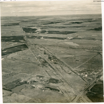
An oblique aerial photograph of four grain silos.
In Bob's memoirs he identifies these as being at Josephburg, close to Fort Saskatchewan.
In Bob's memoirs he identifies these as being at Josephburg, close to Fort Saskatchewan.
Tags: aerial photograph
Bridge over the North Saskatchewan River
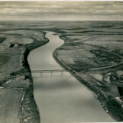
An oblique aerial view of a railway bridge crossing a river.
In Bob's memoirs he identifies the bridge as over the North Saskatchewan River about 1.5 miles SW of Fort Saskatchewan looking in the general direction of Edmonton.
In Bob's memoirs he identifies the bridge as over the North Saskatchewan River about 1.5 miles SW of Fort Saskatchewan looking in the general direction of Edmonton.
Tags: aerial photograph
Carbondale Grain Silo
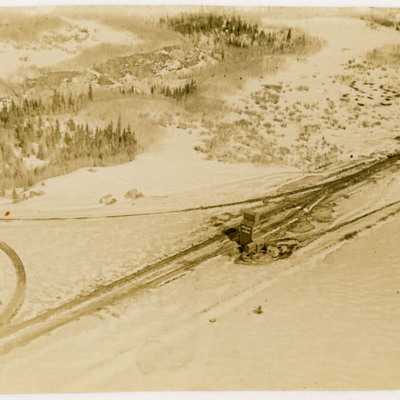
Two oblique aerial photographs of a grain silo at a railway junction. The ground is covered in snow.
In Bob's memoirs the location is identified as Carbondale, a few miles north of Edmonton.
In Bob's memoirs the location is identified as Carbondale, a few miles north of Edmonton.
Tags: aerial photograph
Udine Signal Square and Control Tower
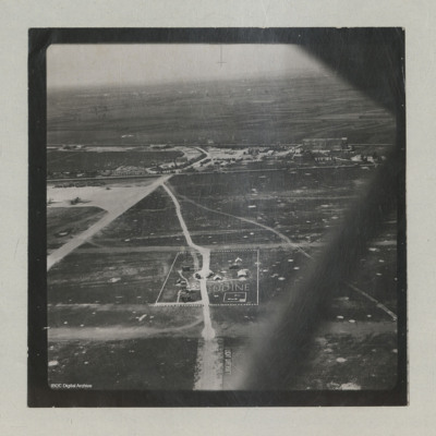
Oblique aerial views of the signal square and control tower at Udine airfield. Two C-47s can be seen on the hard standing. Airfield marking reads "LIGHT AIRCRAFT".
In the background, the 'caserma avieri', the 'Voisin' hangars, the main road, and the…
In the background, the 'caserma avieri', the 'Voisin' hangars, the main road, and the…
Tags: aerial photograph; C-47; control tower; hangar; RAF Udine; taxiway
Westkapelle
Three aerial photographs showing bomb craters and damage to the seawall. Much of the area is flooded. Houses and roads forming part of the village of Westkapelle are visible in the lower right corner of the main (topmost) photograph which is…
Tags: aerial photograph; bombing
Djibouti
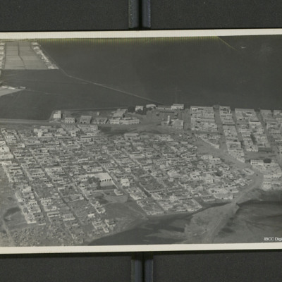
A low level oblique of Djibouti. Streets are laid out in a regular grid pattern. On the reverse 'Djibouti (French Somaliland)'.
Tags: aerial photograph
St. George Cathedral and surroundings
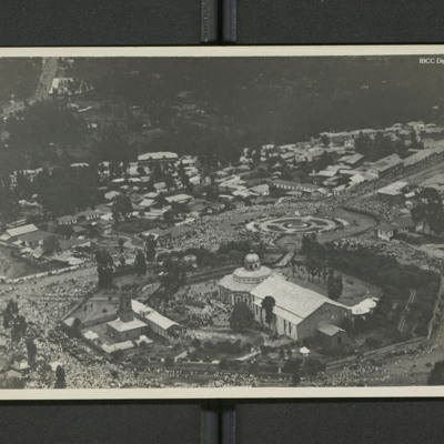
An aerial view of a domed church with large crowds visible.
On the reverse 'Adis Abbaba [sic] (Abyssinia)'.
On the reverse 'Adis Abbaba [sic] (Abyssinia)'.
Tags: aerial photograph
Sangatte and course photograph
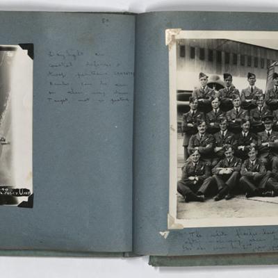
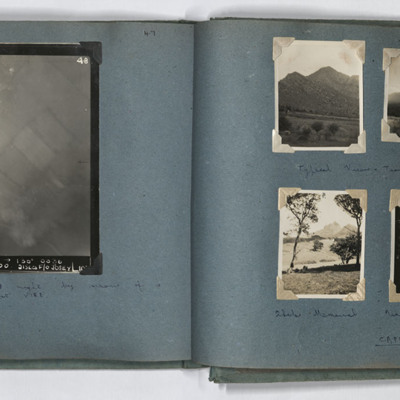
LH page, target photograph of the coastline southwest of Sangatte, with the current D940 road. Captioned '953 EWS 20.9.44// 8" 3000 120 (degrees) 1640 Sangatte ? U 13 X 1000 4 X 500 16secs F/L Josey U 103'. Handwritten caption 'Daylight on coastal…
Vire and Cape Town
LH page target photograph, rural area, some explosions visible, captioned '4B. 3637? EWS 6/7.6.44 ? 5000 ? 130 degrees. ? Vire(Eastern? 18x500. Disco. F/O Josey. 103' Handwritten caption '"Bombs Gone" photograph - taken on D night by means of a…
Ontario views
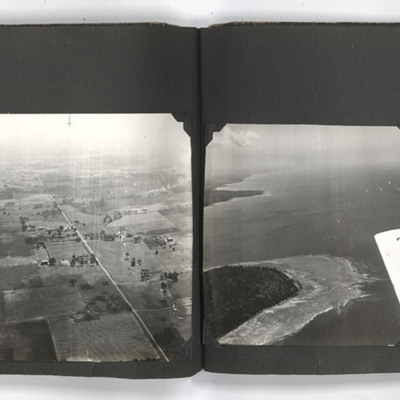
The photograph on the left of the left page shows an aerial view of Kincardine taken from an aircraft. The wing of the aircraft can be seen in the right of the photograph.
The photograph on the right of the left page shows an aerial view of the…
The photograph on the right of the left page shows an aerial view of the…
Tags: aerial photograph; training
Ontario views
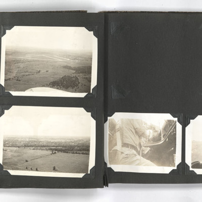
The photograph on the top left of the left page shows an aerial view of Picton airfield Ontario.
The photograph on the top right of the left page shows an aerial view of Picton airfield with a runway in the background. A wing of an aircraft can be…
The photograph on the top right of the left page shows an aerial view of Picton airfield with a runway in the background. A wing of an aircraft can be…
Tags: aerial photograph; perimeter track; runway
School sports and an aerial view of Goderich
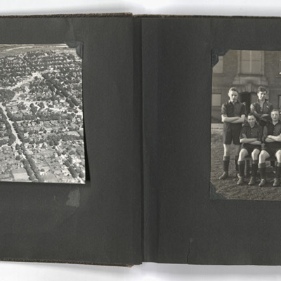
The left photograph shows an aerial view of Goderich, Ontario, Canada. The photo is taken facing east from just south of the town centre, towards the Maitland River; the geometric area of trees in the upper centre of the image is Courthouse Square.…
Tags: aerial photograph; sport; training
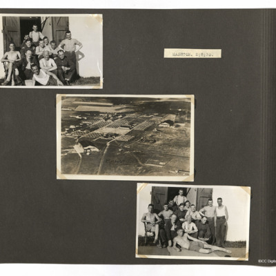
Men at Manston
Top left and bottom right photographs both show men outside a building and the centre photo shows various buildings at Manston.
Tags: aerial photograph; RAF Manston
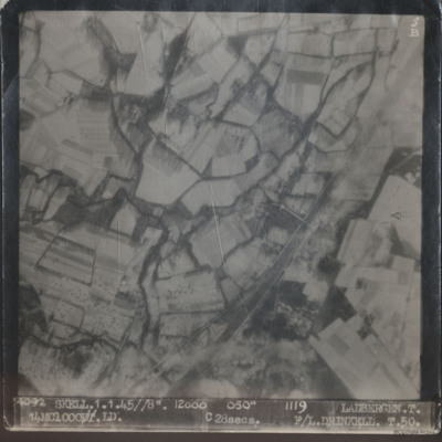
Ladbergen
Two sequential vertical aerial photographs of Ladbergen. Both show snow covered fields and the Dortmund-Ems canal. A bomb is visible in the second image.
The first is captioned '4092 Skell.1.1.45//8" 12000 050° 1119 Ladbergen. T. 14MC 1000.LD.…
The first is captioned '4092 Skell.1.1.45//8" 12000 050° 1119 Ladbergen. T. 14MC 1000.LD.…
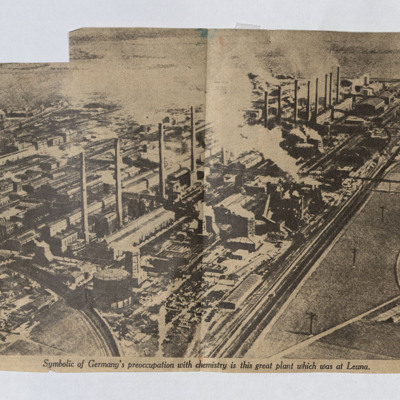
Leuna Chemical Plant
A newspaper cutting with an aerial photograph of the chemical plant at Leuna.
Tags: aerial photograph
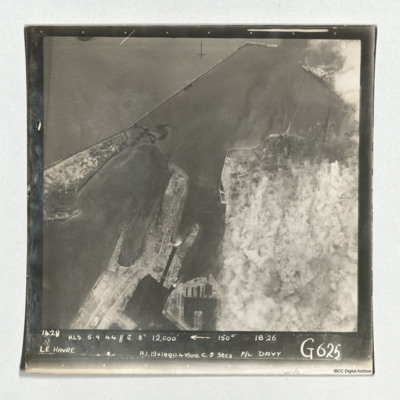
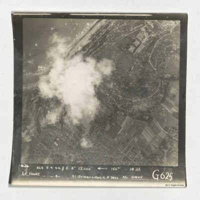
Le Havre
Target photograph of Le Havre taken during an operation. The right side is obscured by smoke. The left and top are clear and show the harbour, docks and breakwater. One vessel can be seen at an angle within the dock, bottom centre, but otherwise no…
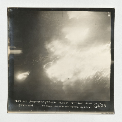
Stettin
A vertical aerial photograph taken during an operation at Stettin. Much of the image is obscured by light and explosions but there are street patterns visible at the top. It is captioned '1359 KLS 29/30-8-44//NT C. 8" 16,000'
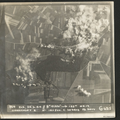
Ligescourt V-1 site
A target photograph during an operation at Ligescourt V-1 site. The village, tracks and woods to the south are visible. Explosions and smoke are seen on the village at top right and bottom left in the woodlands. Many craters in the fields around are…
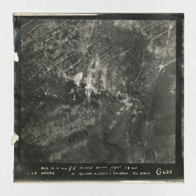
Le Havre
A vertical aerial photograph taken during an operation at Le Havre, centered on the Aplemont district, near the Forêt de Montgeon. The central area has explosions and smoke and many bomb craters are visible.
It is captioned 'KLS 10.0.44//8"…
It is captioned 'KLS 10.0.44//8"…
Tags: 625 Squadron; bombing; RAF Kelstern; target photograph
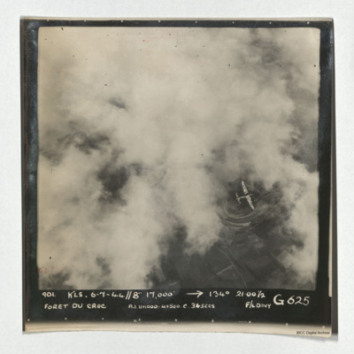
Foret du Croc
A vertical aerial photograph of Foret du Croc. Most of the image is obscured by cloud. A Lancaster is visible in a clear patch under which road patterns are visible. It is captioned '901 KLS 6-7-44//8" 17,000' -->134° 21.00 1/2 Foret du Croc…
Le Havre
A target photograph taken during an operation at Le Havre. The left-centre of the image is obscured by cloud. The coastline and beaches north of the port is shown. A mix of urban and rural landscape with roads are visible, including the distinctive S…
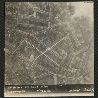
Birmingham
A vertical aerial photograph of Birmingham. The intersection between Church Hill Road and Crompton Road is highlighted. Captioned 'FN78 KLS 6-7-44//8" 6500' --> Birmingham 'Y' Training F/L Davy G625'.
Identification kindly provided by Kenneth R.…
Identification kindly provided by Kenneth R.…
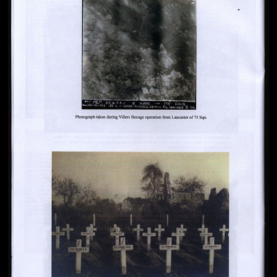
Villers Bocage during Bombing
Two photographs from an album.
#1 is a vertical aerial photograph taken during the bombing at Villers Bocage.
#2 is temporary graves of Bob Cooke and Crew at Tilly-sur-Seulles, Normandy.
#1 is a vertical aerial photograph taken during the bombing at Villers Bocage.
#2 is temporary graves of Bob Cooke and Crew at Tilly-sur-Seulles, Normandy.
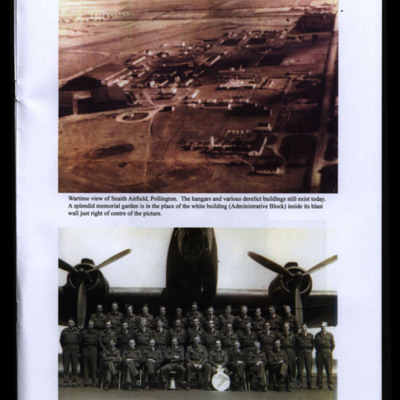
RAF Snaith and 51 Squadron Group
Two photographs from an album.
#1 is an oblique aerial photograph of Snaith taken during the war.
#2 is a group of men arranged in three rows in front of a Halifax. Bob's position is indicated in the caption.
#1 is an oblique aerial photograph of Snaith taken during the war.
#2 is a group of men arranged in three rows in front of a Halifax. Bob's position is indicated in the caption.
Tags: 51 Squadron; aerial photograph; aircrew; Halifax; RAF Snaith

