Browse Items (133 total)
- Contributor is exactly "Stuart Cummins"
Sort by:
Cahagnes
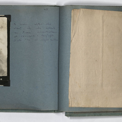
LH page, target photograph rural area with road running left to right and several buildings in top left. Many bomb explosions visible, captioned '429.EWS.30.7.44.//8" 2500 200(degrees) 0832.CAHAGNES MTT/TGT. U. 20 X 500.C.23 secs. F/Lt Josey. U.103'.…
Cahagnes
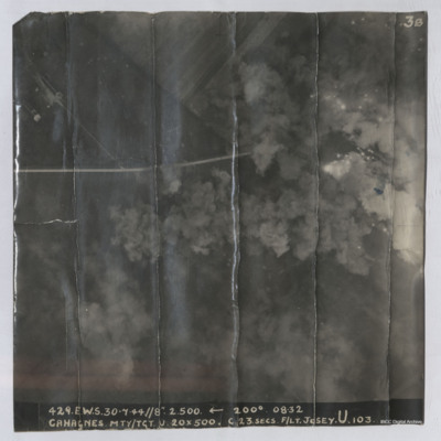
Target photograph shows explosions with dust and smoke clouds. Some target indicator flares are to right. Rural area with some buildings visible in top left with track crossing left to right. Captioned '429.E.W.S. 30.7.44//8" 2.500 200(Degrees) 08.32…
Airspeed AS 10 Oxford in fight
Air-to-air view of Airspeed AS 10 Oxford Mk.1 over a flat rural landscape with fields and woodland.
Tags: Oxford
Le Havre
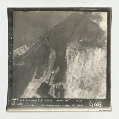
Target photograph of Le Havre taken during an operation. The right side is obscured by smoke. The left and top are clear and show the harbour, docks and breakwater. One vessel can be seen at an angle within the dock, bottom centre, but otherwise no…
Ligescourt V-1 site
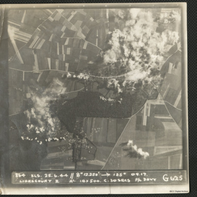
A target photograph during an operation at Ligescourt V-1 site. The village, tracks and woods to the south are visible. Explosions and smoke are seen on the village at top right and bottom left in the woodlands. Many craters in the fields around are…
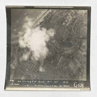
Le Havre
A target photograph taken during an operation at Le Havre. The left-centre of the image is obscured by cloud. The coastline and beaches north of the port is shown. A mix of urban and rural landscape with roads are visible, including the distinctive S…
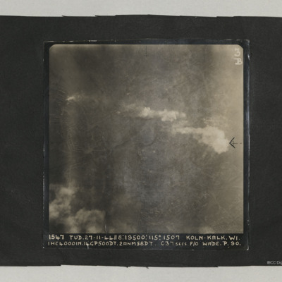
Cologne
A target photograph taken on an operation at Cologne-Kalk. Bombs can be seen falling in lower right quadrant. Smoke is being emitted from near river bank top left. The River Rhine forms a curve from centre bottom to top left corner. Two bridges are…
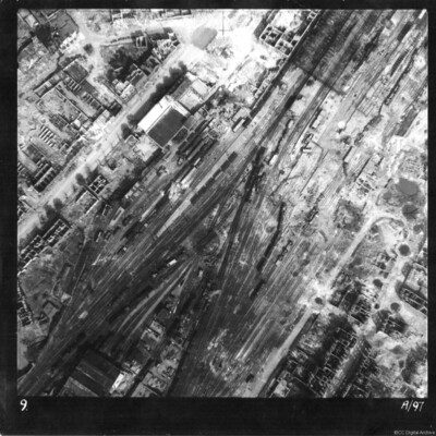
Münster railway station
Reconnaissance photograph of Münster railway station and marshalling yard. Entire area extensively damaged, with tracks destroyed and at odd angles, goods and passenger carriages blown over. Majority of buildings seen are without roofs. The main…
Tags: aerial photograph; bombing
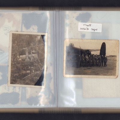
Lincoln Cathedral and airmen
Left page - Oblique aerial photograph of Lincoln cathedral.
Right page - nine airmen standing in front of the rear turret of a Lancaster with another Lancaster in the background. Captioned '1945 463 sqn'.
Right page - nine airmen standing in front of the rear turret of a Lancaster with another Lancaster in the background. Captioned '1945 463 sqn'.
Tags: 463 Squadron; aerial photograph; aircrew; ground crew; Lancaster
Ludwigshafen
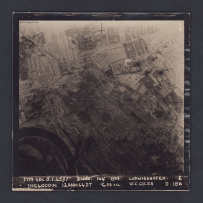
A vertical target photograph of Ludwigshafen, orientated with the south west at the top. In the lower left corner is a bend in the River Rhine and the entrance to Kaiserworthhafen docks. Just visible at the bottom edge is the end of Luitpoldhafen…
Bomber Crew
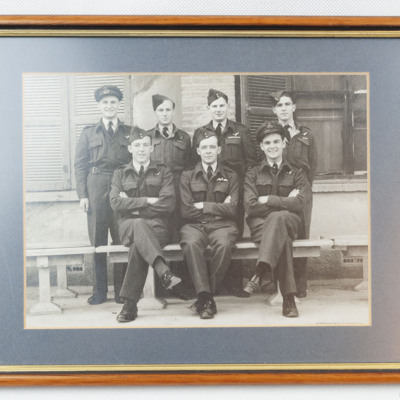
Seven airmen wearing battledress with brevet, three sitting on a bench and four standing behind. Pilot is sitting centre. Three of the airmen standing have significant medal ribbons displayed, particularly the AG second from right. In the background…
Stettin
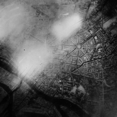
Reconnaissance photograph of Stettin. Urban area shown with the Centrum being clearly visible right of centre with roads radiating out. The West Oder river is to the middle left to bottom right of the photograph and parkland lower right above the…
Berlin
A target photograph of Berlin orientated with south-east to the top. In the upper right corner the Spree river winds it way through the city. In the middle of the photograph is a significant area of glare and just below this are the docks of…
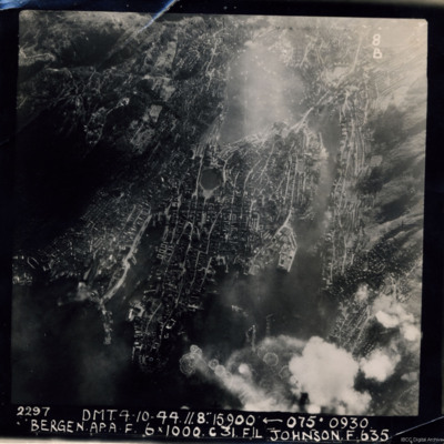
Bergen
A near vertical aerial photograph of Bergen Harbour, showing its entire layout, with the town in the centre. In the town the seven-sided lake, Lille Lungegardsvannet, next to the Festplassen can be identified. Above this is the large body of water…
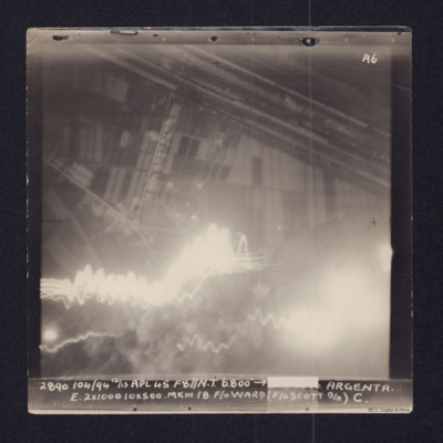
Argenta
Target photograph showing fields in top half and town and roads below. Straight lines running top left to middle right are the River Reno and beyond it, the wider Canale Della Botte. Tracer lines in bottom left and explosions left and right bottom.…
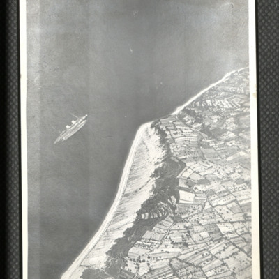
SS Rex near Semedella
Oblique aerial photograph of coastline running bottom left to top right with sea to left. Middle left a passenger liner is seen rolled over and on its side. On the reverse 'Italian [....] sunk by Beaufighters off NE coast near Trieste. Planes were…
Tags: aerial photograph; Beaufighter
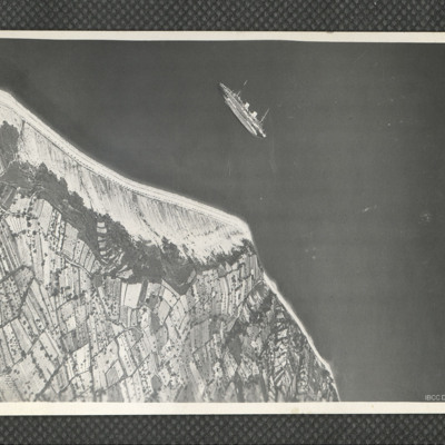
SS Rex near Semedella
Oblique aerial photograph of a passenger ship lying on her port side just off the Adriatic coastline to the west of Koper, Slovenia. The ship is the Italian ocean liner SS Rex, which was sunk in shallow water by the RAF and SAAF on 8 September 1944.…
Tags: aerial photograph
Panzano Bagni
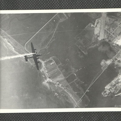
Air-to-air view looking down at B-24 KK320/Vwith smoke issuing from port inner engine from which the propeller is missing. Below is Panzano Bagni coastline and Monfalcone docks with smoke and explosions. The entrance to the Canale Navigabile is just…
Tags: 37 Squadron; aerial photograph; B-24
Port Albert airfield
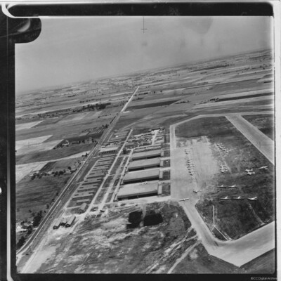
Oblique aerial photograph showing Port Albert Airfield in Ontario Canada with taxiways and hardstanding. Many Avro Anson aircraft in silver finish and lacking dorsal turrets, parked on airfield. Hangars and buildings to the left and a road (Bluewater…
Tags: aerial photograph; Anson; hangar; taxiway
Kiel
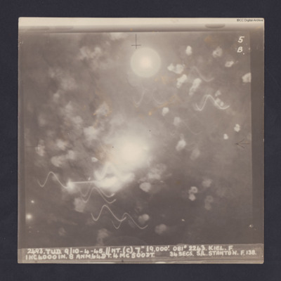
Target photograph for an operation to Kiel. It shows light trails and smoke, including multiple Flax bursts but no ground detail. It is annotated '5B' and captioned:
'2493. TUD. 9/10-4-45. //NT. (C). 7". 19,000'. 081 º 2243. KEIL. F.
1HC4000IN. 8…
'2493. TUD. 9/10-4-45. //NT. (C). 7". 19,000'. 081 º 2243. KEIL. F.
1HC4000IN. 8…
Dortmund-Hansa
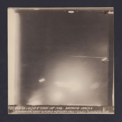
Target photograph for an operation to Dortmund - Hansa. An area of glare occupies the lower part of the image and there is another down the left side. The rest is in darkness and n ground detail is visible. The photograph is annotated '6' and…
Neuss
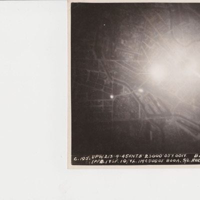
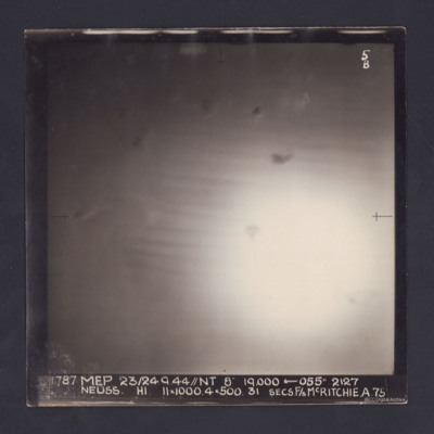
Target photograph of an operation to Neuss. Only a large area of glare, roughly in the middle, is visible. It is annotated '5B' and captioned:
'1787 MEP 23/24.9.44//NT 8" 19,000 ← 055 º 2127
NEUSS. H1. 11 x 1000. 4 x 500. 31 SECS. F/S…
'1787 MEP 23/24.9.44//NT 8" 19,000 ← 055 º 2127
NEUSS. H1. 11 x 1000. 4 x 500. 31 SECS. F/S…
Duisberg
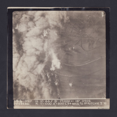
Target photograph taken on an operation to Duisberg. Left hand side is obscured by smoke or cloud and several bomb explosions can be seen. The Rhine river runs across the image, just below half height and there is built up area towards top of…
Pas de Calais
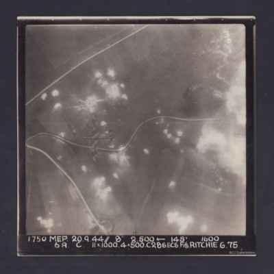
Target photograph. Fields and several minor roads visible. Much of the image is dotted with smoke from bomb bursts or Anti-aircraft fire and glare obscures right hand side. A Lancaster can be seen flying below. Annotated '3B' and captioned '1750 MEP…
Flushing
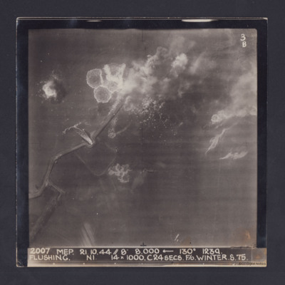
Target photograph taken during an operation to Flushing, Netherlands. Several bomb splashes in the water and smoke from explosions on the ground. Water is flowing through the sea wall at one point. The photograph is captioned:
2007 MEP 21.10.44 //…
2007 MEP 21.10.44 //…

