Browse Items (1414 total)
- Tags: aerial photograph
Sort by:
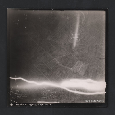
Argenteuil
Vertical aerial photograph of Argenteuil. Street pattern and buildings are visible, the cemetery is in the bottom-right corner. Anti-aircraft fire along bottom of photograph.Captioned ‘A O (x4) 12 NT 29/30/4/42 F/8” [arrow] TX
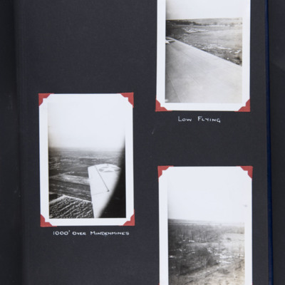
Ariel views
Top right - oblique aerial photograph over wing of open countryside at low level. Captioned 'Low flying'.
Middle left - oblique aerial photograph over wing of farmland. Captioned '1000' over Mindenmines'.
Bottom right - oblique aerial photograph…
Middle left - oblique aerial photograph over wing of farmland. Captioned '1000' over Mindenmines'.
Bottom right - oblique aerial photograph…
Tags: aerial photograph; training
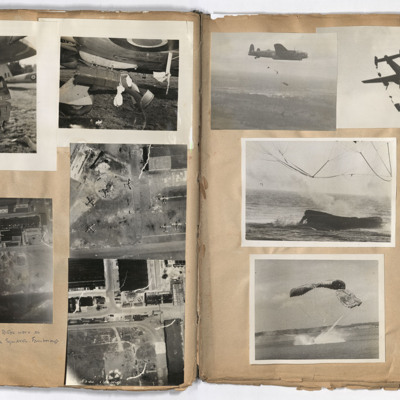
Armaments squadron
Left page: top left and right, damage to the undercarriage of an aircraft. Middle right, aerial view of aircraft on the ground.
Bottom left and right, aerial views of an airfield, annotated '4 pages to do with Bob's work as test pilot Armaments…
Bottom left and right, aerial views of an airfield, annotated '4 pages to do with Bob's work as test pilot Armaments…
Tags: aerial photograph; air sea rescue; aircrew; Halifax; Lancaster; pilot
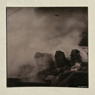
Attack on Gestapo Headquarters
Most of area obscured by smoke and dust, two badly damaged buildings in the foreground, attacking Mosquito in distance. On the reverse 'Taken by Sid Moulds over the target 'Aarhus University Gestapo Headquarters raid 31 October 1944.'
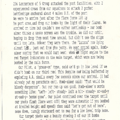
Attack on the Lützow at Gydnia [sic]
Describes attack by 236 Lancaster of 5 Group on port facilities and two aircraft to attack two pocket battleships anchored off the port. Gives a detailed description of attack on ship which was hit with three of their ten bombs.
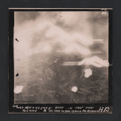
Aulnoye
Vertical aerial photograph of Aulnoye. The image is largely obscured by cloud or fires and anti-aircraft fire. The bottom half has roads and an urban area surrounded by fields. Captioned ‘608 WKY 10/11.4.44 //NT 8” 9000 [arrow] 030° 0221 …
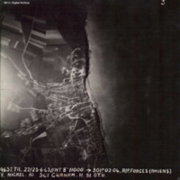
Ault
Target photograph showing coastal village of Ault, just south of the Somme estuary. Coastline and beach can be seen, with village to the left with roads radiating out into countryside. Captioned '3, 9637.TIL.22/23.6.43//NT.8" 11000: 301.02.04.…
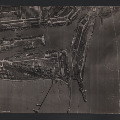
Avonmouth
An aerial vertical photograph of Avonmouth docks. To the bottom of the photograph is the Bristol Channel, stretching up to the right of the photo. Three jetties protrude into the channel. Two tidal locks can be seen, one in the centre and one to the…
Tags: aerial photograph
Axis research station destroyed
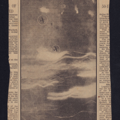
Target photograph showing two Lancasters and anti-aircraft fire. Captioned 'a striking night picture taken during the RAF attack on Peenemunde aircraft research and radiolocation establishment on Aug. 17'.
B. De Cassan
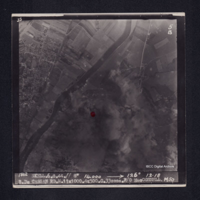
Target photograph of Bois de Cassan. Both banks of river Oise visible, rural area. Red dot left of centre, much of photograph obscured by smoke and dust, but roads and field patterns clearly visible. Captioned '3°F', '5B', '1862 SKELL.6.8.44.// 8"…
Bad Oldesloe
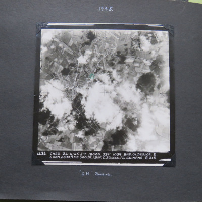
A vertical aerial photograph of Bad Oldesloe. The road pattern is clearly visible despite intermittent cloud cover. it is annotated '1436 Ched 23-4-45//7" 18000 339° 1039 Bad.Oldesloe . E. 6 ANM. 65 DT .9.MC.500.DT.1.BSF.C.32 secs. F/L Guinane . A.…
Bad Oldesloe
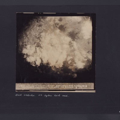
Target photograph showing roads with houses and fields and large amount of smoke in the centre. Captioned '3946 WIT 24.4.45//7" 8000 340 1043, Bad Oldesloe, 10ANM590T.2 ANM64DT.C32 secs F/O Rosser 115'. Underneath 'Bad Oldesloe, 115 Sqdns last raid'.
Battle Area, El Alamein
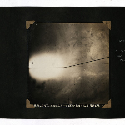
A vertical aerial photograph of the battle area at El Alamein. Much of the detail is obscured by a flash. It is captioned 'B.A.40 NT 1/2/11/42.8-->6500.Battle Area' and annotated 'Battle Area. A flash illuminates the road and railway'.
Tags: 40 Squadron; aerial photograph; bombing
Battle Area, El Alamein
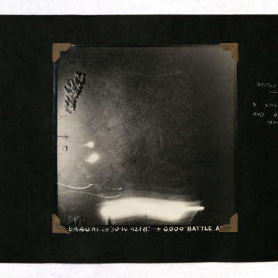
A vertical aerial photograph taken during the battle at El Alamein. It is captioned 'BA 40 NT 29/30-10-42. F8" --> 6,000' Battle Area' and annotated 'Battle Area. 3 sticks of bombs and burning transport'.
Tags: 40 Squadron; aerial photograph; bombing
Battle of Britain Memorial Flight flypast, Elsham Wolds and Humber Bridge
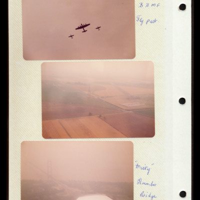
Photograph 1 is of a Battle of Britain Memorial Flight flypast with a Lancaster, Hurricane and Spitfire.
Photograph 2 is an aerial oblique photograph of modern Elsham Wolds.
Photgraph 3 is an aerial oblique photograph of the Humber bridge.…
Photograph 2 is an aerial oblique photograph of modern Elsham Wolds.
Photgraph 3 is an aerial oblique photograph of the Humber bridge.…
Beacon Bay East Beach
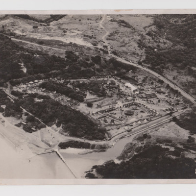
Aerial photograph of a settlement built along a single loop of unpaved road at the confluence of a river and the sea. The area is forested, giving way to open countryside on the hillside beyond. A road alongside has cars travelling on it with cars…
Tags: aerial photograph; training
Beaulieu Airfield
Two oblique aerial photographs.
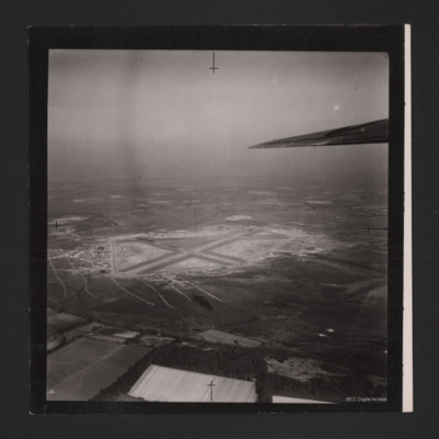
Photo 1 covers the airfield which has a three runway layout.
Photo 2 has the airfield in the distance but in the centre is many buildings. There are lines of unidentified objects covering substantial areas of the…
Photo 1 covers the airfield which has a three runway layout.
Photo 2 has the airfield in the distance but in the centre is many buildings. There are lines of unidentified objects covering substantial areas of the…
Tags: aerial photograph; runway
Beauvoir
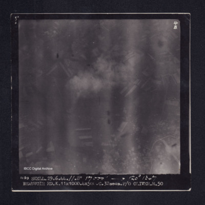
Target photograph of Beauvoir. Rural area, end of runway, taxiway and craters visible lower right. Captioned '5°F', '4B', '1159 SKELL.29.6.44.//.8" 17000' [arrow] 120° 1347 BEAUVOIR RD.K.11X1000.4X500.C.32secs.P/O OLIVER.M.50'. On the reverse…
Beauvoir
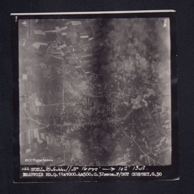
Target photograph of Beauvoir. Rural area smoke and dust top right, roads and many craters clearly visible. Captioned '3F', 5B', 1162 SKELL.29.6.44.//.8" 16000' [arrow] 102° 1348. BEAUVOIR RD.Q.11X1000.4X500.C.32secs.F/SGT CURPHEY.G.50'. On the…
Beauvoir
Target photograph of Beauvois. No detail visible. Captioned '3°F', '4B', '1179 SKELL.29.6.44.//.8" 15000' [arrow] 111° 1346 BEAUVOIR RD.N.11X10-00.4X500.C32secs.S/L STUBBS.O.50'. 'On the reverse ' [underlined] 29.6.44 S/L STUBBS…
Beauvoir
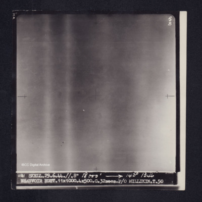
Target photograph of Beauvoir. Nothing visible other than large bands of light. Captioned '3°F', '5B', '1181 SKELL.29.6.44.//.8" 18000' [arrow] 145° 1356 BEAUVOIR RDTT. 11X1000.4X500.C.32secs.P/O MILLIKIN.T.50'. On the reverse '[underlined] 29.6.44…
Beauvoir
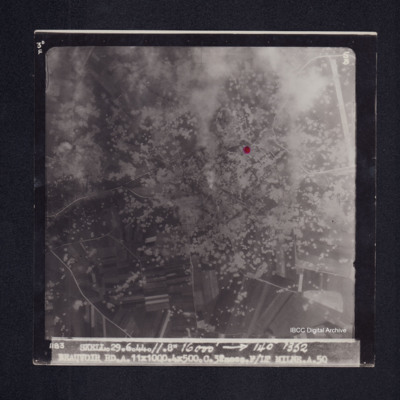
Target photograph of Beauvoir between Bonnières and La Croix Tempex. Open country, roads visible, very many craters, and an airfield top right. Red dot right of centre, some smoke and dust. Captioned '3°F', '5B', '1183 SKELL.29.6.44.//.8" 16000'…
Bergen
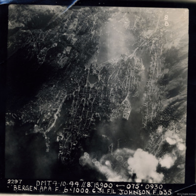
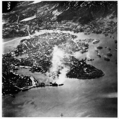
A near vertical aerial photograph of Bergen Harbour, showing its entire layout, with the town in the centre. In the town the seven-sided lake, Lille Lungegardsvannet, next to the Festplassen can be identified. Above this is the large body of water…
Bergen
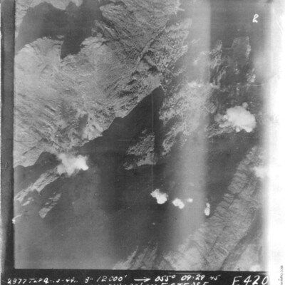
A vertical aerial photograph of Bergen. In the top of the image are the U-boat pens. It is captioned '2877 TLP 4-10-44 8" 12000' --> 055° 09.29 45 Bergen (B) E (9x1000( (2x500) c27 ½ sec F/S Tease E 420'.
Bergen harbour
An oblique aerial photograph of Bergen Harbour showing a number of vessels operating in the waters surrounding the town. Bergen occupies the central part of the image and in the centre left of the image can be seen the water of Lille…
Tags: aerial photograph; bombing

