Browse Items (1442 total)
- Tags: aerial photograph
Sort by:
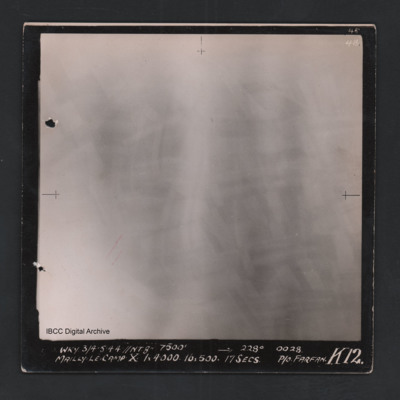
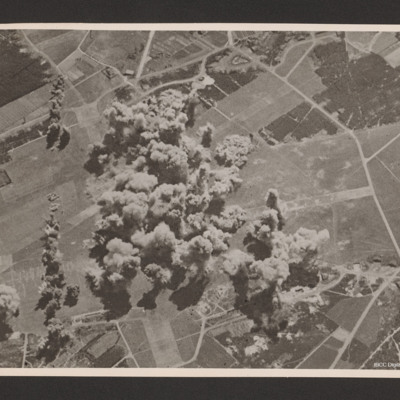
Mailly-le-Camp
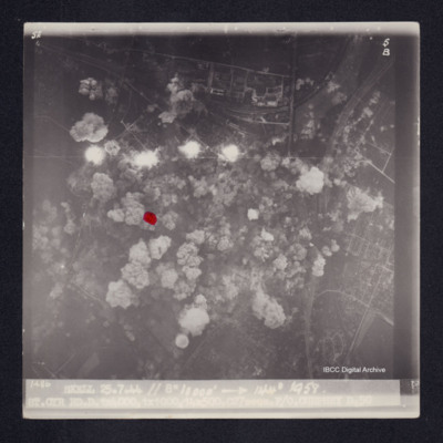
Vertical aerial photograph of Mailly-le-Camp. All of the image is obscured by bombs and smoke. Captioned ‘4B 4B’ and 'WKY 3/4.5.44 // NT 8” 7500’ [arrow] 228° 0028 Mailly-le-Camp X 1 x 4000 16 x 500 17secs P/O Farfan K12’.
Obscured target
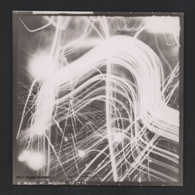
Vertical aerial photograph of unidentified location. Details are obscured by anti-aircraft fire. Captioned ‘5. P(X6) 12 NT 26/27/4/42 F/8” [arrow] TX’.
Obscured target
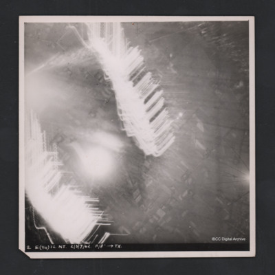
Vertical aerial photograph of unidentified location. Most detail is obscured by anti-aircraft fire. Some roads and fields can be made out. Captioned ‘2. E(Y4) 12 NT 2/3/7/42 F/8” [arrow] TX’.
Rostock
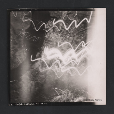
Vertical aerial photograph of Rostock. Most detail is obscured by anti-aircraft fire. The Unterwarnow and the Altstadt are partially visible. Captioned ‘1. T(Y5) 12 NT 26/27/4/42 F/8” [arrow] TX’.
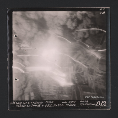
Mailly-le-Camp
Vertical aerial photograph of Mailly-le-Camp. Most of the image is obscured by bombs and smoke. Some roads and the camp can be seen. Captioned ‘4B 4B’ and '835 WKY 3/4.5.44 // NT 8” 8000’ [arrow] 208° 0028 Mailly-le-Camp X 1 x 4000…
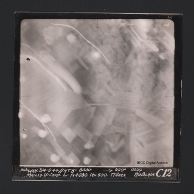
Mailly-le-Camp
Vertical aerial photograph of Mailly-le-Camp. Most of the image is obscured by anti-aircraft fire. Some roads and fields can be seen. Captioned at top right ‘4B 4B’. Captioned along the bottom ‘‘848 WKY 3/4.5.44 // NT 8” 8000’ [arrow]…
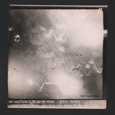
Friedrichshafen
Vertical aerial photograph of Friedrichshafen. Most of the image is obscured by smoke, clouds and anti-aircraft fire. Near the centre a regular street pattern is visible. Captioned ‘4B 4B’ and '797 WKY 27/28-4-44 // NT 8” 18000’ [arrow]…
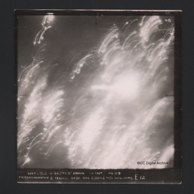
Friedrichshafen
Vertical aerial photograph of Friedrichshafen. All of the image is obscured by smoke, clouds and anti-aircraft fire. Captioned ‘4B 4B’ and '777 WKY 27/28-4-44 // NT 8” 20000’ [arrow] 170° 02.09 Friedrichshaven S 1 x 4000 6 x 30 6 x 4…
Kiel
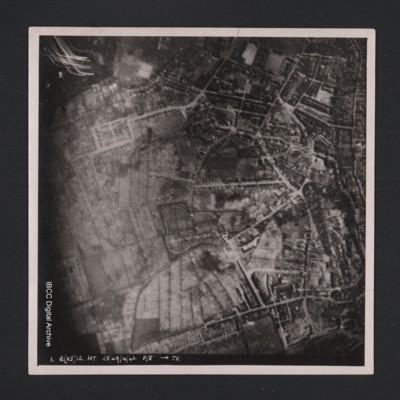
Vertical aerial photograph of an urban area at the top and right hand side. Street patterns and parks are clearly visible. At the bottom it is captioned ‘1. R(X5) 12 NT 28/29/4/42 F/8” [arrow] TX’.
Lancaster under attack from anti-aircraft fire
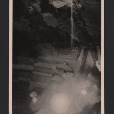
Vertical aerial photograph of unnamed location. A Lancaster is silhouetted under the photo aircraft. It has dropped bombs and is now under attack from ant-aircraft fire which can be seen heading towards the aircraft.
Mailly-le-Camp
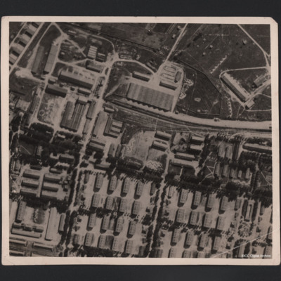
Aerial photograph of large military camp, showing it before and after bombing. A railway line runs in from the right centre of the photograph and terminates in upper centre, having split into three lines. There is a train in situ on the main line.…
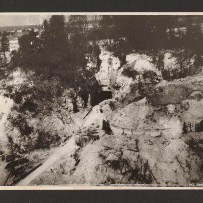
F/Bomb Depot at St. Leu d'Esserent
Low level oblique aerial photograph of a narrow road leading from the bottom left up a valley to the centre where it meets the square entrance to a tunnel in a hillside. To the left of the valley and above the entrance are trees.
Gilze Rijen
Oblique aerial photograph of an Gilze Rijen airfield. Runways going from bottom middle to top and left to middle. A large number of bomb explosion visible in the centre of the airfield with one string of bombs offset to the left running bottom to…
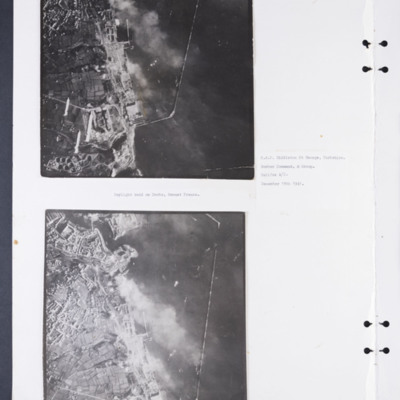
Daylight attack on Brest docks
Two vertical aerial photographs of the docks at Brest. The upper photographs shows some of the bombs being dropped. Captioned: 'Daylight raid on Docks, Breast [sic] France. R.A.F. Middleton St George, Yorkshire. Bomber Command, 4 Group. Halifax A/C.…
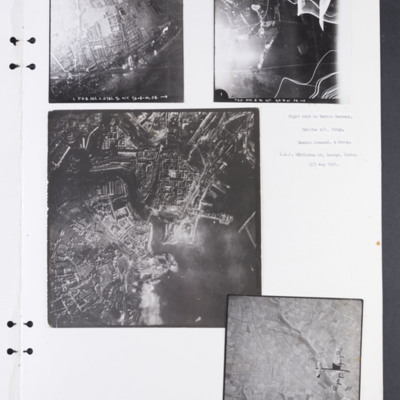
Berlin and Brest
Photograph 1 shows a railway running left to right through an urban area. Captioned '1. J.D.S. 382.X.12782.76.N/T.7/8 -8-41 F.8. ➝'.
Photograph 2 shows a mostly rural area, much obscured by anti-aircraft fire and light flare. Captioned 'T.K.A.…
Photograph 2 shows a mostly rural area, much obscured by anti-aircraft fire and light flare. Captioned 'T.K.A.…
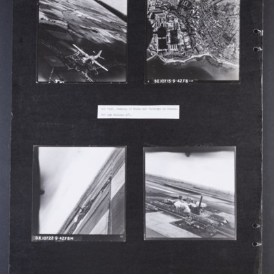
Bombing of docks and factories in France
Photograph 1 is an air-to-air photograph of a Boston in flight, taken from above and to the front.
Photograph 2 is a vertical photograph of docks and coastline with Cherbourg behind. Captioned 'D.E.107 15-9-42.F8➝'
Photograph 3 and 4 are aerial…
Photograph 2 is a vertical photograph of docks and coastline with Cherbourg behind. Captioned 'D.E.107 15-9-42.F8➝'
Photograph 3 and 4 are aerial…
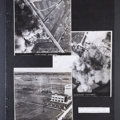
Low level bombing over Orleans
Photograph 1 is a vertical aerial photograph of a transformer and switching station at Orleans. Most of it is obscured by bomb explosions and smoke. A wide road runs diagonally across the image. Captioned 'R1.342F 3 OCT 43//…
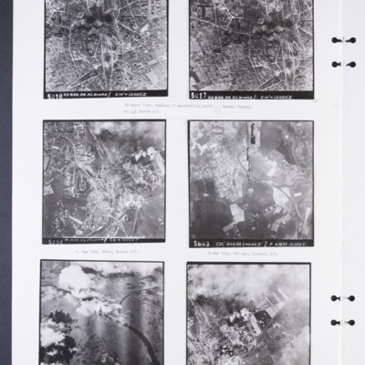
88 and 226 Squadron aerial photographs
Photograph 1 and 2 are sequential vertical aerial photographs of the marshalling yards at Arras. They are partly obscured by smoke. They are numbered 5018 and 5017 and captioned 'RS 636 88 30.APR44//D14" → 10,000'Z'. Captioned: '30 April 1944,…
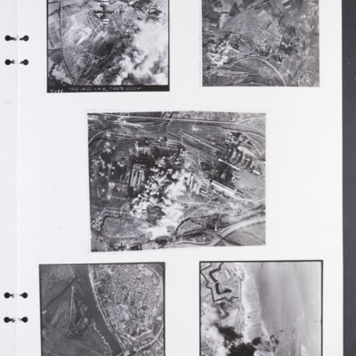
Colombelles steel works, Arnhem, and Breskens fort
Photograph 1 is of a vertical of Colombelles steel works marshalling yard. Much of the ground is obscured by cloud and bomb explosions. There is a Boston with invasion stripes in the top half of the image. It is annotated '5018 F342 134 22 Jun 44…
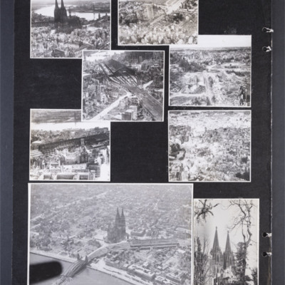
Cologne 15 August 1945
Photograph 1 is a low level oblique photograph of the cathedral.
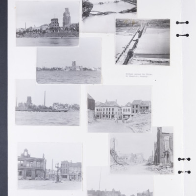
Photograph 2 is a low level oblique photograph of a church, a bridge and the river Rhine.
Photograph 3 and 5 are low level oblique photographs of the main railway station.
Photograph…
Photograph 2 is a low level oblique photograph of a church, a bridge and the river Rhine.
Photograph 3 and 5 are low level oblique photographs of the main railway station.
Photograph…
Tags: aerial photograph; bombing; Cook’s tour
Bomb damaged German cities
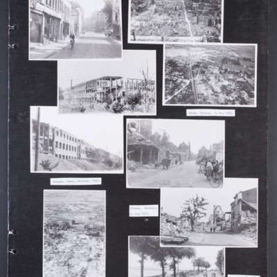
Photograph 1 is a street scene of damaged building with a girl cycling. Captioned 'Krefield, [sic] Germany 5 Aug 1945.'
Photograph 2 is a low level oblique photograph of a badly damaged city. In the distance are port cranes.
Photograph 3 and 5 are…
Photograph 2 is a low level oblique photograph of a badly damaged city. In the distance are port cranes.
Photograph 3 and 5 are…
Tags: aerial photograph; bombing; Cook’s tour
Bomb damage to Emmerich, Cologne and Weser
Photographs 1, 3 and 5 show damage to buildings on the riverside.
Photograph 2 is a low level oblique photograph of Cologne, with bomb damaged Hohenzollern Bridge.
Photograph 4 is a low level oblique photograph of Wesel with bomb damaged…
Photograph 2 is a low level oblique photograph of Cologne, with bomb damaged Hohenzollern Bridge.
Photograph 4 is a low level oblique photograph of Wesel with bomb damaged…
Tags: aerial photograph; bombing; Cook’s tour
Reconnaissance photographs
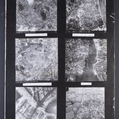
Photograph 1 is a vertical aerial photograph of the city of Aachen. There are numbered and arrowed points of interest on the image plus a north arrow. It is annotated 'R405 B/218.3.PRU 22.14.7.41 28" ' Captioned '14th July 1941 Archen [sic],…
St. Cyr
Target photograph of St. Cyr, urban area, street patterns visible although largely obscured by smoke and dust from bomb explosions. Two sets of railway tracks from top right corner, four bomb explosions and many bomb craters. A red dot is visible on…
J/Laroche
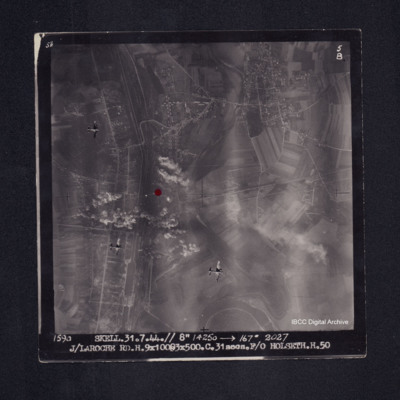
Target photograph of Laroche - Migennes. Largely rural but with built up area along canal that runs top to bottom on left side of photograph and also across the top third, street patterns clearly visible. Railway with extensive sidings runs alongside…

