Browse Items (1442 total)
- Tags: aerial photograph
Sort by:
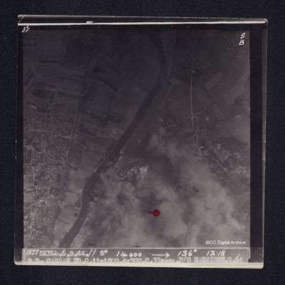
Bois de Cassan
Target photograph of Bois de Cassan. Red dot lower centre. River Oise, bomb craters, roads and field patterns all visible. Partially obscured by bomb explosions, smoke and dust. Captioned '3°F', '5B', '1877 SKELL.6.8.44.// 8" 14000 [arrow] 136°…
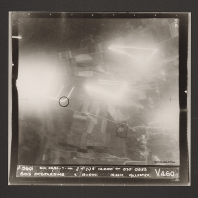
Bois Desjardins
A vertical aerial photograph identified as Bois Desjardins. Much of the image is obscured by bright lights. Captioned '5691 BIN. 25/26-7-44 //NT(C) 8" 10.000' [arrow] 070° 0253 Bois Desjardins Y. 18x500. 19 secs. P/O. Lester. V 460'.
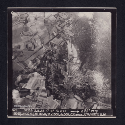
Bois-de-Cassan
Target photograph of Bois-de- Cassan. Rural area, roads, woods, field patterns and houses clearly visible. Captioned '3°F', '4B', '1614 SKELL. 2.8.44 // 8" 16000' [arrow] 085° 1719 BOIS-DE-CASSAN RD.M.11X1000.4X500.C33secs.F/O. WHITE. M.61'. On the…
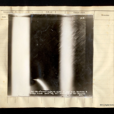
Bologna
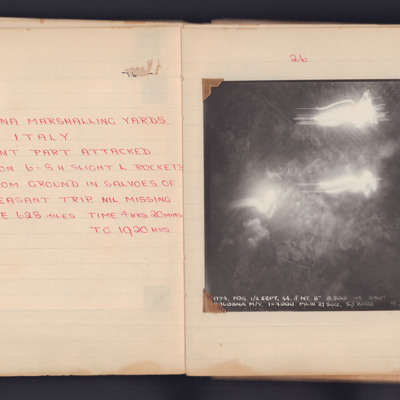
Vertical aerial photograph of Bologna. Field patterns are visible but the centre and lower portions of the image are obscured by bright lights, flares or anti-aircraft fire. Captioned 'A4 1943. FOG.12/13 Sept 44//NT F8 10300' [arrow] 265° 21.23…
Bologna
A target photograph taken on an operation to the Bologna Main Marshalling Yards. Fields and roads are visible in most of the image. There is an area of glare at the left edge, which obscure some ground detail. The photograph is annotated 'A4' and…
Bologna
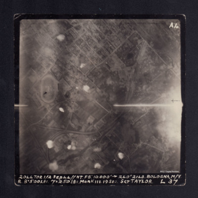
A vertical aerial photograph taken during bombing of Bologna. There are several small bomb explosions and anti-aircraft fire. The photograph is captioned '2044 TOR 1/2 Sep 44//NT F8" 10,000' -->240° 2143 BOLOGNA. M/Y R 8x500lbs 7x250lbs Mark III. 19…
Bologna Marshalling Yards
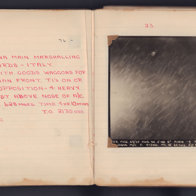
On the left page is a handwritten summary of an operation to the marshalling yards in Bologna, Italy.
On the righthand page is a target photograph taken on that operation. The central part is obscured by smoke and light but around this some roads…
On the righthand page is a target photograph taken on that operation. The central part is obscured by smoke and light but around this some roads…
Bomb damage
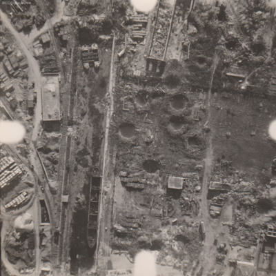
Reconnaissance photograph at low level of goods yard with significant bomb damage with craters and destroyed buildings throughout. A drained canal runs top to bottom with large barge aground against quay and another smaller pair tied together at top.…
Bomb damage
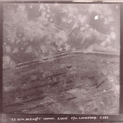
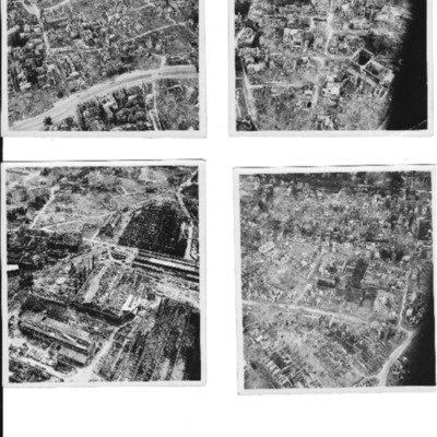
Four photographs of damage to German cities taken on two of the 'Cooks Tours' flown by no 153 Squadron.
The first has the caption 'T3 SCM 30.5.45//7" HAMM 2,000'. F/LT LANGFORD C.153 and shows Hamm railway marshalling yard with tracks running from…
The first has the caption 'T3 SCM 30.5.45//7" HAMM 2,000'. F/LT LANGFORD C.153 and shows Hamm railway marshalling yard with tracks running from…
Bomb damage and aircraft
13 photographs showing bomb damage and aircraft.
Three photographs of Dortmund residential areas. Only skeletons of buildings are remaining.
Heavily bombed Krupp works
Four bombs in flight
Hamm Railway bridge. In the foreground is the destroyed…
Three photographs of Dortmund residential areas. Only skeletons of buildings are remaining.
Heavily bombed Krupp works
Four bombs in flight
Hamm Railway bridge. In the foreground is the destroyed…
Tags: aerial photograph; aircrew; B-25; bombing
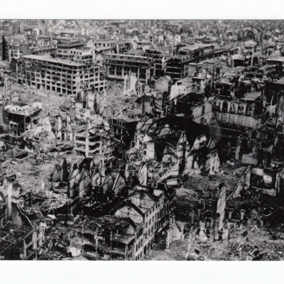
Bomb damage to Cologne
View of city centre with many badly damaged buildings as well as some completely destroyed.
Additional information about this item was kindly provided by the donor.
Additional information about this item was kindly provided by the donor.
Tags: aerial photograph; bombing
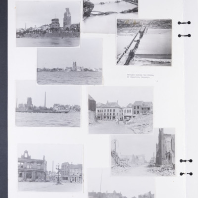
Bomb damage to Emmerich, Cologne and Weser
Photographs 1, 3 and 5 show damage to buildings on the riverside.
Photograph 2 is a low level oblique photograph of Cologne, with bomb damaged Hohenzollern Bridge.
Photograph 4 is a low level oblique photograph of Wesel with bomb damaged…
Photograph 2 is a low level oblique photograph of Cologne, with bomb damaged Hohenzollern Bridge.
Photograph 4 is a low level oblique photograph of Wesel with bomb damaged…
Tags: aerial photograph; bombing; Cook’s tour
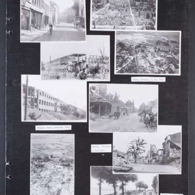
Bomb damaged German cities
Photograph 1 is a street scene of damaged building with a girl cycling. Captioned 'Krefield, [sic] Germany 5 Aug 1945.'
Photograph 2 is a low level oblique photograph of a badly damaged city. In the distance are port cranes.
Photograph 3 and 5 are…
Photograph 2 is a low level oblique photograph of a badly damaged city. In the distance are port cranes.
Photograph 3 and 5 are…
Tags: aerial photograph; bombing; Cook’s tour
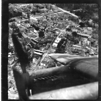
Bomb Damaged Town
An oblique aerial photograph of a town destroyed by bombing. The starboard wing of an aircraft obscures the bottom of the image.
Tags: aerial photograph; bombing; Cook’s tour; Lancaster
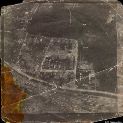
Bomb damaged town and marshalling yard
Unidentified aerial oblique photograph of a damaged urban area and large marshalling yard. Captioned 'J/83'.
Tags: aerial photograph; bombing
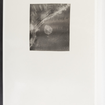
Bomb in sea
Target photograph showing coast running bottom left to top right with sea to the right. In the centre a bomb explosion in the sea.
Bombed city
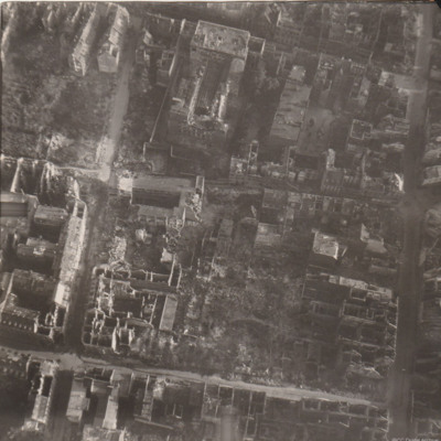
Reconnaissance photograph of part of a city with damaged buildings.
Bombed synthetic oil plant at Politz
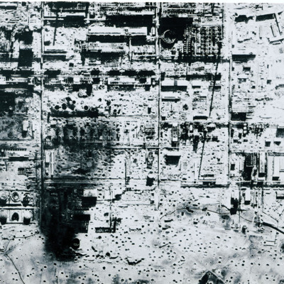
Reconnaissance photograph of severely bomb damaged synthetic oil plant at Politz. Many bomb craters and destroyed buildings.
Bomber boys were on target
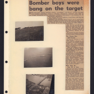
Top right - newspaper cutting notes that rain an poor weather nearly led to the cancellation of the RAF Victory fly-past over London. Report by correspondent airborne in formation. Fly-past of 307 planes of RAF and Fleet Air Arm. Notes that 35…
Bombing
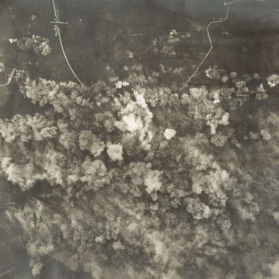
A vertical aerial photograph of a daylight bombing operation. Six Lancasters can be seen at lower levels. Below them are lots of explosions and smoke. Open countryside, with few buildings but several minor roads, can be seen around the bombing area.
Bombing and people
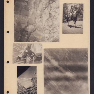
Five photographs from an album page. From top left to bottom right:
1. A target photograph showing open countryside. On the left is a line of bomb craters in fields. Roads are also visible here as is a railway line. On the right, the ground is…
1. A target photograph showing open countryside. On the left is a line of bomb craters in fields. Roads are also visible here as is a railway line. On the right, the ground is…
Tags: aerial photograph; animal; bombing; target photograph
Bombing and people
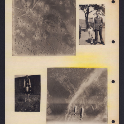
Top left - target photograph showing open countryside with many bomb craters.
Top right - Arthur Pearce in uniform holding hand of young child on the left. Another child is partly visible to the left of the photography. In the background a tree…
Top right - Arthur Pearce in uniform holding hand of young child on the left. Another child is partly visible to the left of the photography. In the background a tree…
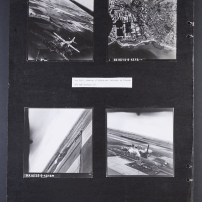
Bombing of docks and factories in France
Photograph 1 is an air-to-air photograph of a Boston in flight, taken from above and to the front.
Photograph 2 is a vertical photograph of docks and coastline with Cherbourg behind. Captioned 'D.E.107 15-9-42.F8➝'
Photograph 3 and 4 are aerial…
Photograph 2 is a vertical photograph of docks and coastline with Cherbourg behind. Captioned 'D.E.107 15-9-42.F8➝'
Photograph 3 and 4 are aerial…
Bombing photographs
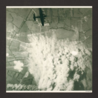
Target photograph shows extensive smoke from explosions obscuring the main part of the photograph. The surrounding view is of a rural area with fields and several converging minor roads. A Lancaster is visible top centre going from left to right.…
Bombs dropping
A vertical aerial photograph showing multiple bombs being dropped. The ground is mostly obscured by cloud and explosions. A the bottom of the image are fields and buildings.

