Browse Items (1442 total)
- Tags: aerial photograph
Sort by:
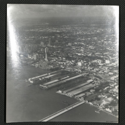
Steamship Docks, Miami
An oblique aerial photograph of the west end of the Venetian Causeway Bridge. The docks were known as the Steamship docks but have now been filled in.
Tags: aerial photograph
Sterkade
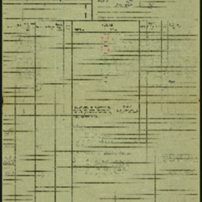
Operation 26 for the crew. Three navigation log sheets showing the route to be taken and the observations made throughout the operation. The plotting map shows the coasts of England and Holland and the route to Sterkrade.
The target photograph…
The target photograph…
Sterkrade
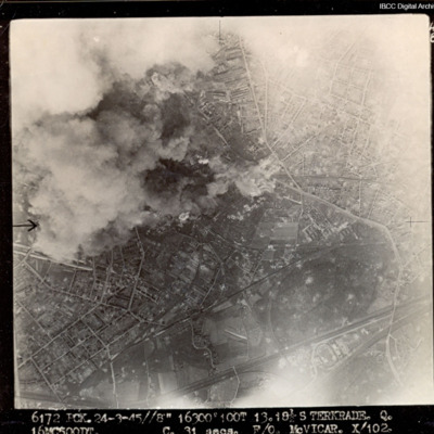
Target partially obscured by cloud and dust. Captioned '6172 PCK 24-3-45 //8" 16300 100T 13 181/2 STERKRADE Q [?] C 31secs F/O McVICAR. X 102'.
Sterkrade
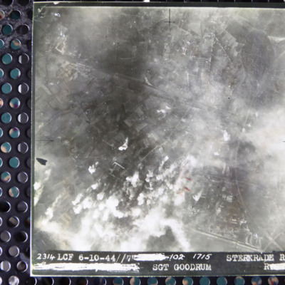
A vertical aerial photograph of an attack on Sterkrade. Road patterns and housing are clearly visible. It is captioned '2314 LCF 6-10-44 // 7 [deleted]/02 1715 Sterkrade Rd [deleted] Sgt Goodrum R [deleted]'
Sterkrade
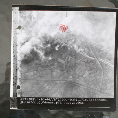
Target photograph showing built up area in top half with road and railway running left to right. Smoke from bomb explosions top left. Captioned '2630 DRF.6-10-44//8"17500 >094.1716.Sterkrade. R.16x500.C.34 secs.F/S Jubb.R.462.'.
This item was sent…
This item was sent…
Sterkrade and Hannover
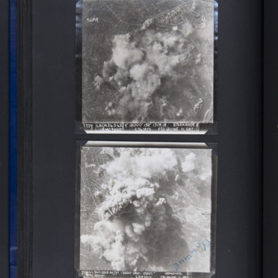
Top - target photograph showing smoke from bomb explosions in centre with some built up area to top left. Captioned '3737 LSGN 24.3.45 Y 18000' ISO 13.19.18 STERKRADE E, 18MC500DT, C34SECS, F/O QUINE. H. 582'.
Bottom - target photograph showing…
Bottom - target photograph showing…
Stettin
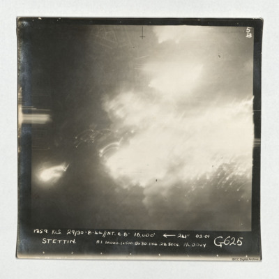
A vertical aerial photograph taken during an operation at Stettin. Much of the image is obscured by light and explosions but there are street patterns visible at the top. It is captioned '1359 KLS 29/30-8-44//NT C. 8" 16,000'
Stettin
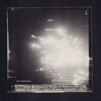
Target photograph of Stettin. Completely obscured by light streaks and balls of light. Captioned '3[degreesF', '8B', '2173 SKELL 16/17.8.44 // NT (C) 8" 15000' [ARROW] 138[DEGREES] 0106 STETTIN RD.A.1X2000,12JX500.30 secs. F/O.MARTIN A.61'. On the…
Stettin
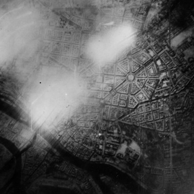
Reconnaissance photograph of Stettin. Urban area shown with the Centrum being clearly visible right of centre with roads radiating out. The West Oder river is to the middle left to bottom right of the photograph and parkland lower right above the…
Stettin
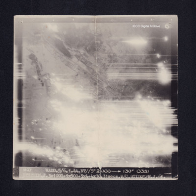
Target photograph of Stettin. Mainly obscured by light streaks and balls of light. Visible are urban areas, no clear detail visible. Captioned '6', '1627 WADD.5/6.1.44.NT//5" 21000 [arrow] 130° 0351 STETTIN.J.3X1000+1X500+9X4+4X30.31secs.W/C.…
Storage area
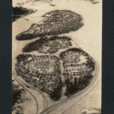
Oblique aerial photograph of logs stored in four separate areas on a frozen lake divided by vehicle tracks.
Tags: aerial photograph
Strike to defend
A 25 page account of the preparation for, and carrying out of a maximum effort operation against Duisburg by Lancasters of 83 Squadron at RAF Wyton, part of 8 Group Bomber Command. Account provides detailed description of preparations, briefing and…
Tags: 5 Group; 8 Group; 83 Squadron; aerial photograph; air gunner; aircrew; anti-aircraft fire; Bennett, Donald Clifford Tyndall (1910-1986); bomb aimer; bombing; briefing; debriefing; ditching; flight engineer; Holocaust; Lancaster; navigator; Pathfinders; perception of bombing war; pilot; RAF Wyton; searchlight; target indicator; target photograph; wireless operator
Stuttgart
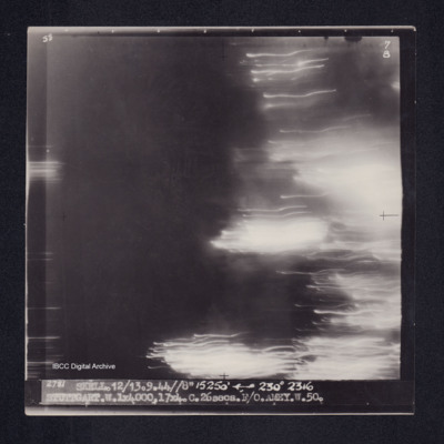
Target photograph of Stuttgart. No detail visible, many light streaks right side of photograph. Captioned '5°F', '7B', '2781 SKELL.12/13.9.44//8" 15250' [arrow] 230° 2316 STUTTGART.W.1X4000.17X4.C.26secs.F/O.AMEY.W.50.'. On the reverse…
Stuttgart
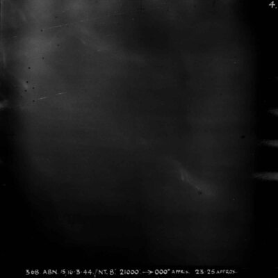
Almost entirely black target photograph. Captioned '368 ABN 15/16-3-44//NT 8", 21000, 000degrees APPRX, 2325 APPROX, STUTTGART R, 5x30, 5x4 INC 32 SECS, W/CR LAWRENCE M 78 SQN'.
Stuttgart
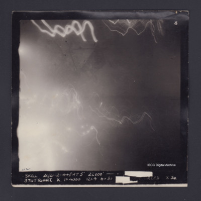
Target photograph of Stuttgart. A number of light streaks, no detail visible. Captioned '8', '112 SKELL 20/21.2.44//NT 5" 22000' [arrow] [track and time censored] STUTTGART. X. 1X4000 12X4 6X30 [exposure censored] REED X 50.' [reverse not scanned]
Stuttgart
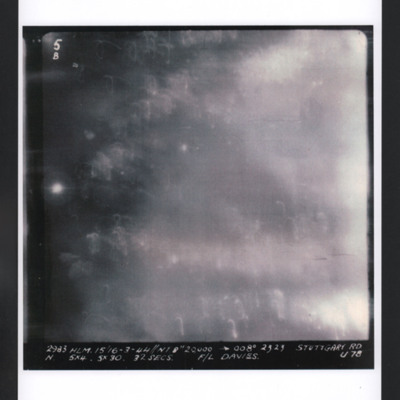
Target photograph for an operation to Stuttgart. Light traces and glare cover most of the image but no ground detail is visible. It is annotated '5B' and is captioned:
2983 HLM. 15/16-3-44 //NT 8" 20,000. → 008º 2323 STUTTGART RD
N. 5x4.…
2983 HLM. 15/16-3-44 //NT 8" 20,000. → 008º 2323 STUTTGART RD
N. 5x4.…
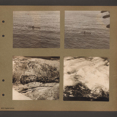
Submarine at sea and mountain views
Top left is an aerial inclined photograph of sea with a submarine heading left to right in the centre.
Top right is a similar aerial inclined photograph of a submarine at sea heading left to right. In the top right corner is part of the aircraft…
Top right is a similar aerial inclined photograph of a submarine at sea heading left to right. In the top right corner is part of the aircraft…
Tags: aerial photograph; submarine
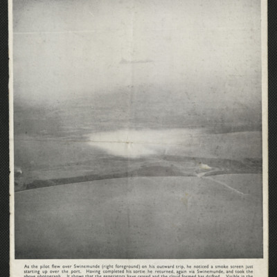
Swinemünde
The air to ground photograph shows a smokescreen having drifted away from the area it was intended to protect. It also shows the smoke from over 100 miles away created by a bombing raid on the Erkner ball bearing factory.
Tags: aerial photograph; bombing
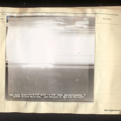
Szekesfehervar
Vertical aerial photograph of Szekesfehervar. In the lower half some street detail is visible but all of the top half is obscured by bright light and tracers. Captioned 'A4 1989 40/4. 19 Sept 44 F8"//NT. 9100' [arrow] 049°. 2046. Szekesfehervar.T.…
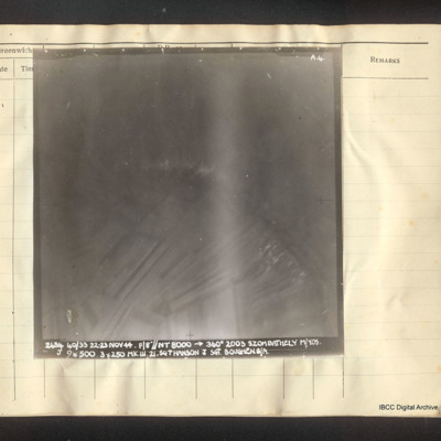
Szombathely
Vertical aerial photograph of Szombathely. Field pattern and some buildings are visible as well as a river. It is captioned 'A4 2484 40/33 22-23 Nov 44. F/8"//NT 8000 --> 360° 2003 Szombathely M/YOS. J 9x500 3x250 Mk III Sgt Hanson J Sgt. Boughen…
Szombathely
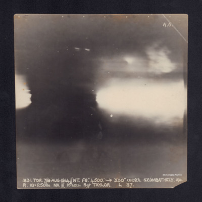
A vertical aerial photograph taken during the bombing of Szombathely. No detail is visible due to anti-aircraft explosions. It is captioned '1831.TOR.7/8 AUG.1944//NT.F8". 4500: ->330°0102½.Szombathely.A/D
R.18x250lbs.MKIII 15secs.Sgt…
R.18x250lbs.MKIII 15secs.Sgt…
Szombathely
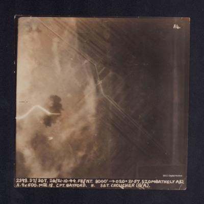
A vertical aerial photograph taken during the bombing of Szombathely aerodrome. The left side of the image is obscured by explosions and smoke. It is captioned ' 2393. 37/307. 20/21.10.44. F8//NT.8000' -->020°. 21.57.Szombathely A/D. X. 9x500. MkIII…
Szombathely
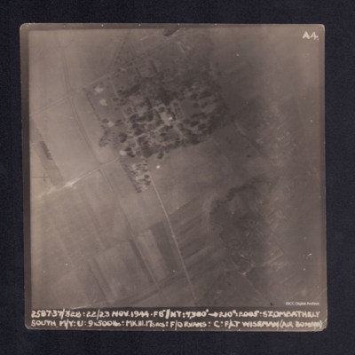
A vertical aerial photograph taken during the bombing of Szombathely South marshalling yard. Fields and a wood are visible with connecting grid of road. It is captioned ' 2. 37/328. 22/23 NOV.44. F8"//NT.7300' -->210°. 2005 . Szombathely South M/Y.…
Taj Mahal
An oblique aerial photograph of the Taj Mahal taken from an Avro York.
Tags: aerial photograph; York
Target decoy ship
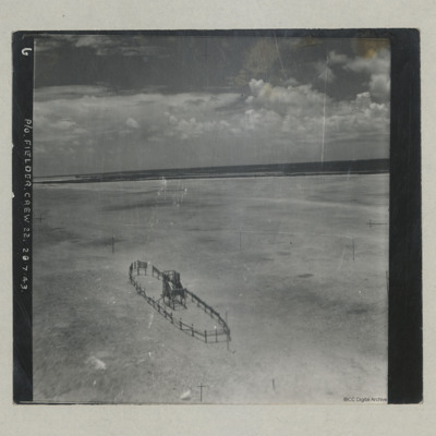
Aerial photograph of a target decoy ship made from scaffold poles, situated on a sandy beach. It is annotated 'P/O Fielder. Crew 22. 26.7.43'.
Tags: aerial photograph; training

