Browse Items (1442 total)
- Tags: aerial photograph
Sort by:
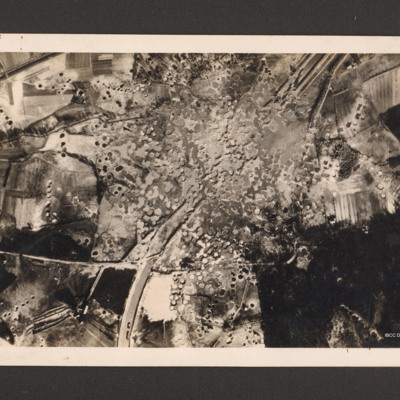
Royal Air Force Bomber Command attacks on enemy communications
Reconnaissance photograph showing the Mitelland Canal at Gravenhorst running from top right to centre bottom. A large area in the centre is completely covered with craters and the canal has disappeared. To the right bottom a large wooded area and to…
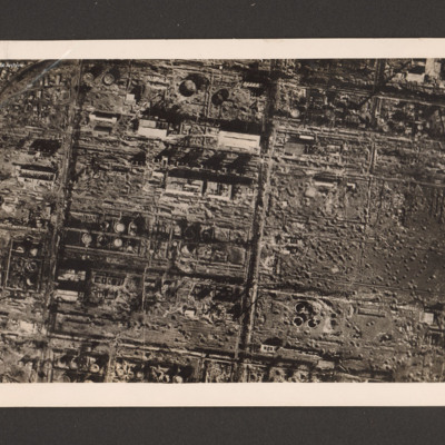
Royal Air Force destroys German synthetic oil plant
Reconnaissance photograph of the destroyed Zeitz synthetic oil plant, Saxony-Anhalt, Germany. On the left side within a grid a large number of damaged oil tanks, manufacturing buildings and installations. On the right three destroyed oil tanks at…
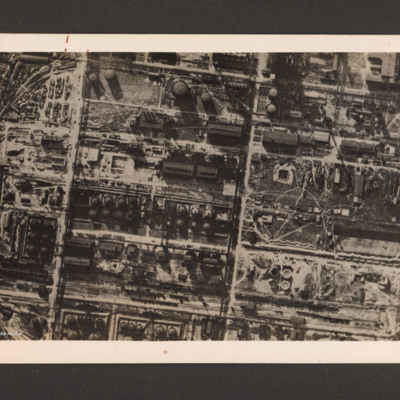
Royal Air Force destroys German synthetic oil plant
Reconnaissance photograph of a German synthetic oil plant. Within a grid pattern a large number of oil tanks, buildings, pipeline and oil manufacturing installations. A railway runs along the bottom. On the reverse 'R.A.F. destroys German synthetic…
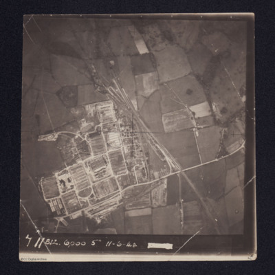
Royal Electrical & Mechanical Engineers (REME) Old Dalby, 35 Base Workshops
Aerial photograph of a newly constructed facility with rail tracks leading into at least two tunnels.
It is annotated '711 812 6000 5" 11-6-44'
It is annotated '711 812 6000 5" 11-6-44'
Tags: aerial photograph
Royan
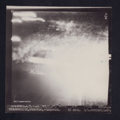
Target photograph of Royan. Almost completely obscured by light streaks and a ball of light. no clear detail visible. Captioned '8°F', '6CLB', '4179 SKELL.4/5.1.44//NT(C).8" 8000 213° 0402 ROYAN.L. 1HC4000(M) IN,5GP500DT,11MC500DT, 23secs. S/L.…
Rüsselsheim
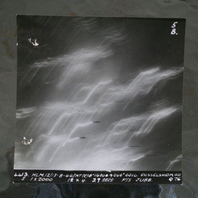
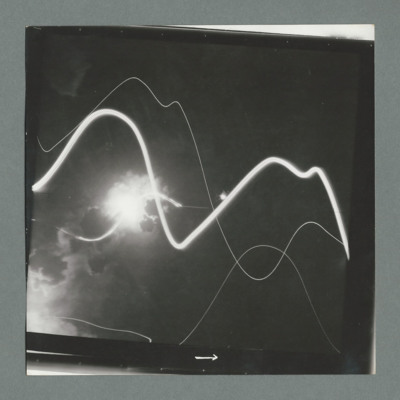
Night target photograph showing tracer lines. Captioned '4413 HLM12/13-8-44//NT8" 16000 >060 degrees 0016. Russelsheim RD, S 1x2000 12x4 29 Secs F/S Jubb Q76'.This item was sent to the IBCC Digital Archive already in digital form. No better…
Rural area
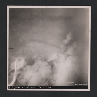
Vertical aerial photograph of unidentified location. Detail are largely obscured by clouds, smoke and anti-aircraft fire. Towards the top a road and fields are visible. Captioned ‘2. S (X8) 12 NT 31/1-1/2-42 TX. F/8” [arrow].
Russelheim
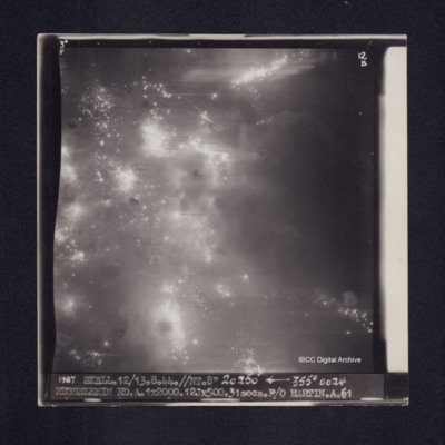
Target photograph of Russelheim. Many points of light and larger balls of light. Captioned '3°F', '12B', '1987 SKELL.12/13.8.44.//NT.8" 20250' arrow] 355° 0024 RUSSELHEIM RD.A.1X2000.12JX500.31secs.F/O MARTIN.A.61'. On the reverse 'F/O MARTIN…
Südbrücke in Cologne and marshalling yard
Two aerial photographs.
The first is a target photograph taken at high level. Bombs are visible falling to centre left. A railway is seen running left to right in the bottom half, with marshalling yard in the centre. Below the railway is a river…
The first is a target photograph taken at high level. Bombs are visible falling to centre left. A railway is seen running left to right in the bottom half, with marshalling yard in the centre. Below the railway is a river…
Saarbrucken
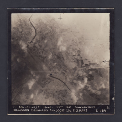
A vertical aerial photograph of the centre of Saarbrücken, orientated with south-east at the top and clearly showing the River Saar. Cloud and/or smoke covers parts of the town but residential areas, the railway and other details can still be seen.…
Saint-Leu-d'Esserent
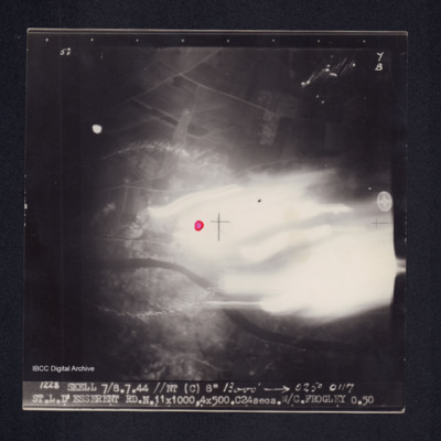
Target photograph of Saint-Leu-d'Esserent. Centre right of photograph obscured by light streaks, river Oise from left to right, red dot in centre. Top third appears rural. Captioned '5°F', '7B', '1228 SKELL 7/8.7.44 //NT (C) 8" 13000' [arrow] 025°…
Salcano railway bridge
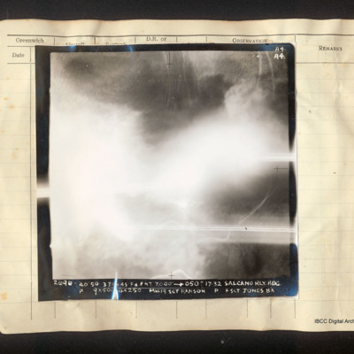
Vertical aerial photograph of the Salcano railway bridge, most of the frame is obscured by cloud. There is a road on the right side and some railway lines at the top. Captioned 'A4 A4 2696 40/50 3 Jan 45 F8//NT 7000' [arrow] 050° 17.32 Salcano Rly.…
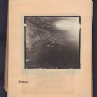
Salonika
Target photograph showing a coastline running middle left to middle right. Bay on left, town and port towards the right side. Explosions visible in bay. Captioned '1912.104/6, 21/22 Sept 44, F8, NT, 8100 ft,→ 130 degrees, 20.01'. Handwritten below…
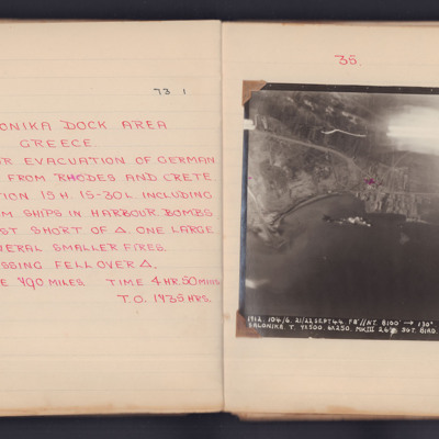
Salonika
A target photograph for an operation to Salonika (Thessaloniki). Thessaloniki Bay occupies the lower half of the image and the upper right corner is obscured by light traces. The coastline and dock area are visible. There appears to be a ship in the…
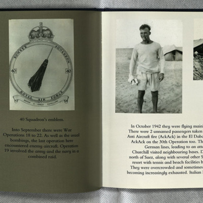
Sam Saunder's Operations
Some details about operations carried out by Sam after he transferred to 40 squadron.
Photo 1 is a vertical aerial photograph partly obscured by tracer fire.
Photo 2 is the 40 squadron crest.
Photo 3 is Sam in shorts and tee shirt in front of a…
Photo 1 is a vertical aerial photograph partly obscured by tracer fire.
Photo 2 is the 40 squadron crest.
Photo 3 is Sam in shorts and tee shirt in front of a…
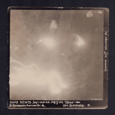
San Benedetto Pontoon Bridge
A vertical aerial photograph of the San Benedetto pontoon bridge. Most of the image is obscured by anti-aircraft fire. It is captioned '2249. 37/275. 30/1 Oct 44. F8"//NT.7500' --> S. BENEDETTO PONTOON BR.Q. Cpt BAYFORD. P. Sgt CROUCHER (Air…
Sangatte
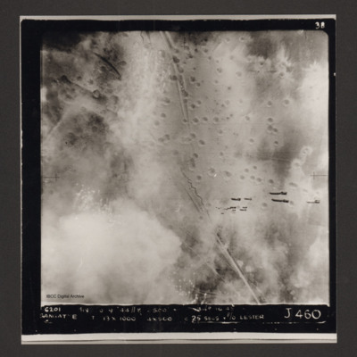
Vertical aerial photograph of Sangatte. A road and trenches run from top to bottom and there are many bomb craters. A stick of bombs can be seen falling from the aircraft. Captioned '6201 BIN [undecipherable] 9-44 //8 /500'
Sangatte and course photograph
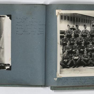
LH page, target photograph of the coastline southwest of Sangatte, with the current D940 road. Captioned '953 EWS 20.9.44// 8" 3000 120 (degrees) 1640 Sangatte ? U 13 X 1000 4 X 500 16secs F/L Josey U 103'. Handwritten caption 'Daylight on coastal…
Santo Stefano Harbour
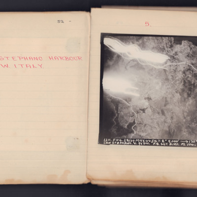
A vertical aerial photograph taken during an operation. The top left of the image is obscured by explosions and light flashes but much ground detail is visible on the image.
It is captioned '1211. Fog. 28/29 May 44 // N.T. 8" 9000' -> 135° 00.12…
It is captioned '1211. Fog. 28/29 May 44 // N.T. 8" 9000' -> 135° 00.12…
Sarnia oil refinery and St Clair River
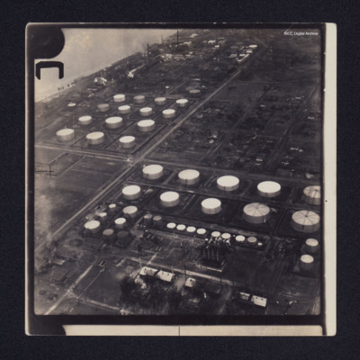
Two low angle oblique aerial photographs of Sarnia oil refinery on the St Clair River. Photograph 1 is mostly storage tanks; photograph 2 is of tanks and production facilities.
Identification kindly provided by Richard Evans of the Finding the…
Identification kindly provided by Richard Evans of the Finding the…
Saskatoon
Three vertical aerial photographs on two pages:
Photo 1 is a grain elevator, captioned 'Government Grain Elevator'.
Photo 2 is a bridge crossing a river, captioned 'Main rail bridge over S Sask R'.
Photo 3 is a railway and town, captioned…
Photo 1 is a grain elevator, captioned 'Government Grain Elevator'.
Photo 2 is a bridge crossing a river, captioned 'Main rail bridge over S Sask R'.
Photo 3 is a railway and town, captioned…
Tags: aerial photograph; training
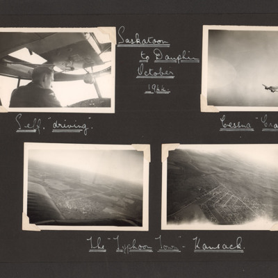
Saskatoon to Dauphin October 1944
Eight photographs from two pages of an album.
Page 28:
Photo 1 is an airman in the cockpit of an aircraft, captioned 'Self "driving" '.
Photo 2 is an air to air shot of a Cessna Crane, captioned 'Cessna Crane'.
Photo 3 and 4 are aerial views of a…
Page 28:
Photo 1 is an airman in the cockpit of an aircraft, captioned 'Self "driving" '.
Photo 2 is an air to air shot of a Cessna Crane, captioned 'Cessna Crane'.
Photo 3 and 4 are aerial views of a…
Tags: aerial photograph; aircrew; pilot; training
Saumur
Target photograph shows bomb explosion left side half way up. Tracer tracks across image. On the reverse '51:92/17'.
Saumur
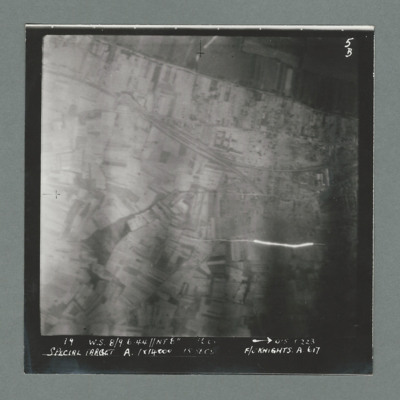
Target photograph showing open countryside with railway line running from top left to middle right. Caption '19, W.S 8/9 6.44, NT 8", 0'5 0223, Special Target A. 1 x 14000, 15 secs, F/O Knight'. On the reverse '51:92/5'.
Saumur
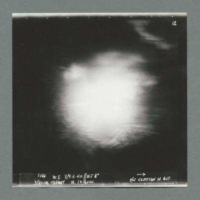
Target photograph shows bomb explosion in centre of image. Caption ' 114, W.S, 8/9.6.44, N.T. 8", Special Target, H. 1 x 14000, F/Lt Clayton H, 617''. On the reverse '51:92/6'.

