Browse Items (1442 total)
- Tags: aerial photograph
Sort by:
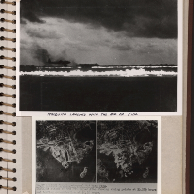
Mosquito landing and target photographs
Top - a runway with FIDO aflame on edges. A Mosquito is landing on left side. Submitted with description 'Mosquito landing with the aid of FIDO. Date and location not recorded'.
Bottom - side by side target photographs of port area showing aiming…
Bottom - side by side target photographs of port area showing aiming…
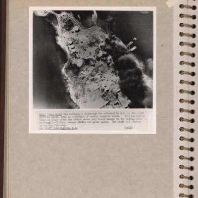
Vallo-Taneberg oil refinery
Reconnaissance photograph of an oil refinery on a peninsular with large plume of smoke from damaged oil tanks upper right area. Oslofjord is to the left with Prinds Christians Batterie just visible on the edge top left. Explanatory note underneath…
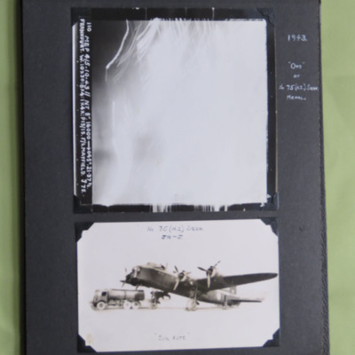
Frankfurt and a Stirling
Two photographs from an album.
Photo 1 is a vertical aerial photograph taken over Frankfurt. All the detail is obscured by light and anti-aircraft fire. It is annotated '110 Mep 4/5.10.43//NT 8" 16000 --> 045° . 21.37 ½. Frankfurt. W. 10x30: 8…
Photo 1 is a vertical aerial photograph taken over Frankfurt. All the detail is obscured by light and anti-aircraft fire. It is annotated '110 Mep 4/5.10.43//NT 8" 16000 --> 045° . 21.37 ½. Frankfurt. W. 10x30: 8…
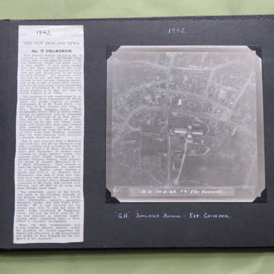
75 Squadron News Story
Two items from a photo album.
Item 1 is a newspaper cutting about 75 Squadron, dated 1943.
Item 2 is a vertical aerial photograph taken during a training exercise, annotated ' C.1. N.U. 10-3-45 F7" F/Lt Guinane' and captioned ' "G.H." Simulated…
Item 1 is a newspaper cutting about 75 Squadron, dated 1943.
Item 2 is a vertical aerial photograph taken during a training exercise, annotated ' C.1. N.U. 10-3-45 F7" F/Lt Guinane' and captioned ' "G.H." Simulated…
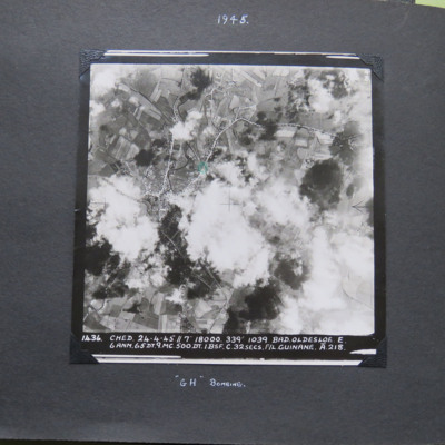
Bad Oldesloe
A vertical aerial photograph of Bad Oldesloe. The road pattern is clearly visible despite intermittent cloud cover. it is annotated '1436 Ched 23-4-45//7" 18000 339° 1039 Bad.Oldesloe . E. 6 ANM. 65 DT .9.MC.500.DT.1.BSF.C.32 secs. F/L Guinane . A.…
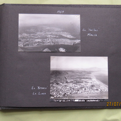
Malta and La Linea, 1959
Two oblique aerial photographs .
Photo 1 is of Valetta, captioned 'Ex "Fair Isle" Malta'.
Photo 2 is La Linea, captioned ' Ex "Spanex" La Linea'. Annotated on the image is 'P204 RAF A5 10 Oct 59 Z 678 S/L Jarmy Rest D'.
This item was sent to the…
Photo 1 is of Valetta, captioned 'Ex "Fair Isle" Malta'.
Photo 2 is La Linea, captioned ' Ex "Spanex" La Linea'. Annotated on the image is 'P204 RAF A5 10 Oct 59 Z 678 S/L Jarmy Rest D'.
This item was sent to the…
Tags: aerial photograph
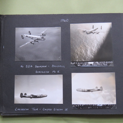
Shackleton
Four aerial photographs of an inflight Shackleton.
Photo 1 is taken from the front and above showing the starboard side of the aircraft. It is captioned 'No 204 Squadron - Ballykelly, Shackleton Mk II'.
Photo 2 is taken from the front and above…
Photo 1 is taken from the front and above showing the starboard side of the aircraft. It is captioned 'No 204 Squadron - Ballykelly, Shackleton Mk II'.
Photo 2 is taken from the front and above…
Tags: aerial photograph; Shackleton
Day bombing Cologne
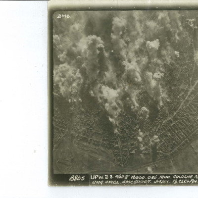
Target photograph of Cologne Melatenfriedhof area. Falling bombs on the left side and a burst of anti aircraft fire on top right.
Identification kindly provided by Frank Doerschner of the Finding the location WW1 & WW2 Facebook Group.
Identification kindly provided by Frank Doerschner of the Finding the location WW1 & WW2 Facebook Group.
Cologne
Target photograph of Cologne orientated with North to the bottom left. The railway complex Koln-Neustadt-Nord is in the bottom left corner and the square outline of the lake known as Aachener Weiher is in the bottom right. The River Rhine and…
Mittelland Canal
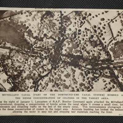
Reconnaissance photograph showing concentration of bomb craters in the target area where canal crossed a small river.
Canadian Townscape
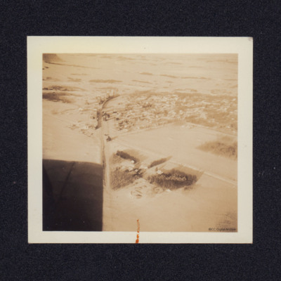
An aerial view of a Canadian town. On the reverse 'Looking down from a Maggie Moth Aircraft'.
Tags: aerial photograph; Magister; training
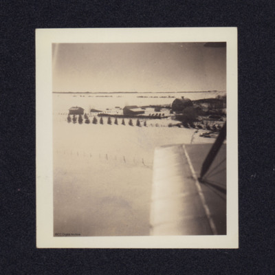
Farms in the Snow
Two aerial views.
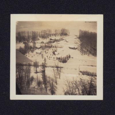
Photo 1. A low level aerial photograph of farms set in snowy fields. On the reverse 'Catching a scene on the port side of Maggie Moth [indecipherable]'.
Photo 2. A different view from a biplane with rigging wires.
Photo 1. A low level aerial photograph of farms set in snowy fields. On the reverse 'Catching a scene on the port side of Maggie Moth [indecipherable]'.
Photo 2. A different view from a biplane with rigging wires.
Tags: aerial photograph
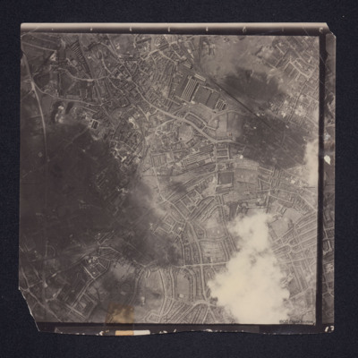
West Bromwich
A vertical aerial photograph of West Bromwich. Canals and railway branches are clearly visible.
Identification kindly provided by Richard Evans of the Unidentified photos of the British Isles Group.
Identification kindly provided by Richard Evans of the Unidentified photos of the British Isles Group.
Tags: aerial photograph
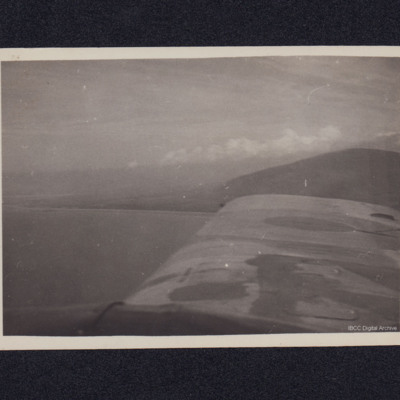
Aerial View of Mountains
A view from the starboard side of an aircraft looking across a wing to mountains and clouds.
Tags: aerial photograph
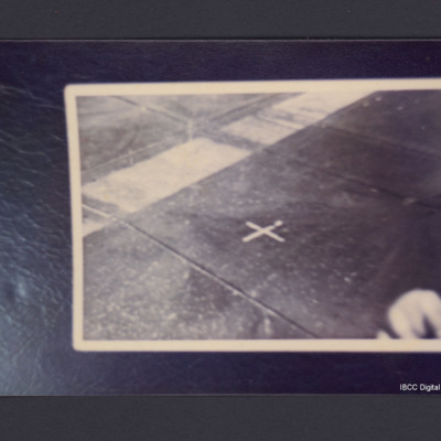
Rotterdam Drop zone marker
An aerial photograph showing a white cross on the background of a dark field with a broad white band running diagonally from left to top right. On the reverse 'Rotterdam Apr/May 1945. Cross is white sheets. 'Fingers bottom right in fact are Bullets…
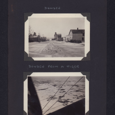
Bowden
Top - town street scene with buildings either side. Captioned 'Bowden'.
Bottom - view of town in snow from airborne aircraft. Captioned 'Bowden from a Tiger'.
Bottom - view of town in snow from airborne aircraft. Captioned 'Bowden from a Tiger'.
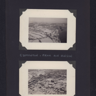
Edmonton
The upper photo is an oblique aerial photographs of Low Level Bridge facing south. In the distance, the Old Walterdale Bridge, the High Level Bridge and the Alberta Legislature Building.
The lower photo is of Alberta Legislature Building, next to…
The lower photo is of Alberta Legislature Building, next to…
Tags: aerial photograph; Anson
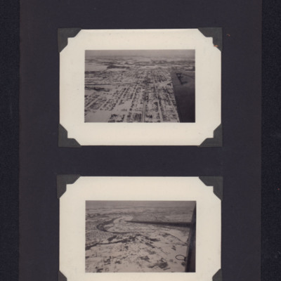
Edmonton
The upper photo is of 82 Ave facing West. Centre left, the Canadian Pacific Railway station Irvine; in the distance the North Saskatchewan River.
The lower photo is of North Saskatchewan River. The Low Level Bridge, the High Level Bridge, the…
The lower photo is of North Saskatchewan River. The Low Level Bridge, the High Level Bridge, the…
Tags: aerial photograph
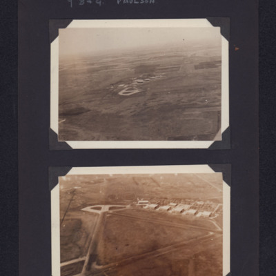
Paulson airfield
Top - view from the air of concrete hardstanding and buildings on an airfield in the distance. Bottom - closer view showing triangular runways, hardstanding and buildings. Captioned '7 B & G Paulson'.
Tags: aerial photograph; hangar; runway; taxiway; training
Hamilton Main Street
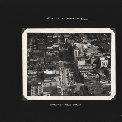
Built up area showing mixture of buildings arranged around grid pattern streets. Captioned 'Hamilton Main Street.' and 'Still in the Anson at 300feet'.
Tags: aerial photograph; aircrew; Anson; training
Burlington Bridge
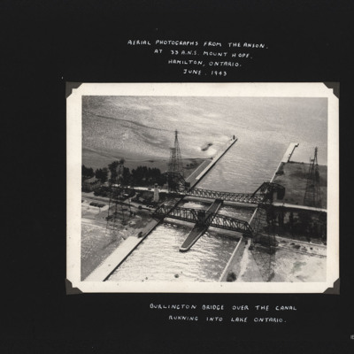
Photograph shows two bridges spanning a canal which leads to open water. Also four large pylons. Captioned 'Aerial photographs from the Anson at 33 A.N.S. Mount Hope, Hamilton, Ontario. June 1943.' and 'Burlington Bridge over the canal running into…
Tags: aerial photograph; Anson; training
Niagara Falls from the air
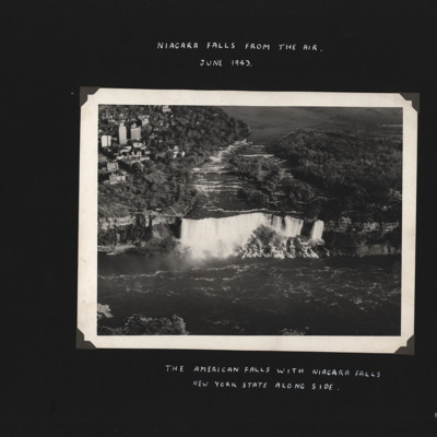
Two photographs of Niagra Falls, both captioned 'Niagra Falls from the air June 1943'.
The first is of a large wide body of water cascading over the edge with large buildings close by, captioned 'The American Falls with Niagra Falls, New york State…
The first is of a large wide body of water cascading over the edge with large buildings close by, captioned 'The American Falls with Niagra Falls, New york State…
Tags: aerial photograph
Marignane
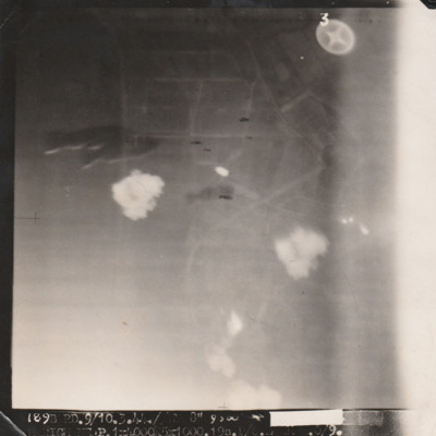
Target photograph with indistinct ground but several bombs visible centre left and centre. Caption mostly unreadable '[....], 9/10.3.44, Marignane P. 1 x 4000, 5 x 1000, 19s [..]'.
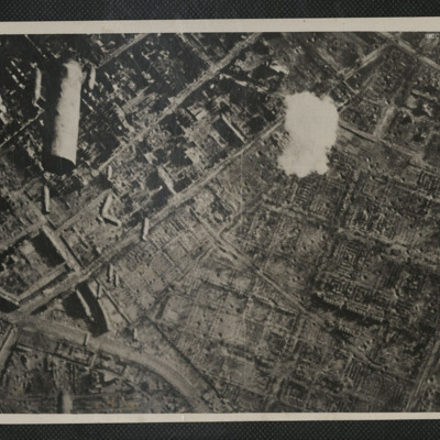
Bombed city
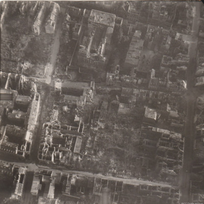
Reconnaissance photograph of part of a city with damaged buildings.

